
How to get from Forrest (airport) (Arizona) to Sierra Vista Southeast (Arizona)
Calculate route from Forrest (airport) (Arizona, United States) to Sierra Vista Southeast (Arizona, United States).
The flight distance (as the crow flies) between Forrest (airport) and Sierra Vista Southeast is 52.3 km.
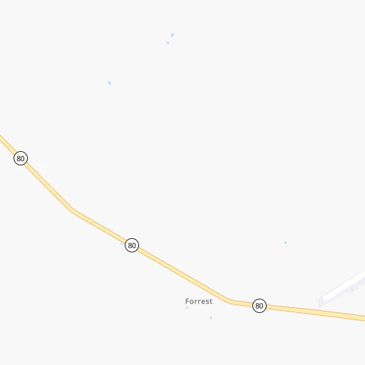
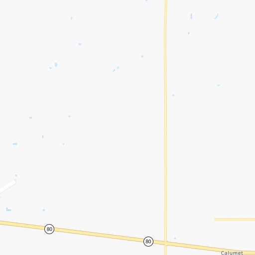
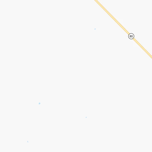
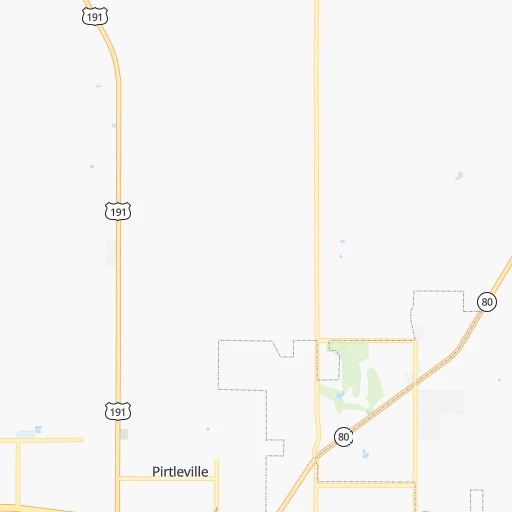
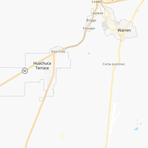
Roadmap (route) to go from Forrest Airport to Sierra Vista Southeast detailed above, you can also see the course layout on the map.
While doing trip Forrest (airport) - Sierra Vista Southeast by car, the calculated route ends at a distance , or more straight.
Distance and duration of the route between Forrest (airport) and Sierra Vista Southeast
Calculation of distance and route from Sierra Vista Southeast to Forrest (airport) :
52.364.6 km1h55mn
Continue 0h1mn 409 mTurn right onto AZ 80, US 80 Hist 0h17mn 24.7 kmAt roundabout, take exit 2 onto Sierra Vista-Bisbee Highway 0h14mn 18.5 kmTurn right onto South Hereford Road 0h16mn 16.8 kmTurn right onto South Moson Road 0h1mn 1.6 kmTurn left onto East Nevada Drive 0h5mn 2.4 kmTurn right onto South Burro Drive 0h0mn 111 mArrive at destination 0h0mn 0 m
Travel from Forrest (airport) (Arizona) to a selection of major cities.
Distances from Forrest Airport to biggest cities in Arizona
- Catalina Foothills,50,796 inhabitants.157 km
- Maricopa,48,602 inhabitants.292 km
- Oro Valley,43,565 inhabitants.167 km
- Sierra Vista,43,355 inhabitants.63 km
- Prescott Valley,42,197 inhabitants.437 km
- Prescott,41,899 inhabitants.439 km
- Marana,41,315 inhabitants.189 km
- Bullhead City,39,445 inhabitants.620 km
- Apache Junction,38,074 inhabitants.288 km
- Sun City,37,499 inhabitants.348 km
- Queen Creek,34,614 inhabitants.279 km
- El Mirage,33,935 inhabitants.353 km
- San Luis,31,520 inhabitants.498 km
- Florence,31,110 inhabitants.246 km
- Kingman,28,912 inhabitants.589 km
- Drexel Heights,27,749 inhabitants.154 km
- Fortuna Foothills,26,265 inhabitants.470 km
- Sahuarita,25,707 inhabitants.138 km
- Sun City West,24,535 inhabitants.358 km
- Fountain Hills,23,899 inhabitants.315 km
Other major cities in country :
- Seattle [WA], 684,451 inhabitants. 2,103 km
- Denver [CO], 682,545 inhabitants. 1,024 km
- El Paso [TX], 681,124 inhabitants. 305 km
- Detroit [MI], 677,116 inhabitants. 2,652 km
- Boston [MA], 667,137 inhabitants. 3,614 km
- Memphis [TN], 655,770 inhabitants. 1,871 km
- New South Memphis [TN], 641,608 inhabitants. 1,870 km
- Portland [OR], 632,309 inhabitants. 1,936 km
- Oklahoma City [OK], 631,346 inhabitants. 1,217 km
- Las Vegas [NV], 623,747 inhabitants. 736 km
- Baltimore [MD], 621,849 inhabitants. 3,110 km
- Washington, D.C. [DC], 601,723 inhabitants. 3,069 km
- Milwaukee [WI], 600,155 inhabitants. 2,315 km
- South Boston [MA], 571,281 inhabitants. 3,615 km
- Albuquerque [NM], 559,121 inhabitants. 500 km
- Nashville [TN], 530,852 inhabitants. 2,179 km
- Fresno [CA], 520,052 inhabitants. 1,106 km
- Sacramento [CA], 490,712 inhabitants. 1,342 km
- Kansas City [MO], 475,378 inhabitants. 1,617 km
- Long Beach [CA], 474,140 inhabitants. 842 km
Route from Sierra Vista Southeast to major cities (United States).
- Distance Sierra Vista Southeast New York City3,390 km
- Distance Sierra Vista Southeast Los Angeles805 km
- Distance Sierra Vista Southeast Chicago2,314 km
- Distance Sierra Vista Southeast Brooklyn3,394 km
- Distance Sierra Vista Southeast Houston1,434 km
- Distance Sierra Vista Southeast Queens3,403 km
- Distance Sierra Vista Southeast Philadelphia3,283 km
- Distance Sierra Vista Southeast Manhattan3,394 km
- Distance Sierra Vista Southeast San Antonio1,147 km
- Distance Sierra Vista Southeast San Diego670 km
- Distance Sierra Vista Southeast The Bronx3,403 km
- Distance Sierra Vista Southeast Dallas1,272 km
- Distance Sierra Vista Southeast San Jose1,256 km
- Distance Sierra Vista Southeast Austin1,199 km
- Distance Sierra Vista Southeast Jacksonville2,723 km
- Distance Sierra Vista Southeast San Francisco1,319 km
- Distance Sierra Vista Southeast Columbus2,623 km
- Distance Sierra Vista Southeast Fort Worth1,224 km
- Distance Sierra Vista Southeast Indianapolis2,356 km
- Distance Sierra Vista Southeast Charlotte2,754 km
Nearest cities to Forrest (airport) :
- Phoenix, 1,563,025 inhabitants. 323 km
- Tucson, 531,641 inhabitants. 152 km
- Mesa, 471,825 inhabitants. 305 km
- Chandler, 260,828 inhabitants. 297 km
- Gilbert, 247,542 inhabitants. 297 km
- Glendale, 240,126 inhabitants. 338 km
- Scottsdale, 236,839 inhabitants. 317 km
- Tempe, 175,826 inhabitants. 310 km
- Peoria, 171,237 inhabitants. 344 km
- Tempe Junction, 158,368 inhabitants. 312 km
- Surprise, 128,422 inhabitants. 355 km
- Las Cruces, 101,643 inhabitants. 293 km
- San Tan Valley, 81,321 inhabitants. 268 km
- Avondale, 80,684 inhabitants. 341 km
- Goodyear, 79,003 inhabitants. 341 km
- Casas Adobes, 66,795 inhabitants. 164 km
- Casa Grande, 51,460 inhabitants. 259 km
- Buckeye, 50,876 inhabitants. 353 km
- Catalina Foothills, 50,796 inhabitants. 157 km
- Maricopa, 48,602 inhabitants. 292 km
- Oro Valley, 43,565 inhabitants. 167 km
- Sierra Vista, 43,355 inhabitants. 63 km
- Marana, 41,315 inhabitants. 189 km
- Apache Junction, 38,074 inhabitants. 288 km
- Sun City, 37,499 inhabitants. 348 km
- Queen Creek, 34,614 inhabitants. 279 km
- El Mirage, 33,935 inhabitants. 353 km
- Florence, 31,110 inhabitants. 246 km
- Drexel Heights, 27,749 inhabitants. 154 km
- Sahuarita, 25,707 inhabitants. 138 km
- Sun City West, 24,535 inhabitants. 358 km
- Fountain Hills, 23,899 inhabitants. 315 km
- Anthem, 21,700 inhabitants. 362 km
- Green Valley, 21,391 inhabitants. 136 km
- Nogales, 20,252 inhabitants. 120 km
- Rio Rico, 18,962 inhabitants. 124 km
- Eloy, 17,059 inhabitants. 235 km
- Tanque Verde, 16,901 inhabitants. 141 km
- Douglas, 16,592 inhabitants. 13 km
- Flowing Wells, 16,419 inhabitants. 163 km
- Payson, 15,345 inhabitants. 354 km
- New River, 14,952 inhabitants. 366 km
- Sierra Vista Southeast, 14,797 inhabitants. 52 km
- Deming, 14,522 inhabitants. 207 km
- Sun Lakes, 13,975 inhabitants. 292 km
- Paradise Valley, 13,922 inhabitants. 322 km
- Coolidge, 12,297 inhabitants. 250 km
- Tucson Estates, 12,192 inhabitants. 162 km
- Show Low, 10,860 inhabitants. 323 km
- Arizona City, 10,475 inhabitants. 244 km
Location Forrest (airport) (Arizona) :
| Country flag |  |
| Location | Forrest (airport) |
| State | Arizona |
| County | Cochise County |
| Country | United States |
| Country code / ISO 2 | US |
| Latitude | 31.3681600 |
| Longitude | -109.6742400 |
| Altitude | 1250 meters |
| Time zone | America/Phoenix |
Location Sierra Vista Southeast (Arizona) :
| Country flag | |
| Location | Sierra Vista Southeast |
| State | Arizona |
| County | Cochise County |
| Country | United States |
| Country code / ISO 2 | US |
| Latitude | 31.4538500 |
| Longitude | -110.2163700 |
| Altitude | 1387 meters |
| Time zone | America/Phoenix |


