
Home
››
Darlington Aviation Inc Airport
››
Roadmap from Darlington Aviation Inc Airport to Fond du Lac
How to get from Darlington Aviation Inc (airport) (Wisconsin) to Fond du Lac (Wisconsin)
Calculate route from Darlington Aviation Inc (airport) (Wisconsin, United States) to Fond du Lac (Wisconsin, United States).
The flight distance (as the crow flies) between Darlington Aviation Inc (airport) and Fond du Lac is 183.7 km.
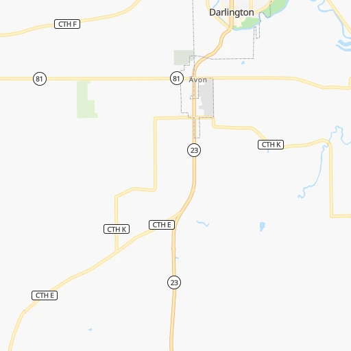
Roadmap (route) to go from Darlington Aviation Inc Airport to Fond du Lac detailed above, you can also see the course layout on the map.
While doing trip Darlington Aviation Inc (airport) - Fond du Lac by car, the calculated route ends at a distance , or more straight.
Distance and duration of the route between Darlington Aviation Inc (airport) and Fond du Lac
Calculation of distance and route from Fond du Lac to Darlington Aviation Inc (airport) :
183.7208.9 km3h54mn
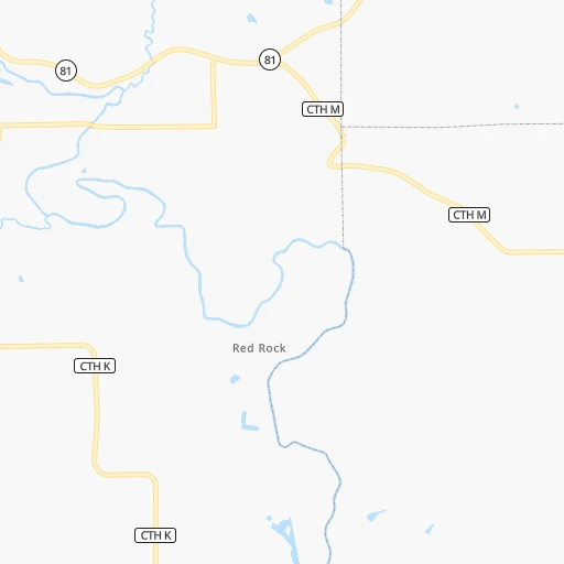
Continue onto County Road K 0h2mn 1.3 kmTurn left onto Red Rock Road 0h2mn 1.2 kmTurn left onto Roller Coaster Road 0h3mn 1.4 kmTurn right onto Roller Coaster Road 0h4mn 3.0 kmTurn left onto River End Road 0h1mn 874 mTurn sharp right onto State Highway 81 0h18mn 17.8 kmContinue onto West Milwaukee Street 0h1mn 622 mTurn left onto North State Street 0h2mn 3.0 kmTurn right onto County Road A 0h13mn 16.7 kmTurn left onto County Highway J 0h6mn 8.5 kmTurn right onto County Road A 0h9mn 8.5 kmTurn left onto Washington Street 0h0mn 327 mTurn right onto County Road G 0h10mn 8.0 kmTurn right 0h1mn 1.2 kmKeep right onto US 18 Business, US 151 Business and take US 18 Business, US 151 Business, CTH MV toward Epic Lane, West Verona Avenue 0h1mn 868 mContinue onto West Verona Avenue 0h11mn 11.0 kmKeep left 0h0mn 67 mTurn right 0h0mn 302 mTurn right onto Nakoma Road 0h5mn 4.5 kmContinue onto Monroe Street 0h1mn 510 mTurn right onto West Dayton Street 0h0mn 268 mTurn left onto North Charter Street 0h0mn 126 mTurn right onto West Johnson Street 0h7mn 4.8 kmKeep right onto East Johnson Street 0h2mn 1.6 kmTurn left onto East Washington Avenue 0h3mn 2.1 kmKeep left 0h0mn 159 mTurn right onto North Stoughton Road 0h0mn 10 mTurn left onto East Washington Avenue 0h2mn 2.6 kmContinue onto East Washington Avenue 1h2mn 99.3 kmKeep right toward CTH D 0h0mn 290 mKeep right toward CTH D South 0h0mn 574 mTurn right onto County Road D 0h0mn 157 mMake a U-turn onto County Road D 0h4mn 4.0 kmAt roundabout, take exit 2 onto South Military Road 0h2mn 2.0 kmTurn right onto Western Avenue 0h1mn 515 mContinue onto 4th Street 0h1mn 667 mTurn left onto South Park Avenue 0h0mn 189 mArrive at destination 0h0mn 0 m
Travel from Darlington Aviation Inc (airport) (Wisconsin) to a selection of major cities.
Distances from Darlington Aviation Inc Airport to biggest cities in Wisconsin
- Beloit,36,891 inhabitants.90 km
- Franklin,36,222 inhabitants.171 km
- Menomonee Falls,36,119 inhabitants.172 km
- Oak Creek,35,243 inhabitants.185 km
- Manitowoc,33,010 inhabitants.255 km
- Sun Prairie,32,365 inhabitants.94 km
- West Bend,31,695 inhabitants.179 km
- Fitchburg,27,996 inhabitants.62 km
- Stevens Point,26,604 inhabitants.212 km
- Superior,26,579 inhabitants.479 km
- Mount Pleasant,26,272 inhabitants.184 km
- Neenah,25,792 inhabitants.216 km
- Muskego,24,755 inhabitants.163 km
- De Pere,24,724 inhabitants.259 km
- Caledonia,24,684 inhabitants.179 km
- Watertown,23,819 inhabitants.127 km
- Mequon,23,132 inhabitants.180 km
- South Milwaukee,21,233 inhabitants.186 km
- Pleasant Prairie,20,726 inhabitants.179 km
Other major cities in country :
- Charlotte [NC], 827,097 inhabitants. 1,151 km
- Seattle [WA], 684,451 inhabitants. 2,570 km
- Denver [CO], 682,545 inhabitants. 1,286 km
- El Paso [TX], 681,124 inhabitants. 1,886 km
- Detroit [MI], 677,116 inhabitants. 581 km
- Boston [MA], 667,137 inhabitants. 1,560 km
- Memphis [TN], 655,770 inhabitants. 836 km
- New South Memphis [TN], 641,608 inhabitants. 843 km
- Portland [OR], 632,309 inhabitants. 2,605 km
- Oklahoma City [OK], 631,346 inhabitants. 1,024 km
- Las Vegas [NV], 623,747 inhabitants. 2,260 km
- Baltimore [MD], 621,849 inhabitants. 1,193 km
- Washington, D.C. [DC], 601,723 inhabitants. 1,177 km
- South Boston [MA], 571,281 inhabitants. 1,561 km
- Albuquerque [NM], 559,121 inhabitants. 1,659 km
- Tucson [AZ], 531,641 inhabitants. 2,167 km
- Nashville [TN], 530,852 inhabitants. 777 km
- Fresno [CA], 520,052 inhabitants. 2,610 km
- Sacramento [CA], 490,712 inhabitants. 2,675 km
- Kansas City [MO], 475,378 inhabitants. 546 km
Route from Fond du Lac to major cities (United States).
- Distance Fond du Lac New York City1,235 km
- Distance Fond du Lac Los Angeles2,780 km
- Distance Fond du Lac Chicago224 km
- Distance Fond du Lac Brooklyn1,242 km
- Distance Fond du Lac Houston1,676 km
- Distance Fond du Lac Queens1,250 km
- Distance Fond du Lac Philadelphia1,178 km
- Distance Fond du Lac Phoenix2,343 km
- Distance Fond du Lac Manhattan1,236 km
- Distance Fond du Lac San Antonio1,830 km
- Distance Fond du Lac San Diego2,778 km
- Distance Fond du Lac The Bronx1,241 km
- Distance Fond du Lac Dallas1,424 km
- Distance Fond du Lac San Jose2,897 km
- Distance Fond du Lac Austin1,713 km
- Distance Fond du Lac Jacksonville1,612 km
- Distance Fond du Lac San Francisco2,919 km
- Distance Fond du Lac Columbus619 km
- Distance Fond du Lac Fort Worth1,453 km
- Distance Fond du Lac Indianapolis484 km
Nearest cities to Darlington Aviation Inc (airport) :
- Chicago, 2,720,546 inhabitants. 222 km
- Milwaukee, 600,155 inhabitants. 185 km
- Saint Paul, 285,068 inhabitants. 350 km
- Madison, 248,951 inhabitants. 74 km
- Aurora, 200,661 inhabitants. 178 km
- Rockford, 148,278 inhabitants. 94 km
- Joliet, 147,861 inhabitants. 209 km
- Naperville, 147,100 inhabitants. 188 km
- Cedar Rapids, 130,405 inhabitants. 145 km
- Springfield, 116,565 inhabitants. 320 km
- Peoria, 115,070 inhabitants. 223 km
- North Peoria, 113,004 inhabitants. 220 km
- Rochester, 112,225 inhabitants. 244 km
- Elgin, 112,111 inhabitants. 165 km
- Green Bay, 105,207 inhabitants. 267 km
- Davenport, 102,582 inhabitants. 132 km
- Kenosha, 99,858 inhabitants. 188 km
- Waukegan, 88,475 inhabitants. 189 km
- West Town, 86,429 inhabitants. 218 km
- Champaign, 86,096 inhabitants. 323 km
- Near North Side, 85,711 inhabitants. 220 km
- Cicero, 83,886 inhabitants. 214 km
- Belmont Cragin, 79,159 inhabitants. 209 km
- Bloomington, 78,292 inhabitants. 259 km
- Racine, 77,742 inhabitants. 190 km
- Hammond, 77,614 inhabitants. 246 km
- Gary, 77,156 inhabitants. 257 km
- Arlington Heights, 75,926 inhabitants. 186 km
- Evanston, 75,527 inhabitants. 210 km
- Schaumburg, 74,693 inhabitants. 180 km
- Bolingbrook, 74,306 inhabitants. 199 km
- Iowa City, 74,220 inhabitants. 161 km
- Appleton, 74,139 inhabitants. 225 km
- South Lawndale, 73,826 inhabitants. 217 km
- Logan Square, 73,702 inhabitants. 214 km
- Decatur, 73,254 inhabitants. 328 km
- West Ridge, 72,211 inhabitants. 212 km
- Waukesha, 71,970 inhabitants. 158 km
- Palatine, 69,308 inhabitants. 181 km
- Waterloo, 68,460 inhabitants. 184 km
- Woodbury, 67,855 inhabitants. 341 km
- Eau Claire, 67,778 inhabitants. 265 km
- Lincoln Park, 66,959 inhabitants. 218 km
- Oshkosh, 66,555 inhabitants. 198 km
- Portage Park, 64,841 inhabitants. 208 km
- Skokie, 64,821 inhabitants. 207 km
- Janesville, 64,123 inhabitants. 89 km
- West Allis, 60,620 inhabitants. 176 km
- Dubuque, 58,799 inhabitants. 49 km
- Des Plaines, 58,677 inhabitants. 196 km
Location Darlington Aviation Inc (airport) (Wisconsin) :
| Country flag |  |
| Location | Darlington Aviation Inc (airport) |
| State | Wisconsin |
| County | Lafayette County |
| Country | United States |
| Country code / ISO 2 | US |
| Latitude | 42.6555600 |
| Longitude | -90.1084600 |
| Altitude | 258 meters |
| Time zone | America/Chicago |
Location Fond du Lac (Wisconsin) :
| Country flag | |
| Location | Fond du Lac |
| State | Wisconsin |
| County | Fond du Lac County |
| Country | United States |
| Country code / ISO 2 | US |
| Latitude | 43.7750000 |
| Longitude | -88.4388300 |
| Altitude | 232 meters |
| Time zone | America/Chicago |

