


How to get from Miller Municipal (airport) (South Dakota) to Los Angeles (California)
Calculate route from Miller Municipal (airport) (South Dakota, United States) to Los Angeles (California, United States).
The flight distance (as the crow flies) between Miller Municipal (airport) and Los Angeles is 2,017.7 km.
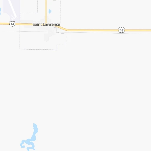
Roadmap (route) to go from Miller Municipal Airport to Los Angeles detailed above, you can also see the course layout on the map.
While doing trip Miller Municipal (airport) - Los Angeles by car, the calculated route ends at a distance , or more straight.
Distance and duration of the route between Miller Municipal (airport) and Los Angeles
Calculation of distance and route from Los Angeles to Miller Municipal (airport) :
2,017.72,504.4 km27h31mn
Continue 0h0mn 153 mTurn right onto US 14 0h2mn 2.5 kmTurn left onto North Broadway 1h45mn 49.0 kmTurn right onto SD 34 1h31mn 34.6 kmKeep left onto SD Highway 249 0h2mn 1.8 kmContinue onto SD Highway 47 0h29mn 32.4 kmTurn sharp right 1h20mn 154.1 kmKeep right onto I 90 Business and take I 90 Business toward Kadoka 0h0mn 516 mTurn left onto I 90 Business 0h0mn 351 mTurn right onto Highway 16 0h3mn 3.5 kmTurn left onto SD 73 1h47mn 73.0 kmKeep right 0h0mn 50 mTurn slight right onto US 18, SD 73 1h2mn 92.3 kmTurn left onto State Highway 407 0h5mn 6.0 kmTurn right onto 450 Lane 0h18mn 21.0 kmKeep right onto 720 Road 0h1mn 1.2 kmKeep left onto 478 Trail 0h2mn 1.8 kmTurn right onto 710 Road 0h20mn 24.4 kmContinue onto Bartlett Road 0h2mn 2.4 kmTurn left onto Stockade Road 0h1mn 1.6 kmTurn right onto US 20, US 385 0h2mn 2.7 kmKeep left onto US 20, US 385 0h22mn 33.7 kmKeep right 0h0mn 204 mContinue onto McPherson Street 1h7mn 91.7 kmTurn left onto South Cedar Street 0h1mn 814 mTurn right onto West 8th Street 1h40mn 66.8 kmKeep right onto I 25, US 20 1h56mn 96.8 kmKeep right onto I 25 Business and take I 25 Business, US 20, US 26, US 87 toward North Beverly Street, Bryan Stock Trail 0h0mn 302 mTurn left onto Bryan Stock Trail 0h0mn 405 mTurn right onto East Yellowstone Highway 0h2mn 2.3 kmTurn left onto South Center Street 0h0mn 476 mTurn right onto West Collins Drive 0h0mn 253 mTurn left onto South Ash Street 0h0mn 358 mTurn right onto CY Avenue 0h12mn 12.9 kmContinue onto County Road 308 0h7mn 8.0 kmTurn slight right onto WY 220 2h54mn 133.0 kmTurn right 0h5mn 5.3 kmTurn right onto Oil Road To Mines 0h3mn 4.0 kmKeep left onto Stratton Road 0h4mn 4.0 kmTurn left 0h6mn 6.0 kmTurn left 0h3mn 2.6 kmTurn slight right 0h2mn 1.9 kmTurn left 0h9mn 9.1 kmTurn left 0h0mn 383 mTurn right 0h2mn 2.3 kmKeep left 0h1mn 742 mTurn left 0h5mn 4.6 kmTurn right 0h2mn 1.8 kmTurn left onto BLM Road 3203 0h5mn 4.5 kmTurn left onto Riner Road 0h0mn 28 mTurn right 4h36mn 394.4 kmKeep right onto US 189 and take US 40 East, US 189 South toward Heber, Vernal, Provo 0h0mn 371 mKeep left onto US 189 and take US 40 East, US 189 South toward Heber, Vernal, Provo 0h0mn 187 mTurn slight left onto US 40 0h13mn 20.8 kmContinue onto US 40, US 189 0h6mn 7.7 kmKeep right toward US 189 0h30mn 34.5 kmContinue onto University Avenue 0h9mn 9.6 kmTurn slight right onto South University Avenue 0h2mn 1.8 kmKeep right and take I 15 South toward Las Vegas, Lakeview Parkway 6h33mn 603.2 kmKeep left 1h47mn 77.4 kmKeep left onto Mojave Freeway 0h1mn 1.4 kmContinue onto Mojave Freeway 3h35mn 262.4 kmKeep left onto Ontario Freeway 0h14mn 22.7 kmKeep right and drive toward 4th Street 0h0mn 556 mTurn right onto 4th Street 0h5mn 7.0 kmKeep right toward I 10 West 0h23mn 36.4 kmKeep left onto I-10 Metro ExpressLanes 0h14mn 22.6 kmTurn left onto North Los Angeles Street 0h1mn 517 mTurn right onto East 1st Street 0h0mn 120 mContinue onto West 1st Street 0h0mn 21 mArrive at destination 0h0mn 0 m
Travel from Miller Municipal (airport) (California) to a selection of major cities.
Distances from Miller Municipal Airport to biggest cities in South Dakota
Other major cities in country :
- Charlotte [NC], 827,097 inhabitants. 1,855 km
- Seattle [WA], 684,451 inhabitants. 1,831 km
- Denver [CO], 682,545 inhabitants. 728 km
- El Paso [TX], 681,124 inhabitants. 1,564 km
- Detroit [MI], 677,116 inhabitants. 1,307 km
- Boston [MA], 667,137 inhabitants. 2,257 km
- Memphis [TN], 655,770 inhabitants. 1,290 km
- New South Memphis [TN], 641,608 inhabitants. 1,295 km
- Portland [OR], 632,309 inhabitants. 1,863 km
- Oklahoma City [OK], 631,346 inhabitants. 1,015 km
- Las Vegas [NV], 623,747 inhabitants. 1,653 km
- Baltimore [MD], 621,849 inhabitants. 1,933 km
- Washington, D.C. [DC], 601,723 inhabitants. 1,919 km
- Milwaukee [WI], 600,155 inhabitants. 903 km
- South Boston [MA], 571,281 inhabitants. 2,258 km
- Albuquerque [NM], 559,121 inhabitants. 1,238 km
- Tucson [AZ], 531,641 inhabitants. 1,718 km
- Nashville [TN], 530,852 inhabitants. 1,387 km
- Fresno [CA], 520,052 inhabitants. 1,952 km
- Sacramento [CA], 490,712 inhabitants. 1,983 km
Route from Los Angeles to major cities (United States).
- Distance Los Angeles New York City3,940 km
- Distance Los Angeles Chicago2,805 km
- Distance Los Angeles Brooklyn3,945 km
- Distance Los Angeles Houston2,209 km
- Distance Los Angeles Queens3,955 km
- Distance Los Angeles Philadelphia3,848 km
- Distance Los Angeles Phoenix575 km
- Distance Los Angeles Manhattan3,943 km
- Distance Los Angeles San Antonio1,936 km
- Distance Los Angeles The Bronx3,951 km
- Distance Los Angeles Dallas1,993 km
- Distance Los Angeles Austin1,974 km
- Distance Los Angeles Jacksonville3,453 km
- Distance Los Angeles Columbus3,180 km
- Distance Los Angeles Fort Worth1,947 km
- Distance Los Angeles Indianapolis2,909 km
- Distance Los Angeles Charlotte3,408 km
- Distance Los Angeles Seattle1,547 km
- Distance Los Angeles Denver1,337 km
- Distance Los Angeles El Paso1,127 km
Nearest cities to Miller Municipal (airport) :
- Sioux Falls, 171,544 inhabitants. 210 km
- Fargo, 118,523 inhabitants. 312 km
- Sioux City, 82,821 inhabitants. 305 km
- Bismarck, 71,167 inhabitants. 292 km
- Moorhead, 42,005 inhabitants. 312 km
- West Fargo, 33,597 inhabitants. 307 km
- Aberdeen, 28,102 inhabitants. 112 km
- Norfolk, 24,366 inhabitants. 304 km
- Brookings, 23,657 inhabitants. 173 km
- Watertown, 22,073 inhabitants. 152 km
- Mandan, 21,382 inhabitants. 298 km
- Mitchell, 15,669 inhabitants. 117 km
- Jamestown, 15,422 inhabitants. 267 km
- Yankton, 14,557 inhabitants. 222 km
- Pierre, 14,002 inhabitants. 112 km
- South Sioux City, 13,319 inhabitants. 307 km
- Huron, 13,313 inhabitants. 62 km
- Fergus Falls, 13,281 inhabitants. 299 km
- Vermillion, 10,738 inhabitants. 253 km
- Brandon, 9,856 inhabitants. 217 km
- Le Mars, 9,761 inhabitants. 296 km
- Blair, 7,975 inhabitants. 403 km
- Wahpeton, 7,899 inhabitants. 267 km
- Sioux Center, 7,461 inhabitants. 275 km
- Madison, 7,258 inhabitants. 158 km
- Valley City, 6,669 inhabitants. 278 km
- Orange City, 6,198 inhabitants. 287 km
- Wayne, 5,569 inhabitants. 299 km
- Harrisburg, 5,498 inhabitants. 218 km
- Tea, 4,839 inhabitants. 208 km
- Luverne, 4,677 inhabitants. 240 km
- Sergeant Bluff, 4,520 inhabitants. 315 km
- Dilworth, 4,366 inhabitants. 316 km
- Pipestone, 4,141 inhabitants. 218 km
- Dell Rapids, 3,706 inhabitants. 196 km
- Rock Valley, 3,693 inhabitants. 259 km
- O'Neill, 3,653 inhabitants. 231 km
- Lincoln, 3,519 inhabitants. 284 km
- Mobridge, 3,466 inhabitants. 162 km
- Beulah, 3,393 inhabitants. 376 km
- West Point, 3,368 inhabitants. 349 km
- Canton, 3,331 inhabitants. 233 km
- Breckenridge, 3,290 inhabitants. 268 km
- Milbank, 3,192 inhabitants. 199 km
- Hartford, 3,025 inhabitants. 189 km
Location Miller Municipal (airport) (South Dakota) :
| Country flag |  |
| Location | Miller Municipal (airport) |
| State | South Dakota |
| County | Hand County |
| Country | United States |
| Country code / ISO 2 | US |
| Latitude | 44.5190500 |
| Longitude | -98.9567100 |
| Altitude | 480 meters |
| Time zone | America/Chicago |
Location Los Angeles (California) :
| Country flag | |
| Location | Los Angeles |
| State | California |
| County | Los Angeles County |
| Country | United States |
| Country code / ISO 2 | US |
| Latitude | 34.0522300 |
| Longitude | -118.2436800 |
| Altitude | 89 meters |
| Time zone | America/Los_Angeles |


