

How to get from Husky Haven (airport) (Pennsylvania) to Easton (Pennsylvania)
Calculate route from Husky Haven (airport) (Pennsylvania, United States) to Easton (Pennsylvania, United States).
The flight distance (as the crow flies) between Husky Haven (airport) and Easton is 134.5 km.
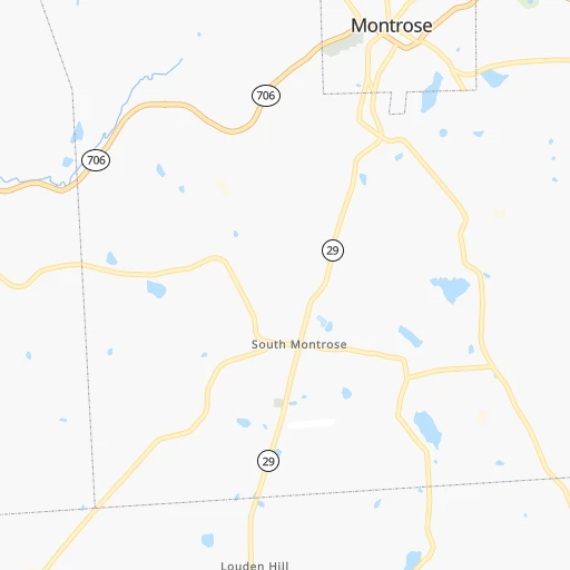
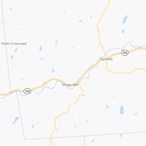
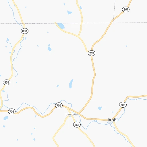
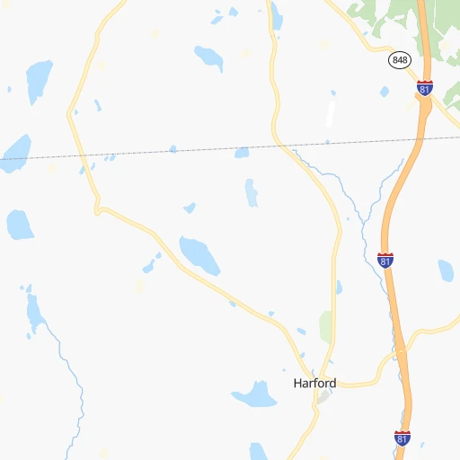
Roadmap (route) to go from Husky Haven Airport to Easton detailed above, you can also see the course layout on the map.
While doing trip Husky Haven (airport) - Easton by car, the calculated route ends at a distance , or more straight.
Distance and duration of the route between Husky Haven (airport) and Easton
Calculation of distance and route from Easton to Husky Haven (airport) :
134.5156.6 km2h11mn
Continue 0h0mn 144 mTurn left onto State Route 29 0h5mn 5.0 kmTurn left onto State Route 3023 0h18mn 15.2 kmTurn right onto State Route 2007 0h4mn 3.7 kmTurn right onto State Street 0h0mn 156 mTurn left onto Bacontown Road 0h8mn 7.0 kmTurn left onto Civic Club Way 0h0mn 134 mTurn right onto State Route 6&11 0h14mn 13.3 kmKeep right onto US 6 and take I 81, US 6 East, PATP South, I 476 South toward Binghamton, Wilkes-Barre 0h1mn 676 mKeep right onto US 6 and take I 81, US 6 East toward Binghamton, Wilkes-Barre 0h0mn 211 mKeep right onto US 6 and take I 81 South, US 6 East toward Wilkes-Barre 0h7mn 8.9 kmKeep right onto US 6 and take I 84 East, I 380 South, US 6 East toward Carbondale, Mt Pocono 0h1mn 700 mKeep left onto US 6 and take US 6 East, I 84 East, I 380 South toward Carbondale, Mt Pocono 0h0mn 529 mKeep right and take I 84 East, I 380 South toward Mount Pocono, Milford 0h4mn 5.9 kmKeep right onto I 380 and take I 380 South toward Mount Pocono 0h23mn 38.0 kmKeep left and take I 80 E toward Stroudsburg 0h11mn 15.3 kmKeep right and take PA 33 South toward Snydersville 0h23mn 32.2 kmKeep right and drive toward Tatamy 0h0mn 272 mKeep left and drive toward Tatamy 0h0mn 148 mTurn sharp left onto Tatamy Road 0h1mn 849 mTurn right onto South 8th Street 0h5mn 4.8 kmTurn left onto Hackett Avenue 0h2mn 1.7 kmTurn left onto Wood Avenue 0h1mn 627 mTurn right onto Wood Avenue 0h1mn 632 mTurn right onto North 9th Street 0h1mn 389 mTurn left onto Spruce Street 0h0mn 12 mArrive at destination 0h0mn 0 m
Travel from Husky Haven (airport) (Pennsylvania) to a selection of major cities.
Distances from Husky Haven Airport to biggest cities in Pennsylvania
- Mount Lebanon,32,730 inhabitants.384 km
- Bethel Park,32,118 inhabitants.384 km
- Wayne,30,892 inhabitants.199 km
- Radnor,30,878 inhabitants.199 km
- Williamsport,29,201 inhabitants.111 km
- Monroeville,28,176 inhabitants.360 km
- Cranberry Township,28,098 inhabitants.374 km
- Drexel Hill,28,043 inhabitants.211 km
- Plum,27,505 inhabitants.354 km
- Back Mountain,26,973 inhabitants.51 km
- Easton,26,915 inhabitants.135 km
- Pennsport,26,000 inhabitants.216 km
- Lebanon,25,534 inhabitants.167 km
- Whitehall Township,24,896 inhabitants.129 km
- Hazleton,24,825 inhabitants.93 km
- Springfield,23,363 inhabitants.212 km
- Pottstown,22,664 inhabitants.173 km
- New Castle,22,375 inhabitants.382 km
- Allison Park,21,552 inhabitants.367 km
- Chambersburg,20,691 inhabitants.254 km
Other major cities in country :
- Seattle [WA], 684,451 inhabitants. 3,675 km
- Denver [CO], 682,545 inhabitants. 2,452 km
- El Paso [TX], 681,124 inhabitants. 2,928 km
- Detroit [MI], 677,116 inhabitants. 594 km
- Boston [MA], 667,137 inhabitants. 404 km
- Memphis [TN], 655,770 inhabitants. 1,436 km
- New South Memphis [TN], 641,608 inhabitants. 1,440 km
- Portland [OR], 632,309 inhabitants. 3,737 km
- Oklahoma City [OK], 631,346 inhabitants. 2,001 km
- Las Vegas [NV], 623,747 inhabitants. 3,423 km
- Baltimore [MD], 621,849 inhabitants. 285 km
- Washington, D.C. [DC], 601,723 inhabitants. 336 km
- Milwaukee [WI], 600,155 inhabitants. 996 km
- South Boston [MA], 571,281 inhabitants. 405 km
- Albuquerque [NM], 559,121 inhabitants. 2,768 km
- Tucson [AZ], 531,641 inhabitants. 3,265 km
- Nashville [TN], 530,852 inhabitants. 1,130 km
- Fresno [CA], 520,052 inhabitants. 3,782 km
- Sacramento [CA], 490,712 inhabitants. 3,849 km
- Kansas City [MO], 475,378 inhabitants. 1,608 km
Route from Easton to major cities (United States).
- Distance Easton New York City103 km
- Distance Easton Los Angeles3,838 km
- Distance Easton Chicago1,047 km
- Distance Easton Brooklyn107 km
- Distance Easton Houston2,190 km
- Distance Easton Queens117 km
- Distance Easton Phoenix3,345 km
- Distance Easton Manhattan106 km
- Distance Easton San Antonio2,452 km
- Distance Easton San Diego3,809 km
- Distance Easton The Bronx116 km
- Distance Easton Dallas2,110 km
- Distance Easton San Jose4,007 km
- Distance Easton Austin2,338 km
- Distance Easton Jacksonville1,291 km
- Distance Easton San Francisco4,034 km
- Distance Easton Columbus665 km
- Distance Easton Fort Worth2,154 km
- Distance Easton Indianapolis935 km
- Distance Easton Charlotte783 km
Nearest cities to Husky Haven (airport) :
- New York City, 8,175,133 inhabitants. 198 km
- Brooklyn, 2,300,664 inhabitants. 206 km
- Queens, 2,272,771 inhabitants. 212 km
- Philadelphia, 1,567,442 inhabitants. 213 km
- Manhattan, 1,487,536 inhabitants. 196 km
- The Bronx, 1,385,108 inhabitants. 199 km
- Baltimore, 621,849 inhabitants. 285 km
- Washington, D.C., 601,723 inhabitants. 336 km
- Staten Island, 468,730 inhabitants. 200 km
- Newark, 281,944 inhabitants. 186 km
- Jersey City, 264,290 inhabitants. 192 km
- Buffalo, 258,071 inhabitants. 274 km
- Jamaica, 216,866 inhabitants. 213 km
- Rochester, 209,802 inhabitants. 208 km
- Arlington, 207,627 inhabitants. 340 km
- Yonkers, 201,116 inhabitants. 192 km
- Harlem, 181,259 inhabitants. 196 km
- East Flatbush, 178,464 inhabitants. 207 km
- East New York, 173,198 inhabitants. 210 km
- Alexandria, 153,511 inhabitants. 346 km
- Washington Heights, 152,613 inhabitants. 194 km
- Astoria, 150,165 inhabitants. 199 km
- Borough Park, 149,248 inhabitants. 204 km
- Paterson, 147,754 inhabitants. 173 km
- Bridgeport, 147,629 inhabitants. 235 km
- Syracuse, 144,142 inhabitants. 142 km
- New Haven, 130,322 inhabitants. 253 km
- Elizabeth, 129,007 inhabitants. 188 km
- Stamford, 128,874 inhabitants. 213 km
- Sunset Park, 126,000 inhabitants. 202 km
- Sheepshead Bay, 122,534 inhabitants. 211 km
- Amherst, 122,366 inhabitants. 273 km
- North Stamford, 121,230 inhabitants. 209 km
- Allentown, 120,207 inhabitants. 136 km
- East Harlem, 115,921 inhabitants. 197 km
- Elmhurst, 113,364 inhabitants. 205 km
- Bushwick, 112,620 inhabitants. 205 km
- Gravesend, 112,229 inhabitants. 209 km
- Corona, 109,698 inhabitants. 206 km
- Waterbury, 108,802 inhabitants. 238 km
- Edison, 102,548 inhabitants. 188 km
- Columbia, 99,615 inhabitants. 295 km
- Richmond Hill, 98,984 inhabitants. 211 km
- Albany, 98,469 inhabitants. 201 km
- Fordham, 94,678 inhabitants. 196 km
- West Albany, 93,794 inhabitants. 201 km
- Flatbush, 93,361 inhabitants. 205 km
- Toms River, 88,791 inhabitants. 249 km
- Norwalk, 88,485 inhabitants. 220 km
- Reading, 87,879 inhabitants. 162 km
Location Husky Haven (airport) (Pennsylvania) :
| Country flag |  |
| Location | Husky Haven (airport) |
| State | Pennsylvania |
| County | Susquehanna County |
| Country | United States |
| Country code / ISO 2 | US |
| Latitude | 41.7888700 |
| Longitude | -75.8919600 |
| Altitude | 509 meters |
| Time zone | America/New_York |
Location Easton (Pennsylvania) :
| Country flag | |
| Location | Easton |
| State | Pennsylvania |
| County | Northampton County |
| Country | United States |
| Country code / ISO 2 | US |
| Latitude | 40.6884300 |
| Longitude | -75.2207300 |
| Altitude | 97 meters |
| Time zone | America/New_York |


