

How to get from Perkiomen Valley (airport) (Pennsylvania) to Lebanon (Pennsylvania)
Calculate route from Perkiomen Valley (airport) (Pennsylvania, United States) to Lebanon (Pennsylvania, United States).
The flight distance (as the crow flies) between Perkiomen Valley (airport) and Lebanon is 84.8 km.
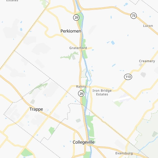
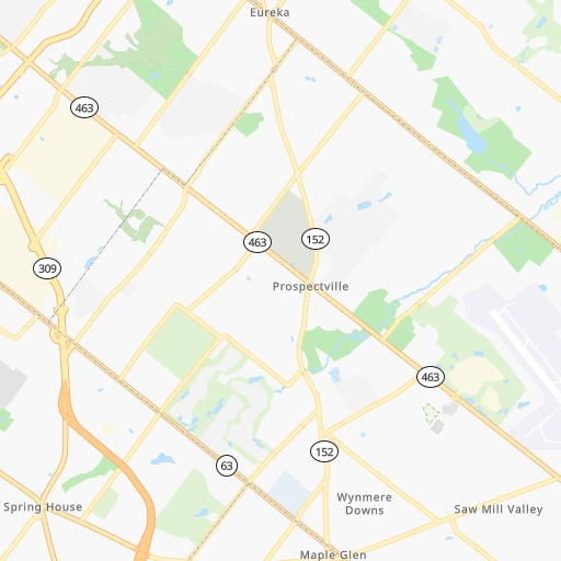
Roadmap (route) to go from Perkiomen Valley Airport to Lebanon detailed above, you can also see the course layout on the map.
While doing trip Perkiomen Valley (airport) - Lebanon by car, the calculated route ends at a distance , or more straight.
Distance and duration of the route between Perkiomen Valley (airport) and Lebanon
Calculation of distance and route from Lebanon to Perkiomen Valley (airport) :
84.895.1 km1h27mn
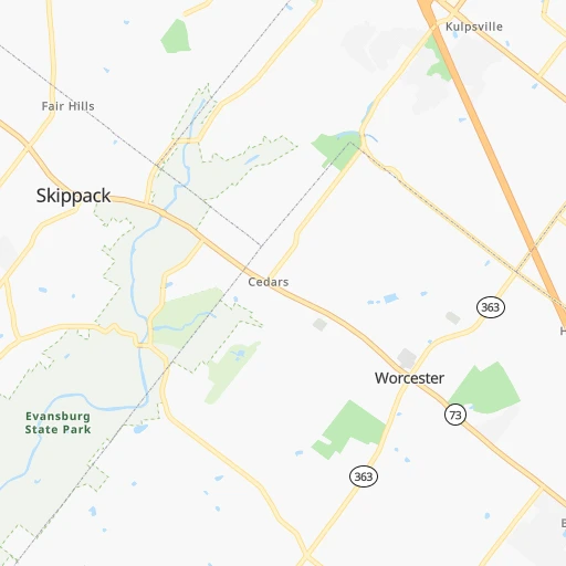
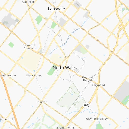
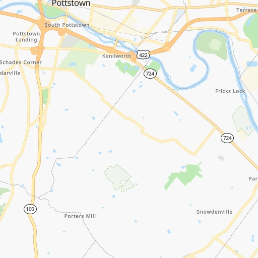
Continue 0h0mn 80 mTurn left onto Collegeville Road 0h0mn 230 mTurn left onto Landis Road 0h1mn 758 mTurn left onto Bridge Road 0h4mn 4.2 kmTurn right onto West Main Street 0h10mn 10.1 kmKeep left onto Evergreen Road 0h1mn 571 mKeep right and take US 422 West toward Pottstown 0h23mn 27.3 kmKeep left onto West Shore Bypass 0h6mn 8.5 kmKeep right and take US 422 Business West toward Pennsylvania Avenue, West Reading 1h41mn 43.2 kmTurn sharp right onto North Lincoln Avenue 0h0mn 70 mTurn right onto Spring Street 0h0mn 20 mArrive at destination 0h0mn 0 m
Travel from Perkiomen Valley (airport) (Pennsylvania) to a selection of major cities.
Distances from Perkiomen Valley Airport to biggest cities in Pennsylvania
- Mount Lebanon,32,730 inhabitants.393 km
- Bethel Park,32,118 inhabitants.392 km
- Wayne,30,892 inhabitants.18 km
- Radnor,30,878 inhabitants.18 km
- Williamsport,29,201 inhabitants.176 km
- Monroeville,28,176 inhabitants.371 km
- Cranberry Township,28,098 inhabitants.400 km
- Drexel Hill,28,043 inhabitants.31 km
- Plum,27,505 inhabitants.368 km
- Back Mountain,26,973 inhabitants.135 km
- Easton,26,915 inhabitants.57 km
- Pennsport,26,000 inhabitants.39 km
- Lebanon,25,534 inhabitants.85 km
- Whitehall Township,24,896 inhabitants.52 km
- Hazleton,24,825 inhabitants.96 km
- Springfield,23,363 inhabitants.32 km
- Pottstown,22,664 inhabitants.19 km
- New Castle,22,375 inhabitants.425 km
- Allison Park,21,552 inhabitants.386 km
- Chambersburg,20,691 inhabitants.193 km
Other major cities in country :
- Seattle [WA], 684,451 inhabitants. 3,791 km
- Denver [CO], 682,545 inhabitants. 2,510 km
- El Paso [TX], 681,124 inhabitants. 2,934 km
- Detroit [MI], 677,116 inhabitants. 680 km
- Boston [MA], 667,137 inhabitants. 437 km
- Memphis [TN], 655,770 inhabitants. 1,404 km
- New South Memphis [TN], 641,608 inhabitants. 1,407 km
- Portland [OR], 632,309 inhabitants. 3,844 km
- Oklahoma City [OK], 631,346 inhabitants. 2,006 km
- Las Vegas [NV], 623,747 inhabitants. 3,474 km
- Baltimore [MD], 621,849 inhabitants. 144 km
- Washington, D.C. [DC], 601,723 inhabitants. 201 km
- Milwaukee [WI], 600,155 inhabitants. 1,084 km
- South Boston [MA], 571,281 inhabitants. 436 km
- Albuquerque [NM], 559,121 inhabitants. 2,795 km
- Tucson [AZ], 531,641 inhabitants. 3,286 km
- Nashville [TN], 530,852 inhabitants. 1,090 km
- Fresno [CA], 520,052 inhabitants. 3,844 km
- Sacramento [CA], 490,712 inhabitants. 3,922 km
- Kansas City [MO], 475,378 inhabitants. 1,643 km
Route from Lebanon to major cities (United States).
- Distance Lebanon New York City208 km
- Distance Lebanon Los Angeles3,739 km
- Distance Lebanon Chicago957 km
- Distance Lebanon Brooklyn211 km
- Distance Lebanon Houston2,083 km
- Distance Lebanon Queens221 km
- Distance Lebanon Phoenix3,243 km
- Distance Lebanon Manhattan213 km
- Distance Lebanon San Antonio2,344 km
- Distance Lebanon San Diego3,709 km
- Distance Lebanon The Bronx222 km
- Distance Lebanon Dallas2,002 km
- Distance Lebanon San Jose3,914 km
- Distance Lebanon Austin2,230 km
- Distance Lebanon Jacksonville1,211 km
- Distance Lebanon San Francisco3,942 km
- Distance Lebanon Columbus562 km
- Distance Lebanon Fort Worth2,047 km
- Distance Lebanon Indianapolis833 km
- Distance Lebanon Charlotte690 km
Nearest cities to Perkiomen Valley (airport) :
- New York City, 8,175,133 inhabitants. 133 km
- Brooklyn, 2,300,664 inhabitants. 135 km
- Queens, 2,272,771 inhabitants. 145 km
- Philadelphia, 1,567,442 inhabitants. 36 km
- Manhattan, 1,487,536 inhabitants. 139 km
- The Bronx, 1,385,108 inhabitants. 150 km
- Baltimore, 621,849 inhabitants. 144 km
- Washington, D.C., 601,723 inhabitants. 201 km
- Staten Island, 468,730 inhabitants. 116 km
- Newark, 281,944 inhabitants. 122 km
- Jersey City, 264,290 inhabitants. 128 km
- Richmond, 220,289 inhabitants. 344 km
- Jamaica, 216,866 inhabitants. 148 km
- Rochester, 209,802 inhabitants. 376 km
- Arlington, 207,627 inhabitants. 206 km
- Yonkers, 201,116 inhabitants. 153 km
- Harlem, 181,259 inhabitants. 142 km
- East Flatbush, 178,464 inhabitants. 136 km
- East New York, 173,198 inhabitants. 141 km
- Springfield, 154,341 inhabitants. 318 km
- Alexandria, 153,511 inhabitants. 209 km
- Washington Heights, 152,613 inhabitants. 145 km
- Astoria, 150,165 inhabitants. 142 km
- Borough Park, 149,248 inhabitants. 130 km
- Paterson, 147,754 inhabitants. 133 km
- Bridgeport, 147,629 inhabitants. 216 km
- Syracuse, 144,142 inhabitants. 322 km
- New Haven, 130,322 inhabitants. 244 km
- Elizabeth, 129,007 inhabitants. 115 km
- Stamford, 128,874 inhabitants. 185 km
- Sunset Park, 126,000 inhabitants. 130 km
- Hartford, 124,006 inhabitants. 289 km
- Sheepshead Bay, 122,534 inhabitants. 133 km
- North Stamford, 121,230 inhabitants. 190 km
- Allentown, 120,207 inhabitants. 45 km
- East Harlem, 115,921 inhabitants. 142 km
- Elmhurst, 113,364 inhabitants. 144 km
- Bushwick, 112,620 inhabitants. 139 km
- Gravesend, 112,229 inhabitants. 131 km
- Corona, 109,698 inhabitants. 146 km
- Waterbury, 108,802 inhabitants. 250 km
- Edison, 102,548 inhabitants. 93 km
- Columbia, 99,615 inhabitants. 162 km
- Richmond Hill, 98,984 inhabitants. 146 km
- Albany, 98,469 inhabitants. 306 km
- Fordham, 94,678 inhabitants. 148 km
- West Albany, 93,794 inhabitants. 308 km
- Flatbush, 93,361 inhabitants. 134 km
- Toms River, 88,791 inhabitants. 108 km
- Norwalk, 88,485 inhabitants. 199 km
Location Perkiomen Valley (airport) (Pennsylvania) :
| Country flag |  |
| Location | Perkiomen Valley (airport) |
| State | Pennsylvania |
| County | Montgomery County |
| Country | United States |
| Country code / ISO 2 | US |
| Latitude | 40.2037100 |
| Longitude | -75.4270700 |
| Altitude | 82 meters |
| Time zone | America/New_York |
Location Lebanon (Pennsylvania) :
| Country flag | |
| Location | Lebanon |
| State | Pennsylvania |
| County | Lebanon County |
| Country | United States |
| Country code / ISO 2 | US |
| Latitude | 40.3409300 |
| Longitude | -76.4113500 |
| Altitude | 143 meters |
| Time zone | America/New_York |
