

How to get from Culmerville (airport) (Pennsylvania) to Lorain (Ohio)
Calculate route from Culmerville (airport) (Pennsylvania, United States) to Lorain (Ohio, United States).
The flight distance (as the crow flies) between Culmerville (airport) and Lorain is 214.5 km.
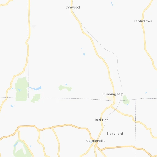
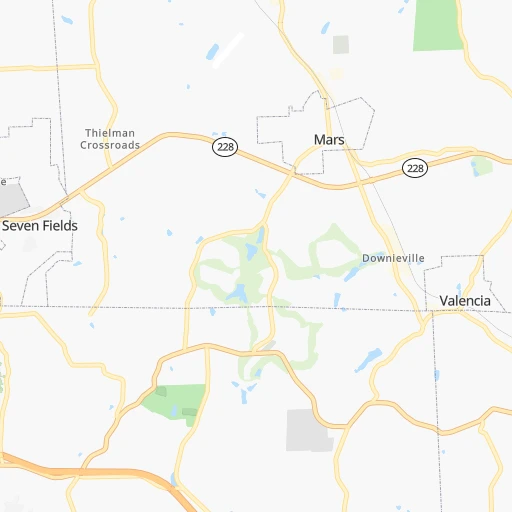
Roadmap (route) to go from Culmerville Airport to Lorain detailed above, you can also see the course layout on the map.
While doing trip Culmerville (airport) - Lorain by car, the calculated route ends at a distance , or more straight.
Distance and duration of the route between Culmerville (airport) and Lorain
Calculation of distance and route from Lorain to Culmerville (airport) :
214.5237.5 km3h39mn
Continue 0h0mn 116 mTurn sharp right onto Bakerstown Culmerville Road 0h12mn 11.9 kmTurn right onto Valencia Road 0h3mn 2.5 kmTurn left onto Babcock Boulevard 0h1mn 591 mTurn sharp right onto Mars Valencia Road 0h2mn 2.3 kmTurn left onto Mars Road 0h8mn 8.5 kmTurn left onto Perry Highway 0h0mn 365 mKeep right and take I 76, PATP toward Youngstown Ohio, Harrisburg 0h0mn 166 mKeep right and take I 76 West toward Youngstown Ohio 2h58mn 199.3 kmKeep right and take SR 57 toward Lorain, Elyria 0h1mn 988 mKeep right and take SR 57 North toward Lorain 0h1mn 1.1 kmTurn left onto Griswold Road 0h2mn 1.3 kmTurn right onto Lake Avenue 0h2mn 1.6 kmKeep right onto Elyria Avenue 0h4mn 3.2 kmTurn left onto East 39th Street 0h0mn 143 mTurn right onto Broadway 0h2mn 2.0 kmTurn left onto West 21st Street 0h1mn 1.4 kmTurn right onto Hamilton Avenue 0h0mn 220 mArrive at destination 0h0mn 0 m
Travel from Culmerville (airport) (Ohio) to a selection of major cities.
Distances from Culmerville Airport to biggest cities in Pennsylvania
- Mount Lebanon,32,730 inhabitants.38 km
- Bethel Park,32,118 inhabitants.41 km
- Wayne,30,892 inhabitants.384 km
- Radnor,30,878 inhabitants.387 km
- Williamsport,29,201 inhabitants.248 km
- Monroeville,28,176 inhabitants.27 km
- Cranberry Township,28,098 inhabitants.22 km
- Drexel Hill,28,043 inhabitants.395 km
- Plum,27,505 inhabitants.20 km
- Back Mountain,26,973 inhabitants.332 km
- Easton,26,915 inhabitants.391 km
- Pennsport,26,000 inhabitants.407 km
- Lebanon,25,534 inhabitants.293 km
- Whitehall Township,24,896 inhabitants.367 km
- Hazleton,24,825 inhabitants.328 km
- Springfield,23,363 inhabitants.393 km
- Pottstown,22,664 inhabitants.359 km
- New Castle,22,375 inhabitants.57 km
- Allison Park,21,552 inhabitants.15 km
- Chambersburg,20,691 inhabitants.202 km
Other major cities in country :
- Seattle [WA], 684,451 inhabitants. 3,436 km
- Denver [CO], 682,545 inhabitants. 2,133 km
- El Paso [TX], 681,124 inhabitants. 2,577 km
- Detroit [MI], 677,116 inhabitants. 325 km
- Boston [MA], 667,137 inhabitants. 756 km
- Memphis [TN], 655,770 inhabitants. 1,085 km
- New South Memphis [TN], 641,608 inhabitants. 1,090 km
- Portland [OR], 632,309 inhabitants. 3,481 km
- Oklahoma City [OK], 631,346 inhabitants. 1,650 km
- Las Vegas [NV], 623,747 inhabitants. 3,097 km
- Baltimore [MD], 621,849 inhabitants. 315 km
- Washington, D.C. [DC], 601,723 inhabitants. 311 km
- Milwaukee [WI], 600,155 inhabitants. 718 km
- South Boston [MA], 571,281 inhabitants. 756 km
- Albuquerque [NM], 559,121 inhabitants. 2,425 km
- Tucson [AZ], 531,641 inhabitants. 2,920 km
- Nashville [TN], 530,852 inhabitants. 785 km
- Fresno [CA], 520,052 inhabitants. 3,466 km
- Sacramento [CA], 490,712 inhabitants. 3,545 km
- Kansas City [MO], 475,378 inhabitants. 1,269 km
Route from Lorain to major cities (United States).
- Distance Lorain New York City691 km
- Distance Lorain Los Angeles3,254 km
- Distance Lorain Chicago457 km
- Distance Lorain Brooklyn697 km
- Distance Lorain Houston1,761 km
- Distance Lorain Queens705 km
- Distance Lorain Philadelphia615 km
- Distance Lorain Phoenix2,772 km
- Distance Lorain Manhattan693 km
- Distance Lorain San Antonio1,989 km
- Distance Lorain San Diego3,230 km
- Distance Lorain The Bronx700 km
- Distance Lorain Dallas1,614 km
- Distance Lorain San Jose3,417 km
- Distance Lorain Austin1,871 km
- Distance Lorain Jacksonville1,239 km
- Distance Lorain San Francisco3,444 km
- Distance Lorain Fort Worth1,655 km
- Distance Lorain Indianapolis385 km
- Distance Lorain Charlotte703 km
Nearest cities to Culmerville (airport) :
- Washington, D.C., 601,723 inhabitants. 311 km
- Cleveland, 388,072 inhabitants. 181 km
- Pittsburgh, 304,391 inhabitants. 28 km
- Meads, 288,649 inhabitants. 351 km
- Ironville, 288,649 inhabitants. 346 km
- Buffalo, 258,071 inhabitants. 260 km
- Rochester, 209,802 inhabitants. 333 km
- Arlington, 207,627 inhabitants. 307 km
- Akron, 197,542 inhabitants. 148 km
- Alexandria, 153,511 inhabitants. 317 km
- Amherst, 122,366 inhabitants. 272 km
- Erie, 99,475 inhabitants. 164 km
- Germantown, 86,395 inhabitants. 275 km
- Parma, 79,937 inhabitants. 178 km
- Cheektowaga, 75,178 inhabitants. 265 km
- Canton, 71,885 inhabitants. 130 km
- Silver Spring, 71,452 inhabitants. 305 km
- Centreville, 71,135 inhabitants. 290 km
- Frederick, 69,479 inhabitants. 250 km
- Waldorf, 67,752 inhabitants. 337 km
- Gaithersburg, 67,456 inhabitants. 282 km
- Rockville, 66,980 inhabitants. 290 km
- Dale City, 65,969 inhabitants. 313 km
- Youngstown, 64,628 inhabitants. 83 km
- Lorain, 63,647 inhabitants. 215 km
- Bethesda, 60,858 inhabitants. 300 km
- Reston, 58,404 inhabitants. 285 km
- Elyria, 53,775 inhabitants. 205 km
- Harrisonburg, 52,538 inhabitants. 260 km
- Irondequoit, 51,692 inhabitants. 340 km
- Leesburg, 51,209 inhabitants. 260 km
- Lakewood, 50,656 inhabitants. 187 km
- Charleston, 49,736 inhabitants. 300 km
- Cuyahoga Falls, 49,146 inhabitants. 147 km
- Harrisburg, 49,081 inhabitants. 255 km
- Niagara Falls, 48,916 inhabitants. 278 km
- Aspen Hill, 48,759 inhabitants. 295 km
- Huntington, 48,638 inhabitants. 335 km
- Wheaton, 48,284 inhabitants. 299 km
- McLean, 48,115 inhabitants. 299 km
- Newark, 47,986 inhabitants. 227 km
- Euclid, 47,676 inhabitants. 175 km
- Mentor, 46,901 inhabitants. 168 km
- Mansfield, 46,830 inhabitants. 225 km
- Charlottesville, 46,597 inhabitants. 316 km
- Altoona, 45,344 inhabitants. 124 km
- Potomac, 44,965 inhabitants. 290 km
- Cleveland Heights, 44,962 inhabitants. 172 km
- West Seneca, 44,711 inhabitants. 258 km
- Strongsville, 44,668 inhabitants. 182 km
Location Culmerville (airport) (Pennsylvania) :
| Country flag |  |
| Location | Culmerville (airport) |
| State | Pennsylvania |
| County | Allegheny County |
| Country | United States |
| Country code / ISO 2 | US |
| Latitude | 40.6635200 |
| Longitude | -79.8466800 |
| Altitude | 375 meters |
| Time zone | America/New_York |
Location Lorain (Ohio) :
| Country flag | |
| Location | Lorain |
| State | Ohio |
| County | Lorain County |
| Country | United States |
| Country code / ISO 2 | US |
| Latitude | 41.4528200 |
| Longitude | -82.1823700 |
| Altitude | 186 meters |
| Time zone | America/New_York |


