
How to get from Perkins Memorial Airpark (Nebraska) to McCook (Nebraska)
Calculate route from Perkins Memorial Airpark (Nebraska, United States) to McCook (Nebraska, United States).
The flight distance (as the crow flies) between Perkins Memorial Airpark and McCook is 272.6 km.
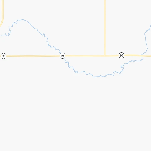
Roadmap (route) to go from Perkins Memorial Airpark to McCook detailed above, you can also see the course layout on the map.
While doing trip Perkins Memorial Airpark - McCook by car, the calculated route ends at a distance , or more straight.
Distance and duration of the route between Perkins Memorial Airpark and McCook
Calculation of distance and route from McCook to Perkins Memorial Airpark :
272.6355.4 km4h59mn
Continue onto Airport Road 0h1mn 395 mTurn left onto East Main Street 0h14mn 19.5 kmTurn left onto Highway 11 1h33mn 51.2 kmTurn right onto Highway 11 0h3mn 3.2 kmTurn right onto Highway 91 0h14mn 21.5 kmTurn left onto Highway 183 0h25mn 39.2 kmTurn right onto Highway 70 0h12mn 19.3 kmTurn left onto Memorial Drive 0h0mn 59 mKeep right onto NE 70 0h2mn 1.9 kmTurn left onto South 8th Avenue 1h50mn 75.3 kmTurn left onto Cattlemen Drive 0h1mn 789 mTurn right onto Plum Creek Parkway 0h17mn 25.3 kmContinue onto North Smith Avenue 0h22mn 33.0 kmTurn right onto Chestnut Street 1h45mn 64.2 kmTurn right onto East 1st Street 0h0mn 339 mTurn left onto East E Street 0h0mn 119 mTurn right onto Norris Avenue 0h0mn 32 mArrive at destination 0h0mn 0 m
Travel from Perkins Memorial Airpark (Nebraska) to a selection of major cities.
Distances from Perkins Memorial Airpark to biggest cities in Nebraska
Other major cities in country :
- Charlotte [NC], 827,097 inhabitants. 1,732 km
- Seattle [WA], 684,451 inhabitants. 1,947 km
- Denver [CO], 682,545 inhabitants. 592 km
- El Paso [TX], 681,124 inhabitants. 1,350 km
- Detroit [MI], 677,116 inhabitants. 1,291 km
- Boston [MA], 667,137 inhabitants. 2,269 km
- Memphis [TN], 655,770 inhabitants. 1,088 km
- New South Memphis [TN], 641,608 inhabitants. 1,093 km
- Portland [OR], 632,309 inhabitants. 1,949 km
- Oklahoma City [OK], 631,346 inhabitants. 757 km
- Las Vegas [NV], 623,747 inhabitants. 1,563 km
- Baltimore [MD], 621,849 inhabitants. 1,888 km
- Washington, D.C. [DC], 601,723 inhabitants. 1,867 km
- Milwaukee [WI], 600,155 inhabitants. 891 km
- South Boston [MA], 571,281 inhabitants. 2,271 km
- Albuquerque [NM], 559,121 inhabitants. 1,048 km
- Tucson [AZ], 531,641 inhabitants. 1,547 km
- Nashville [TN], 530,852 inhabitants. 1,229 km
- Fresno [CA], 520,052 inhabitants. 1,901 km
- Sacramento [CA], 490,712 inhabitants. 1,965 km
Route from McCook to major cities (United States).
- Distance McCook New York City2,247 km
- Distance McCook Los Angeles1,703 km
- Distance McCook Chicago1,104 km
- Distance McCook Brooklyn2,252 km
- Distance McCook Houston1,257 km
- Distance McCook Queens2,261 km
- Distance McCook Philadelphia2,162 km
- Distance McCook Phoenix1,265 km
- Distance McCook Manhattan2,249 km
- Distance McCook San Antonio1,215 km
- Distance McCook San Diego1,695 km
- Distance McCook The Bronx2,257 km
- Distance McCook Dallas894 km
- Distance McCook San Jose1,869 km
- Distance McCook Austin1,136 km
- Distance McCook Jacksonville2,038 km
- Distance McCook San Francisco1,900 km
- Distance McCook Columbus1,499 km
- Distance McCook Fort Worth883 km
- Distance McCook Indianapolis1,234 km
Nearest cities to Perkins Memorial Airpark :
- Omaha, 443,885 inhabitants. 255 km
- Lincoln, 277,348 inhabitants. 232 km
- Sioux Falls, 171,544 inhabitants. 224 km
- Sioux City, 82,821 inhabitants. 195 km
- Council Bluffs, 62,597 inhabitants. 261 km
- Bellevue, 55,510 inhabitants. 264 km
- Grand Island, 51,440 inhabitants. 146 km
- Kearney, 33,021 inhabitants. 170 km
- Fremont, 26,474 inhabitants. 204 km
- Hastings, 24,924 inhabitants. 182 km
- Norfolk, 24,366 inhabitants. 110 km
- North Platte, 24,194 inhabitants. 207 km
- Brookings, 23,657 inhabitants. 283 km
- Columbus, 22,797 inhabitants. 142 km
- Watertown, 22,073 inhabitants. 328 km
- Papillion, 19,510 inhabitants. 252 km
- La Vista, 16,921 inhabitants. 252 km
- Mitchell, 15,669 inhabitants. 178 km
- Yankton, 14,557 inhabitants. 133 km
- Pierre, 14,002 inhabitants. 275 km
- Marshall, 13,652 inhabitants. 346 km
- South Sioux City, 13,319 inhabitants. 193 km
- Huron, 13,313 inhabitants. 244 km
- Beatrice, 12,388 inhabitants. 272 km
- Chalco, 10,994 inhabitants. 243 km
- Vermillion, 10,738 inhabitants. 162 km
- Lexington, 10,075 inhabitants. 179 km
- Brandon, 9,856 inhabitants. 235 km
- Le Mars, 9,761 inhabitants. 221 km
- Elkhorn, 8,251 inhabitants. 231 km
- Blair, 7,975 inhabitants. 228 km
- York, 7,864 inhabitants. 176 km
- McCook, 7,580 inhabitants. 273 km
- Sioux Center, 7,461 inhabitants. 231 km
- Nebraska City, 7,335 inhabitants. 294 km
- Madison, 7,258 inhabitants. 240 km
- Seward, 7,167 inhabitants. 198 km
- Crete, 7,037 inhabitants. 229 km
- Plattsmouth, 6,462 inhabitants. 272 km
- Orange City, 6,198 inhabitants. 237 km
- Schuyler, 6,171 inhabitants. 162 km
- Ralston, 5,994 inhabitants. 250 km
- Wayne, 5,569 inhabitants. 142 km
- Holdrege, 5,561 inhabitants. 203 km
- Harrisburg, 5,498 inhabitants. 216 km
- Colby, 5,417 inhabitants. 368 km
- Glenwood, 5,253 inhabitants. 280 km
- Concordia, 5,218 inhabitants. 306 km
- Sheldon, 5,088 inhabitants. 260 km
- Gretna, 5,046 inhabitants. 239 km
Location Perkins Memorial Airpark (Nebraska) :
| Country flag |  |
| Location | Perkins Memorial Airpark |
| State | Nebraska |
| County | Holt County |
| Country | United States |
| Country code / ISO 2 | US |
| Latitude | 42.2002800 |
| Longitude | -98.7348100 |
| Altitude | 646 meters |
| Time zone | America/Chicago |
Location McCook (Nebraska) :
| Country flag | |
| Location | McCook |
| State | Nebraska |
| County | Red Willow County |
| Country | United States |
| Country code / ISO 2 | US |
| Latitude | 40.2019500 |
| Longitude | -100.6257100 |
| Altitude | 784 meters |
| Time zone | America/Chicago |

