

How to get from Mc Millan Ranch (airport) (Nebraska) to York (Nebraska)
Calculate route from Mc Millan Ranch (airport) (Nebraska, United States) to York (Nebraska, United States).
The flight distance (as the crow flies) between Mc Millan Ranch (airport) and York is 205.7 km.
Roadmap (route) to go from Mc Millan Ranch Airport to York detailed above, you can also see the course layout on the map.
While doing trip Mc Millan Ranch (airport) - York by car, the calculated route ends at a distance , or more straight.
Distance and duration of the route between Mc Millan Ranch (airport) and York
Calculation of distance and route from York to Mc Millan Ranch (airport) :
205.7246.5 km3h54mn
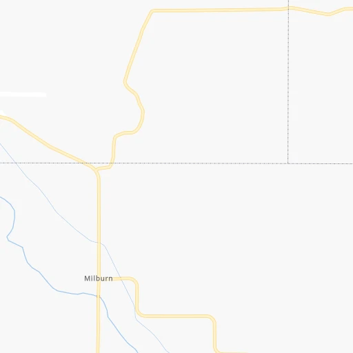
Continue onto Milburn Avenue 0h12mn 15.3 kmTurn left onto Sargent Road 0h1mn 802 mTurn right onto 435 Drive 0h1mn 1.6 kmKeep left onto 435 Drive 0h0mn 40 mTurn slight left onto 813 Road 0h7mn 8.5 kmTurn right onto Lillian Road 0h12mn 14.1 kmTurn right onto Airport Road 0h3mn 3.9 kmTurn left onto Paulson Road 0h1mn 1.6 kmTurn right onto 411 Road 0h1mn 1.8 kmTurn left onto Memorial Drive 0h1mn 685 mTurn left onto Highway 2 1h21mn 124.4 kmTurn right onto North Broadwell Avenue 0h0mn 198 mTurn left onto West Capital Avenue 0h1mn 528 mTurn right onto North Sycamore Street 0h3mn 2.7 kmTurn left onto East 1st Street 0h1mn 418 mTurn right onto South Plum Street 0h2mn 1.4 kmTurn left onto East Bismark Road 0h0mn 350 mTurn right onto South Stuhr Road 0h3mn 3.3 kmTurn left onto Highway 34 1h43mn 62.7 kmTurn right onto North Lincoln Avenue 0h2mn 2.1 kmTurn left onto East 7th Street 0h0mn 83 mArrive at destination 0h0mn 0 m
Travel from Mc Millan Ranch (airport) (Nebraska) to a selection of major cities.
Distances from Mc Millan Ranch Airport to biggest cities in Nebraska
Other major cities in country :
- Charlotte [NC], 827,097 inhabitants. 1,796 km
- Seattle [WA], 684,451 inhabitants. 1,894 km
- Denver [CO], 682,545 inhabitants. 494 km
- El Paso [TX], 681,124 inhabitants. 1,263 km
- Detroit [MI], 677,116 inhabitants. 1,381 km
- Boston [MA], 667,137 inhabitants. 2,362 km
- Memphis [TN], 655,770 inhabitants. 1,120 km
- New South Memphis [TN], 641,608 inhabitants. 1,124 km
- Portland [OR], 632,309 inhabitants. 1,887 km
- Oklahoma City [OK], 631,346 inhabitants. 726 km
- Las Vegas [NV], 623,747 inhabitants. 1,466 km
- Baltimore [MD], 621,849 inhabitants. 1,972 km
- Washington, D.C. [DC], 601,723 inhabitants. 1,948 km
- Milwaukee [WI], 600,155 inhabitants. 984 km
- South Boston [MA], 571,281 inhabitants. 2,363 km
- Albuquerque [NM], 559,121 inhabitants. 955 km
- Tucson [AZ], 531,641 inhabitants. 1,451 km
- Nashville [TN], 530,852 inhabitants. 1,282 km
- Fresno [CA], 520,052 inhabitants. 1,808 km
- Sacramento [CA], 490,712 inhabitants. 1,877 km
Route from York to major cities (United States).
- Distance York New York City1,982 km
- Distance York Los Angeles1,970 km
- Distance York Chicago837 km
- Distance York Brooklyn1,988 km
- Distance York Houston1,253 km
- Distance York Queens1,997 km
- Distance York Philadelphia1,899 km
- Distance York Phoenix1,524 km
- Distance York Manhattan1,984 km
- Distance York San Antonio1,277 km
- Distance York San Diego1,961 km
- Distance York The Bronx1,991 km
- Distance York Dallas903 km
- Distance York San Jose2,129 km
- Distance York Austin1,180 km
- Distance York Jacksonville1,854 km
- Distance York San Francisco2,158 km
- Distance York Columbus1,240 km
- Distance York Fort Worth907 km
- Distance York Indianapolis977 km
Nearest cities to Mc Millan Ranch (airport) :
- Grand Island, 51,440 inhabitants. 150 km
- Salina, 47,813 inhabitants. 372 km
- Kearney, 33,021 inhabitants. 130 km
- Hastings, 24,924 inhabitants. 173 km
- Junction City, 24,621 inhabitants. 392 km
- Norfolk, 24,366 inhabitants. 196 km
- North Platte, 24,194 inhabitants. 109 km
- Brookings, 23,657 inhabitants. 373 km
- Columbus, 22,797 inhabitants. 202 km
- Hays, 21,092 inhabitants. 322 km
- Mitchell, 15,669 inhabitants. 260 km
- Yankton, 14,557 inhabitants. 231 km
- Pierre, 14,002 inhabitants. 295 km
- Huron, 13,313 inhabitants. 316 km
- Vermillion, 10,738 inhabitants. 259 km
- Lexington, 10,075 inhabitants. 108 km
- York, 7,864 inhabitants. 206 km
- Fort Riley North, 7,761 inhabitants. 386 km
- McCook, 7,580 inhabitants. 187 km
- Madison, 7,258 inhabitants. 331 km
- Seward, 7,167 inhabitants. 241 km
- Crete, 7,037 inhabitants. 266 km
- Abilene, 6,558 inhabitants. 382 km
- Schuyler, 6,171 inhabitants. 227 km
- Wayne, 5,569 inhabitants. 233 km
- Holdrege, 5,561 inhabitants. 150 km
- Colby, 5,417 inhabitants. 284 km
- Concordia, 5,218 inhabitants. 300 km
- Tea, 4,839 inhabitants. 305 km
- Ogallala, 4,570 inhabitants. 178 km
- Russell, 4,534 inhabitants. 327 km
- Aurora, 4,496 inhabitants. 177 km
- Goodland, 4,457 inhabitants. 314 km
- Clay Center, 4,173 inhabitants. 346 km
- Cozad, 3,863 inhabitants. 101 km
- Beloit, 3,790 inhabitants. 291 km
- Fairbury, 3,751 inhabitants. 282 km
- Burlington, 3,720 inhabitants. 345 km
- O'Neill, 3,653 inhabitants. 121 km
- Yuma, 3,596 inhabitants. 309 km
- Broken Bow, 3,551 inhabitants. 40 km
- Gothenburg, 3,514 inhabitants. 98 km
- Pine Ridge, 3,308 inhabitants. 270 km
- Hartford, 3,025 inhabitants. 310 km
- Minden, 3,006 inhabitants. 155 km
Location Mc Millan Ranch (airport) (Nebraska) :
| Country flag |  |
| Location | Mc Millan Ranch (airport) |
| State | Nebraska |
| County | Blaine County |
| Country | United States |
| Country code / ISO 2 | US |
| Latitude | 41.7529300 |
| Longitude | -99.7567700 |
| Altitude | 766 meters |
| Time zone | America/Chicago |
Location York (Nebraska) :
| Country flag | |
| Location | York |
| State | Nebraska |
| County | York County |
| Country | United States |
| Country code / ISO 2 | US |
| Latitude | 40.8680700 |
| Longitude | -97.5920000 |
| Altitude | 488 meters |
| Time zone | America/Chicago |


