
How to get from Boardman Aerial (airport) (Nebraska) to Leavenworth (Kansas)
Calculate route from Boardman Aerial (airport) (Nebraska, United States) to Leavenworth (Kansas, United States).
The flight distance (as the crow flies) between Boardman Aerial (airport) and Leavenworth is 296.2 km.
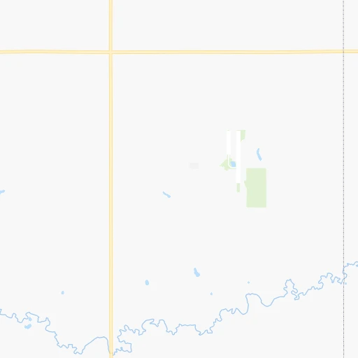
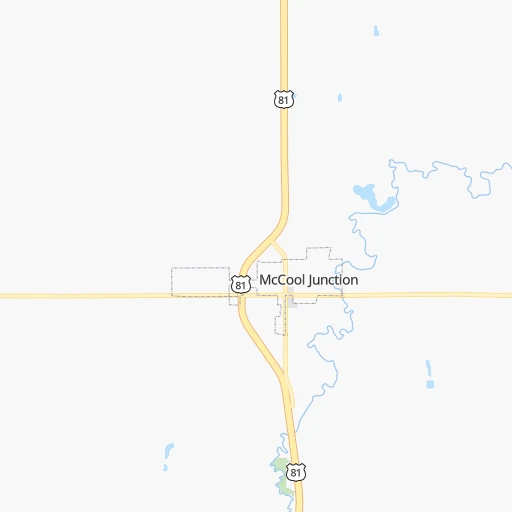
Roadmap (route) to go from Boardman Aerial Airport to Leavenworth detailed above, you can also see the course layout on the map.
While doing trip Boardman Aerial (airport) - Leavenworth by car, the calculated route ends at a distance , or more straight.
Distance and duration of the route between Boardman Aerial (airport) and Leavenworth
Calculation of distance and route from Leavenworth to Boardman Aerial (airport) :
296.2392.5 km4h4mn
Continue 0h1mn 429 mTurn right onto East 5th Road 0h1mn 788 mTurn left onto South Y Road 0h1mn 1.6 kmTurn right onto East 6th Road 0h1mn 1.6 kmTurn left onto Road A 0h3mn 3.2 kmTurn right onto Road 8 0h1mn 1.6 kmTurn left onto Road B 0h2mn 2.1 kmTurn right toward I 80 east 1h49mn 88.0 kmKeep right and take US 77 South, To NE 2 toward Beatrice, Nebraska City 0h3mn 4.3 kmKeep right and drive toward Lincoln via Van Dorn Street, Pioneers Park, Nebraska City 0h0mn 276 mKeep left and drive toward Lincoln, Nebraska City 0h0mn 101 mKeep right 0h2mn 2.0 kmTurn right onto South 9th Street 0h13mn 15.7 kmTurn left toward NE 2 East, I 29 1h43mn 70.6 kmTurn right 2h48mn 182.2 kmTurn right and take MO 273 North toward Tracy, Weston 0h0mn 237 mKeep right and take MO 273 North toward Tracy, Weston 0h0mn 74 mTurn slight right onto 273 Highway 0h1mn 945 mContinue onto MO 92 Spur 0h0mn 361 mTurn sharp right onto MO 92 and take MO 92 West toward Leavenworth 0h9mn 11.8 kmAt roundabout, take exit 1 onto MO 92 0h2mn 1.8 kmTurn left onto North 4th Street 0h1mn 880 mTurn right onto Miami Street 0h0mn 406 mTurn left onto North 7th Street 0h0mn 397 mTurn right onto Cherokee Street 0h0mn 239 mTurn left onto South Broadway Street 0h1mn 668 mTurn right onto Spruce Street 0h0mn 162 mTurn right 0h0mn 55 mArrive at destination 0h0mn 0 m
Travel from Boardman Aerial (airport) (Kansas) to a selection of major cities.
Distances from Boardman Aerial Airport to biggest cities in Nebraska
Other major cities in country :
- Charlotte [NC], 827,097 inhabitants. 1,611 km
- Seattle [WA], 684,451 inhabitants. 2,087 km
- Denver [CO], 682,545 inhabitants. 616 km
- El Paso [TX], 681,124 inhabitants. 1,265 km
- Detroit [MI], 677,116 inhabitants. 1,244 km
- Boston [MA], 667,137 inhabitants. 2,230 km
- Memphis [TN], 655,770 inhabitants. 926 km
- New South Memphis [TN], 641,608 inhabitants. 930 km
- Portland [OR], 632,309 inhabitants. 2,076 km
- Oklahoma City [OK], 631,346 inhabitants. 589 km
- Las Vegas [NV], 623,747 inhabitants. 1,587 km
- Baltimore [MD], 621,849 inhabitants. 1,813 km
- Washington, D.C. [DC], 601,723 inhabitants. 1,787 km
- Milwaukee [WI], 600,155 inhabitants. 862 km
- South Boston [MA], 571,281 inhabitants. 2,231 km
- Albuquerque [NM], 559,121 inhabitants. 997 km
- Tucson [AZ], 531,641 inhabitants. 1,504 km
- Nashville [TN], 530,852 inhabitants. 1,090 km
- Fresno [CA], 520,052 inhabitants. 1,949 km
- Sacramento [CA], 490,712 inhabitants. 2,034 km
Route from Leavenworth to major cities (United States).
- Distance Leavenworth New York City1,786 km
- Distance Leavenworth Los Angeles2,156 km
- Distance Leavenworth Chicago676 km
- Distance Leavenworth Brooklyn1,791 km
- Distance Leavenworth Houston1,064 km
- Distance Leavenworth Queens1,800 km
- Distance Leavenworth Philadelphia1,692 km
- Distance Leavenworth Phoenix1,666 km
- Distance Leavenworth Manhattan1,789 km
- Distance Leavenworth San Antonio1,148 km
- Distance Leavenworth San Diego2,126 km
- Distance Leavenworth The Bronx1,797 km
- Distance Leavenworth Dallas746 km
- Distance Leavenworth San Jose2,357 km
- Distance Leavenworth Austin1,039 km
- Distance Leavenworth Jacksonville1,568 km
- Distance Leavenworth San Francisco2,391 km
- Distance Leavenworth Columbus1,024 km
- Distance Leavenworth Fort Worth764 km
- Distance Leavenworth Indianapolis754 km
Nearest cities to Boardman Aerial (airport) :
- Omaha, 443,885 inhabitants. 170 km
- Lincoln, 277,348 inhabitants. 100 km
- Sioux Falls, 171,544 inhabitants. 326 km
- Topeka, 127,265 inhabitants. 265 km
- Lawrence, 93,917 inhabitants. 299 km
- Sioux City, 82,821 inhabitants. 229 km
- Council Bluffs, 62,597 inhabitants. 177 km
- Manhattan, 56,308 inhabitants. 206 km
- Bellevue, 55,510 inhabitants. 170 km
- Grand Island, 51,440 inhabitants. 46 km
- Salina, 47,813 inhabitants. 214 km
- Hutchinson, 41,569 inhabitants. 300 km
- Leavenworth, 35,980 inhabitants. 297 km
- Kearney, 33,021 inhabitants. 104 km
- Dodge City, 27,912 inhabitants. 383 km
- Fremont, 26,474 inhabitants. 137 km
- Hastings, 24,924 inhabitants. 49 km
- Emporia, 24,649 inhabitants. 298 km
- Junction City, 24,621 inhabitants. 211 km
- Norfolk, 24,366 inhabitants. 147 km
- North Platte, 24,194 inhabitants. 248 km
- Columbus, 22,797 inhabitants. 86 km
- Hays, 21,092 inhabitants. 244 km
- Gardner, 20,868 inhabitants. 331 km
- Papillion, 19,510 inhabitants. 159 km
- Newton, 19,216 inhabitants. 304 km
- La Vista, 16,921 inhabitants. 160 km
- Great Bend, 15,717 inhabitants. 277 km
- Mitchell, 15,669 inhabitants. 329 km
- Yankton, 14,557 inhabitants. 239 km
- South Sioux City, 13,319 inhabitants. 226 km
- McPherson, 13,144 inhabitants. 266 km
- Worthington, 13,090 inhabitants. 369 km
- El Dorado, 12,931 inhabitants. 338 km
- Beatrice, 12,388 inhabitants. 108 km
- Ottawa, 12,387 inhabitants. 325 km
- Maryville, 11,879 inhabitants. 256 km
- Lansing, 11,767 inhabitants. 302 km
- Spencer, 11,212 inhabitants. 348 km
- Chalco, 10,994 inhabitants. 151 km
- Storm Lake, 10,910 inhabitants. 304 km
- Vermillion, 10,738 inhabitants. 238 km
- Atchison, 10,712 inhabitants. 267 km
- Lexington, 10,075 inhabitants. 159 km
- Carroll, 9,968 inhabitants. 289 km
- Brandon, 9,856 inhabitants. 334 km
- Le Mars, 9,761 inhabitants. 267 km
- Denison, 8,334 inhabitants. 252 km
- Elkhorn, 8,251 inhabitants. 148 km
- Blair, 7,975 inhabitants. 169 km
Location Boardman Aerial (airport) (Nebraska) :
| Country flag |  |
| Location | Boardman Aerial (airport) |
| State | Nebraska |
| County | Hamilton County |
| Country | United States |
| Country code / ISO 2 | US |
| Latitude | 40.7524600 |
| Longitude | -97.8516600 |
| Altitude | 526 meters |
| Time zone | America/Chicago |
Location Leavenworth (Kansas) :
| Country flag | |
| Location | Leavenworth |
| State | Kansas |
| County | Leavenworth County |
| Country | United States |
| Country code / ISO 2 | US |
| Latitude | 39.3111100 |
| Longitude | -94.9224600 |
| Altitude | 256 meters |
| Time zone | America/Chicago |


