


How to get from Gackle Municipal (airport) (North Dakota) to El Paso (Texas)
Calculate route from Gackle Municipal (airport) (North Dakota, United States) to El Paso (Texas, United States).
The flight distance (as the crow flies) between Gackle Municipal (airport) and El Paso is 1,766.2 km.
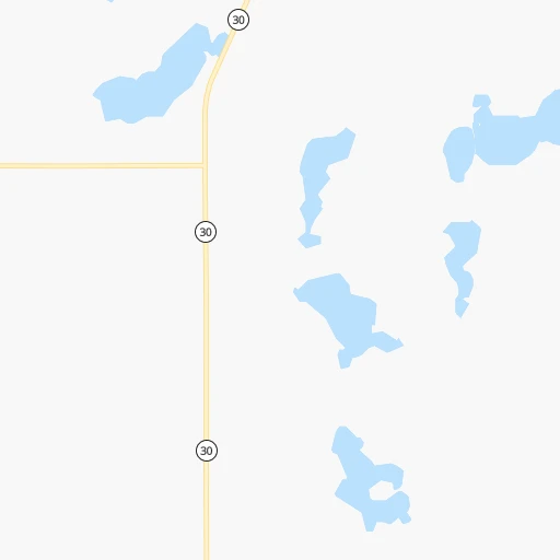
Roadmap (route) to go from Gackle Municipal Airport to El Paso detailed above, you can also see the course layout on the map.
While doing trip Gackle Municipal (airport) - El Paso by car, the calculated route ends at a distance , or more straight.
Distance and duration of the route between Gackle Municipal (airport) and El Paso
Calculation of distance and route from El Paso to Gackle Municipal (airport) :
1,766.22,106.1 km25h12mn
Continue 0h5mn 1.7 kmTurn right onto Main Street 0h7mn 10.6 kmTurn right onto State Highway 34 0h11mn 17.6 kmTurn left onto State Highway 30 0h1mn 1.6 kmKeep right onto ND 34 0h0mn 50 mTurn slight right onto State Highway 34 0h19mn 30.4 kmTurn left onto Broadway 0h20mn 28.5 kmTurn right onto State Highway 13 0h3mn 4.9 kmTurn left onto 26th Avenue Southeast 1h31mn 25.5 kmTurn right onto 96th Street Southeast 0h0mn 242 mTurn slight right onto State Highway 11 0h12mn 17.6 kmTurn left onto US 83 1h47mn 55.0 kmTurn left onto US 12, US 83, SD 20 0h9mn 10.6 kmKeep right onto US 83, SD 20 1h42mn 49.5 kmKeep right 1h50mn 58.2 kmKeep right onto US 83 0h0mn 120 mContinue onto US 14, US 83 0h23mn 26.9 kmTurn right onto East Elizabeth Street 0h1mn 591 mTurn left onto North Poplar Avenue 0h1mn 308 mContinue onto South Poplar Avenue 0h0mn 306 mTurn right onto West Sioux Avenue 1h46mn 53.6 kmKeep right onto US 83 1h50mn 96.5 kmKeep right onto I 90 Business and take I 90 Business toward Kadoka 0h0mn 516 mTurn left onto I 90 Business 0h0mn 351 mTurn right onto Highway 16 0h3mn 3.5 kmTurn left onto SD 73 1h47mn 73.0 kmKeep right 0h0mn 50 mTurn slight right onto US 18, SD 73 0h13mn 19.4 kmTurn left onto State Highway 73 0h27mn 29.2 kmTurn right onto US 20, NE 61 0h0mn 50 mTurn left onto Mills Street 1h9mn 107.8 kmTurn right onto NE 2 0h8mn 11.3 kmTurn sharp left onto South Ashby 1h55mn 72.9 kmTurn right onto Road 72 0h4mn 4.8 kmTurn left onto Road 183 0h10mn 12.8 kmContinue onto Road 58 0h2mn 1.6 kmTurn left onto West 2nd Street 0h25mn 35.8 kmTurn right onto US 30, I 80 Alt 0h2mn 3.2 kmTurn left onto Road 175 0h4mn 4.8 kmTurn right onto Road 8 0h6mn 7.4 kmTurn left onto Road 167 0h0mn 241 mTurn left onto Road 167 0h12mn 11.9 kmTurn right onto United States Highway 138 0h3mn 3.4 kmTurn left onto CO 59, CR 15 0h3mn 3.5 kmTurn right onto I 76 1h5mn 117.5 kmKeep right and take US 34, US 6 toward Brush, Yuma 0h0mn 322 mTurn left onto I 76 Bus, US 6, US 34 Spur 0h1mn 1.6 kmKeep right 0h0mn 233 mContinue onto I 76 Bus, US 34 0h0mn 429 mTurn left onto CO 71 1h17mn 116.7 kmTurn right onto Main Street 0h2mn 1.6 kmTurn left onto Indiana Avenue 2h52mn 136.3 kmTurn left onto United States Highway 50 0h1mn 1.8 kmTurn sharp right onto North 2nd Street 0h0mn 269 mTurn left onto Maple Avenue 0h1mn 842 mTurn right onto South Main Street 0h0mn 345 mTurn left onto Pine Avenue 0h0mn 257 mTurn right onto 11th Street 0h1mn 302 mContinue onto South 12th Street 0h5mn 6.9 kmTurn right onto First Cavalry Division Memorial Highway 0h1mn 809 mTurn left onto State Highway 71 0h10mn 14.5 kmTurn right onto United States Highway 350 1h8mn 103.8 kmTurn right onto US Highway 160 0h1mn 1.5 kmTurn left 2h20mn 244.9 kmKeep right 0h0mn 290 mTurn sharp left onto NM 3 2h50mn 116.2 kmTurn right onto US 54 2h24mn 193.4 kmKeep right onto US 54, US 70 0h6mn 7.9 kmKeep right onto US 70 0h1mn 510 mTurn left onto US Highway 54 South 1h10mn 116.3 kmKeep left onto US 54 0h9mn 13.0 kmKeep right and drive toward Fort Bliss, Pershing Drive 0h1mn 594 mKeep left onto Gateway South Boulevard 0h2mn 1.8 kmTurn right onto Pershing Drive 0h3mn 3.3 kmTurn right onto East Missouri Avenue 0h1mn 607 mKeep left 0h1mn 1.9 kmKeep right and drive toward Missouri Avenue, Downtown 0h1mn 879 mTurn left onto North Mesa Street 0h0mn 427 mArrive at destination 0h0mn 0 m
Travel from Gackle Municipal (airport) (Texas) to a selection of major cities.
Distances from Gackle Municipal Airport to biggest cities in North Dakota
Other major cities in country :
- Charlotte [NC], 827,097 inhabitants. 1,987 km
- Seattle [WA], 684,451 inhabitants. 1,752 km
- Denver [CO], 682,545 inhabitants. 900 km
- El Paso [TX], 681,124 inhabitants. 1,769 km
- Detroit [MI], 677,116 inhabitants. 1,363 km
- Boston [MA], 667,137 inhabitants. 2,269 km
- Memphis [TN], 655,770 inhabitants. 1,488 km
- New South Memphis [TN], 641,608 inhabitants. 1,493 km
- Portland [OR], 632,309 inhabitants. 1,813 km
- Oklahoma City [OK], 631,346 inhabitants. 1,249 km
- Las Vegas [NV], 623,747 inhabitants. 1,764 km
- Baltimore [MD], 621,849 inhabitants. 2,001 km
- Washington, D.C. [DC], 601,723 inhabitants. 1,993 km
- Milwaukee [WI], 600,155 inhabitants. 973 km
- South Boston [MA], 571,281 inhabitants. 2,271 km
- Albuquerque [NM], 559,121 inhabitants. 1,429 km
- Tucson [AZ], 531,641 inhabitants. 1,891 km
- Nashville [TN], 530,852 inhabitants. 1,553 km
- Fresno [CA], 520,052 inhabitants. 2,026 km
- Sacramento [CA], 490,712 inhabitants. 2,028 km
Route from El Paso to major cities (United States).
- Distance El Paso New York City3,062 km
- Distance El Paso Los Angeles1,127 km
- Distance El Paso Chicago2,013 km
- Distance El Paso Brooklyn3,065 km
- Distance El Paso Queens3,075 km
- Distance El Paso Philadelphia2,952 km
- Distance El Paso Phoenix557 km
- Distance El Paso Manhattan3,066 km
- Distance El Paso San Diego1,011 km
- Distance El Paso The Bronx3,075 km
- Distance El Paso San Jose1,541 km
- Distance El Paso Jacksonville2,368 km
- Distance El Paso San Francisco1,601 km
- Distance El Paso Columbus2,298 km
- Distance El Paso Indianapolis2,035 km
- Distance El Paso Charlotte2,405 km
- Distance El Paso Seattle2,217 km
- Distance El Paso Denver899 km
- Distance El Paso Detroit2,381 km
- Distance El Paso Boston3,332 km
Nearest cities to Gackle Municipal (airport) :
- Fargo, 118,523 inhabitants. 183 km
- Bismarck, 71,167 inhabitants. 125 km
- Grand Forks, 57,011 inhabitants. 216 km
- Minot, 49,450 inhabitants. 241 km
- Moorhead, 42,005 inhabitants. 185 km
- West Fargo, 33,597 inhabitants. 175 km
- Aberdeen, 28,102 inhabitants. 139 km
- Brookings, 23,657 inhabitants. 317 km
- Watertown, 22,073 inhabitants. 249 km
- Mandan, 21,382 inhabitants. 134 km
- Mitchell, 15,669 inhabitants. 336 km
- Jamestown, 15,422 inhabitants. 47 km
- Pierre, 14,002 inhabitants. 268 km
- Huron, 13,313 inhabitants. 262 km
- Thief River Falls, 8,752 inhabitants. 280 km
- East Grand Forks, 8,643 inhabitants. 217 km
- Wahpeton, 7,899 inhabitants. 200 km
- Crookston, 7,787 inhabitants. 232 km
- Devils Lake, 7,351 inhabitants. 167 km
- Madison, 7,258 inhabitants. 333 km
- Valley City, 6,669 inhabitants. 94 km
- Minot Air Force Base, 5,521 inhabitants. 258 km
- Luverne, 4,677 inhabitants. 404 km
- Dilworth, 4,366 inhabitants. 190 km
- Grafton, 4,243 inhabitants. 239 km
- Pipestone, 4,141 inhabitants. 367 km
- Dell Rapids, 3,706 inhabitants. 366 km
- Lincoln, 3,519 inhabitants. 118 km
- Mobridge, 3,466 inhabitants. 155 km
- Beulah, 3,393 inhabitants. 211 km
- Breckenridge, 3,290 inhabitants. 201 km
- Milbank, 3,192 inhabitants. 250 km
Location Gackle Municipal (airport) (North Dakota) :
| Country flag |  |
| Location | Gackle Municipal (airport) |
| State | North Dakota |
| County | Logan County |
| Country | United States |
| Country code / ISO 2 | US |
| Latitude | 46.6234900 |
| Longitude | -99.1621200 |
| Altitude | 576 meters |
| Time zone | America/Chicago |
Location El Paso (Texas) :
| Country flag | |
| Location | El Paso |
| State | Texas |
| County | El Paso County |
| Country | United States |
| Country code / ISO 2 | US |
| Latitude | 31.7587200 |
| Longitude | -106.4869300 |
| Altitude | 1133 meters |
| Time zone | America/Denver |


