
How to get from Steele (airport) (Missouri) to Rolla (Missouri)
Calculate route from Steele (airport) (Missouri, United States) to Rolla (Missouri, United States).
The flight distance (as the crow flies) between Steele (airport) and Rolla is 414.5 km.
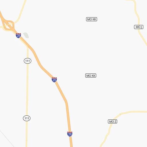
Roadmap (route) to go from Steele Airport to Rolla detailed above, you can also see the course layout on the map.
While doing trip Steele (airport) - Rolla by car, the calculated route ends at a distance , or more straight.
Distance and duration of the route between Steele (airport) and Rolla
Calculation of distance and route from Rolla to Steele (airport) :
414.5512.9 km6h48mn
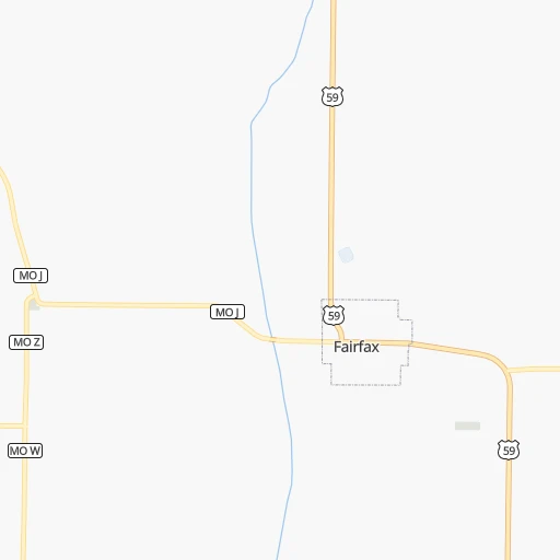
Continue onto 250 Street 0h2mn 860 mTurn left onto Lynx Avenue 0h1mn 613 mKeep left onto State Highway J 0h2mn 1.8 kmTurn right onto MO Z 0h12mn 10.1 kmTurn left and take I 29 South toward Saint Joseph 1h21mn 136.2 kmKeep left onto I 29, US 71 and take I 29 South, US 71 South toward Kansas City 0h12mn 19.3 kmKeep right and take US 169 South toward Kansas City Downtown 0h2mn 2.6 kmKeep right and take MO 9 South toward North Kansas City 0h2mn 2.7 kmContinue onto Burlington Street 0h3mn 3.1 kmKeep right 0h0mn 289 mTurn left onto East 3rd Street 0h0mn 51 mTurn right onto Cherry Street 0h1mn 605 mTurn right onto Charlotte Street 0h1mn 563 mTurn left onto East 10th Street 0h0mn 66 mTurn right toward I 70 East, US 24 East, US 40 East, US 71 South 0h0mn 323 mKeep left onto George Brett Super Highway and take I 70 East, US 24 East, US 40 East toward Saint Louis 2h41mn 166.7 kmKeep right and take MO 87 toward Boonville, Prairie Home 0h0mn 346 mTurn right onto MO 87 0h23mn 29.3 kmKeep left onto MO 179 0h28mn 35.7 kmTurn sharp left onto Industrial Drive 0h2mn 2.3 kmTurn right onto Dix Road 0h1mn 389 mTurn left and take US 50 East toward Jefferson City 0h1mn 1.4 kmKeep right and take US 54, US 63 North toward Fulton, Columbia, Lake of the Ozarks 0h0mn 264 mKeep left onto US 63 0h13mn 19.3 kmKeep right onto US 63 and take US 63 South toward Rolla 1h39mn 52.5 kmTurn right onto MO A 0h9mn 12.0 kmKeep left onto MO A 0h0mn 30 mTurn slight left onto MO E 0h10mn 12.1 kmAt roundabout, take exit 2 onto Tim Bradley Way 0h1mn 630 mAt roundabout, take exit 1 onto North Bishop Avenue 0h0mn 244 mTurn left onto West 10th Street 0h1mn 515 mArrive at destination 0h0mn 0 m
Travel from Steele (airport) (Missouri) to a selection of major cities.
Distances from Steele Airport to biggest cities in Missouri
- University City,35,058 inhabitants.480 km
- Ballwin,30,577 inhabitants.464 km
- Liberty,30,450 inhabitants.152 km
- Raytown,29,401 inhabitants.173 km
- Mehlville,28,380 inhabitants.486 km
- Kirkwood,27,750 inhabitants.476 km
- Maryland Heights,27,389 inhabitants.468 km
- Gladstone,26,861 inhabitants.150 km
- Hazelwood,25,661 inhabitants.470 km
- Grandview,25,256 inhabitants.182 km
- Webster Groves,23,177 inhabitants.479 km
- Belton,23,168 inhabitants.190 km
- Sedalia,21,516 inhabitants.265 km
- Arnold,21,357 inhabitants.486 km
- Ferguson,21,059 inhabitants.476 km
- Nixa,20,984 inhabitants.414 km
- Raymore,20,374 inhabitants.194 km
- Affton,20,307 inhabitants.483 km
- Rolla,20,019 inhabitants.415 km
Other major cities in country :
- Charlotte [NC], 827,097 inhabitants. 1,403 km
- Seattle [WA], 684,451 inhabitants. 2,286 km
- Denver [CO], 682,545 inhabitants. 816 km
- El Paso [TX], 681,124 inhabitants. 1,379 km
- Detroit [MI], 677,116 inhabitants. 1,058 km
- Boston [MA], 667,137 inhabitants. 2,042 km
- Memphis [TN], 655,770 inhabitants. 749 km
- New South Memphis [TN], 641,608 inhabitants. 755 km
- Portland [OR], 632,309 inhabitants. 2,280 km
- Oklahoma City [OK], 631,346 inhabitants. 575 km
- Las Vegas [NV], 623,747 inhabitants. 1,779 km
- Baltimore [MD], 621,849 inhabitants. 1,611 km
- Washington, D.C. [DC], 601,723 inhabitants. 1,583 km
- Milwaukee [WI], 600,155 inhabitants. 693 km
- South Boston [MA], 571,281 inhabitants. 2,043 km
- Albuquerque [NM], 559,121 inhabitants. 1,148 km
- Tucson [AZ], 531,641 inhabitants. 1,655 km
- Nashville [TN], 530,852 inhabitants. 889 km
- Fresno [CA], 520,052 inhabitants. 2,149 km
- Sacramento [CA], 490,712 inhabitants. 2,240 km
Route from Rolla to major cities (United States).
- Distance Rolla New York City1,557 km
- Distance Rolla Los Angeles2,415 km
- Distance Rolla Chicago559 km
- Distance Rolla Brooklyn1,561 km
- Distance Rolla Houston970 km
- Distance Rolla Queens1,571 km
- Distance Rolla Philadelphia1,453 km
- Distance Rolla Phoenix1,898 km
- Distance Rolla Manhattan1,561 km
- Distance Rolla San Antonio1,134 km
- Distance Rolla San Diego2,370 km
- Distance Rolla The Bronx1,571 km
- Distance Rolla Dallas735 km
- Distance Rolla San Jose2,644 km
- Distance Rolla Austin1,017 km
- Distance Rolla Jacksonville1,259 km
- Distance Rolla San Francisco2,681 km
- Distance Rolla Columbus791 km
- Distance Rolla Fort Worth769 km
- Distance Rolla Indianapolis527 km
Nearest cities to Steele (airport) :
- Kansas City, 475,378 inhabitants. 159 km
- Omaha, 443,885 inhabitants. 108 km
- Wichita, 389,965 inhabitants. 340 km
- Lincoln, 277,348 inhabitants. 115 km
- Des Moines, 210,330 inhabitants. 206 km
- Overland Park, 186,515 inhabitants. 167 km
- Kansas City, 151,306 inhabitants. 156 km
- Olathe, 134,305 inhabitants. 174 km
- Topeka, 127,265 inhabitants. 148 km
- Independence, 117,255 inhabitants. 167 km
- East Independence, 110,675 inhabitants. 169 km
- Lee's Summit, 95,094 inhabitants. 186 km
- Lawrence, 93,917 inhabitants. 156 km
- Sioux City, 82,821 inhabitants. 251 km
- Saint Joseph, 76,780 inhabitants. 83 km
- Ames, 65,060 inhabitants. 240 km
- Shawnee, 65,046 inhabitants. 160 km
- West Des Moines, 64,113 inhabitants. 198 km
- Council Bluffs, 62,597 inhabitants. 106 km
- Ankeny, 56,764 inhabitants. 216 km
- Manhattan, 56,308 inhabitants. 163 km
- Bellevue, 55,510 inhabitants. 94 km
- Blue Springs, 54,148 inhabitants. 180 km
- Lenexa, 52,490 inhabitants. 168 km
- Grand Island, 51,440 inhabitants. 253 km
- Salina, 47,813 inhabitants. 252 km
- Urbandale, 44,062 inhabitants. 202 km
- Hutchinson, 41,569 inhabitants. 335 km
- Cedar Falls, 41,255 inhabitants. 347 km
- Leavenworth, 35,980 inhabitants. 125 km
- Leawood, 34,579 inhabitants. 171 km
- Liberty, 30,450 inhabitants. 152 km
- Raytown, 29,401 inhabitants. 173 km
- Marshalltown, 27,620 inhabitants. 283 km
- Mason City, 27,366 inhabitants. 362 km
- Gladstone, 26,861 inhabitants. 150 km
- Fremont, 26,474 inhabitants. 149 km
- Grandview, 25,256 inhabitants. 182 km
- Hastings, 24,924 inhabitants. 251 km
- Fort Dodge, 24,649 inhabitants. 260 km
- Emporia, 24,649 inhabitants. 227 km
- Junction City, 24,621 inhabitants. 191 km
- Norfolk, 24,366 inhabitants. 248 km
- Derby, 23,509 inhabitants. 352 km
- Belton, 23,168 inhabitants. 190 km
- Columbus, 22,797 inhabitants. 201 km
- Prairie Village, 21,877 inhabitants. 168 km
- Sedalia, 21,516 inhabitants. 265 km
- Johnston, 20,871 inhabitants. 206 km
- Gardner, 20,868 inhabitants. 179 km
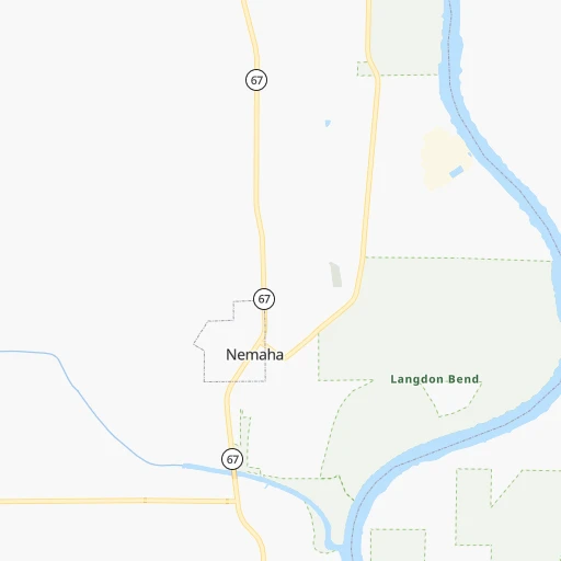
Location Steele (airport) (Missouri) :
| Country flag |  |
| Location | Steele (airport) |
| State | Missouri |
| County | Atchison County |
| Country | United States |
| Country code / ISO 2 | US |
| Latitude | 40.3651100 |
| Longitude | -95.4393200 |
| Altitude | 320 meters |
| Time zone | America/Chicago |
Location Rolla (Missouri) :
| Country flag | |
| Location | Rolla |
| State | Missouri |
| County | Phelps County |
| Country | United States |
| Country code / ISO 2 | US |
| Latitude | 37.9514300 |
| Longitude | -91.7712700 |
| Altitude | 342 meters |
| Time zone | America/Chicago |


