
How to get from Rankin (airport) (Missouri) to Rolla (Missouri)
Calculate route from Rankin (airport) (Missouri, United States) to Rolla (Missouri, United States).
The flight distance (as the crow flies) between Rankin (airport) and Rolla is 373.8 km.
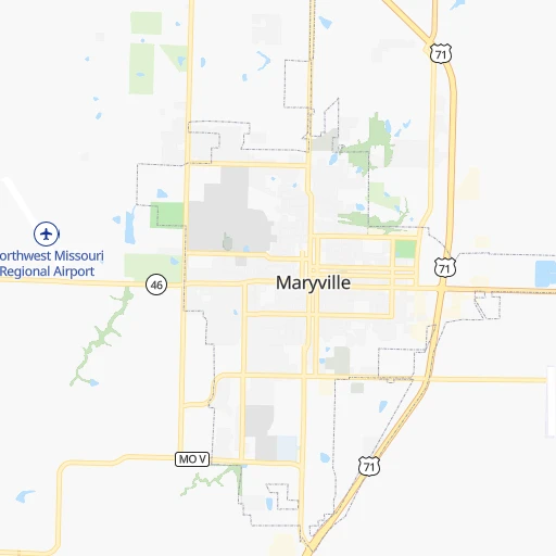
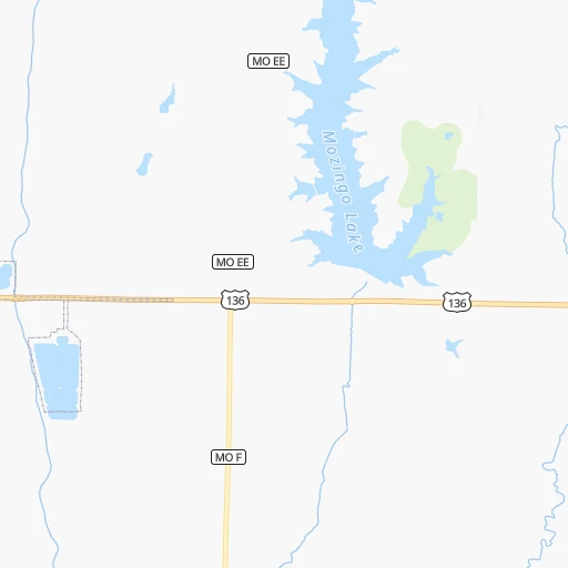
Roadmap (route) to go from Rankin Airport to Rolla detailed above, you can also see the course layout on the map.
While doing trip Rankin (airport) - Rolla by car, the calculated route ends at a distance , or more straight.
Distance and duration of the route between Rankin (airport) and Rolla
Calculation of distance and route from Rolla to Rankin (airport) :
373.8484.7 km5h25mn
Continue onto Jet Road 0h0mn 113 mTurn left onto 268th Street 0h2mn 1.6 kmTurn left onto US 71 1h33mn 51.0 kmKeep left onto US 59, US 71 and take I 29 South, US 71 South, US 59 South toward Kansas City 1h41mn 68.5 kmKeep left onto I 29, US 71 and take I 29 South, US 71 South toward Kansas City 0h12mn 19.3 kmKeep right and take US 169 South toward Kansas City Downtown 0h2mn 2.6 kmKeep right and take MO 9 South toward North Kansas City 0h2mn 2.7 kmContinue onto Burlington Street 0h3mn 3.1 kmKeep right 0h0mn 289 mTurn left onto East 3rd Street 0h0mn 51 mTurn right onto Cherry Street 0h1mn 605 mTurn right onto Charlotte Street 0h1mn 563 mTurn left onto East 10th Street 0h0mn 66 mTurn right toward I 70 East, US 24 East, US 40 East, US 71 South 0h0mn 323 mKeep left onto George Brett Super Highway and take I 70 East, US 24 East, US 40 East toward Saint Louis 2h41mn 166.7 kmKeep right and take MO 87 toward Boonville, Prairie Home 0h0mn 346 mTurn right onto MO 87 0h23mn 29.3 kmKeep left onto MO 179 0h28mn 35.7 kmTurn sharp left onto Industrial Drive 0h2mn 2.3 kmTurn right onto Dix Road 0h1mn 389 mTurn left and take US 50 East toward Jefferson City 0h1mn 1.4 kmKeep right and take US 54, US 63 North toward Fulton, Columbia, Lake of the Ozarks 0h0mn 264 mKeep left onto US 63 0h13mn 19.3 kmKeep right onto US 63 and take US 63 South toward Rolla 1h39mn 52.5 kmTurn right onto MO A 0h9mn 12.0 kmKeep left onto MO A 0h0mn 30 mTurn slight left onto MO E 0h10mn 12.1 kmAt roundabout, take exit 2 onto Tim Bradley Way 0h1mn 630 mAt roundabout, take exit 1 onto North Bishop Avenue 0h0mn 244 mTurn left onto West 10th Street 0h1mn 515 mArrive at destination 0h0mn 0 m
Travel from Rankin (airport) (Missouri) to a selection of major cities.
Distances from Rankin Airport to biggest cities in Missouri
- University City,35,058 inhabitants.431 km
- Ballwin,30,577 inhabitants.416 km
- Liberty,30,450 inhabitants.126 km
- Raytown,29,401 inhabitants.151 km
- Mehlville,28,380 inhabitants.438 km
- Kirkwood,27,750 inhabitants.427 km
- Maryland Heights,27,389 inhabitants.419 km
- Gladstone,26,861 inhabitants.128 km
- Hazelwood,25,661 inhabitants.421 km
- Grandview,25,256 inhabitants.163 km
- Webster Groves,23,177 inhabitants.431 km
- Belton,23,168 inhabitants.171 km
- Sedalia,21,516 inhabitants.228 km
- Arnold,21,357 inhabitants.438 km
- Ferguson,21,059 inhabitants.427 km
- Nixa,20,984 inhabitants.390 km
- Raymore,20,374 inhabitants.174 km
- Affton,20,307 inhabitants.435 km
- Rolla,20,019 inhabitants.374 km
Other major cities in country :
- Charlotte [NC], 827,097 inhabitants. 1,354 km
- Seattle [WA], 684,451 inhabitants. 2,332 km
- Denver [CO], 682,545 inhabitants. 867 km
- El Paso [TX], 681,124 inhabitants. 1,416 km
- Detroit [MI], 677,116 inhabitants. 1,009 km
- Boston [MA], 667,137 inhabitants. 1,993 km
- Memphis [TN], 655,770 inhabitants. 714 km
- New South Memphis [TN], 641,608 inhabitants. 720 km
- Portland [OR], 632,309 inhabitants. 2,329 km
- Oklahoma City [OK], 631,346 inhabitants. 591 km
- Las Vegas [NV], 623,747 inhabitants. 1,830 km
- Baltimore [MD], 621,849 inhabitants. 1,560 km
- Washington, D.C. [DC], 601,723 inhabitants. 1,532 km
- Milwaukee [WI], 600,155 inhabitants. 650 km
- South Boston [MA], 571,281 inhabitants. 1,994 km
- Albuquerque [NM], 559,121 inhabitants. 1,192 km
- Tucson [AZ], 531,641 inhabitants. 1,699 km
- Nashville [TN], 530,852 inhabitants. 842 km
- Fresno [CA], 520,052 inhabitants. 2,200 km
- Sacramento [CA], 490,712 inhabitants. 2,291 km
Route from Rolla to major cities (United States).
- Distance Rolla New York City1,557 km
- Distance Rolla Los Angeles2,415 km
- Distance Rolla Chicago559 km
- Distance Rolla Brooklyn1,561 km
- Distance Rolla Houston970 km
- Distance Rolla Queens1,571 km
- Distance Rolla Philadelphia1,453 km
- Distance Rolla Phoenix1,898 km
- Distance Rolla Manhattan1,561 km
- Distance Rolla San Antonio1,134 km
- Distance Rolla San Diego2,370 km
- Distance Rolla The Bronx1,571 km
- Distance Rolla Dallas735 km
- Distance Rolla San Jose2,644 km
- Distance Rolla Austin1,017 km
- Distance Rolla Jacksonville1,259 km
- Distance Rolla San Francisco2,681 km
- Distance Rolla Columbus791 km
- Distance Rolla Fort Worth769 km
- Distance Rolla Indianapolis527 km
Nearest cities to Rankin (airport) :
- Kansas City, 475,378 inhabitants. 139 km
- Omaha, 443,885 inhabitants. 139 km
- Wichita, 389,965 inhabitants. 365 km
- Lincoln, 277,348 inhabitants. 163 km
- Des Moines, 210,330 inhabitants. 175 km
- Overland Park, 186,515 inhabitants. 151 km
- Kansas City, 151,306 inhabitants. 137 km
- Olathe, 134,305 inhabitants. 162 km
- Topeka, 127,265 inhabitants. 160 km
- Columbia, 119,108 inhabitants. 264 km
- Independence, 117,255 inhabitants. 143 km
- East Independence, 110,675 inhabitants. 144 km
- Lee's Summit, 95,094 inhabitants. 163 km
- Lawrence, 93,917 inhabitants. 155 km
- Sioux City, 82,821 inhabitants. 274 km
- Saint Joseph, 76,780 inhabitants. 63 km
- Waterloo, 68,460 inhabitants. 318 km
- Ames, 65,060 inhabitants. 215 km
- Shawnee, 65,046 inhabitants. 144 km
- West Des Moines, 64,113 inhabitants. 168 km
- Council Bluffs, 62,597 inhabitants. 135 km
- Ankeny, 56,764 inhabitants. 187 km
- Manhattan, 56,308 inhabitants. 196 km
- Bellevue, 55,510 inhabitants. 126 km
- Blue Springs, 54,148 inhabitants. 154 km
- Lenexa, 52,490 inhabitants. 154 km
- Salina, 47,813 inhabitants. 290 km
- Urbandale, 44,062 inhabitants. 172 km
- Jefferson City, 43,169 inhabitants. 301 km
- Cedar Falls, 41,255 inhabitants. 315 km
- Leavenworth, 35,980 inhabitants. 114 km
- Leawood, 34,579 inhabitants. 153 km
- Liberty, 30,450 inhabitants. 126 km
- Raytown, 29,401 inhabitants. 151 km
- Marshalltown, 27,620 inhabitants. 250 km
- Mason City, 27,366 inhabitants. 342 km
- Gladstone, 26,861 inhabitants. 128 km
- Fremont, 26,474 inhabitants. 186 km
- Grandview, 25,256 inhabitants. 163 km
- Fort Dodge, 24,649 inhabitants. 247 km
- Emporia, 24,649 inhabitants. 244 km
- Ottumwa, 24,624 inhabitants. 218 km
- Junction City, 24,621 inhabitants. 224 km
- Norfolk, 24,366 inhabitants. 287 km
- Derby, 23,509 inhabitants. 375 km
- Belton, 23,168 inhabitants. 171 km
- Columbus, 22,797 inhabitants. 246 km
- Prairie Village, 21,877 inhabitants. 150 km
- Sedalia, 21,516 inhabitants. 228 km
- Johnston, 20,871 inhabitants. 177 km
Location Rankin (airport) (Missouri) :
| Country flag |  |
| Location | Rankin (airport) |
| State | Missouri |
| County | Nodaway County |
| Country | United States |
| Country code / ISO 2 | US |
| Latitude | 40.3332000 |
| Longitude | -94.8352400 |
| Altitude | 298 meters |
| Time zone | America/Chicago |
Location Rolla (Missouri) :
| Country flag | |
| Location | Rolla |
| State | Missouri |
| County | Phelps County |
| Country | United States |
| Country code / ISO 2 | US |
| Latitude | 37.9514300 |
| Longitude | -91.7712700 |
| Altitude | 342 meters |
| Time zone | America/Chicago |


