
How to get from Helblad (airport) (Minnesota) to Shakopee (Minnesota)
Calculate route from Helblad (airport) (Minnesota, United States) to Shakopee (Minnesota, United States).
The flight distance (as the crow flies) between Helblad (airport) and Shakopee is 365.0 km.
Roadmap (route) to go from Helblad Airport to Shakopee detailed above, you can also see the course layout on the map.
While doing trip Helblad (airport) - Shakopee by car, the calculated route ends at a distance , or more straight.
Distance and duration of the route between Helblad (airport) and Shakopee
Calculation of distance and route from Shakopee to Helblad (airport) :
365.0425.2 km6h36mn
Continue onto Pioneer Road Northeast 0h8mn 6.6 kmTurn right onto Hoyum Road Northeast 0h8mn 7.0 kmTurn right onto MN 1, CR 23 0h2mn 1.9 kmTurn left onto Everts Road Northeast 0h24mn 20.0 kmTurn right onto Gull Lake Loop Road Northeast 0h14mn 11.5 kmTurn right onto Voyageur Highway 0h8mn 11.1 kmKeep right 0h0mn 407 mTurn left onto Irvine Avenue Northwest 0h0mn 275 mAt roundabout, take exit 1 0h3mn 4.2 kmAt roundabout, take exit 1 onto Irvine Avenue Northwest 0h2mn 1.6 kmTurn left onto State Highway 197 0h0mn 375 mKeep right 0h0mn 78 mTurn slight right onto Bemidji Avenue North 0h4mn 4.1 kmContinue onto Paul Bunyan Drive Southeast 0h0mn 156 mKeep right onto MN 197 0h24mn 32.4 kmTurn right onto State 64 0h17mn 25.0 kmTurn right onto Broadway Street East 0h1mn 957 mTurn left onto Marie Avenue Southeast 0h17mn 23.8 kmTurn right onto State Highway 64 Southwest 1h38mn 54.3 kmTurn right onto State Highway 210 0h0mn 505 mTurn left onto US 10 1h39mn 46.1 kmKeep right 0h4mn 3.7 kmTurn left onto Broadway West 0h1mn 704 mTurn right onto 1st Street Southeast 0h4mn 4.1 kmContinue 0h29mn 39.3 kmKeep left onto US 10 0h28mn 44.2 kmKeep right onto County Road 50 0h4mn 3.0 kmTurn left onto Park Boulevard Southeast 0h1mn 1.1 kmTurn right onto State Highway 25 0h1mn 679 mTurn left onto Broadway Street West 0h2mn 2.4 kmTurn right onto Fenning Avenue 0h1mn 543 mTurn left onto Chelsea Road West 0h21mn 34.5 kmKeep right toward I 494 South 0h13mn 18.6 kmKeep right toward MN 7 West 0h4mn 4.7 kmTurn left onto County Road 101 0h3mn 2.7 kmKeep right onto CR 101 0h3mn 3.8 kmKeep right 0h1mn 1.1 kmTurn left onto Market Boulevard 0h5mn 5.6 kmAt roundabout, take exit 2 onto Flying Cloud Drive 0h2mn 1.8 kmKeep right 0h0mn 274 mTurn left onto Fuller Street South 0h0mn 71 mTurn left 0h0mn 92 mArrive at destination 0h0mn 0 m
Travel from Helblad (airport) (Minnesota) to a selection of major cities.
Distances from Helblad Airport to biggest cities in Minnesota
- Minnetonka Mills,50,117 inhabitants.352 km
- Saint Louis Park,45,250 inhabitants.353 km
- Moorhead,42,005 inhabitants.200 km
- Mankato,41,044 inhabitants.429 km
- Maplewood,40,567 inhabitants.361 km
- Shakopee,39,981 inhabitants.366 km
- Richfield,36,216 inhabitants.362 km
- Cottage Grove,35,918 inhabitants.376 km
- Roseville,35,580 inhabitants.352 km
- Inver Grove Heights,34,857 inhabitants.371 km
- Andover,32,213 inhabitants.324 km
- Brooklyn Center,30,770 inhabitants.340 km
- Savage,30,391 inhabitants.371 km
- Oakdale,28,080 inhabitants.361 km
- Fridley,27,713 inhabitants.340 km
- Winona,27,094 inhabitants.497 km
- Shoreview,26,477 inhabitants.344 km
- Ramsey,25,828 inhabitants.317 km
- Owatonna,25,725 inhabitants.449 km
- Chanhassen,25,332 inhabitants.359 km
Other major cities in country :
- Charlotte [NC], 827,097 inhabitants. 1,823 km
- Seattle [WA], 684,451 inhabitants. 2,057 km
- Denver [CO], 682,545 inhabitants. 1,233 km
- El Paso [TX], 681,124 inhabitants. 2,063 km
- Detroit [MI], 677,116 inhabitants. 1,107 km
- Boston [MA], 667,137 inhabitants. 1,948 km
- Memphis [TN], 655,770 inhabitants. 1,479 km
- New South Memphis [TN], 641,608 inhabitants. 1,486 km
- Portland [OR], 632,309 inhabitants. 2,141 km
- Oklahoma City [OK], 631,346 inhabitants. 1,413 km
- Las Vegas [NV], 623,747 inhabitants. 2,130 km
- Baltimore [MD], 621,849 inhabitants. 1,741 km
- Washington, D.C. [DC], 601,723 inhabitants. 1,742 km
- Milwaukee [WI], 600,155 inhabitants. 763 km
- South Boston [MA], 571,281 inhabitants. 1,950 km
- Albuquerque [NM], 559,121 inhabitants. 1,744 km
- Tucson [AZ], 531,641 inhabitants. 2,225 km
- Nashville [TN], 530,852 inhabitants. 1,467 km
- Fresno [CA], 520,052 inhabitants. 2,397 km
- Sacramento [CA], 490,712 inhabitants. 2,395 km
Route from Shakopee to major cities (United States).
- Distance Shakopee New York City1,654 km
- Distance Shakopee Los Angeles2,425 km
- Distance Shakopee Chicago578 km
- Distance Shakopee Brooklyn1,662 km
- Distance Shakopee Houston1,681 km
- Distance Shakopee Queens1,669 km
- Distance Shakopee Philadelphia1,599 km
- Distance Shakopee Phoenix2,032 km
- Distance Shakopee Manhattan1,655 km
- Distance Shakopee San Antonio1,766 km
- Distance Shakopee San Diego2,439 km
- Distance Shakopee The Bronx1,660 km
- Distance Shakopee Dallas1,367 km
- Distance Shakopee San Jose2,506 km
- Distance Shakopee Austin1,659 km
- Distance Shakopee Jacksonville1,916 km
- Distance Shakopee San Francisco2,525 km
- Distance Shakopee Columbus1,018 km
- Distance Shakopee Fort Worth1,383 km
- Distance Shakopee Indianapolis825 km
Nearest cities to Helblad (airport) :
- Fargo, 118,523 inhabitants. 201 km
- Duluth, 86,110 inhabitants. 236 km
- Brooklyn Park, 79,149 inhabitants. 337 km
- Plymouth, 75,907 inhabitants. 344 km
- Maple Grove, 68,385 inhabitants. 337 km
- Saint Cloud, 65,842 inhabitants. 273 km
- West Coon Rapids, 62,528 inhabitants. 331 km
- Coon Rapids, 62,240 inhabitants. 336 km
- Blaine, 62,124 inhabitants. 333 km
- Grand Forks, 57,011 inhabitants. 175 km
- Moorhead, 42,005 inhabitants. 200 km
- Roseville, 35,580 inhabitants. 352 km
- West Fargo, 33,597 inhabitants. 208 km
- Andover, 32,213 inhabitants. 324 km
- Brooklyn Center, 30,770 inhabitants. 340 km
- Fridley, 27,713 inhabitants. 340 km
- Superior, 26,579 inhabitants. 240 km
- Shoreview, 26,477 inhabitants. 344 km
- Ramsey, 25,828 inhabitants. 317 km
- White Bear Lake, 25,205 inhabitants. 347 km
- Elk River, 23,963 inhabitants. 310 km
- Champlin, 23,894 inhabitants. 326 km
- Crystal, 22,943 inhabitants. 344 km
- New Brighton, 22,351 inhabitants. 344 km
- Golden Valley, 21,270 inhabitants. 347 km
- Lino Lakes, 21,050 inhabitants. 337 km
- New Hope, 21,032 inhabitants. 343 km
- Columbia Heights, 19,715 inhabitants. 345 km
- Willmar, 19,638 inhabitants. 320 km
- Forest Lake, 19,618 inhabitants. 328 km
- Stillwater, 18,924 inhabitants. 356 km
- Anoka, 17,350 inhabitants. 326 km
- Sartell, 16,788 inhabitants. 266 km
- Saint Michael, 16,399 inhabitants. 319 km
- Hibbing, 16,204 inhabitants. 145 km
- Ham Lake, 16,062 inhabitants. 323 km
- Buffalo, 16,026 inhabitants. 319 km
- Otsego, 15,551 inhabitants. 313 km
- Bemidji, 14,594 inhabitants. 59 km
- Robbinsdale, 14,418 inhabitants. 344 km
- Hugo, 14,388 inhabitants. 340 km
- Sauk Rapids, 13,424 inhabitants. 269 km
- Brainerd, 13,371 inhabitants. 185 km
- Monticello, 13,299 inhabitants. 306 km
- Fergus Falls, 13,281 inhabitants. 217 km
- Vadnais Heights, 13,266 inhabitants. 348 km
- Mounds View, 12,914 inhabitants. 340 km
- Rogers, 12,562 inhabitants. 323 km
- Cloquet, 12,075 inhabitants. 219 km
- Alexandria, 11,843 inhabitants. 240 km
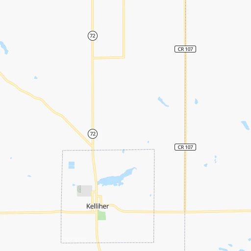
Location Helblad (airport) (Minnesota) :
| Country flag |  |
| Location | Helblad (airport) |
| State | Minnesota |
| County | Beltrami County |
| Country | United States |
| Country code / ISO 2 | US |
| Latitude | 47.9846200 |
| Longitude | -94.6818700 |
| Altitude | 363 meters |
| Time zone | America/Chicago |
Location Shakopee (Minnesota) :
| Country flag | |
| Location | Shakopee |
| State | Minnesota |
| County | Scott County |
| Country | United States |
| Country code / ISO 2 | US |
| Latitude | 44.7980200 |
| Longitude | -93.5269000 |
| Altitude | 229 meters |
| Time zone | America/Chicago |


