

Home
››
South Haven Area Regional Airport
››
Roadmap from South Haven Area Regional Airport to Fresno
How to get from South Haven Area Regional (airport) (Michigan) to Fresno (California)
Calculate route from South Haven Area Regional (airport) (Michigan, United States) to Fresno (California, United States).
The flight distance (as the crow flies) between South Haven Area Regional (airport) and Fresno is 2,918.6 km.
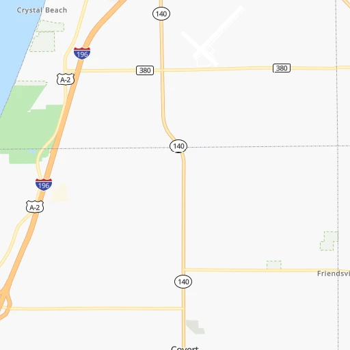
Roadmap (route) to go from South Haven Area Regional Airport to Fresno detailed above, you can also see the course layout on the map.
While doing trip South Haven Area Regional (airport) - Fresno by car, the calculated route ends at a distance , or more straight.
Distance and duration of the route between South Haven Area Regional (airport) and Fresno
Calculation of distance and route from Fresno to South Haven Area Regional (airport) :
2,918.63,520.1 km37h39mn
Continue 0h2mn 504 mTurn right onto County Road 380 0h4mn 3.3 kmTurn left onto Blue Star Highway 0h6mn 5.5 kmTurn sharp left onto County Road 378 0h1mn 489 mTurn sharp right 2h30mn 146.5 kmKeep right and take US 41 North toward Calumet Avenue, Hammond, Munster 0h0mn 318 mKeep left and drive toward Calumet Avenue South 0h0mn 361 mKeep left 0h10mn 13.4 kmKeep right onto I 80 and take I 80 West toward Iowa 2h22mn 233.4 kmKeep right onto I 80 and take I 80 West toward Davenport 3h47mn 280.3 kmKeep right onto US 6 and take US 6 West, US 65 North, IA 330 North toward Marshalltown, Bondurant 0h1mn 755 mTurn left onto Northeast Hubbell Avenue 0h6mn 6.1 kmContinue onto Hubbell Avenue 0h0mn 240 mTurn slight right onto Hubbell Avenue 0h2mn 2.0 kmTurn right onto Guthrie Avenue 0h1mn 1.0 kmTurn left 2h6mn 209.1 kmKeep left onto I 80 Express and take I 80 West Express toward Council Bluffs, Omaha 5h21mn 570.8 kmKeep left onto I 80 and take I 80 West toward Sidney, Cheyanne 9h35mn 931.0 kmKeep right and take I 15 South, UT 201 West toward Las Vegas, West Valley 0h1mn 733 mKeep left and take I 15 South, UT 201 West toward Las Vegas, West Valley 0h0mn 273 mKeep right and take UT 201 West toward West Valley 0h1mn 999 mKeep left and take UT 201 West toward West Valley 2h43mn 190.5 kmKeep right and drive toward Wendover 0h0mn 295 mTurn left onto Aria Boulevard 0h0mn 287 mTurn sharp right onto Wendover Boulevard 0h1mn 1.2 kmTurn left onto US 93 ALT 1h56mn 94.7 kmContinue onto Great Basin Highway 1h2mn 95.5 kmTurn left onto Great Basin Boulevard 0h1mn 1.2 kmTurn right onto Veterans Boulevard 3h41mn 270.2 kmKeep right onto US 6 1h40mn 65.5 kmTurn left onto Grand Army of the Republic Highway 1h59mn 65.3 kmTurn right onto Mono Mills Road 1h5mn 65.5 kmTurn sharp right onto Test Station Road 0h2mn 1.2 kmTurn left onto Test Station Road 0h12mn 6.1 kmTurn left onto Picnic Grounds Road 0h3mn 1.7 kmTurn right onto Highway 395 0h1mn 1.3 kmTurn left onto Tioga Road 2h31mn 94.2 kmTurn left onto Big Oak Flat Road 0h19mn 15.3 kmTurn left onto Northside Drive 0h4mn 2.9 kmKeep right onto Wawona Road 1h43mn 42.1 kmAt roundabout, take exit 1 onto Wawona Road 1h15mn 95.0 kmKeep right and drive toward McKinley Avenue 0h0mn 366 mTurn left onto East McKinley Avenue 0h1mn 590 mTurn right onto North 1st Street 0h2mn 1.9 kmTurn left onto East Washington Avenue 0h0mn 21 mArrive at destination 0h0mn 0 m
Travel from South Haven Area Regional (airport) (California) to a selection of major cities.
Distances from South Haven Area Regional Airport to biggest cities in Michigan
- West Bloomfield Township,64,690 inhabitants.237 km
- Taylor,61,568 inhabitants.246 km
- Pontiac,59,917 inhabitants.245 km
- Saint Clair Shores,59,715 inhabitants.277 km
- Royal Oak,59,008 inhabitants.256 km
- Novi,58,723 inhabitants.229 km
- Dearborn Heights,56,145 inhabitants.245 km
- Battle Creek,51,589 inhabitants.89 km
- Kentwood,51,357 inhabitants.76 km
- Redford,49,936 inhabitants.243 km
- Saginaw,49,347 inhabitants.222 km
- East Lansing,48,471 inhabitants.152 km
- Portage,48,177 inhabitants.58 km
- Roseville,47,637 inhabitants.273 km
- Midland,42,200 inhabitants.216 km
- Muskegon,38,401 inhabitants.98 km
- Lincoln Park,37,012 inhabitants.254 km
- Bay City,33,917 inhabitants.237 km
- Holland,33,742 inhabitants.50 km
- Jackson,33,133 inhabitants.153 km
Other major cities in country :
- Charlotte [NC], 827,097 inhabitants. 921 km
- Seattle [WA], 684,451 inhabitants. 2,873 km
- Denver [CO], 682,545 inhabitants. 1,596 km
- El Paso [TX], 681,124 inhabitants. 2,141 km
- Boston [MA], 667,137 inhabitants. 1,248 km
- Memphis [TN], 655,770 inhabitants. 866 km
- New South Memphis [TN], 641,608 inhabitants. 873 km
- Portland [OR], 632,309 inhabitants. 2,915 km
- Oklahoma City [OK], 631,346 inhabitants. 1,239 km
- Las Vegas [NV], 623,747 inhabitants. 2,569 km
- Baltimore [MD], 621,849 inhabitants. 880 km
- Washington, D.C. [DC], 601,723 inhabitants. 868 km
- Milwaukee [WI], 600,155 inhabitants. 155 km
- South Boston [MA], 571,281 inhabitants. 1,250 km
- Albuquerque [NM], 559,121 inhabitants. 1,941 km
- Tucson [AZ], 531,641 inhabitants. 2,446 km
- Nashville [TN], 530,852 inhabitants. 690 km
- Fresno [CA], 520,052 inhabitants. 2,924 km
- Sacramento [CA], 490,712 inhabitants. 2,992 km
- Kansas City [MO], 475,378 inhabitants. 789 km
Route from Fresno to major cities (United States).
- Distance Fresno New York City3,954 km
- Distance Fresno Chicago2,808 km
- Distance Fresno Brooklyn3,960 km
- Distance Fresno Houston2,394 km
- Distance Fresno Queens3,969 km
- Distance Fresno Philadelphia3,870 km
- Distance Fresno Phoenix791 km
- Distance Fresno Manhattan3,956 km
- Distance Fresno San Antonio2,140 km
- Distance Fresno The Bronx3,963 km
- Distance Fresno Dallas2,141 km
- Distance Fresno Austin2,162 km
- Distance Fresno Jacksonville3,584 km
- Distance Fresno Columbus3,207 km
- Distance Fresno Fort Worth2,097 km
- Distance Fresno Indianapolis2,940 km
- Distance Fresno Charlotte3,486 km
- Distance Fresno Seattle1,227 km
- Distance Fresno Denver1,333 km
- Distance Fresno El Paso1,341 km
Nearest cities to South Haven Area Regional (airport) :
- Chicago, 2,720,546 inhabitants. 128 km
- Indianapolis, 829,718 inhabitants. 288 km
- Milwaukee, 600,155 inhabitants. 155 km
- Toledo, 279,789 inhabitants. 236 km
- Fort Wayne, 260,326 inhabitants. 165 km
- Aurora, 200,661 inhabitants. 183 km
- Grand Rapids, 195,097 inhabitants. 83 km
- Rockford, 148,278 inhabitants. 234 km
- Joliet, 147,861 inhabitants. 177 km
- Naperville, 147,100 inhabitants. 168 km
- Dayton, 140,599 inhabitants. 337 km
- Ann Arbor, 117,070 inhabitants. 207 km
- Lansing, 115,056 inhabitants. 146 km
- Elgin, 112,111 inhabitants. 171 km
- Green Bay, 105,207 inhabitants. 280 km
- South Bend, 101,516 inhabitants. 74 km
- Kenosha, 99,858 inhabitants. 131 km
- Flint, 98,310 inhabitants. 223 km
- Livonia, 94,635 inhabitants. 239 km
- Carmel, 88,713 inhabitants. 264 km
- Waukegan, 88,475 inhabitants. 131 km
- Canton, 86,825 inhabitants. 228 km
- West Town, 86,429 inhabitants. 128 km
- Champaign, 86,096 inhabitants. 299 km
- Near North Side, 85,711 inhabitants. 124 km
- Cicero, 83,886 inhabitants. 136 km
- Westland, 82,000 inhabitants. 235 km
- Farmington Hills, 81,330 inhabitants. 237 km
- Belmont Cragin, 79,159 inhabitants. 133 km
- Bloomington, 78,292 inhabitants. 309 km
- Racine, 77,742 inhabitants. 132 km
- Hammond, 77,614 inhabitants. 134 km
- Gary, 77,156 inhabitants. 124 km
- Fishers, 76,794 inhabitants. 267 km
- Kalamazoo, 76,041 inhabitants. 55 km
- Arlington Heights, 75,926 inhabitants. 145 km
- Waterford, 75,737 inhabitants. 236 km
- Evanston, 75,527 inhabitants. 123 km
- Wyoming, 75,275 inhabitants. 77 km
- Schaumburg, 74,693 inhabitants. 155 km
- Bolingbrook, 74,306 inhabitants. 167 km
- Appleton, 74,139 inhabitants. 275 km
- South Lawndale, 73,826 inhabitants. 133 km
- Logan Square, 73,702 inhabitants. 128 km
- Decatur, 73,254 inhabitants. 360 km
- West Ridge, 72,211 inhabitants. 125 km
- Waukesha, 71,970 inhabitants. 178 km
- Lafayette, 71,111 inhabitants. 221 km
- Muncie, 70,087 inhabitants. 251 km
- Palatine, 69,308 inhabitants. 149 km
Location South Haven Area Regional (airport) (Michigan) :
| Country flag |  |
| Location | South Haven Area Regional (airport) |
| State | Michigan |
| County | Van Buren County |
| Country | United States |
| Country code / ISO 2 | US |
| Latitude | 42.3508700 |
| Longitude | -86.2561400 |
| Altitude | 200 meters |
| Time zone | America/Detroit |
Location Fresno (California) :
| Country flag | |
| Location | Fresno |
| State | California |
| County | Fresno County |
| Country | United States |
| Country code / ISO 2 | US |
| Latitude | 36.7477300 |
| Longitude | -119.7723700 |
| Altitude | 94 meters |
| Time zone | America/Los_Angeles |


