


How to get from Rossettie (airport) (Michigan) to Sacramento (California)
Calculate route from Rossettie (airport) (Michigan, United States) to Sacramento (California, United States).
The flight distance (as the crow flies) between Rossettie (airport) and Sacramento is 3,170.5 km.
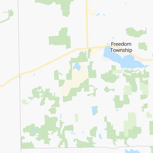
Roadmap (route) to go from Rossettie Airport to Sacramento detailed above, you can also see the course layout on the map.
While doing trip Rossettie (airport) - Sacramento by car, the calculated route ends at a distance , or more straight.
Distance and duration of the route between Rossettie (airport) and Sacramento
Calculation of distance and route from Sacramento to Rossettie (airport) :
3,170.53,629.7 km35h42mn
Continue onto M-52 0h4mn 5.3 kmTurn left onto Lehman Road 0h2mn 3.3 kmTurn right onto Sylvan Road 0h4mn 5.2 kmTurn left onto Jackson Road 0h0mn 162 mTurn right onto Fahrner Road 0h1mn 1.4 kmTurn sharp right onto Kalmbach Road 0h1mn 853 mTurn left and take I 94 West toward Chicago 3h13mn 321.7 kmKeep right and take US 41 North toward Calumet Avenue, Hammond, Munster 0h0mn 318 mKeep left and drive toward Calumet Avenue South 0h0mn 361 mKeep left 0h10mn 13.4 kmKeep right onto I 80 and take I 80 West toward Iowa 2h22mn 233.4 kmKeep right onto I 80 and take I 80 West toward Davenport 3h47mn 280.3 kmKeep right onto US 6 and take US 6 West, US 65 North, IA 330 North toward Marshalltown, Bondurant 0h1mn 755 mTurn left onto Northeast Hubbell Avenue 0h6mn 6.1 kmContinue onto Hubbell Avenue 0h0mn 240 mTurn slight right onto Hubbell Avenue 0h2mn 2.0 kmTurn right onto Guthrie Avenue 0h1mn 1.0 kmTurn left 2h6mn 209.1 kmKeep left onto I 80 Express and take I 80 West Express toward Council Bluffs, Omaha 5h21mn 570.8 kmKeep left onto I 80 and take I 80 West toward Sidney, Cheyanne 9h35mn 931.0 kmKeep right and take I 15 South, UT 201 West toward Las Vegas, West Valley 0h1mn 733 mKeep left and take I 15 South, UT 201 West toward Las Vegas, West Valley 0h0mn 273 mKeep right and take UT 201 West toward West Valley 0h1mn 999 mKeep left and take UT 201 West toward West Valley 10h34mn 1,026.5 kmKeep right onto Capital City Freeway and take I 80 Business West toward Sacramento 0h5mn 7.8 kmKeep right onto North Sacramento Freeway and take CA 160 West toward Downtown Sacramento 0h3mn 4.3 kmContinue onto North 12th Street 0h1mn 946 mKeep left onto 12th Street 0h1mn 996 mTurn right onto I Street 0h0mn 365 mTurn left onto 9th Street 0h0mn 22 mArrive at destination 0h0mn 0 m
Travel from Rossettie (airport) (California) to a selection of major cities.
Distances from Rossettie Airport to biggest cities in Michigan
- West Bloomfield Township,64,690 inhabitants.67 km
- Taylor,61,568 inhabitants.63 km
- Pontiac,59,917 inhabitants.78 km
- Saint Clair Shores,59,715 inhabitants.100 km
- Royal Oak,59,008 inhabitants.80 km
- Novi,58,723 inhabitants.55 km
- Dearborn Heights,56,145 inhabitants.64 km
- Battle Creek,51,589 inhabitants.96 km
- Kentwood,51,357 inhabitants.152 km
- Redford,49,936 inhabitants.64 km
- Saginaw,49,347 inhabitants.136 km
- East Lansing,48,471 inhabitants.71 km
- Portage,48,177 inhabitants.128 km
- Roseville,47,637 inhabitants.96 km
- Midland,42,200 inhabitants.159 km
- Muskegon,38,401 inhabitants.215 km
- Lincoln Park,37,012 inhabitants.70 km
- Bay City,33,917 inhabitants.156 km
- Holland,33,742 inhabitants.183 km
- Jackson,33,133 inhabitants.31 km
Other major cities in country :
- Charlotte [NC], 827,097 inhabitants. 824 km
- Seattle [WA], 684,451 inhabitants. 3,047 km
- Denver [CO], 682,545 inhabitants. 1,778 km
- El Paso [TX], 681,124 inhabitants. 2,300 km
- Boston [MA], 667,137 inhabitants. 1,067 km
- Memphis [TN], 655,770 inhabitants. 942 km
- New South Memphis [TN], 641,608 inhabitants. 949 km
- Portland [OR], 632,309 inhabitants. 3,094 km
- Oklahoma City [OK], 631,346 inhabitants. 1,386 km
- Las Vegas [NV], 623,747 inhabitants. 2,750 km
- Baltimore [MD], 621,849 inhabitants. 704 km
- Washington, D.C. [DC], 601,723 inhabitants. 696 km
- Milwaukee [WI], 600,155 inhabitants. 331 km
- South Boston [MA], 571,281 inhabitants. 1,068 km
- Albuquerque [NM], 559,121 inhabitants. 2,112 km
- Tucson [AZ], 531,641 inhabitants. 2,616 km
- Nashville [TN], 530,852 inhabitants. 712 km
- Fresno [CA], 520,052 inhabitants. 3,107 km
- Sacramento [CA], 490,712 inhabitants. 3,176 km
- Kansas City [MO], 475,378 inhabitants. 955 km
Route from Sacramento to major cities (United States).
- Distance Sacramento New York City4,027 km
- Distance Sacramento Chicago2,881 km
- Distance Sacramento Brooklyn4,034 km
- Distance Sacramento Houston2,588 km
- Distance Sacramento Queens4,042 km
- Distance Sacramento Philadelphia3,950 km
- Distance Sacramento Phoenix1,022 km
- Distance Sacramento Manhattan4,029 km
- Distance Sacramento San Antonio2,346 km
- Distance Sacramento The Bronx4,036 km
- Distance Sacramento Dallas2,316 km
- Distance Sacramento Austin2,360 km
- Distance Sacramento Jacksonville3,739 km
- Distance Sacramento Columbus3,295 km
- Distance Sacramento Fort Worth2,274 km
- Distance Sacramento Indianapolis3,032 km
- Distance Sacramento Charlotte3,608 km
- Distance Sacramento Seattle1,007 km
- Distance Sacramento Denver1,429 km
- Distance Sacramento El Paso1,560 km
Nearest cities to Rossettie (airport) :
- Columbus, 850,106 inhabitants. 264 km
- Indianapolis, 829,718 inhabitants. 324 km
- Detroit, 677,116 inhabitants. 82 km
- Cleveland, 388,072 inhabitants. 209 km
- Toledo, 279,789 inhabitants. 71 km
- Fort Wayne, 260,326 inhabitants. 150 km
- Akron, 197,542 inhabitants. 243 km
- Grand Rapids, 195,097 inhabitants. 159 km
- Dayton, 140,599 inhabitants. 272 km
- Warren, 134,056 inhabitants. 90 km
- Sterling Heights, 132,052 inhabitants. 93 km
- Ann Arbor, 117,070 inhabitants. 25 km
- Lansing, 115,056 inhabitants. 74 km
- South Bend, 101,516 inhabitants. 193 km
- Clinton Township, 99,753 inhabitants. 101 km
- Flint, 98,310 inhabitants. 95 km
- Dearborn, 95,171 inhabitants. 72 km
- Livonia, 94,635 inhabitants. 59 km
- Carmel, 88,713 inhabitants. 303 km
- Canton, 86,825 inhabitants. 47 km
- Troy, 83,280 inhabitants. 85 km
- Westland, 82,000 inhabitants. 54 km
- Farmington Hills, 81,330 inhabitants. 63 km
- Parma, 79,937 inhabitants. 211 km
- Fishers, 76,794 inhabitants. 300 km
- Kalamazoo, 76,041 inhabitants. 129 km
- Waterford, 75,737 inhabitants. 75 km
- Wyoming, 75,275 inhabitants. 159 km
- Shelby, 74,099 inhabitants. 97 km
- Rochester Hills, 73,424 inhabitants. 89 km
- Southfield, 73,156 inhabitants. 73 km
- Canton, 71,885 inhabitants. 270 km
- Lafayette, 71,111 inhabitants. 310 km
- Muncie, 70,087 inhabitants. 250 km
- West Bloomfield Township, 64,690 inhabitants. 67 km
- Lorain, 63,647 inhabitants. 174 km
- Hamilton, 62,407 inhabitants. 315 km
- Taylor, 61,568 inhabitants. 63 km
- Pontiac, 59,917 inhabitants. 78 km
- Saint Clair Shores, 59,715 inhabitants. 100 km
- Springfield, 59,680 inhabitants. 254 km
- Noblesville, 59,093 inhabitants. 291 km
- Royal Oak, 59,008 inhabitants. 80 km
- Novi, 58,723 inhabitants. 55 km
- Kokomo, 57,995 inhabitants. 259 km
- Dearborn Heights, 56,145 inhabitants. 64 km
- Greenwood, 55,586 inhabitants. 337 km
- Kettering, 55,525 inhabitants. 279 km
- Anderson, 55,305 inhabitants. 271 km
- Elyria, 53,775 inhabitants. 184 km
Location Rossettie (airport) (Michigan) :
| Country flag |  |
| Location | Rossettie (airport) |
| State | Michigan |
| County | Washtenaw County |
| Country | United States |
| Country code / ISO 2 | US |
| Latitude | 42.1977000 |
| Longitude | -84.0300500 |
| Altitude | 296 meters |
| Time zone | America/Detroit |
Location Sacramento (California) :
| Country flag | |
| Location | Sacramento |
| State | California |
| County | Sacramento County |
| Country | United States |
| Country code / ISO 2 | US |
| Latitude | 38.5815700 |
| Longitude | -121.4944000 |
| Altitude | 9 meters |
| Time zone | America/Los_Angeles |


