
How to get from Ray Community (airport) (Michigan) to Clinton Township (Michigan)
Calculate route from Ray Community (airport) (Michigan, United States) to Clinton Township (Michigan, United States).
The flight distance (as the crow flies) between Ray Community (airport) and Clinton Township is 17.1 km.
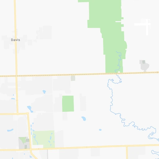
Roadmap (route) to go from Ray Community Airport to Clinton Township detailed above, you can also see the course layout on the map.
While doing trip Ray Community (airport) - Clinton Township by car, the calculated route ends at a distance , or more straight.
Distance and duration of the route between Ray Community (airport) and Clinton Township
Calculation of distance and route from Clinton Township to Ray Community (airport) :
17.119.8 km0h20mn
Continue 0h0mn 60 mTurn right onto Indian Trail 0h1mn 657 mTurn left onto 27 Mile Road 0h1mn 740 mTurn right onto North Avenue 0h15mn 16.9 kmTurn right onto Harrington Street 0h1mn 891 mTurn left onto Moravian Drive 0h0mn 65 mTurn right onto North Riverhill Drive 0h0mn 161 mTurn left onto South Riverhill Drive 0h1mn 275 mTurn left onto Red Oaks Drive 0h0mn 95 mArrive at destination 0h0mn 0 m
Travel from Ray Community (airport) (Michigan) to a selection of major cities.
Distances from Ray Community Airport to biggest cities in Michigan
- West Bloomfield Township,64,690 inhabitants.45 km
- Taylor,61,568 inhabitants.64 km
- Pontiac,59,917 inhabitants.35 km
- Saint Clair Shores,59,715 inhabitants.27 km
- Royal Oak,59,008 inhabitants.35 km
- Novi,58,723 inhabitants.56 km
- Dearborn Heights,56,145 inhabitants.55 km
- Battle Creek,51,589 inhabitants.194 km
- Kentwood,51,357 inhabitants.226 km
- Redford,49,936 inhabitants.52 km
- Saginaw,49,347 inhabitants.115 km
- East Lansing,48,471 inhabitants.131 km
- Portage,48,177 inhabitants.229 km
- Roseville,47,637 inhabitants.27 km
- Midland,42,200 inhabitants.147 km
- Muskegon,38,401 inhabitants.279 km
- Lincoln Park,37,012 inhabitants.59 km
- Bay City,33,917 inhabitants.125 km
- Holland,33,742 inhabitants.263 km
- Jackson,33,133 inhabitants.136 km
Other major cities in country :
- Charlotte [NC], 827,097 inhabitants. 855 km
- Seattle [WA], 684,451 inhabitants. 3,108 km
- Denver [CO], 682,545 inhabitants. 1,874 km
- El Paso [TX], 681,124 inhabitants. 2,410 km
- Boston [MA], 667,137 inhabitants. 970 km
- Memphis [TN], 655,770 inhabitants. 1,047 km
- New South Memphis [TN], 641,608 inhabitants. 1,053 km
- Portland [OR], 632,309 inhabitants. 3,162 km
- Oklahoma City [OK], 631,346 inhabitants. 1,498 km
- Las Vegas [NV], 623,747 inhabitants. 2,848 km
- Baltimore [MD], 621,849 inhabitants. 652 km
- Washington, D.C. [DC], 601,723 inhabitants. 652 km
- Milwaukee [WI], 600,155 inhabitants. 411 km
- South Boston [MA], 571,281 inhabitants. 971 km
- Albuquerque [NM], 559,121 inhabitants. 2,218 km
- Tucson [AZ], 531,641 inhabitants. 2,723 km
- Nashville [TN], 530,852 inhabitants. 804 km
- Fresno [CA], 520,052 inhabitants. 3,200 km
- Sacramento [CA], 490,712 inhabitants. 3,264 km
- Kansas City [MO], 475,378 inhabitants. 1,062 km
Route from Clinton Township to major cities (United States).
- Distance Clinton Township New York City770 km
- Distance Clinton Township Los Angeles3,202 km
- Distance Clinton Township Chicago398 km
- Distance Clinton Township Brooklyn777 km
- Distance Clinton Township Houston1,809 km
- Distance Clinton Township Queens784 km
- Distance Clinton Township Philadelphia712 km
- Distance Clinton Township Phoenix2,735 km
- Distance Clinton Township Manhattan771 km
- Distance Clinton Township San Antonio2,022 km
- Distance Clinton Township San Diego3,186 km
- Distance Clinton Township The Bronx776 km
- Distance Clinton Township Dallas1,635 km
- Distance Clinton Township San Jose3,346 km
- Distance Clinton Township Austin1,903 km
- Distance Clinton Township Jacksonville1,369 km
- Distance Clinton Township San Francisco3,371 km
- Distance Clinton Township Columbus292 km
- Distance Clinton Township Fort Worth1,674 km
- Distance Clinton Township Indianapolis415 km
Nearest cities to Ray Community (airport) :
- Columbus, 850,106 inhabitants. 309 km
- Detroit, 677,116 inhabitants. 47 km
- Cleveland, 388,072 inhabitants. 169 km
- Pittsburgh, 304,391 inhabitants. 351 km
- Toledo, 279,789 inhabitants. 132 km
- Fort Wayne, 260,326 inhabitants. 258 km
- Akron, 197,542 inhabitants. 216 km
- Grand Rapids, 195,097 inhabitants. 228 km
- Dayton, 140,599 inhabitants. 349 km
- Warren, 134,056 inhabitants. 30 km
- Sterling Heights, 132,052 inhabitants. 21 km
- Ann Arbor, 117,070 inhabitants. 87 km
- Lansing, 115,056 inhabitants. 136 km
- Clinton Township, 99,753 inhabitants. 17 km
- Erie, 99,475 inhabitants. 240 km
- Flint, 98,310 inhabitants. 72 km
- Dearborn, 95,171 inhabitants. 52 km
- Livonia, 94,635 inhabitants. 56 km
- Canton, 86,825 inhabitants. 68 km
- Troy, 83,280 inhabitants. 26 km
- Westland, 82,000 inhabitants. 62 km
- Farmington Hills, 81,330 inhabitants. 49 km
- Parma, 79,937 inhabitants. 177 km
- Kalamazoo, 76,041 inhabitants. 227 km
- Waterford, 75,737 inhabitants. 43 km
- Wyoming, 75,275 inhabitants. 231 km
- Shelby, 74,099 inhabitants. 14 km
- Rochester Hills, 73,424 inhabitants. 23 km
- Southfield, 73,156 inhabitants. 40 km
- Canton, 71,885 inhabitants. 250 km
- Muncie, 70,087 inhabitants. 352 km
- West Bloomfield Township, 64,690 inhabitants. 45 km
- Youngstown, 64,628 inhabitants. 260 km
- Lorain, 63,647 inhabitants. 154 km
- Taylor, 61,568 inhabitants. 64 km
- Pontiac, 59,917 inhabitants. 35 km
- Saint Clair Shores, 59,715 inhabitants. 27 km
- Springfield, 59,680 inhabitants. 323 km
- Royal Oak, 59,008 inhabitants. 35 km
- Novi, 58,723 inhabitants. 56 km
- Dearborn Heights, 56,145 inhabitants. 55 km
- Anderson, 55,305 inhabitants. 375 km
- Elyria, 53,775 inhabitants. 166 km
- Battle Creek, 51,589 inhabitants. 194 km
- Kentwood, 51,357 inhabitants. 226 km
- Lakewood, 50,656 inhabitants. 166 km
- Redford, 49,936 inhabitants. 52 km
- Saginaw, 49,347 inhabitants. 115 km
- Cuyahoga Falls, 49,146 inhabitants. 213 km
- East Lansing, 48,471 inhabitants. 131 km
Location Ray Community (airport) (Michigan) :
| Country flag |  |
| Location | Ray Community (airport) |
| State | Michigan |
| County | Macomb County |
| Country | United States |
| Country code / ISO 2 | US |
| Latitude | 42.7385200 |
| Longitude | -82.8863200 |
| Altitude | 192 meters |
| Time zone | America/Detroit |
Location Clinton Township (Michigan) :
| Country flag | |
| Location | Clinton Township |
| State | Michigan |
| County | Macomb County |
| Country | United States |
| Country code / ISO 2 | US |
| Latitude | 42.5869800 |
| Longitude | -82.9199200 |
| Altitude | 183 meters |
| Time zone | America/Detroit |


