
Home
››
Waterville Robert Lafleur Airport
››
Roadmap from Waterville Robert Lafleur Airport to Woonsocket
How to get from Waterville Robert Lafleur (airport) (Maine) to Woonsocket (Rhode Island)
Calculate route from Waterville Robert Lafleur (airport) (Maine, United States) to Woonsocket (Rhode Island, United States).
The flight distance (as the crow flies) between Waterville Robert Lafleur (airport) and Woonsocket is 318.0 km.
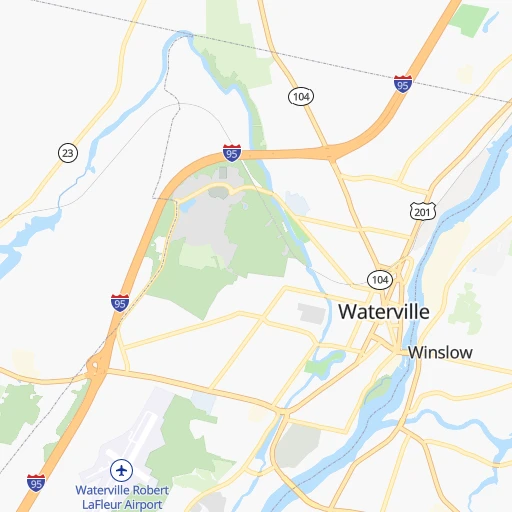
Roadmap (route) to go from Waterville Robert Lafleur Airport to Woonsocket detailed above, you can also see the course layout on the map.
While doing trip Waterville Robert Lafleur (airport) - Woonsocket by car, the calculated route ends at a distance , or more straight.
Distance and duration of the route between Waterville Robert Lafleur (airport) and Woonsocket
Calculation of distance and route from Woonsocket to Waterville Robert Lafleur (airport) :
318.0346.4 km4h10mn
Continue 0h0mn 60 mTurn slight right onto Lafleur Road 0h0mn 164 mTurn right onto Airport Road 0h2mn 1.2 kmTurn left onto Kennedy Memorial Drive 0h1mn 725 mMake a U-turn onto Kennedy Memorial Drive 0h0mn 60 mKeep right 0h23mn 38.6 kmKeep right onto I 295 and take I 295 South, ME 9, ME 126 toward Gardiner, Brunswick 0h1mn 1.2 kmKeep right 1h51mn 80.2 kmKeep left onto I 295 1h55mn 89.5 kmKeep left onto Blue Star Turnpike 0h8mn 12.3 kmKeep left onto I 95 0h24mn 37.1 kmKeep right and take US 1 South toward Boston 0h12mn 13.9 kmKeep right and take MA 60 toward Malden, Revere, Logan Airport 0h0mn 310 mAt roundabout, take exit 2 onto Robert M. Copeland Circle 0h5mn 8.2 kmKeep right and take I 93 North toward Somerville, Charlestown 0h1mn 759 mKeep right and take MA 99 South toward North Station, Government Center 0h2mn 1.2 kmTurn left and take MA 1A North, I 93 South toward Logan Airport, Quincy 0h0mn 59 mKeep right and take I 93 South toward Quincy 0h1mn 1.0 kmKeep right and take I 90 West toward Mass Pike, South Station 0h0mn 184 mKeep left and take I 90 Toll West toward Albany Street 0h1mn 920 mKeep right and take I 90 West toward Albany Street, Mass Pike 0h0mn 131 mKeep left and drive toward Albany Street 0h1mn 596 mTurn right onto East Berkeley Street 0h1mn 301 mTurn left onto Washington Street 0h7mn 6.6 kmTurn right onto Ukraine Way 0h0mn 89 mTurn left onto Washington Street 0h3mn 1.7 kmTurn left onto Poplar Street 0h0mn 140 mTurn slight right onto Washington Street 0h7mn 6.7 kmTurn left onto Washington Street 0h6mn 5.7 kmContinue onto Walpole Street 0h7mn 6.8 kmTurn right onto West Street 0h2mn 1.9 kmKeep right 0h0mn 45 mTurn slight right onto West Street 0h3mn 3.5 kmTurn right onto Main Street 0h2mn 1.8 kmAt roundabout, take exit 2 onto Main Street 0h24mn 22.3 kmTurn right onto High Street 0h0mn 153 mTurn left 0h0mn 84 mArrive at destination 0h0mn 0 m
Travel from Waterville Robert Lafleur (airport) (Rhode Island) to a selection of major cities.
Distances from Waterville Robert Lafleur Airport to biggest cities in Maine
Other major cities in country :
- Charlotte [NC], 827,097 inhabitants. 1,406 km
- Seattle [WA], 684,451 inhabitants. 4,002 km
- Denver [CO], 682,545 inhabitants. 2,939 km
- El Paso [TX], 681,124 inhabitants. 3,485 km
- Detroit [MI], 677,116 inhabitants. 1,107 km
- Boston [MA], 667,137 inhabitants. 267 km
- Memphis [TN], 655,770 inhabitants. 2,022 km
- New South Memphis [TN], 641,608 inhabitants. 2,027 km
- Portland [OR], 632,309 inhabitants. 4,094 km
- Oklahoma City [OK], 631,346 inhabitants. 2,563 km
- Las Vegas [NV], 623,747 inhabitants. 3,914 km
- Baltimore [MD], 621,849 inhabitants. 818 km
- Washington, D.C. [DC], 601,723 inhabitants. 876 km
- Milwaukee [WI], 600,155 inhabitants. 1,471 km
- South Boston [MA], 571,281 inhabitants. 269 km
- Albuquerque [NM], 559,121 inhabitants. 3,300 km
- Tucson [AZ], 531,641 inhabitants. 3,804 km
- Nashville [TN], 530,852 inhabitants. 1,719 km
- Fresno [CA], 520,052 inhabitants. 4,251 km
- Sacramento [CA], 490,712 inhabitants. 4,294 km
Route from Woonsocket to major cities (United States).
- Distance Woonsocket New York City253 km
- Distance Woonsocket Los Angeles4,139 km
- Distance Woonsocket Chicago1,334 km
- Distance Woonsocket Brooklyn253 km
- Distance Woonsocket Houston2,533 km
- Distance Woonsocket Queens243 km
- Distance Woonsocket Philadelphia382 km
- Distance Woonsocket Phoenix3,659 km
- Distance Woonsocket Manhattan246 km
- Distance Woonsocket San Antonio2,794 km
- Distance Woonsocket San Diego4,118 km
- Distance Woonsocket The Bronx235 km
- Distance Woonsocket Dallas2,449 km
- Distance Woonsocket San Jose4,286 km
- Distance Woonsocket Austin2,680 km
- Distance Woonsocket Jacksonville1,584 km
- Distance Woonsocket San Francisco4,309 km
- Distance Woonsocket Columbus991 km
- Distance Woonsocket Fort Worth2,493 km
- Distance Woonsocket Indianapolis1,256 km
Nearest cities to Waterville Robert Lafleur (airport) :
- Boston, 667,137 inhabitants. 267 km
- South Boston, 571,281 inhabitants. 269 km
- Worcester, 184,815 inhabitants. 306 km
- Providence, 179,207 inhabitants. 333 km
- Springfield, 154,341 inhabitants. 359 km
- Lowell, 110,699 inhabitants. 249 km
- Cambridge, 110,402 inhabitants. 267 km
- Manchester, 110,229 inhabitants. 223 km
- Brockton, 95,314 inhabitants. 294 km
- New Bedford, 94,958 inhabitants. 338 km
- Quincy, 93,618 inhabitants. 276 km
- Lynn, 92,457 inhabitants. 252 km
- Newton, 88,817 inhabitants. 274 km
- Fall River, 88,777 inhabitants. 337 km
- Nashua, 87,970 inhabitants. 244 km
- Warwick, 81,699 inhabitants. 346 km
- Cranston, 81,073 inhabitants. 338 km
- Somerville, 80,318 inhabitants. 265 km
- Lawrence, 80,231 inhabitants. 236 km
- Pawtucket, 71,591 inhabitants. 326 km
- Framingham, 68,318 inhabitants. 288 km
- Portland, 66,881 inhabitants. 107 km
- Framingham Center, 65,413 inhabitants. 287 km
- Waltham, 63,378 inhabitants. 271 km
- Haverhill, 62,765 inhabitants. 226 km
- Malden, 61,068 inhabitants. 260 km
- Brookline, 58,732 inhabitants. 271 km
- Medford, 57,403 inhabitants. 262 km
- Taunton, 56,789 inhabitants. 315 km
- Chicopee, 56,741 inhabitants. 356 km
- North Chicopee, 55,179 inhabitants. 353 km
- Weymouth, 54,395 inhabitants. 277 km
- Revere, 53,422 inhabitants. 260 km
- Peabody, 52,504 inhabitants. 245 km
- East Hartford, 51,252 inhabitants. 388 km
- South Peabody, 50,293 inhabitants. 248 km
- Barnstable, 47,821 inhabitants. 319 km
- East Providence, 47,408 inhabitants. 332 km
- Methuen, 47,255 inhabitants. 235 km
- Middletown, 46,756 inhabitants. 410 km
- Everett, 46,050 inhabitants. 261 km
- Enfield, 45,212 inhabitants. 370 km
- Attleboro, 44,284 inhabitants. 316 km
- Salem, 42,869 inhabitants. 245 km
- Arlington, 42,844 inhabitants. 264 km
- Concord, 42,620 inhabitants. 210 km
- East Concord, 42,605 inhabitants. 207 km
- Leominster, 41,569 inhabitants. 280 km
- Woonsocket, 41,475 inhabitants. 319 km
- Beverly, 41,186 inhabitants. 240 km
Location Waterville Robert Lafleur (airport) (Maine) :
| Country flag |  |
| Location | Waterville Robert Lafleur (airport) |
| State | Maine |
| County | Kennebec County |
| Country | United States |
| Country code / ISO 2 | US |
| Latitude | 44.5337500 |
| Longitude | -69.6785600 |
| Altitude | 93 meters |
| Time zone | America/New_York |
Location Woonsocket (Rhode Island) :
| Country flag | |
| Location | Woonsocket |
| State | Rhode Island |
| County | Providence County |
| Country | United States |
| Country code / ISO 2 | US |
| Latitude | 42.0028800 |
| Longitude | -71.5147800 |
| Altitude | 55 meters |
| Time zone | America/New_York |


