

How to get from Berlin Landing Area (airport) (Massachusetts) to Attleboro (Massachusetts)
Calculate route from Berlin Landing Area (airport) (Massachusetts, United States) to Attleboro (Massachusetts, United States).
The flight distance (as the crow flies) between Berlin Landing Area (airport) and Attleboro is 55.5 km.
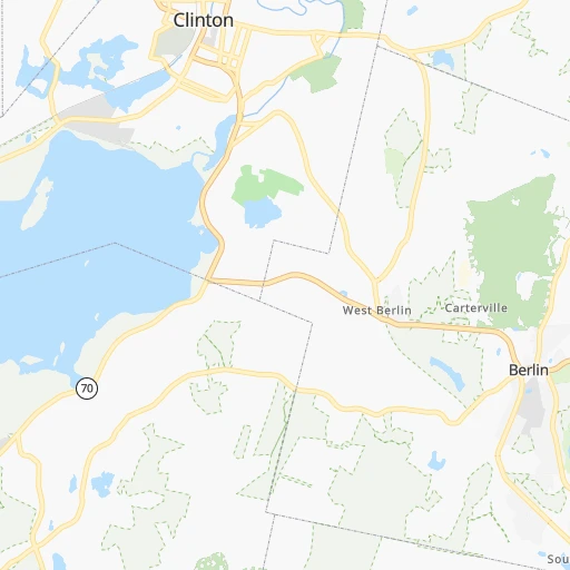
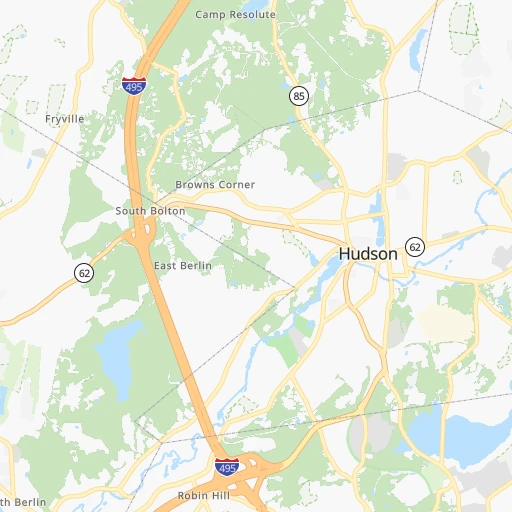
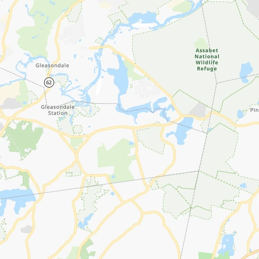
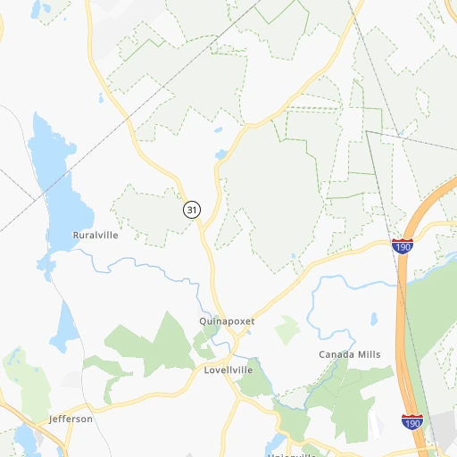
Roadmap (route) to go from Berlin Landing Area Airport to Attleboro detailed above, you can also see the course layout on the map.
While doing trip Berlin Landing Area (airport) - Attleboro by car, the calculated route ends at a distance , or more straight.
Distance and duration of the route between Berlin Landing Area (airport) and Attleboro
Calculation of distance and route from Attleboro to Berlin Landing Area (airport) :
55.562.2 km1h51mn
Continue onto Crosby Road 0h0mn 164 mTurn sharp right onto Jones Road 0h0mn 179 mTurn right onto South Street 0h2mn 2.0 kmAt roundabout, take exit 2 onto River Road West 0h0mn 253 mAt roundabout, take exit 2 onto River Road West 0h2mn 1.9 kmTurn left onto Hudson Street 0h1mn 577 mTurn right onto Boundary Street 0h2mn 1.6 kmTurn left onto Boston Post Road West 0h1mn 667 mTurn right onto Ames Street 0h3mn 2.3 kmTurn left onto Joseph A. Ferrecchia Connector Road and take I 495 toward Cape Cod, Lowell 0h0mn 353 mKeep right and take I 495 South toward Cape Cod 0h25mn 38.8 kmKeep right and take MA 1A toward Wrentham, Plainville 0h0mn 230 mKeep right and take MA 1A South toward Plainville 0h0mn 125 mContinue onto South Street 0h5mn 5.2 kmTurn left 0h0mn 54 mTurn right onto East Washington Street 0h1mn 1.5 kmTurn left onto Elm Street 0h2mn 1.8 kmContinue onto Commonwealth Avenue 0h2mn 850 mKeep right 0h0mn 43 mTurn slight right onto Commonwealth Avenue 0h0mn 5 mContinue onto North Avenue 0h2mn 2.1 kmTurn left onto West Street 0h1mn 540 mTurn right onto North Main Street 0h1mn 928 mTurn right 0h0mn 60 mArrive at destination 0h0mn 0 m
Travel from Berlin Landing Area (airport) (Massachusetts) to a selection of major cities.
Distances from Berlin Landing Area Airport to biggest cities in Massachusetts
- Medford,57,403 inhabitants.44 km
- Taunton,56,789 inhabitants.69 km
- Chicopee,56,741 inhabitants.83 km
- North Chicopee,55,179 inhabitants.81 km
- Weymouth,54,395 inhabitants.60 km
- Revere,53,422 inhabitants.52 km
- Peabody,52,504 inhabitants.61 km
- South Peabody,50,293 inhabitants.59 km
- Barnstable,47,821 inhabitants.134 km
- Methuen,47,255 inhabitants.54 km
- Everett,46,050 inhabitants.49 km
- Attleboro,44,284 inhabitants.56 km
- Pittsfield,43,303 inhabitants.132 km
- Salem,42,869 inhabitants.64 km
- Arlington,42,844 inhabitants.40 km
- Westfield,41,690 inhabitants.95 km
- Leominster,41,569 inhabitants.20 km
- Beverly,41,186 inhabitants.66 km
- Holyoke,40,684 inhabitants.82 km
- Fitchburg,40,545 inhabitants.27 km
Other major cities in country :
- Charlotte [NC], 827,097 inhabitants. 1,125 km
- Seattle [WA], 684,451 inhabitants. 3,961 km
- Denver [CO], 682,545 inhabitants. 2,796 km
- El Paso [TX], 681,124 inhabitants. 3,285 km
- Detroit [MI], 677,116 inhabitants. 937 km
- Memphis [TN], 655,770 inhabitants. 1,783 km
- New South Memphis [TN], 641,608 inhabitants. 1,788 km
- Portland [OR], 632,309 inhabitants. 4,036 km
- Oklahoma City [OK], 631,346 inhabitants. 2,358 km
- Las Vegas [NV], 623,747 inhabitants. 3,769 km
- Baltimore [MD], 621,849 inhabitants. 541 km
- Washington, D.C. [DC], 601,723 inhabitants. 597 km
- Milwaukee [WI], 600,155 inhabitants. 1,330 km
- Albuquerque [NM], 559,121 inhabitants. 3,122 km
- Tucson [AZ], 531,641 inhabitants. 3,621 km
- Nashville [TN], 530,852 inhabitants. 1,473 km
- Fresno [CA], 520,052 inhabitants. 4,122 km
- Sacramento [CA], 490,712 inhabitants. 4,182 km
- Kansas City [MO], 475,378 inhabitants. 1,962 km
- Long Beach [CA], 474,140 inhabitants. 4,136 km
Route from Attleboro to major cities (United States).
- Distance Attleboro New York City265 km
- Distance Attleboro Los Angeles4,158 km
- Distance Attleboro Chicago1,354 km
- Distance Attleboro Brooklyn265 km
- Distance Attleboro Houston2,547 km
- Distance Attleboro Queens255 km
- Distance Attleboro Philadelphia394 km
- Distance Attleboro Phoenix3,678 km
- Distance Attleboro Manhattan259 km
- Distance Attleboro San Antonio2,810 km
- Distance Attleboro San Diego4,137 km
- Distance Attleboro The Bronx248 km
- Distance Attleboro Dallas2,465 km
- Distance Attleboro San Jose4,305 km
- Distance Attleboro Austin2,695 km
- Distance Attleboro Jacksonville1,591 km
- Distance Attleboro San Francisco4,329 km
- Distance Attleboro Columbus1,008 km
- Distance Attleboro Fort Worth2,510 km
- Distance Attleboro Indianapolis1,274 km
Nearest cities to Berlin Landing Area (airport) :
- New York City, 8,175,133 inhabitants. 270 km
- Brooklyn, 2,300,664 inhabitants. 271 km
- Queens, 2,272,771 inhabitants. 262 km
- Manhattan, 1,487,536 inhabitants. 262 km
- The Bronx, 1,385,108 inhabitants. 251 km
- Boston, 667,137 inhabitants. 48 km
- South Boston, 571,281 inhabitants. 49 km
- Staten Island, 468,730 inhabitants. 289 km
- Newark, 281,944 inhabitants. 278 km
- Jersey City, 264,290 inhabitants. 273 km
- Jamaica, 216,866 inhabitants. 259 km
- Yonkers, 201,116 inhabitants. 247 km
- Worcester, 184,815 inhabitants. 18 km
- Harlem, 181,259 inhabitants. 259 km
- Providence, 179,207 inhabitants. 63 km
- East Flatbush, 178,464 inhabitants. 270 km
- East New York, 173,198 inhabitants. 266 km
- Springfield, 154,341 inhabitants. 84 km
- Washington Heights, 152,613 inhabitants. 255 km
- Astoria, 150,165 inhabitants. 260 km
- Borough Park, 149,248 inhabitants. 275 km
- Paterson, 147,754 inhabitants. 265 km
- Bridgeport, 147,629 inhabitants. 186 km
- New Haven, 130,322 inhabitants. 159 km
- Elizabeth, 129,007 inhabitants. 286 km
- Stamford, 128,874 inhabitants. 215 km
- Sunset Park, 126,000 inhabitants. 275 km
- Hartford, 124,006 inhabitants. 109 km
- Sheepshead Bay, 122,534 inhabitants. 276 km
- North Stamford, 121,230 inhabitants. 209 km
- East Harlem, 115,921 inhabitants. 259 km
- Elmhurst, 113,364 inhabitants. 260 km
- Bushwick, 112,620 inhabitants. 266 km
- Gravesend, 112,229 inhabitants. 276 km
- Lowell, 110,699 inhabitants. 40 km
- Cambridge, 110,402 inhabitants. 44 km
- Manchester, 110,229 inhabitants. 72 km
- Corona, 109,698 inhabitants. 258 km
- Waterbury, 108,802 inhabitants. 147 km
- Edison, 102,548 inhabitants. 309 km
- Richmond Hill, 98,984 inhabitants. 260 km
- Albany, 98,469 inhabitants. 176 km
- Brockton, 95,314 inhabitants. 60 km
- New Bedford, 94,958 inhabitants. 100 km
- Fordham, 94,678 inhabitants. 252 km
- West Albany, 93,794 inhabitants. 179 km
- Quincy, 93,618 inhabitants. 54 km
- Flatbush, 93,361 inhabitants. 272 km
- Lynn, 92,457 inhabitants. 58 km
- Newton, 88,817 inhabitants. 36 km
Location Berlin Landing Area (airport) (Massachusetts) :
| Country flag |  |
| Location | Berlin Landing Area (airport) |
| State | Massachusetts |
| County | Worcester County |
| Country | United States |
| Country code / ISO 2 | US |
| Latitude | 42.3678800 |
| Longitude | -71.6427500 |
| Altitude | 87 meters |
| Time zone | America/New_York |
Location Attleboro (Massachusetts) :
| Country flag | |
| Location | Attleboro |
| State | Massachusetts |
| County | Bristol County |
| Country | United States |
| Country code / ISO 2 | US |
| Latitude | 41.9445400 |
| Longitude | -71.2856100 |
| Altitude | 35 meters |
| Time zone | America/New_York |


