
How to get from Ruzicka (airport) (Indiana) to Valparaiso (Indiana)
Calculate route from Ruzicka (airport) (Indiana, United States) to Valparaiso (Indiana, United States).
The flight distance (as the crow flies) between Ruzicka (airport) and Valparaiso is 137.0 km.
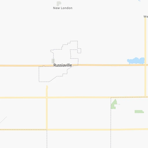
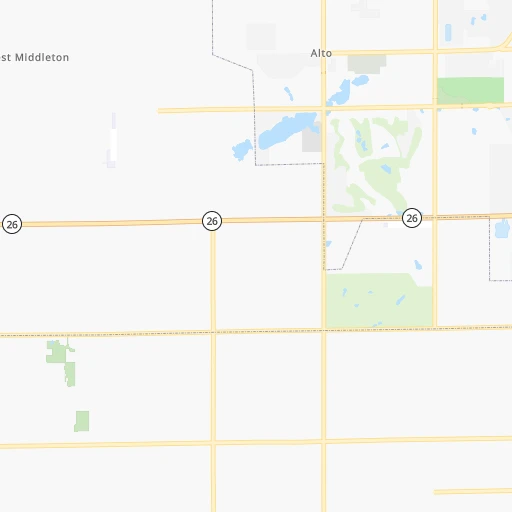
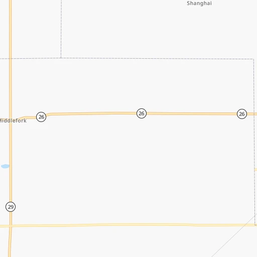
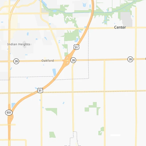
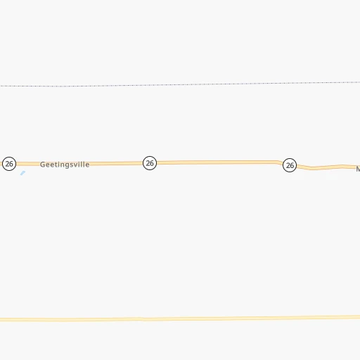
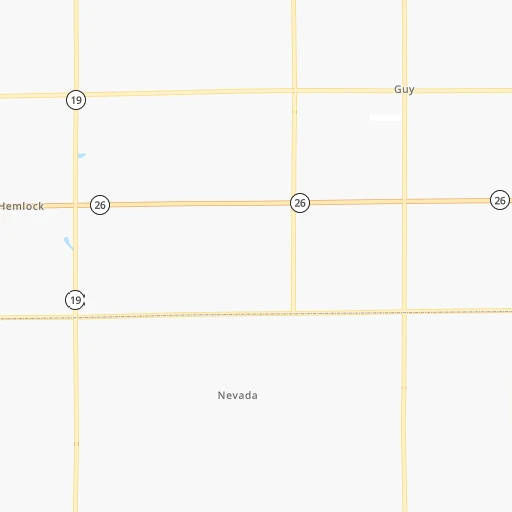
Roadmap (route) to go from Ruzicka Airport to Valparaiso detailed above, you can also see the course layout on the map.
While doing trip Ruzicka (airport) - Valparaiso by car, the calculated route ends at a distance , or more straight.
Distance and duration of the route between Ruzicka (airport) and Valparaiso
Calculation of distance and route from Valparaiso to Ruzicka (airport) :
137.0165.9 km2h27mn
Continue 0h0mn 79 mTurn left onto County Road West 300 South 0h2mn 1.5 kmTurn left onto South Dixon Road 0h11mn 10.0 kmTurn right onto County Road West 300 North 0h2mn 846 mTurn left onto North 150 W 0h3mn 1.3 kmTurn left onto North Davis Road 0h2mn 1.8 kmContinue onto Davis Road 0h22mn 24.6 kmContinue onto Wabash Road 0h3mn 4.2 kmKeep right 0h1mn 978 mContinue onto Monticello Road 0h2mn 1.4 kmKeep right 1h10mn 79.7 kmTurn left 0h0mn 12 mTurn slight right 0h26mn 36.2 kmTurn right onto Sturdy Road 0h1mn 691 mAt roundabout, take exit 3 onto East Lincolnway 0h3mn 2.1 kmTurn right onto North Washington Street 0h1mn 591 mTurn left onto Walnut Street 0h0mn 11 mArrive at destination 0h0mn 0 m
Travel from Ruzicka (airport) (Indiana) to a selection of major cities.
Distances from Ruzicka Airport to biggest cities in Indiana
- Columbus,46,690 inhabitants.139 km
- West Lafayette,45,550 inhabitants.61 km
- Portage,36,738 inhabitants.152 km
- Westfield,36,738 inhabitants.44 km
- New Albany,36,732 inhabitants.241 km
- Richmond,35,854 inhabitants.129 km
- Merrillville,35,224 inhabitants.152 km
- Goshen,32,983 inhabitants.131 km
- Valparaiso,32,626 inhabitants.137 km
- Michigan City,31,459 inhabitants.154 km
- Plainfield,30,590 inhabitants.83 km
- Granger,30,465 inhabitants.147 km
- Marion,29,081 inhabitants.47 km
- Crown Point,28,879 inhabitants.148 km
- Schererville,28,791 inhabitants.158 km
- East Chicago,28,699 inhabitants.172 km
- Hobart,28,404 inhabitants.152 km
- Zionsville,26,296 inhabitants.54 km
- Brownsburg,24,996 inhabitants.68 km
- Franklin,24,598 inhabitants.107 km
Other major cities in country :
- Seattle [WA], 684,451 inhabitants. 2,972 km
- Denver [CO], 682,545 inhabitants. 1,600 km
- El Paso [TX], 681,124 inhabitants. 2,059 km
- Detroit [MI], 677,116 inhabitants. 337 km
- Boston [MA], 667,137 inhabitants. 1,279 km
- Memphis [TN], 655,770 inhabitants. 679 km
- New South Memphis [TN], 641,608 inhabitants. 686 km
- Portland [OR], 632,309 inhabitants. 2,999 km
- Oklahoma City [OK], 631,346 inhabitants. 1,137 km
- Las Vegas [NV], 623,747 inhabitants. 2,561 km
- Baltimore [MD], 621,849 inhabitants. 827 km
- Washington, D.C. [DC], 601,723 inhabitants. 802 km
- Milwaukee [WI], 600,155 inhabitants. 323 km
- South Boston [MA], 571,281 inhabitants. 1,280 km
- Albuquerque [NM], 559,121 inhabitants. 1,892 km
- Tucson [AZ], 531,641 inhabitants. 2,390 km
- Nashville [TN], 530,852 inhabitants. 478 km
- Fresno [CA], 520,052 inhabitants. 2,933 km
- Sacramento [CA], 490,712 inhabitants. 3,020 km
- Kansas City [MO], 475,378 inhabitants. 733 km
Route from Valparaiso to major cities (United States).
- Distance Valparaiso New York City1,097 km
- Distance Valparaiso Los Angeles2,848 km
- Distance Valparaiso Chicago64 km
- Distance Valparaiso Brooklyn1,103 km
- Distance Valparaiso Houston1,503 km
- Distance Valparaiso Queens1,112 km
- Distance Valparaiso Philadelphia1,017 km
- Distance Valparaiso Phoenix2,373 km
- Distance Valparaiso Manhattan1,100 km
- Distance Valparaiso San Antonio1,692 km
- Distance Valparaiso San Diego2,828 km
- Distance Valparaiso The Bronx1,107 km
- Distance Valparaiso Dallas1,296 km
- Distance Valparaiso San Jose3,011 km
- Distance Valparaiso Austin1,574 km
- Distance Valparaiso Jacksonville1,332 km
- Distance Valparaiso San Francisco3,038 km
- Distance Valparaiso Columbus382 km
- Distance Valparaiso Fort Worth1,331 km
- Distance Valparaiso Charlotte882 km
Nearest cities to Ruzicka (airport) :
- Chicago, 2,720,546 inhabitants. 200 km
- Indianapolis, 829,718 inhabitants. 74 km
- Milwaukee, 600,155 inhabitants. 323 km
- Lexington-Fayette, 314,488 inhabitants. 304 km
- Cincinnati, 296,943 inhabitants. 204 km
- Toledo, 279,789 inhabitants. 260 km
- Fort Wayne, 260,326 inhabitants. 118 km
- Louisville, 243,639 inhabitants. 245 km
- Lexington, 225,366 inhabitants. 309 km
- Aurora, 200,661 inhabitants. 232 km
- Grand Rapids, 195,097 inhabitants. 285 km
- Rockford, 148,278 inhabitants. 318 km
- Joliet, 147,861 inhabitants. 201 km
- Naperville, 147,100 inhabitants. 223 km
- Dayton, 140,599 inhabitants. 185 km
- Evansville, 119,943 inhabitants. 298 km
- Ann Arbor, 117,070 inhabitants. 289 km
- Lansing, 115,056 inhabitants. 290 km
- Elgin, 112,111 inhabitants. 250 km
- South Bend, 101,516 inhabitants. 139 km
- Kenosha, 99,858 inhabitants. 276 km
- Flint, 98,310 inhabitants. 354 km
- Livonia, 94,635 inhabitants. 320 km
- Carmel, 88,713 inhabitants. 51 km
- Waukegan, 88,475 inhabitants. 256 km
- Canton, 86,825 inhabitants. 307 km
- West Town, 86,429 inhabitants. 205 km
- Champaign, 86,096 inhabitants. 178 km
- Near North Side, 85,711 inhabitants. 204 km
- Bloomington, 84,067 inhabitants. 144 km
- Cicero, 83,886 inhabitants. 205 km
- Westland, 82,000 inhabitants. 314 km
- Farmington Hills, 81,330 inhabitants. 327 km
- Belmont Cragin, 79,159 inhabitants. 213 km
- Bloomington, 78,292 inhabitants. 238 km
- Racine, 77,742 inhabitants. 288 km
- Hammond, 77,614 inhabitants. 169 km
- Gary, 77,156 inhabitants. 162 km
- Fishers, 76,794 inhabitants. 55 km
- Kalamazoo, 76,041 inhabitants. 213 km
- Arlington Heights, 75,926 inhabitants. 238 km
- Waterford, 75,737 inhabitants. 341 km
- Evanston, 75,527 inhabitants. 219 km
- Wyoming, 75,275 inhabitants. 279 km
- Schaumburg, 74,693 inhabitants. 239 km
- Bolingbrook, 74,306 inhabitants. 212 km
- South Lawndale, 73,826 inhabitants. 203 km
- Logan Square, 73,702 inhabitants. 209 km
- Decatur, 73,254 inhabitants. 245 km
- Southfield, 73,156 inhabitants. 336 km
Location Ruzicka (airport) (Indiana) :
| Country flag |  |
| Location | Ruzicka (airport) |
| State | Indiana |
| County | Howard County |
| Country | United States |
| Country code / ISO 2 | US |
| Latitude | 40.4333700 |
| Longitude | -86.1833300 |
| Altitude | 254 meters |
| Time zone | America/Indiana/Indianapolis |
Location Valparaiso (Indiana) :
| Country flag | |
| Location | Valparaiso |
| State | Indiana |
| County | Porter County |
| Country | United States |
| Country code / ISO 2 | US |
| Latitude | 41.4730900 |
| Longitude | -87.0611400 |
| Altitude | 242 meters |
| Time zone | America/Chicago |


