
How to get from Fulton County (airport) (Indiana) to Flint (Michigan)
Calculate route from Fulton County (airport) (Indiana, United States) to Flint (Michigan, United States).
The flight distance (as the crow flies) between Fulton County (airport) and Flint is 299.1 km.
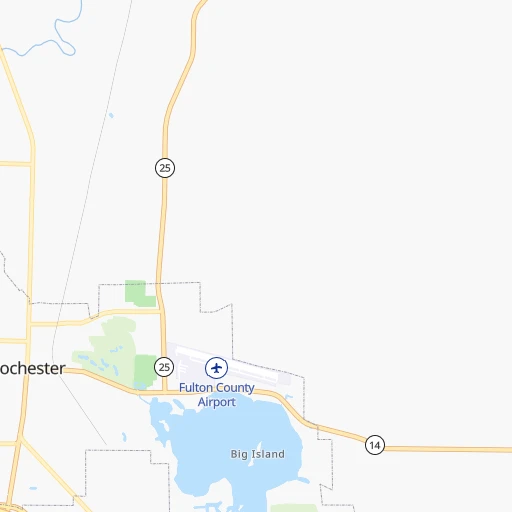
Roadmap (route) to go from Fulton County Airport to Flint detailed above, you can also see the course layout on the map.
While doing trip Fulton County (airport) - Flint by car, the calculated route ends at a distance , or more straight.
Distance and duration of the route between Fulton County (airport) and Flint
Calculation of distance and route from Flint to Fulton County (airport) :
299.1354.1 km5h35mn
Continue 0h1mn 242 mTurn right onto SR 25 0h14mn 14.9 kmTurn left onto SR 331 1h31mn 31.3 kmTurn right onto Grand Army of the Republic Highway 0h1mn 1.9 kmTurn left onto Plymouth Goshen Trail 0h7mn 7.5 kmTurn right onto County Road 46 0h2mn 2.0 kmTurn left onto Nappanee Street 0h1mn 1.6 kmAt roundabout, take exit 1 onto State Road 119 0h8mn 11.2 kmTurn left onto County Road 17 0h13mn 15.9 kmTurn right onto Shore Manor Drive 0h6mn 6.7 kmTurn left onto SR 15 0h9mn 10.2 kmContinue onto West Chicago Road 0h0mn 338 mTurn left onto Riverside Drive 0h9mn 7.3 kmTurn left onto Constantine Bypass 0h11mn 13.1 kmTurn right onto West Michigan Avenue 1h37mn 41.1 kmTurn left onto Athens Road 0h21mn 23.4 kmKeep right onto Sojourner Truth Downtown Parkway 0h0mn 210 mKeep right and take I 94 East toward Detroit 0h9mn 15.6 kmKeep right onto BL I 94 and take I 69 toward Fort Wayne, Lansing 0h0mn 284 mKeep left 0h0mn 560 mKeep right and take I 69 North toward Lansing 0h1mn 625 mKeep left toward I 69 North 1h30mn 51.1 kmKeep right 0h0mn 505 mKeep right 0h9mn 10.9 kmContinue toward I 496 East 0h3mn 5.7 kmKeep right toward US 127 North 0h1mn 873 mKeep right toward US 127 North 0h1mn 1.2 kmKeep right and take I 69 Business, M 43 toward Saginaw Street, Grand River Avenue 0h0mn 441 mTurn right onto East Saginaw Street 0h0mn 255 mKeep left onto East Saginaw Street 0h8mn 9.5 kmKeep right onto BL I 69 1h37mn 66.3 kmKeep right and drive toward Saginaw Street, Downtown 0h0mn 310 mTurn left onto South Grand Traverse Street 0h0mn 467 mTurn right onto West Fifth Street 0h0mn 433 mTurn left 0h0mn 102 mTurn left 0h0mn 28 mArrive at destination 0h0mn 0 m
Travel from Fulton County (airport) (Michigan) to a selection of major cities.
Distances from Fulton County Airport to biggest cities in Indiana
- Columbus,46,690 inhabitants.209 km
- West Lafayette,45,550 inhabitants.93 km
- Portage,36,738 inhabitants.100 km
- Westfield,36,738 inhabitants.114 km
- New Albany,36,732 inhabitants.311 km
- Richmond,35,854 inhabitants.176 km
- Merrillville,35,224 inhabitants.106 km
- Goshen,32,983 inhabitants.65 km
- Valparaiso,32,626 inhabitants.86 km
- Michigan City,31,459 inhabitants.93 km
- Plainfield,30,590 inhabitants.153 km
- Granger,30,465 inhabitants.77 km
- Marion,29,081 inhabitants.72 km
- Crown Point,28,879 inhabitants.106 km
- Schererville,28,791 inhabitants.115 km
- East Chicago,28,699 inhabitants.123 km
- Hobart,28,404 inhabitants.103 km
- Zionsville,26,296 inhabitants.124 km
- Brownsburg,24,996 inhabitants.137 km
- Franklin,24,598 inhabitants.177 km
Other major cities in country :
- Seattle [WA], 684,451 inhabitants. 2,939 km
- Denver [CO], 682,545 inhabitants. 1,597 km
- El Paso [TX], 681,124 inhabitants. 2,085 km
- Detroit [MI], 677,116 inhabitants. 297 km
- Boston [MA], 667,137 inhabitants. 1,264 km
- Memphis [TN], 655,770 inhabitants. 740 km
- New South Memphis [TN], 641,608 inhabitants. 747 km
- Portland [OR], 632,309 inhabitants. 2,971 km
- Oklahoma City [OK], 631,346 inhabitants. 1,168 km
- Las Vegas [NV], 623,747 inhabitants. 2,563 km
- Baltimore [MD], 621,849 inhabitants. 838 km
- Washington, D.C. [DC], 601,723 inhabitants. 817 km
- Milwaukee [WI], 600,155 inhabitants. 261 km
- South Boston [MA], 571,281 inhabitants. 1,265 km
- Albuquerque [NM], 559,121 inhabitants. 1,907 km
- Tucson [AZ], 531,641 inhabitants. 2,408 km
- Nashville [TN], 530,852 inhabitants. 548 km
- Fresno [CA], 520,052 inhabitants. 2,930 km
- Sacramento [CA], 490,712 inhabitants. 3,010 km
- Kansas City [MO], 475,378 inhabitants. 747 km
Route from Flint to major cities (United States).
- Distance Flint New York City842 km
- Distance Flint Los Angeles3,145 km
- Distance Flint Chicago350 km
- Distance Flint Brooklyn849 km
- Distance Flint Houston1,804 km
- Distance Flint Queens857 km
- Distance Flint Philadelphia788 km
- Distance Flint Phoenix2,684 km
- Distance Flint Manhattan842 km
- Distance Flint San Antonio2,008 km
- Distance Flint San Diego3,132 km
- Distance Flint The Bronx848 km
- Distance Flint Dallas1,616 km
- Distance Flint San Jose3,281 km
- Distance Flint Austin1,889 km
- Distance Flint Jacksonville1,423 km
- Distance Flint San Francisco3,305 km
- Distance Flint Columbus344 km
- Distance Flint Fort Worth1,653 km
- Distance Flint Indianapolis416 km
Nearest cities to Fulton County (airport) :
- Chicago, 2,720,546 inhabitants. 150 km
- Indianapolis, 829,718 inhabitants. 144 km
- Milwaukee, 600,155 inhabitants. 261 km
- Cincinnati, 296,943 inhabitants. 259 km
- Toledo, 279,789 inhabitants. 230 km
- Fort Wayne, 260,326 inhabitants. 89 km
- Louisville, 243,639 inhabitants. 315 km
- Aurora, 200,661 inhabitants. 194 km
- Grand Rapids, 195,097 inhabitants. 216 km
- Rockford, 148,278 inhabitants. 276 km
- Joliet, 147,861 inhabitants. 166 km
- Naperville, 147,100 inhabitants. 182 km
- Dayton, 140,599 inhabitants. 223 km
- Ann Arbor, 117,070 inhabitants. 244 km
- Lansing, 115,056 inhabitants. 230 km
- Elgin, 112,111 inhabitants. 205 km
- South Bend, 101,516 inhabitants. 69 km
- Kenosha, 99,858 inhabitants. 217 km
- Flint, 98,310 inhabitants. 300 km
- Livonia, 94,635 inhabitants. 277 km
- Carmel, 88,713 inhabitants. 121 km
- Waukegan, 88,475 inhabitants. 199 km
- Canton, 86,825 inhabitants. 264 km
- West Town, 86,429 inhabitants. 154 km
- Champaign, 86,096 inhabitants. 203 km
- Near North Side, 85,711 inhabitants. 152 km
- Bloomington, 84,067 inhabitants. 213 km
- Cicero, 83,886 inhabitants. 157 km
- Westland, 82,000 inhabitants. 271 km
- Farmington Hills, 81,330 inhabitants. 282 km
- Belmont Cragin, 79,159 inhabitants. 163 km
- Bloomington, 78,292 inhabitants. 245 km
- Racine, 77,742 inhabitants. 227 km
- Hammond, 77,614 inhabitants. 124 km
- Gary, 77,156 inhabitants. 113 km
- Fishers, 76,794 inhabitants. 124 km
- Kalamazoo, 76,041 inhabitants. 145 km
- Arlington Heights, 75,926 inhabitants. 188 km
- Waterford, 75,737 inhabitants. 293 km
- Evanston, 75,527 inhabitants. 166 km
- Wyoming, 75,275 inhabitants. 210 km
- Schaumburg, 74,693 inhabitants. 191 km
- Bolingbrook, 74,306 inhabitants. 172 km
- South Lawndale, 73,826 inhabitants. 154 km
- Logan Square, 73,702 inhabitants. 158 km
- Decatur, 73,254 inhabitants. 271 km
- Southfield, 73,156 inhabitants. 292 km
- West Ridge, 72,211 inhabitants. 163 km
- Waukesha, 71,970 inhabitants. 275 km
- Lafayette, 71,111 inhabitants. 93 km
Location Fulton County (airport) (Indiana) :
| Country flag |  |
| Location | Fulton County (airport) |
| State | Indiana |
| County | Fulton County |
| Country | United States |
| Country code / ISO 2 | US |
| Latitude | 41.0657200 |
| Longitude | -86.1901500 |
| Altitude | 240 meters |
| Time zone | America/Indiana/Indianapolis |
Location Flint (Michigan) :
| Country flag | |
| Location | Flint |
| State | Michigan |
| County | Genesee County |
| Country | United States |
| Country code / ISO 2 | US |
| Latitude | 43.0125300 |
| Longitude | -83.6874600 |
| Altitude | 229 meters |
| Time zone | America/Detroit |


