
How to get from Marshall County (airport) (Illinois) to Aurora (Illinois)
Calculate route from Marshall County (airport) (Illinois, United States) to Aurora (Illinois, United States).
The flight distance (as the crow flies) between Marshall County (airport) and Aurora is 121.1 km.
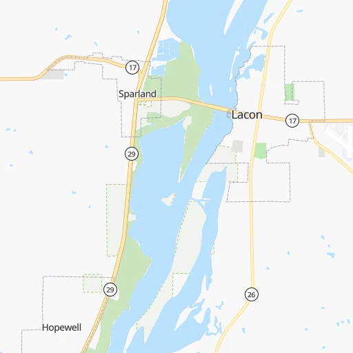
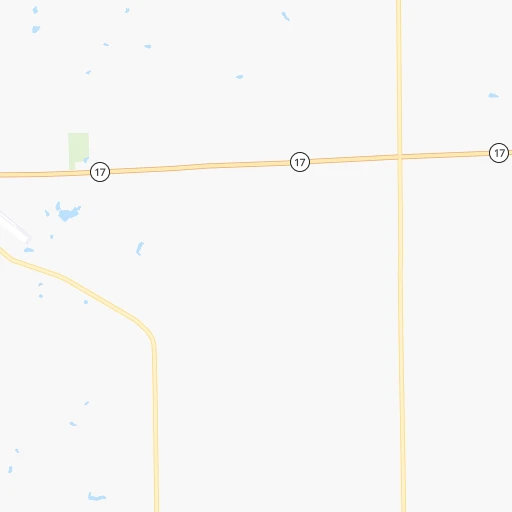
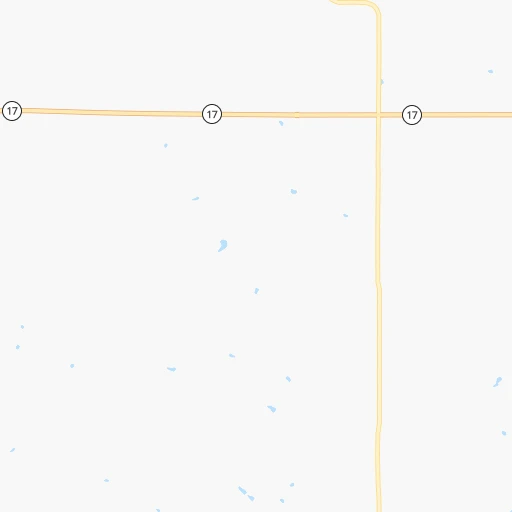
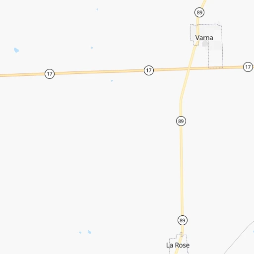
Roadmap (route) to go from Marshall County Airport to Aurora detailed above, you can also see the course layout on the map.
While doing trip Marshall County (airport) - Aurora by car, the calculated route ends at a distance , or more straight.
Distance and duration of the route between Marshall County (airport) and Aurora
Calculation of distance and route from Aurora to Marshall County (airport) :
121.1147.3 km2h57mn
Continue 0h1mn 303 mTurn right onto 5th Street 0h12mn 13.1 kmTurn left onto 2160 E Rd 0h10mn 10.5 kmKeep right 0h0mn 63 mContinue onto North Street 0h11mn 10.7 kmTurn left and take I 39 North, US 51 North toward Rockford 0h16mn 27.3 kmKeep right and take I 80 East toward Chicago 0h14mn 23.6 kmKeep right and take IL 71 toward Ottawa, Oswego 0h0mn 405 mTurn left onto Illinois Route 71 1h34mn 40.3 kmTurn right onto Stagecoach Trail 0h7mn 8.3 kmTurn left onto Orchard Road 0h1mn 1.2 kmTurn right onto US 34 0h10mn 11.4 kmTurn left onto West Galena Boulevard 0h0mn 175 mArrive at destination 0h0mn 0 m
Travel from Marshall County (airport) (Illinois) to a selection of major cities.
Distances from Marshall County Airport to biggest cities in Illinois
- South Lawndale,73,826 inhabitants.167 km
- Logan Square,73,702 inhabitants.173 km
- Decatur,73,254 inhabitants.136 km
- West Ridge,72,211 inhabitants.178 km
- Palatine,69,308 inhabitants.166 km
- Lincoln Park,66,959 inhabitants.176 km
- Portage Park,64,841 inhabitants.171 km
- Skokie,64,821 inhabitants.178 km
- Des Plaines,58,677 inhabitants.169 km
- Orland Park,58,619 inhabitants.145 km
- Tinley Park,57,143 inhabitants.147 km
- Oak Lawn,56,781 inhabitants.156 km
- Irving Park,56,520 inhabitants.172 km
- Berwyn,56,368 inhabitants.162 km
- Chicago Lawn,55,551 inhabitants.164 km
- Uptown,55,137 inhabitants.179 km
- Edgewater,54,873 inhabitants.179 km
- Mount Prospect,54,747 inhabitants.168 km
- Rogers Park,54,402 inhabitants.181 km
- Normal,54,373 inhabitants.66 km
Other major cities in country :
- Seattle [WA], 684,451 inhabitants. 2,702 km
- Denver [CO], 682,545 inhabitants. 1,329 km
- El Paso [TX], 681,124 inhabitants. 1,842 km
- Detroit [MI], 677,116 inhabitants. 547 km
- Boston [MA], 667,137 inhabitants. 1,528 km
- Memphis [TN], 655,770 inhabitants. 656 km
- New South Memphis [TN], 641,608 inhabitants. 663 km
- Portland [OR], 632,309 inhabitants. 2,724 km
- Oklahoma City [OK], 631,346 inhabitants. 941 km
- Las Vegas [NV], 623,747 inhabitants. 2,295 km
- Baltimore [MD], 621,849 inhabitants. 1,103 km
- Washington, D.C. [DC], 601,723 inhabitants. 1,079 km
- Milwaukee [WI], 600,155 inhabitants. 256 km
- South Boston [MA], 571,281 inhabitants. 1,529 km
- Albuquerque [NM], 559,121 inhabitants. 1,648 km
- Tucson [AZ], 531,641 inhabitants. 2,151 km
- Nashville [TN], 530,852 inhabitants. 586 km
- Fresno [CA], 520,052 inhabitants. 2,662 km
- Sacramento [CA], 490,712 inhabitants. 2,744 km
- Kansas City [MO], 475,378 inhabitants. 491 km
Route from Aurora to major cities (United States).
- Distance Aurora New York City1,202 km
- Distance Aurora Los Angeles2,749 km
- Distance Aurora Brooklyn1,208 km
- Distance Aurora Houston1,478 km
- Distance Aurora Queens1,217 km
- Distance Aurora Philadelphia1,125 km
- Distance Aurora Phoenix2,280 km
- Distance Aurora Manhattan1,204 km
- Distance Aurora San Antonio1,651 km
- Distance Aurora San Diego2,731 km
- Distance Aurora The Bronx1,211 km
- Distance Aurora Dallas1,249 km
- Distance Aurora San Jose2,905 km
- Distance Aurora Austin1,533 km
- Distance Aurora Jacksonville1,405 km
- Distance Aurora San Francisco2,932 km
- Distance Aurora Columbus491 km
- Distance Aurora Fort Worth1,282 km
- Distance Aurora Indianapolis287 km
- Distance Aurora Charlotte976 km
Nearest cities to Marshall County (airport) :
- Chicago, 2,720,546 inhabitants. 172 km
- Milwaukee, 600,155 inhabitants. 256 km
- St. Louis, 315,685 inhabitants. 275 km
- Madison, 248,951 inhabitants. 228 km
- Aurora, 200,661 inhabitants. 121 km
- Rockford, 148,278 inhabitants. 141 km
- Joliet, 147,861 inhabitants. 123 km
- Naperville, 147,100 inhabitants. 134 km
- Cedar Rapids, 130,405 inhabitants. 218 km
- Columbia, 119,108 inhabitants. 341 km
- Springfield, 116,565 inhabitants. 138 km
- Peoria, 115,070 inhabitants. 40 km
- North Peoria, 113,004 inhabitants. 38 km
- Elgin, 112,111 inhabitants. 146 km
- Davenport, 102,582 inhabitants. 114 km
- Kenosha, 99,858 inhabitants. 217 km
- Waukegan, 88,475 inhabitants. 197 km
- West Town, 86,429 inhabitants. 173 km
- Champaign, 86,096 inhabitants. 140 km
- Near North Side, 85,711 inhabitants. 176 km
- O'Fallon, 85,040 inhabitants. 270 km
- Bloomington, 84,067 inhabitants. 319 km
- Cicero, 83,886 inhabitants. 164 km
- Belmont Cragin, 79,159 inhabitants. 169 km
- Bloomington, 78,292 inhabitants. 68 km
- Racine, 77,742 inhabitants. 232 km
- Hammond, 77,614 inhabitants. 170 km
- Gary, 77,156 inhabitants. 182 km
- Arlington Heights, 75,926 inhabitants. 167 km
- Evanston, 75,527 inhabitants. 181 km
- Schaumburg, 74,693 inhabitants. 157 km
- Bolingbrook, 74,306 inhabitants. 134 km
- Iowa City, 74,220 inhabitants. 193 km
- South Lawndale, 73,826 inhabitants. 167 km
- Logan Square, 73,702 inhabitants. 173 km
- Decatur, 73,254 inhabitants. 136 km
- West Ridge, 72,211 inhabitants. 178 km
- Waukesha, 71,970 inhabitants. 241 km
- Lafayette, 71,111 inhabitants. 222 km
- Palatine, 69,308 inhabitants. 166 km
- Waterloo, 68,460 inhabitants. 295 km
- Lincoln Park, 66,959 inhabitants. 176 km
- Saint Charles, 65,794 inhabitants. 266 km
- Portage Park, 64,841 inhabitants. 171 km
- Skokie, 64,821 inhabitants. 178 km
- Janesville, 64,123 inhabitants. 187 km
- Terre Haute, 60,825 inhabitants. 241 km
- West Allis, 60,620 inhabitants. 250 km
- Dubuque, 58,799 inhabitants. 196 km
- Des Plaines, 58,677 inhabitants. 169 km
Location Marshall County (airport) (Illinois) :
| Country flag |  |
| Location | Marshall County (airport) |
| State | Illinois |
| County | Marshall County |
| Country | United States |
| Country code / ISO 2 | US |
| Latitude | 41.0213800 |
| Longitude | -89.3872900 |
| Altitude | 168 meters |
| Time zone | America/Chicago |
Location Aurora (Illinois) :
| Country flag | |
| Location | Aurora |
| State | Illinois |
| County | Kane County |
| Country | United States |
| Country code / ISO 2 | US |
| Latitude | 41.7605800 |
| Longitude | -88.3200700 |
| Altitude | 207 meters |
| Time zone | America/Chicago |


