
How to get from Stantsiya Tsarëvshchina (Samara Oblast) to Zelenodolsk (Tatarstan Republic)
Calculate route from Stantsiya Tsarëvshchina (Samara Oblast, Russia) to Zelenodolsk (Tatarstan Republic, Russia).
The flight distance (as the crow flies) between Stantsiya Tsarëvshchina and Zelenodolsk is 290.1 km.
Roadmap (route) to go from Stantsiya Tsarëvshchina to Zelenodolsk detailed above, you can also see the course layout on the map.
While doing trip Stantsiya Tsarëvshchina - Zelenodolsk by car, the calculated route ends at a distance , or more straight.
Distance and duration of the route between Stantsiya Tsarëvshchina and Zelenodolsk
Calculation of distance and route from Zelenodolsk to Stantsiya Tsarëvshchina :
290.1382.1 km6h43mn
Continue 0h0mn 210 mKeep left 0h3mn 1.4 kmTurn slight right 0h3mn 2.7 kmTurn right 0h0mn 42 mTurn sharp right onto Красноглинское шоссе 0h3mn 3.0 kmTurn right toward 36А-385 0h1mn 512 mTurn slight right onto 36А-385 0h2mn 2.1 kmKeep right onto «Волжский — аэропорт «Курумоч» — «Урал» 0h8mn 10.9 kmAt roundabout, take exit 1 onto Р-241 0h4mn 5.2 kmAt roundabout, take exit 4 onto Р-241 1h58mn 74.4 kmTurn right onto 73Р-240 0h5mn 5.9 kmTurn left onto 73Р-240 2h13mn 143.7 kmKeep right and take Р-239 toward Казань 0h0mn 447 mKeep left 0h11mn 12.8 kmKeep left onto Р-239 1h50mn 55.0 kmKeep left onto Р-239 0h11mn 13.2 kmKeep right onto Оренбургский тракт 0h0mn 231 mAt roundabout, take exit 5 onto Оренбургский тракт 0h3mn 3.0 kmTurn slight right onto улица Марселя Салимжанова 0h3mn 2.8 kmTurn sharp left onto улица Чернышевского 0h0mn 160 mKeep right 0h0mn 60 mTurn slight right onto Московская улица 0h1mn 627 mTurn left onto улица Ташаяк 0h0mn 305 mTurn right onto улица Саид-Галеева 0h2mn 1.8 kmKeep right onto улица Несмелова 0h1mn 1.5 kmTurn left 0h1mn 1.4 kmKeep right onto улица Фрунзе 0h1mn 1.1 kmTurn slight left onto Горьковское шоссе 0h20mn 24.2 kmKeep left onto А-295 0h0mn 387 mKeep left onto А-295 0h5mn 4.8 kmKeep right 0h0mn 51 mTurn slight right onto улица Салиха Сайдашева 0h2mn 1.3 kmTurn left onto улица Салиха Сайдашева 0h2mn 2.1 kmTurn right onto улица Королёва 0h4mn 3.2 kmTurn right onto улица Гоголя 0h0mn 297 mTurn left onto улица Заикина 0h1mn 698 mAt roundabout, take exit 1 0h0mn 49 mTurn slight right onto улица Ленина 0h0mn 25 mTurn left 0h1mn 183 mTurn right onto улица Фрунзе 0h1mn 359 mTurn left 0h0mn 44 mArrive at destination 0h0mn 0 m
Travel from Stantsiya Tsarëvshchina (Tatarstan Republic) to a selection of major cities.
Distances from Stantsiya Tsarëvshchina to biggest cities in Samara Oblast
Other major cities in country :
- Vladivostok [59], 587,022 inhabitants. 5,820 km
- Irkutsk [20], 586,695 inhabitants. 3,550 km
- Khabarovsk [30], 579,000 inhabitants. 5,618 km
- Khabarovsk Vtoroy [30], 578,303 inhabitants. 5,624 km
- Orenburg [55], 550,204 inhabitants. 379 km
- Novokuznetsk [29], 539,616 inhabitants. 2,412 km
- Ryazan' [62], 520,173 inhabitants. 699 km
- Tyumen [78], 519,119 inhabitants. 1,054 km
- Lipetsk [43], 515,655 inhabitants. 717 km
- Penza [57], 512,602 inhabitants. 346 km
- Naberezhnyye Chelny [73], 509,870 inhabitants. 294 km
- Kalininskiy [42], 504,641 inhabitants. 1,406 km
- Astrakhan [07], 502,533 inhabitants. 802 km
- Makhachkala [17], 497,959 inhabitants. 1,179 km
- Tomsk [75], 485,519 inhabitants. 2,224 km
- Kemerovo [29], 477,090 inhabitants. 2,311 km
- Tula [76], 468,825 inhabitants. 830 km
- Kirov [33], 457,383 inhabitants. 577 km
- Cheboksary [16], 446,781 inhabitants. 356 km
- Kaliningrad [23], 434,954 inhabitants. 1,930 km
Route from Zelenodolsk to major cities (Russia).
- Distance Zelenodolsk Moscow682 km
- Distance Zelenodolsk Saint Petersburg1,165 km
- Distance Zelenodolsk Novosibirsk2,153 km
- Distance Zelenodolsk Yekaterinburg753 km
- Distance Zelenodolsk Nizhniy Novgorod286 km
- Distance Zelenodolsk Samara313 km
- Distance Zelenodolsk Omsk1,565 km
- Distance Zelenodolsk Rostov-na-Donu1,134 km
- Distance Zelenodolsk Chelyabinsk817 km
- Distance Zelenodolsk Ufa488 km
- Distance Zelenodolsk Volgograd839 km
- Distance Zelenodolsk Perm528 km
- Distance Zelenodolsk Krasnoyarsk2,718 km
- Distance Zelenodolsk Saratov507 km
- Distance Zelenodolsk Voronezh769 km
- Distance Zelenodolsk Tol'yatti263 km
- Distance Zelenodolsk Krasnodar1,376 km
- Distance Zelenodolsk Ulyanovsk169 km
- Distance Zelenodolsk Izhevsk310 km
- Distance Zelenodolsk Yaroslavl564 km
Nearest cities to Stantsiya Tsarëvshchina :
- Samara, 1,134,730 inhabitants. 25 km
- Kazan, 1,104,738 inhabitants. 273 km
- Tol'yatti, 702,879 inhabitants. 58 km
- Ulyanovsk, 640,680 inhabitants. 156 km
- Naberezhnyye Chelny, 509,870 inhabitants. 294 km
- Cheboksary, 446,781 inhabitants. 356 km
- Nizhnekamsk, 234,297 inhabitants. 268 km
- Balakovo, 199,572 inhabitants. 224 km
- Syzran', 189,338 inhabitants. 119 km
- Al'met'yevsk, 140,437 inhabitants. 215 km
- Dimitrovgrad, 132,226 inhabitants. 96 km
- Novocheboksarsk, 128,468 inhabitants. 347 km
- Novokuybyshevsk, 111,800 inhabitants. 40 km
- Zelenodolsk, 99,600 inhabitants. 291 km
- Bugul'ma, 91,900 inhabitants. 211 km
- Buzuluk, 87,714 inhabitants. 155 km
- Yelabuga, 72,643 inhabitants. 287 km
- Vol'sk, 70,500 inhabitants. 244 km
- Chapayevsk, 70,147 inhabitants. 59 km
- Leninogorsk, 66,263 inhabitants. 198 km
- Chistopol', 62,200 inhabitants. 218 km
- Volzhsk, 58,000 inhabitants. 297 km
- Zhigulevsk, 57,094 inhabitants. 47 km
- Buguruslan, 53,511 inhabitants. 151 km
- Otradnyy, 50,127 inhabitants. 76 km
- Kanash, 49,886 inhabitants. 291 km
- Zainsk, 42,044 inhabitants. 244 km
- Pugachev, 41,375 inhabitants. 183 km
- Vyatskiye Polyany, 39,534 inhabitants. 317 km
- Nurlat, 34,451 inhabitants. 119 km
- Kinel', 34,336 inhabitants. 36 km
- Sorochinsk, 30,731 inhabitants. 227 km
- Pokhvistnevo, 28,300 inhabitants. 130 km
- Bezenchuk, 23,736 inhabitants. 70 km
- Yershov, 23,681 inhabitants. 265 km
- Mendeleyevsk, 22,969 inhabitants. 308 km
- Buinsk, 20,266 inhabitants. 213 km
- Neftegorsk, 19,542 inhabitants. 95 km
- Kinel'-Cherkassy, 18,393 inhabitants. 85 km
- Arsk, 17,243 inhabitants. 298 km
- Novoul'yanovsk, 17,139 inhabitants. 144 km
- Novouzensk, 16,932 inhabitants. 358 km
- Menzelinsk, 16,858 inhabitants. 318 km
- Vasil'yevo, 16,800 inhabitants. 287 km
- Kukmor, 16,795 inhabitants. 311 km
- Dzhalil', 14,797 inhabitants. 243 km
- Sukhodol, 14,296 inhabitants. 86 km
- Mamadysh, 14,148 inhabitants. 267 km
- Khvalynsk, 13,437 inhabitants. 174 km
- Tsivil'sk, 13,252 inhabitants. 324 km
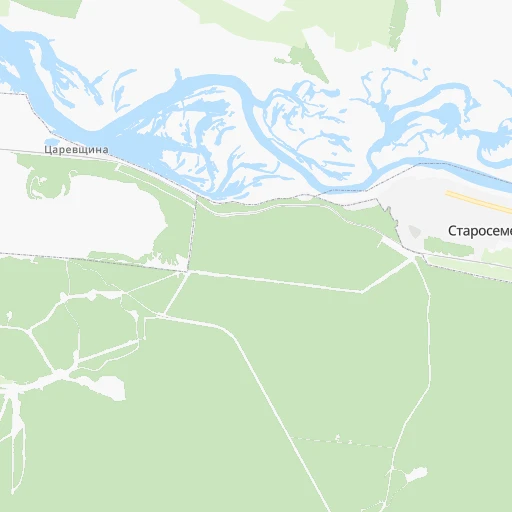
Location Stantsiya Tsarëvshchina (Samara Oblast) :
| Country flag |  |
| Location | Stantsiya Tsarëvshchina |
| State | Samara Oblast |
| County | |
| Country | Russia |
| Country code / ISO 2 | RU |
| Latitude | 53.4198200 |
| Longitude | 50.1954100 |
| Altitude | 0 meters |
| Time zone | Europe/Samara |
Location Zelenodolsk (Tatarstan Republic) :
| Country flag | |
| Location | Zelenodolsk |
| State | Tatarstan Republic |
| County | Zelenodol’skiy Rayon |
| Country | Russia |
| Country code / ISO 2 | RU |
| Latitude | 55.8437600 |
| Longitude | 48.5178400 |
| Altitude | 0 meters |
| Time zone | Europe/Moscow |