
How to get from Sterling (Virginia) to Bowie (Maryland)
Calculate route from Sterling (Virginia, United States) to Bowie (Maryland, United States).
The flight distance (as the crow flies) between Sterling and Bowie is 60.7 km.
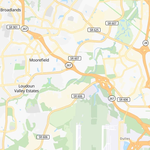
Roadmap (route) to go from Sterling to Bowie detailed above, you can also see the course layout on the map.
While doing trip Sterling - Bowie by car, the calculated route ends at a distance , or more straight.
Distance and duration of the route between Sterling and Bowie
Calculation of distance and route from Bowie to Sterling :
60.773.2 km1h58mn
Continue onto Ruritan Circle 0h1mn 284 mTurn left onto West Church Road 0h1mn 609 mTurn left onto Cascades Parkway 0h2mn 1.9 kmTurn right onto Potomac View Road 0h2mn 1.5 kmTurn right onto Harry Byrd Highway 0h13mn 16.4 kmKeep right and take VA 267 Toll East toward Washington 0h1mn 757 mKeep right onto Dulles Toll Road 0h13mn 17.6 kmKeep right and drive toward Rosslyn, Key Bridge 0h1mn 1.4 kmTurn left onto North Lynn Street 0h1mn 655 mTurn right onto US 29 toward US 29 North 0h1mn 947 mContinue onto Whitehurst Freeway and take US 29 toward K Street 0h0mn 211 mContinue onto K Street Northwest 0h0mn 239 mKeep right 0h0mn 226 mAt roundabout, take exit 4 onto K Street Northwest 0h0mn 474 mContinue onto K Street Northwest 0h1mn 527 mTurn left onto K Street Northwest 0h0mn 18 mTurn right onto K Street Northwest 0h1mn 1.3 kmTurn right onto 9th Street Northwest 0h0mn 47 mTurn left onto K Street Northwest 0h0mn 182 mTurn left onto 7th Street Northwest 0h0mn 95 mTurn right onto New York Avenue Northwest 0h7mn 7.6 kmKeep right onto John Hanson Highway and take US 50 East toward Annapolis, Richmond, Alexandria, Blandensburg 0h12mn 17.9 kmKeep right and take MD 197 toward Bowie 0h1mn 637 mTurn sharp right onto Collington Road 0h1mn 1.3 kmTurn right onto Evergreen Parkway 0h0mn 257 mContinue 0h0mn 35 mTurn sharp right 0h0mn 79 mTurn slight left 0h0mn 33 mArrive at destination 0h0mn 0 m
Travel from Sterling (Maryland) to a selection of major cities.
Distances from Sterling to biggest cities in Virginia
- Leesburg,51,209 inhabitants.17 km
- McLean,48,115 inhabitants.23 km
- Charlottesville,46,597 inhabitants.142 km
- Tuckahoe,44,990 inhabitants.158 km
- Blacksburg,44,215 inhabitants.328 km
- Ashburn,43,511 inhabitants.7 km
- Danville,42,082 inhabitants.320 km
- Manassas,41,764 inhabitants.29 km
- Lake Ridge,41,058 inhabitants.37 km
- Burke,41,055 inhabitants.27 km
- Annandale,41,008 inhabitants.28 km
- Mechanicsville,36,348 inhabitants.156 km
- Linton Hall,35,725 inhabitants.30 km
- Oakton,34,166 inhabitants.18 km
- Oak Hill,33,811 inhabitants.9 km
- Petersburg,32,477 inhabitants.198 km
- Springfield,30,484 inhabitants.32 km
- West Falls Church,29,207 inhabitants.25 km
- Jefferson,28,487 inhabitants.26 km
- Fredericksburg,28,118 inhabitants.78 km
Other major cities in country :
- Charlotte [NC], 827,097 inhabitants. 518 km
- Seattle [WA], 684,451 inhabitants. 3,706 km
- Denver [CO], 682,545 inhabitants. 2,363 km
- El Paso [TX], 681,124 inhabitants. 2,744 km
- Detroit [MI], 677,116 inhabitants. 601 km
- Boston [MA], 667,137 inhabitants. 654 km
- Memphis [TN], 655,770 inhabitants. 1,199 km
- New South Memphis [TN], 641,608 inhabitants. 1,203 km
- Portland [OR], 632,309 inhabitants. 3,746 km
- Oklahoma City [OK], 631,346 inhabitants. 1,819 km
- Las Vegas [NV], 623,747 inhabitants. 3,317 km
- Baltimore [MD], 621,849 inhabitants. 77 km
- Washington, D.C. [DC], 601,723 inhabitants. 36 km
- Milwaukee [WI], 600,155 inhabitants. 987 km
- South Boston [MA], 571,281 inhabitants. 653 km
- Albuquerque [NM], 559,121 inhabitants. 2,621 km
- Tucson [AZ], 531,641 inhabitants. 3,105 km
- Nashville [TN], 530,852 inhabitants. 883 km
- Fresno [CA], 520,052 inhabitants. 3,696 km
- Sacramento [CA], 490,712 inhabitants. 3,785 km
Route from Bowie to major cities (United States).
- Distance Bowie New York City305 km
- Distance Bowie Los Angeles3,722 km
- Distance Bowie Chicago980 km
- Distance Bowie Brooklyn304 km
- Distance Bowie Houston1,988 km
- Distance Bowie Queens314 km
- Distance Bowie Philadelphia175 km
- Distance Bowie Phoenix3,213 km
- Distance Bowie Manhattan313 km
- Distance Bowie San Antonio2,259 km
- Distance Bowie San Diego3,684 km
- Distance Bowie The Bronx324 km
- Distance Bowie Dallas1,932 km
- Distance Bowie San Jose3,917 km
- Distance Bowie Austin2,147 km
- Distance Bowie Jacksonville1,059 km
- Distance Bowie San Francisco3,948 km
- Distance Bowie Columbus550 km
- Distance Bowie Fort Worth1,978 km
- Distance Bowie Indianapolis816 km
Nearest cities to Sterling :
- Philadelphia, 1,567,442 inhabitants. 221 km
- Baltimore, 621,849 inhabitants. 77 km
- Washington, D.C., 601,723 inhabitants. 36 km
- Virginia Beach, 452,745 inhabitants. 271 km
- Pittsburgh, 304,391 inhabitants. 272 km
- Greensboro, 285,342 inhabitants. 387 km
- Norfolk, 246,393 inhabitants. 261 km
- Winston-Salem, 241,218 inhabitants. 408 km
- Chesapeake, 235,429 inhabitants. 264 km
- Richmond, 220,289 inhabitants. 162 km
- Arlington, 207,627 inhabitants. 31 km
- Newport News, 182,385 inhabitants. 230 km
- Alexandria, 153,511 inhabitants. 40 km
- East Hampton, 147,993 inhabitants. 239 km
- Hampton, 136,454 inhabitants. 240 km
- Allentown, 120,207 inhabitants. 243 km
- Roanoke, 99,897 inhabitants. 293 km
- Columbia, 99,615 inhabitants. 57 km
- Portsmouth Heights, 99,049 inhabitants. 260 km
- Portsmouth, 96,201 inhabitants. 261 km
- Suffolk, 88,161 inhabitants. 264 km
- Reading, 87,879 inhabitants. 196 km
- Germantown, 86,395 inhabitants. 23 km
- Trenton, 84,225 inhabitants. 267 km
- South Suffolk, 80,690 inhabitants. 265 km
- Lynchburg, 79,812 inhabitants. 232 km
- Scranton, 77,118 inhabitants. 307 km
- Camden, 76,119 inhabitants. 223 km
- Bethlehem, 74,892 inhabitants. 252 km
- Wilmington, 71,948 inhabitants. 182 km
- Silver Spring, 71,452 inhabitants. 35 km
- Centreville, 71,135 inhabitants. 18 km
- Cherry Hill, 70,475 inhabitants. 231 km
- Frederick, 69,479 inhabitants. 45 km
- Waldorf, 67,752 inhabitants. 60 km
- Glen Burnie, 67,639 inhabitants. 72 km
- Gaithersburg, 67,456 inhabitants. 25 km
- Rockville, 66,980 inhabitants. 25 km
- Dale City, 65,969 inhabitants. 42 km
- Ellicott City, 65,834 inhabitants. 62 km
- West Lynchburg, 65,517 inhabitants. 235 km
- Dundalk, 63,597 inhabitants. 83 km
- Bethesda, 60,858 inhabitants. 29 km
- Vineland, 60,818 inhabitants. 214 km
- Lancaster, 59,339 inhabitants. 150 km
- Reston, 58,404 inhabitants. 9 km
- South Vineland, 58,122 inhabitants. 213 km
- Bowie, 58,025 inhabitants. 61 km
- Center City, 57,239 inhabitants. 222 km
- New Brunswick, 57,035 inhabitants. 303 km
Location Sterling (Virginia) :
| Country flag |  |
| Location | Sterling |
| State | Virginia |
| County | Loudoun County |
| Country | United States |
| Country code / ISO 2 | US |
| Latitude | 39.0062200 |
| Longitude | -77.4286000 |
| Altitude | 89 meters |
| Time zone | America/New_York |
Location Bowie (Maryland) :
| Country flag | |
| Location | Bowie |
| State | Maryland |
| County | Prince George's County |
| Country | United States |
| Country code / ISO 2 | US |
| Latitude | 38.9427800 |
| Longitude | -76.7302800 |
| Altitude | 42 meters |
| Time zone | America/New_York |


