


How to get from Bull Farm (airport) (Virginia) to Bowie (Maryland)
Calculate route from Bull Farm (airport) (Virginia, United States) to Bowie (Maryland, United States).
The flight distance (as the crow flies) between Bull Farm (airport) and Bowie is 209.7 km.
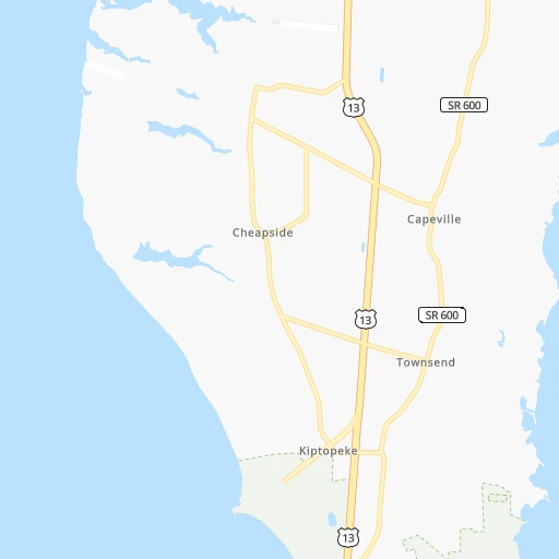
Roadmap (route) to go from Bull Farm Airport to Bowie detailed above, you can also see the course layout on the map.
While doing trip Bull Farm (airport) - Bowie by car, the calculated route ends at a distance , or more straight.
Distance and duration of the route between Bull Farm (airport) and Bowie
An error occured: profile parameter required - for url https://route.cartes.cc/route?point=37.15608%2C-75.95716&point=38.94278%2C-76.73028&vehicle=car&debug=false&data_type=application%2Fjson&locale=en&points_encoded=true&instructions=true&elevation=false&optimize=false&timeout=10000&skip.host=true&skip.basePath=true&graphhopper_maps_host=https%3A%2F%2Fgraphhopper.com%2Fmaps%2F%3F&turn_sign_map.0=continue&turn_sign_map.1=turn%20slight%20right&turn_sign_map.2=turn%20right&turn_sign_map.3=turn%20sharp%20right&turn_sign_map.4=finish&turn_sign_map.5=reached%20via%20point&turn_sign_map.6=enter%20roundabout&turn_sign_map.-6=leave%20roundabout&turn_sign_map.-3=turn%20sharp%20left&turn_sign_map.-2=turn%20left&turn_sign_map.-1=turn%20slight%20left&key=&position=topleft
Calculation of distance and route from Bowie to Bull Farm (airport) :
209.7320.0 km4h15mn
Continue 0h2mn 567 mTurn right 0h3mn 880 mTurn left onto Jones Cove Drive 0h0mn 112 mTurn right onto Seaside Road 0h1mn 1.1 kmTurn left onto Cedar Grove Drive 0h0mn 357 mTurn right onto Lankford Highway 1h31mn 41.4 kmKeep right onto US 13 BUS 0h0mn 113 mTurn slight right onto Main Street 0h2mn 2.3 kmKeep right onto US 13 BUS 0h0mn 112 mTurn slight right onto Lincoln Avenue 0h1mn 944 mTurn sharp right onto Lankford Highway 1h19mn 103.1 kmKeep right onto US 13 BUS toward US 13 Business North 0h7mn 7.1 kmTurn left onto Lloyd Street 0h0mn 68 mTurn right onto Register Street 0h0mn 69 mTurn left onto Monticello Avenue 0h0mn 58 mTurn right onto Hanson Street 0h0mn 98 mTurn left onto South Boulevard 0h0mn 39 mTurn right onto Waverly Drive 0h1mn 975 mTurn left onto West Carroll Street 0h0mn 267 mAt roundabout, take exit 1 onto Mill Street 0h0mn 245 mTurn sharp left onto West Salisbury Parkway 1h10mn 89.5 kmTurn left onto Old Wye Mills Road 0h4mn 5.0 kmTurn left onto Wye Mills Road 0h2mn 2.1 kmTurn left onto Ocean Gateway 1h35mn 44.9 kmKeep right and take I 97 North toward Baltimore 0h1mn 1.7 kmKeep left and take US 50 West, US 301 West toward Washington 0h8mn 12.6 kmKeep right onto US 301 and take MD 3, US 301 toward Crofton, Richmond 0h0mn 405 mKeep left onto US 301 and take US 301 South toward Richmond 0h1mn 701 mKeep right onto US 301 and take US 301 South toward Richmond 0h1mn 1.3 kmTurn right onto Harbour Way 0h0mn 207 mTurn left onto Mitchellville Road 0h1mn 548 mTurn right onto Collington Road 0h1mn 627 mTurn left onto Evergreen Parkway 0h0mn 278 mContinue 0h0mn 35 mTurn sharp right 0h0mn 79 mTurn slight left 0h0mn 33 mArrive at destination 0h0mn 0 m
Travel from Bull Farm (airport) (Maryland) to a selection of major cities.
Distances from Bull Farm Airport to biggest cities in Virginia
- Leesburg,51,209 inhabitants.260 km
- McLean,48,115 inhabitants.225 km
- Charlottesville,46,597 inhabitants.243 km
- Tuckahoe,44,990 inhabitants.149 km
- Blacksburg,44,215 inhabitants.395 km
- Ashburn,43,511 inhabitants.249 km
- Danville,42,082 inhabitants.313 km
- Manassas,41,764 inhabitants.222 km
- Lake Ridge,41,058 inhabitants.207 km
- Burke,41,055 inhabitants.216 km
- Annandale,41,008 inhabitants.216 km
- Mechanicsville,36,348 inhabitants.135 km
- Linton Hall,35,725 inhabitants.228 km
- Oakton,34,166 inhabitants.225 km
- Oak Hill,33,811 inhabitants.234 km
- Petersburg,32,477 inhabitants.128 km
- Springfield,30,484 inhabitants.211 km
- West Falls Church,29,207 inhabitants.221 km
- Jefferson,28,487 inhabitants.219 km
- Fredericksburg,28,118 inhabitants.184 km
Other major cities in country :
- Charlotte [NC], 827,097 inhabitants. 489 km
- Seattle [WA], 684,451 inhabitants. 3,922 km
- Denver [CO], 682,545 inhabitants. 2,536 km
- El Paso [TX], 681,124 inhabitants. 2,853 km
- Detroit [MI], 677,116 inhabitants. 836 km
- Boston [MA], 667,137 inhabitants. 715 km
- Memphis [TN], 655,770 inhabitants. 1,285 km
- New South Memphis [TN], 641,608 inhabitants. 1,287 km
- Portland [OR], 632,309 inhabitants. 3,955 km
- Oklahoma City [OK], 631,346 inhabitants. 1,939 km
- Las Vegas [NV], 623,747 inhabitants. 3,475 km
- Baltimore [MD], 621,849 inhabitants. 244 km
- Washington, D.C. [DC], 601,723 inhabitants. 215 km
- Milwaukee [WI], 600,155 inhabitants. 1,208 km
- South Boston [MA], 571,281 inhabitants. 713 km
- Albuquerque [NM], 559,121 inhabitants. 2,758 km
- Tucson [AZ], 531,641 inhabitants. 3,229 km
- Nashville [TN], 530,852 inhabitants. 973 km
- Fresno [CA], 520,052 inhabitants. 3,862 km
- Sacramento [CA], 490,712 inhabitants. 3,963 km
Route from Bowie to major cities (United States).
- Distance Bowie New York City305 km
- Distance Bowie Los Angeles3,722 km
- Distance Bowie Chicago980 km
- Distance Bowie Brooklyn304 km
- Distance Bowie Houston1,988 km
- Distance Bowie Queens314 km
- Distance Bowie Philadelphia175 km
- Distance Bowie Phoenix3,213 km
- Distance Bowie Manhattan313 km
- Distance Bowie San Antonio2,259 km
- Distance Bowie San Diego3,684 km
- Distance Bowie The Bronx324 km
- Distance Bowie Dallas1,932 km
- Distance Bowie San Jose3,917 km
- Distance Bowie Austin2,147 km
- Distance Bowie Jacksonville1,059 km
- Distance Bowie San Francisco3,948 km
- Distance Bowie Columbus550 km
- Distance Bowie Fort Worth1,978 km
- Distance Bowie Indianapolis816 km
Nearest cities to Bull Farm (airport) :
- Philadelphia, 1,567,442 inhabitants. 319 km
- Baltimore, 621,849 inhabitants. 244 km
- Washington, D.C., 601,723 inhabitants. 215 km
- Virginia Beach, 452,745 inhabitants. 34 km
- Raleigh, 451,066 inhabitants. 285 km
- West Raleigh, 338,759 inhabitants. 286 km
- Durham, 257,636 inhabitants. 293 km
- Norfolk, 246,393 inhabitants. 45 km
- Chesapeake, 235,429 inhabitants. 47 km
- Richmond, 220,289 inhabitants. 140 km
- Arlington, 207,627 inhabitants. 217 km
- Fayetteville, 201,963 inhabitants. 352 km
- Newport News, 182,385 inhabitants. 46 km
- Cary, 159,769 inhabitants. 295 km
- Alexandria, 153,511 inhabitants. 207 km
- East Hampton, 147,993 inhabitants. 36 km
- Hampton, 136,454 inhabitants. 37 km
- Wilmington, 115,933 inhabitants. 372 km
- Columbia, 99,615 inhabitants. 245 km
- Portsmouth Heights, 99,049 inhabitants. 52 km
- Portsmouth, 96,201 inhabitants. 47 km
- Greenville, 90,597 inhabitants. 213 km
- Toms River, 88,791 inhabitants. 347 km
- Suffolk, 88,161 inhabitants. 73 km
- Germantown, 86,395 inhabitants. 252 km
- South Suffolk, 80,690 inhabitants. 75 km
- Camden, 76,119 inhabitants. 317 km
- Wilmington, 71,948 inhabitants. 291 km
- Silver Spring, 71,452 inhabitants. 225 km
- Centreville, 71,135 inhabitants. 228 km
- Cherry Hill, 70,475 inhabitants. 320 km
- Frederick, 69,479 inhabitants. 282 km
- Waldorf, 67,752 inhabitants. 185 km
- Glen Burnie, 67,639 inhabitants. 231 km
- Gaithersburg, 67,456 inhabitants. 247 km
- Jacksonville, 67,357 inhabitants. 299 km
- Rockville, 66,980 inhabitants. 239 km
- Dale City, 65,969 inhabitants. 203 km
- Ellicott City, 65,834 inhabitants. 246 km
- Dundalk, 63,597 inhabitants. 238 km
- Bethesda, 60,858 inhabitants. 226 km
- Vineland, 60,818 inhabitants. 272 km
- Lancaster, 59,339 inhabitants. 322 km
- Reston, 58,404 inhabitants. 235 km
- South Vineland, 58,122 inhabitants. 267 km
- Bowie, 58,025 inhabitants. 210 km
- Center City, 57,239 inhabitants. 319 km
- Rocky Mount, 55,806 inhabitants. 213 km
- Towson, 55,197 inhabitants. 256 km
- Jackson, 54,856 inhabitants. 307 km
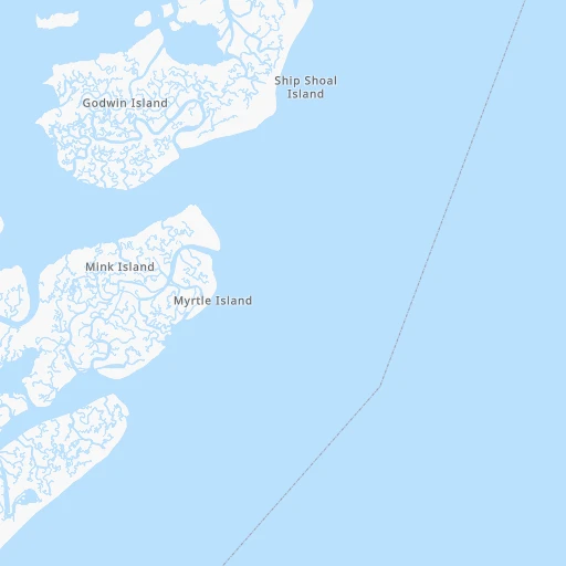
Location Bull Farm (airport) (Virginia) :
| Country flag |  |
| Location | Bull Farm (airport) |
| State | Virginia |
| County | Northampton County |
| Country | United States |
| Country code / ISO 2 | US |
| Latitude | 37.1560800 |
| Longitude | -75.9571600 |
| Altitude | 6 meters |
| Time zone | America/New_York |
Location Bowie (Maryland) :
| Country flag | |
| Location | Bowie |
| State | Maryland |
| County | Prince George's County |
| Country | United States |
| Country code / ISO 2 | US |
| Latitude | 38.9427800 |
| Longitude | -76.7302800 |
| Altitude | 42 meters |
| Time zone | America/New_York |


