


How to get from Stantsiya Voyta (Murmansk) to Kostomuksha (Karelia)
Calculate route from Stantsiya Voyta (Murmansk, Russia) to Kostomuksha (Karelia, Russia).
The flight distance (as the crow flies) between Stantsiya Voyta and Kostomuksha is 267.5 km.
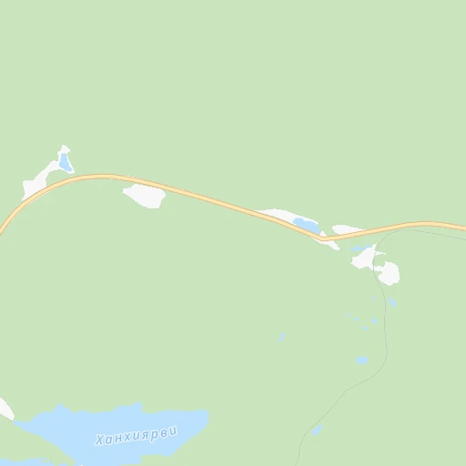
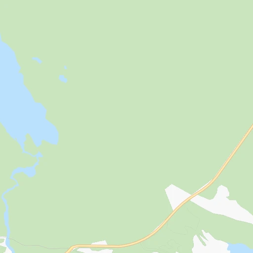
Roadmap (route) to go from Stantsiya Voyta to Kostomuksha detailed above, you can also see the course layout on the map.
While doing trip Stantsiya Voyta - Kostomuksha by car, the calculated route ends at a distance , or more straight.
Distance and duration of the route between Stantsiya Voyta and Kostomuksha
Calculation of distance and route from Kostomuksha to Stantsiya Voyta :
267.5532.5 km12h41mn
Continue onto Старая Алакурттинская 0h2mn 1.0 kmTurn right 0h3mn 1.5 kmTurn right onto «Салла» 1h17mn 84.7 kmKeep right 0h0mn 160 mContinue onto «Кола» 2h57mn 137.9 kmKeep right 0h0mn 55 mTurn slight right onto «Кола» 2h12mn 91.0 kmContinue onto «Кола» 0h12mn 10.9 kmTurn slight left onto «Кола» 0h20mn 22.1 kmKeep left 0h26mn 13.1 kmKeep right 0h6mn 3.0 kmKeep right 0h18mn 9.1 kmKeep right 0h5mn 2.6 kmKeep left 1h37mn 18.6 kmTurn left 0h11mn 5.5 kmTurn right 0h3mn 1.6 kmTurn left 0h6mn 2.9 kmTurn sharp right 0h5mn 2.3 kmKeep left 0h12mn 6.0 kmTurn right 0h2mn 1.2 kmTurn right 0h4mn 2.0 kmTurn left 0h1mn 355 mTurn slight right 0h8mn 3.8 kmTurn left onto 86К-3 0h16mn 13.3 kmKeep right 0h2mn 1.2 kmKeep right 0h3mn 1.3 kmKeep right 1h0mn 30.1 kmKeep left onto 86К-45 2h34mn 50.9 kmTurn right 0h1mn 643 mTurn left 0h1mn 1.0 kmKeep right 0h6mn 6.6 kmTurn right onto Приграничное шоссе 0h0mn 203 mTurn left 0h1mn 440 mKeep left 0h1mn 190 mKeep left 0h3mn 977 mTurn slight left onto Звёздная улица 0h0mn 114 mTurn right onto проспект Горняков 0h1mn 978 mTurn left onto улица Ленина 0h1mn 1.0 kmContinue 0h2mn 1.6 kmTurn left 0h0mn 110 mContinue 0h0mn 26 mContinue 0h0mn 35 mArrive at destination 0h0mn 0 m
Travel from Stantsiya Voyta (Karelia) to a selection of major cities.
Distances from Stantsiya Voyta to biggest cities in Murmansk
Other major cities in country :
- Yaroslavl [88], 606,730 inhabitants. 1,143 km
- Barnaul [04], 599,579 inhabitants. 3,177 km
- Vladivostok [59], 587,022 inhabitants. 6,125 km
- Irkutsk [20], 586,695 inhabitants. 4,153 km
- Khabarovsk [30], 579,000 inhabitants. 5,718 km
- Khabarovsk Vtoroy [30], 578,303 inhabitants. 5,724 km
- Orenburg [55], 550,204 inhabitants. 2,159 km
- Novokuznetsk [29], 539,616 inhabitants. 3,289 km
- Ryazan' [62], 520,173 inhabitants. 1,457 km
- Tyumen [78], 519,119 inhabitants. 2,082 km
- Lipetsk [43], 515,655 inhabitants. 1,673 km
- Penza [57], 512,602 inhabitants. 1,719 km
- Naberezhnyye Chelny [73], 509,870 inhabitants. 1,691 km
- Kalininskiy [42], 504,641 inhabitants. 777 km
- Astrakhan [07], 502,533 inhabitants. 2,511 km
- Makhachkala [17], 497,959 inhabitants. 2,859 km
- Tomsk [75], 485,519 inhabitants. 2,974 km
- Kemerovo [29], 477,090 inhabitants. 3,115 km
- Tula [76], 468,825 inhabitants. 1,471 km
- Kirov [33], 457,383 inhabitants. 1,335 km
Route from Kostomuksha to major cities (Russia).
- Distance Kostomuksha Moscow1,055 km
- Distance Kostomuksha Saint Petersburg516 km
- Distance Kostomuksha Novosibirsk3,014 km
- Distance Kostomuksha Yekaterinburg1,823 km
- Distance Kostomuksha Nizhniy Novgorod1,172 km
- Distance Kostomuksha Samara1,680 km
- Distance Kostomuksha Omsk2,561 km
- Distance Kostomuksha Kazan1,408 km
- Distance Kostomuksha Rostov-na-Donu2,008 km
- Distance Kostomuksha Chelyabinsk1,988 km
- Distance Kostomuksha Ufa1,778 km
- Distance Kostomuksha Volgograd1,950 km
- Distance Kostomuksha Perm1,540 km
- Distance Kostomuksha Krasnoyarsk3,410 km
- Distance Kostomuksha Saratov1,702 km
- Distance Kostomuksha Voronezh1,519 km
- Distance Kostomuksha Tol'yatti1,620 km
- Distance Kostomuksha Krasnodar2,235 km
- Distance Kostomuksha Ulyanovsk1,511 km
- Distance Kostomuksha Izhevsk1,489 km
Nearest cities to Stantsiya Voyta :
- Murmansk, 319,263 inhabitants. 245 km
- Apatity, 61,186 inhabitants. 136 km
- Severomorsk, 53,921 inhabitants. 260 km
- Monchegorsk, 49,868 inhabitants. 144 km
- Kandalaksha, 38,431 inhabitants. 80 km
- Kostomuksha, 30,135 inhabitants. 268 km
- Olenegorsk, 23,670 inhabitants. 171 km
- Kovdor, 19,518 inhabitants. 66 km
- Zapolyarnyy, 17,789 inhabitants. 271 km
- Polyarnyy, 17,332 inhabitants. 274 km
- Nikel, 15,596 inhabitants. 272 km
- Polyarnyye Zori, 15,092 inhabitants. 92 km
- Gadzhiyevo, 14,225 inhabitants. 277 km
- Murmashi, 14,152 inhabitants. 224 km
- Zaozersk, 13,429 inhabitants. 280 km
- Snezhnogorsk, 12,014 inhabitants. 270 km
- Kola, 10,600 inhabitants. 234 km
- Roslyakovo, 8,921 inhabitants. 254 km
- Zelenoborskiy, 7,207 inhabitants. 77 km
- Vidyayevo, 7,062 inhabitants. 276 km
- Vysokiy, 6,860 inhabitants. 175 km
- Alakurtti, 6,293 inhabitants. 12 km
- Vidyayevo, 5,949 inhabitants. 234 km
- Loukhi, 5,764 inhabitants. 147 km
- Kalevala, 5,431 inhabitants. 200 km
- Molochnyy, 5,308 inhabitants. 232 km
- Safonovo, 4,578 inhabitants. 257 km
- Chupa, 3,954 inhabitants. 133 km
- Poyakonda, 3,100 inhabitants. 105 km
Location Stantsiya Voyta (Murmansk) :
| Country flag |  |
| Location | Stantsiya Voyta |
| State | Murmansk |
| County | |
| Country | Russia |
| Country code / ISO 2 | RU |
| Latitude | 66.9783500 |
| Longitude | 30.6256800 |
| Altitude | 0 meters |
| Time zone | Europe/Moscow |
Location Kostomuksha (Karelia) :
| Country flag | |
| Location | Kostomuksha |
| State | Karelia |
| County | |
| Country | Russia |
| Country code / ISO 2 | RU |
| Latitude | 64.5710000 |
| Longitude | 30.5766700 |
| Altitude | 0 meters |
| Time zone | Europe/Moscow |
