
How to get from H M Ranch (airport) (Texas) to Seattle (Washington)
Calculate route from H M Ranch (airport) (Texas, United States) to Seattle (Washington, United States).
The flight distance (as the crow flies) between H M Ranch (airport) and Seattle is 2,876.5 km.
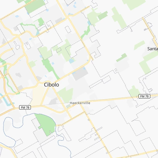
Roadmap (route) to go from H M Ranch Airport to Seattle detailed above, you can also see the course layout on the map.
While doing trip H M Ranch (airport) - Seattle by car, the calculated route ends at a distance , or more straight.
Distance and duration of the route between H M Ranch (airport) and Seattle
Calculation of distance and route from Seattle to H M Ranch (airport) :
2,876.53,435.4 km36h5mn
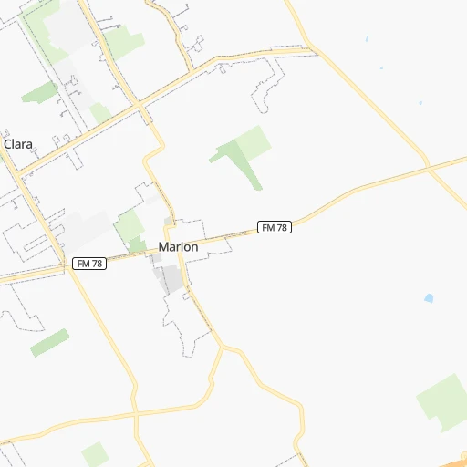
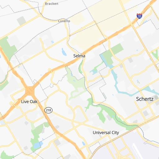
Continue 0h2mn 1.1 kmTurn left onto Weil Road 0h5mn 4.9 kmTurn left onto Farm-to-Market Road 1103 0h4mn 3.6 kmKeep right 0h0mn 71 mTurn slight right onto FM 78 0h1mn 1.4 kmContinue onto John E Peterson Boulevard 0h3mn 3.7 kmKeep right 0h0mn 77 mTurn slight right onto Pat Booker Road 0h5mn 4.2 kmKeep right onto East Loop 1604 North 0h0mn 320 mKeep left toward Loop 1604 West 0h0mn 304 mKeep left and take I 35 South toward San Antonio 0h0mn 520 mKeep left toward Loop 1604 West 0h0mn 447 mKeep left toward Loop 1604 West 0h16mn 27.2 kmKeep right and take I 10 East, US 87 South, I 10 West, US 87 North toward San Antonio, El Paso 0h0mn 188 mKeep right and take I 10 West, US 87 North toward El Paso 1h28mn 161.6 kmKeep right onto US 83 and take US 83 North, US 377 toward Junction, Menard 0h0mn 508 mTurn right onto North Main Street 1h24mn 141.5 kmTurn right onto Hutchings Avenue 0h0mn 118 mTurn left onto North Broadway Street 0h7mn 10.2 kmTurn right onto FM 2111 0h12mn 19.8 kmKeep left onto FM 2111 0h0mn 111 mTurn left onto State Highway 153 0h30mn 47.5 kmContinue onto State Highway 153 0h0mn 266 mContinue onto State Highway 70 0h10mn 17.7 kmTurn left onto Northwest Georgia Avenue 0h0mn 204 mKeep left and take I 20 West toward Midland 0h5mn 9.8 kmKeep right onto US 84 and take US 84 West toward Snyder, Lubbock 0h1mn 1.1 kmKeep left onto US 84 and take US 84 West toward Roscoe 0h28mn 49.9 kmKeep left onto US 84 1h38mn 68.7 kmKeep right 0h0mn 334 mContinue onto South Avenue F 0h1mn 1.4 kmContinue onto North Avenue F 0h1mn 871 mTurn left onto East 15th Street 0h0mn 223 mTurn right onto North Broadway Street 0h19mn 33.8 kmKeep left onto Trooper Jerry Don Davis Memorial Highway 0h21mn 32.4 kmTurn right onto Avenue Q 0h0mn 263 mTurn left onto Clovis Road 1h43mn 53.6 kmKeep right onto Delano Avenue 0h3mn 2.7 kmContinue onto Delano Avenue 0h1mn 1.2 kmContinue onto Delano Avenue 0h4mn 4.0 kmTurn right onto US 84 1h55mn 84.1 kmTurn slight right onto US 60, US 70, US 84 0h4mn 4.7 kmTurn slight right onto Mabry Drive 1h28mn 104.3 kmTurn right onto North 4th Street 1h52mn 67.4 kmTurn left toward I 40 West 2h45mn 184.3 kmKeep right and drive toward San Mateo Boulevard 0h0mn 461 mTurn right onto San Mateo Boulevard Northeast 0h6mn 5.3 kmTurn right onto Pan American Freeway Northeast 0h0mn 108 mKeep left and take I 25 North toward Santa Fe 0h11mn 18.5 kmKeep right and take US 550 North, NM 165 East toward Placitas, Bernalillo, Rio Rancho 0h0mn 283 mKeep left and take US 550 toward Bernalillo, Rio Rancho, Coronado Historic Site 2h26mn 239.2 kmTurn left onto Road 5500 0h12mn 12.1 kmTurn left onto Bloomfield Highway 0h7mn 8.0 kmKeep right onto East Broadway Avenue 1h37mn 47.9 kmKeep right 1h47mn 66.6 kmKeep left onto North Broadway 1h20mn 97.0 kmTurn right onto North Main Street 2h33mn 137.5 kmTurn left onto US 191 toward I-70 West 0h20mn 38.3 kmKeep right onto US 6, US 191 and take US 6 West, US 191 North toward Price, Salt Lake City 0h1mn 1.3 kmContinue onto Dinosaur Diamond Prehistoric Highway 2h27mn 203.1 kmKeep right and take I 15 North toward Salt Lake City 2h53mn 195.7 kmKeep left onto I 84 8h31mn 813.5 kmKeep right onto US 395 and take US 395 North toward Stanfield, Hermiston 0h0mn 519 mKeep right onto US 395 and take US 395 North toward Stanfield, Hermiston, Umatilla 0h19mn 20.0 kmTurn left onto 6th Street 0h1mn 1.1 kmTurn right onto US 395 and take I 82 West, US 395 North toward Kennewick, Yakima 0h2mn 2.8 kmKeep right and take SR 14 toward Plymouth, Vancouver 0h0mn 456 mTurn left onto Lewis and Clark Trail Highway 0h14mn 21.8 kmTurn sharp right onto WA 221 0h27mn 41.7 kmTurn right onto State Highway 22 0h1mn 902 mTurn right onto Wine Country Road 0h0mn 509 mTurn right 1h19mn 131.6 kmKeep left onto US 97 toward I 90 West 2h49mn 174.8 kmKeep right and take I 5 North toward Vancouver British Columbia, James Street, Madison Street 0h1mn 1.2 kmKeep left and take I 5 North toward Vancouver British Columbia, Madison Street, Convention Center 0h0mn 268 mKeep right and drive toward Madison Street, Convention Place 0h1mn 561 mTurn left onto Madison Street 0h0mn 232 mTurn left 0h0mn 9 mArrive at destination 0h0mn 0 m
Travel from H M Ranch (airport) (Washington) to a selection of major cities.
Distances from H M Ranch Airport to biggest cities in Texas
- Killeen,140,806 inhabitants.174 km
- McAllen,140,269 inhabitants.378 km
- Carrollton,133,168 inhabitants.393 km
- Midland,132,950 inhabitants.459 km
- Waco,132,356 inhabitants.238 km
- Denton,131,044 inhabitants.414 km
- Abilene,121,721 inhabitants.350 km
- Odessa,118,968 inhabitants.473 km
- Beaumont,118,129 inhabitants.397 km
- Round Rock,115,997 inhabitants.112 km
- Richardson,110,815 inhabitants.397 km
- Pearland,108,821 inhabitants.279 km
- College Station,107,889 inhabitants.211 km
- Wichita Falls,104,710 inhabitants.481 km
- Lewisville,104,039 inhabitants.400 km
- Tyler,103,700 inhabitants.411 km
- San Angelo,100,450 inhabitants.300 km
- Alief,98,725 inhabitants.249 km
- League City,98,312 inhabitants.298 km
- Allen,98,143 inhabitants.415 km
Other major cities in country :
- Memphis [TN], 655,770 inhabitants. 982 km
- New South Memphis [TN], 641,608 inhabitants. 977 km
- Portland [OR], 632,309 inhabitants. 2,776 km
- Oklahoma City [OK], 631,346 inhabitants. 656 km
- Las Vegas [NV], 623,747 inhabitants. 1,743 km
- Baltimore [MD], 621,849 inhabitants. 2,246 km
- Washington, D.C. [DC], 601,723 inhabitants. 2,195 km
- Milwaukee [WI], 600,155 inhabitants. 1,754 km
- South Boston [MA], 571,281 inhabitants. 2,807 km
- Albuquerque [NM], 559,121 inhabitants. 1,004 km
- Tucson [AZ], 531,641 inhabitants. 1,252 km
- Nashville [TN], 530,852 inhabitants. 1,290 km
- Fresno [CA], 520,052 inhabitants. 2,158 km
- Sacramento [CA], 490,712 inhabitants. 2,362 km
- Kansas City [MO], 475,378 inhabitants. 1,108 km
- Long Beach [CA], 474,140 inhabitants. 1,949 km
- Mesa [AZ], 471,825 inhabitants. 1,362 km
- Staten Island [NY], 468,730 inhabitants. 2,494 km
- Atlanta [GA], 463,878 inhabitants. 1,384 km
- Colorado Springs [CO], 456,568 inhabitants. 1,196 km
Route from Seattle to major cities (United States).
- Distance Seattle New York City3,870 km
- Distance Seattle Los Angeles1,547 km
- Distance Seattle Chicago2,792 km
- Distance Seattle Brooklyn3,877 km
- Distance Seattle Houston3,044 km
- Distance Seattle Queens3,884 km
- Distance Seattle Philadelphia3,824 km
- Distance Seattle Phoenix1,796 km
- Distance Seattle Manhattan3,869 km
- Distance Seattle San Antonio2,877 km
- Distance Seattle San Diego1,714 km
- Distance Seattle The Bronx3,873 km
- Distance Seattle Dallas2,705 km
- Distance Seattle San Jose1,143 km
- Distance Seattle Austin2,851 km
- Distance Seattle Jacksonville3,950 km
- Distance Seattle San Francisco1,094 km
- Distance Seattle Columbus3,236 km
- Distance Seattle Fort Worth2,676 km
- Distance Seattle Indianapolis3,009 km
Nearest cities to H M Ranch (airport) :
- Houston, 2,296,224 inhabitants. 272 km
- San Antonio, 1,469,845 inhabitants. 37 km
- Austin, 931,830 inhabitants. 85 km
- Corpus Christi, 324,074 inhabitants. 214 km
- Laredo, 255,473 inhabitants. 267 km
- Pasadena, 153,784 inhabitants. 287 km
- Killeen, 140,806 inhabitants. 174 km
- Waco, 132,356 inhabitants. 238 km
- Abilene, 121,721 inhabitants. 350 km
- Round Rock, 115,997 inhabitants. 112 km
- Pearland, 108,821 inhabitants. 279 km
- College Station, 107,889 inhabitants. 211 km
- Tyler, 103,700 inhabitants. 411 km
- San Angelo, 100,450 inhabitants. 300 km
- Alief, 98,725 inhabitants. 249 km
- The Woodlands, 93,847 inhabitants. 266 km
- Sugar Land, 88,156 inhabitants. 245 km
- Bryan, 82,118 inhabitants. 211 km
- Kingwood Area, 81,692 inhabitants. 285 km
- Missouri City, 74,139 inhabitants. 255 km
- Temple, 72,277 inhabitants. 185 km
- New Braunfels, 70,543 inhabitants. 12 km
- Conroe, 68,602 inhabitants. 274 km
- Victoria, 67,574 inhabitants. 144 km
- Cedar Park, 65,945 inhabitants. 106 km
- Atascocita, 65,844 inhabitants. 293 km
- Mansfield, 64,274 inhabitants. 344 km
- Georgetown, 63,716 inhabitants. 125 km
- San Marcos, 60,684 inhabitants. 39 km
- Pflugerville, 57,122 inhabitants. 108 km
- Spring, 54,298 inhabitants. 271 km
- DeSoto, 52,486 inhabitants. 356 km
- Cedar Hill, 48,507 inhabitants. 352 km
- Cypress, 46,025 inhabitants. 243 km
- Burleson, 43,625 inhabitants. 338 km
- Huntsville, 40,938 inhabitants. 282 km
- Lancaster, 38,801 inhabitants. 359 km
- Friendswood, 38,800 inhabitants. 288 km
- Schertz, 37,938 inhabitants. 11 km
- Leander, 37,889 inhabitants. 113 km
- Mission Bend, 36,501 inhabitants. 243 km
- Del Rio, 36,153 inhabitants. 265 km
- Kyle, 35,733 inhabitants. 52 km
- Rosenberg, 35,510 inhabitants. 229 km
- Waxahachie, 33,384 inhabitants. 335 km
- Copperas Cove, 33,081 inhabitants. 172 km
- Cleburne, 30,020 inhabitants. 315 km
- Fort Hood, 29,589 inhabitants. 175 km
- Harker Heights, 29,142 inhabitants. 172 km
- Eagle Pass, 28,765 inhabitants. 247 km
Location H M Ranch (airport) (Texas) :
| Country flag |  |
| Location | H M Ranch (airport) |
| State | Texas |
| County | Guadalupe County |
| Country | United States |
| Country code / ISO 2 | US |
| Latitude | 29.5988400 |
| Longitude | -98.1711200 |
| Altitude | 228 meters |
| Time zone | America/Chicago |
Location Seattle (Washington) :
| Country flag | |
| Location | Seattle |
| State | Washington |
| County | King County |
| Country | United States |
| Country code / ISO 2 | US |
| Latitude | 47.6062100 |
| Longitude | -122.3320700 |
| Altitude | 56 meters |
| Time zone | America/Los_Angeles |


