
How to get from Brownsville (Texas) to Kingsville (Texas)
Calculate route from Brownsville (Texas, United States) to Kingsville (Texas, United States).
The flight distance (as the crow flies) between Brownsville and Kingsville is 182.9 km.
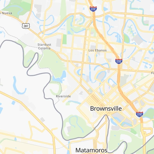
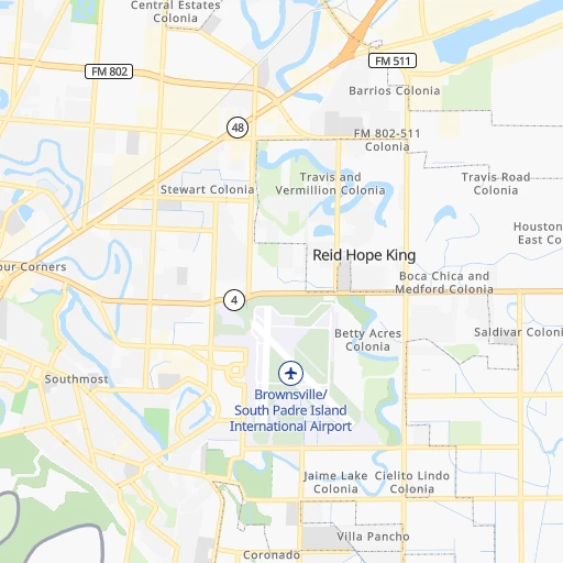
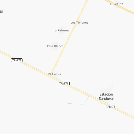
Roadmap (route) to go from Brownsville to Kingsville detailed above, you can also see the course layout on the map.
While doing trip Brownsville - Kingsville by car, the calculated route ends at a distance , or more straight.
Distance and duration of the route between Brownsville and Kingsville
Calculation of distance and route from Kingsville to Brownsville :
182.9194.2 km2h24mn
Continue onto East Washington Street 0h0mn 511 mTurn right onto East 7th Street 0h1mn 1.5 kmTurn sharp left onto North Frontage Road 0h0mn 301 mKeep left toward I 69E North, US 77 North, US 83 North 2h15mn 182.6 kmKeep left onto I 69E, US 77 0h4mn 6.1 kmKeep right toward TX 425 0h1mn 557 mTurn left onto Senator Carlos Truan Boulevard 0h2mn 1.6 kmTurn right onto South 14th Street 0h1mn 1.0 kmArrive at destination 0h0mn 0 m
Travel from Brownsville (Texas) to a selection of major cities.
Distances from Brownsville to biggest cities in Texas
- McAllen,140,269 inhabitants.81 km
- Carrollton,133,168 inhabitants.787 km
- Midland,132,950 inhabitants.812 km
- Waco,132,356 inhabitants.630 km
- Denton,131,044 inhabitants.815 km
- Abilene,121,721 inhabitants.760 km
- Odessa,118,968 inhabitants.814 km
- Beaumont,118,129 inhabitants.573 km
- Round Rock,115,997 inhabitants.513 km
- Richardson,110,815 inhabitants.788 km
- Pearland,108,821 inhabitants.462 km
- College Station,107,889 inhabitants.538 km
- Wichita Falls,104,710 inhabitants.897 km
- Lewisville,104,039 inhabitants.797 km
- Tyler,103,700 inhabitants.749 km
- San Angelo,100,450 inhabitants.682 km
- Alief,98,725 inhabitants.464 km
- League City,98,312 inhabitants.466 km
- Allen,98,143 inhabitants.806 km
- The Woodlands,93,847 inhabitants.513 km
Other major cities in country :
- Memphis [TN], 655,770 inhabitants. 1,252 km
- New South Memphis [TN], 641,608 inhabitants. 1,246 km
- Portland [OR], 632,309 inhabitants. 3,129 km
- Oklahoma City [OK], 631,346 inhabitants. 1,065 km
- Las Vegas [NV], 623,747 inhabitants. 2,029 km
- Baltimore [MD], 621,849 inhabitants. 2,451 km
- Washington, D.C. [DC], 601,723 inhabitants. 2,397 km
- Milwaukee [WI], 600,155 inhabitants. 2,097 km
- South Boston [MA], 571,281 inhabitants. 3,026 km
- Albuquerque [NM], 559,121 inhabitants. 1,346 km
- Tucson [AZ], 531,641 inhabitants. 1,482 km
- Nashville [TN], 530,852 inhabitants. 1,531 km
- Fresno [CA], 520,052 inhabitants. 2,429 km
- Sacramento [CA], 490,712 inhabitants. 2,651 km
- Kansas City [MO], 475,378 inhabitants. 1,494 km
- Long Beach [CA], 474,140 inhabitants. 2,176 km
- Mesa [AZ], 471,825 inhabitants. 1,617 km
- Staten Island [NY], 468,730 inhabitants. 2,705 km
- Atlanta [GA], 463,878 inhabitants. 1,536 km
- Colorado Springs [CO], 456,568 inhabitants. 1,594 km
Route from Kingsville to major cities (United States).
- Distance Kingsville New York City2,630 km
- Distance Kingsville Los Angeles2,077 km
- Distance Kingsville Chicago1,846 km
- Distance Kingsville Brooklyn2,631 km
- Distance Kingsville Queens2,641 km
- Distance Kingsville Philadelphia2,504 km
- Distance Kingsville Phoenix1,514 km
- Distance Kingsville Manhattan2,636 km
- Distance Kingsville San Diego1,944 km
- Distance Kingsville The Bronx2,647 km
- Distance Kingsville San Jose2,500 km
- Distance Kingsville Jacksonville1,608 km
- Distance Kingsville San Francisco2,559 km
- Distance Kingsville Columbus1,947 km
- Distance Kingsville Indianapolis1,739 km
- Distance Kingsville Charlotte1,827 km
- Distance Kingsville Seattle3,083 km
- Distance Kingsville Denver1,511 km
- Distance Kingsville Detroit2,126 km
- Distance Kingsville Boston2,931 km
Nearest cities to Brownsville :
- Corpus Christi, 324,074 inhabitants. 212 km
- Laredo, 255,473 inhabitants. 268 km
- Brownsville, 183,887 inhabitants. 0 km
- McAllen, 140,269 inhabitants. 81 km
- Edinburg, 84,497 inhabitants. 80 km
- Mission, 83,298 inhabitants. 90 km
- Pharr, 76,538 inhabitants. 76 km
- Victoria, 67,574 inhabitants. 327 km
- Harlingen, 65,774 inhabitants. 38 km
- Weslaco, 39,474 inhabitants. 57 km
- San Juan, 36,556 inhabitants. 73 km
- Kingsville, 26,225 inhabitants. 183 km
- San Benito, 24,496 inhabitants. 29 km
- Alice, 19,408 inhabitants. 214 km
- Alamo, 19,246 inhabitants. 70 km
- Mercedes, 16,657 inhabitants. 50 km
- Donna, 16,523 inhabitants. 63 km
- Portland, 16,116 inhabitants. 221 km
- Alton, 15,760 inhabitants. 92 km
- Rio Grande City, 14,404 inhabitants. 143 km
- Hidalgo, 13,709 inhabitants. 80 km
- Beeville, 13,277 inhabitants. 279 km
- Port Lavaca, 12,416 inhabitants. 314 km
- La Homa, 11,985 inhabitants. 95 km
- Robstown, 11,576 inhabitants. 211 km
- Raymondville, 11,139 inhabitants. 71 km
- Rockport, 10,490 inhabitants. 240 km
- Roma, 10,223 inhabitants. 162 km
- Pearsall, 9,980 inhabitants. 368 km
- Roma-Los Saenz, 9,765 inhabitants. 162 km
- Ingleside, 9,695 inhabitants. 222 km
- Eidson Road, 8,960 inhabitants. 428 km
- Aransas Pass, 8,530 inhabitants. 226 km
- Crystal City, 7,496 inhabitants. 386 km
- Murillo Colonia, 7,344 inhabitants. 73 km
- La Feria, 7,338 inhabitants. 43 km
- Cameron Park Colonia, 6,963 inhabitants. 8 km
- Cameron Park, 6,963 inhabitants. 7 km
- Elsa, 6,647 inhabitants. 66 km
- Los Fresnos, 6,582 inhabitants. 19 km
- Mila Doce, 6,222 inhabitants. 59 km
- Progreso, 5,922 inhabitants. 51 km
- Carrizo Springs, 5,898 inhabitants. 374 km
- Sinton, 5,736 inhabitants. 238 km
- Palmview, 5,715 inhabitants. 95 km
- Palmview South, 5,575 inhabitants. 95 km
- Nurillo, 5,547 inhabitants. 74 km
- Alton North (historical), 5,541 inhabitants. 92 km
- Perezville, 5,376 inhabitants. 97 km
- Doffing, 5,091 inhabitants. 98 km
Location Brownsville (Texas) :
| Country flag |  |
| Location | Brownsville |
| State | Texas |
| County | Cameron County |
| Country | United States |
| Country code / ISO 2 | US |
| Latitude | 25.9017500 |
| Longitude | -97.4974800 |
| Altitude | 10 meters |
| Time zone | America/Chicago |
Location Kingsville (Texas) :
| Country flag | |
| Location | Kingsville |
| State | Texas |
| County | Kleberg County |
| Country | United States |
| Country code / ISO 2 | US |
| Latitude | 27.5158700 |
| Longitude | -97.8561100 |
| Altitude | 18 meters |
| Time zone | America/Chicago |


