

How to get from Tan Rara (airport) (Tennessee) to Gainesville (Georgia)
Calculate route from Tan Rara (airport) (Tennessee, United States) to Gainesville (Georgia, United States).
The flight distance (as the crow flies) between Tan Rara (airport) and Gainesville is 178.0 km.
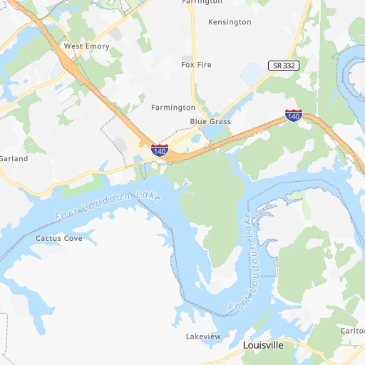
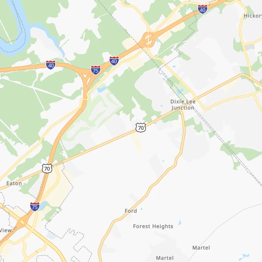
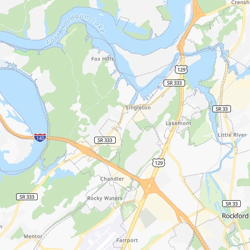
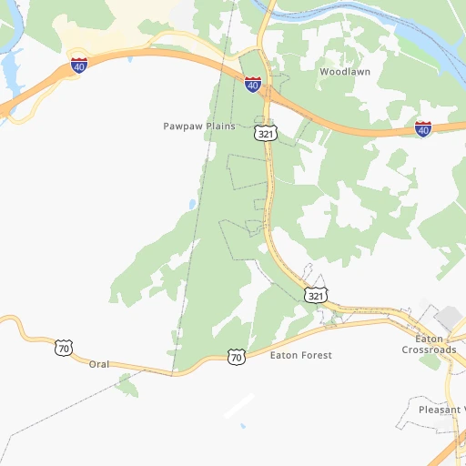
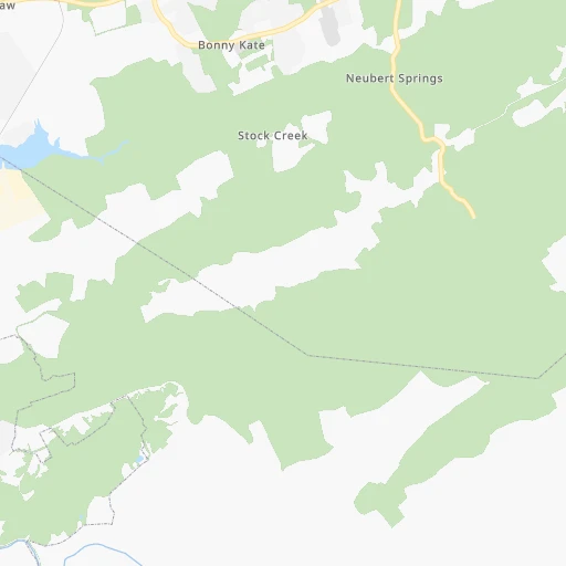
Roadmap (route) to go from Tan Rara Airport to Gainesville detailed above, you can also see the course layout on the map.
While doing trip Tan Rara (airport) - Gainesville by car, the calculated route ends at a distance , or more straight.
Distance and duration of the route between Tan Rara (airport) and Gainesville
Calculation of distance and route from Gainesville to Tan Rara (airport) :
178.0258.1 km4h50mn
Continue onto Casa Real Cove 0h0mn 100 mTurn sharp right onto Largo Vista Road 0h1mn 285 mTurn right onto Tan Rara Drive 0h1mn 527 mTurn sharp right onto Fox Road 0h0mn 236 mContinue onto Fox Road 0h1mn 321 mTurn right onto Fox Road 0h3mn 2.5 kmTurn left onto Woody Drive 0h3mn 2.1 kmTurn right onto Concord Road 0h2mn 1.6 kmTurn left onto Kingston Pike 0h6mn 6.8 kmTurn left onto Lee Highway 0h7mn 8.2 kmTurn left onto Lamar Alexander Parkway 0h2mn 2.0 kmKeep right 0h0mn 279 mKeep right 0h0mn 58 mTurn slight right onto Tellico Parkway 0h17mn 17.3 kmTurn left onto State Route 72 0h9mn 9.7 kmKeep right onto SR 72 0h0mn 104 mTurn slight right onto US 411 0h10mn 11.6 kmKeep right 0h0mn 262 mKeep left 0h0mn 35 mTurn left onto SR 68 1h48mn 55.7 kmKeep left onto Pine Ridge Road 0h4mn 3.0 kmTurn left onto Marian Adams Road 0h3mn 1.3 kmKeep right onto Marian Adams Road 0h2mn 1.6 kmTurn left onto NC 294 0h15mn 16.8 kmTurn left onto US 64, US 74 0h3mn 4.0 kmKeep right 0h18mn 23.3 kmTurn left onto Blue Ridge Street 0h0mn 187 mTurn right onto Hunt Martin Street 0h1mn 553 mTurn right onto Cleveland Street 0h1mn 671 mContinue onto Gainesville Highway 0h28mn 32.4 kmContinue onto US 129, GA 11 0h12mn 14.8 kmContinue onto North Main Street 0h4mn 4.1 kmTurn left onto South Main Street 0h26mn 32.4 kmTurn left onto South Enota Drive Northeast 0h2mn 2.1 kmTurn right onto Jesse Jewell Parkway Southeast 0h2mn 1.3 kmMake a U-turn onto Jesse Jewell Parkway Southeast 0h0mn 122 mTurn right onto Green Street 0h0mn 12 mArrive at destination 0h0mn 0 m
Travel from Tan Rara (airport) (Georgia) to a selection of major cities.
Distances from Tan Rara Airport to biggest cities in Tennessee
- Spring Hill,36,055 inhabitants.255 km
- La Vergne,34,794 inhabitants.223 km
- Gallatin,34,334 inhabitants.217 km
- Cookeville,32,113 inhabitants.129 km
- Mount Juliet,31,540 inhabitants.219 km
- Brentwood Estates,31,279 inhabitants.241 km
- Lebanon,30,262 inhabitants.199 km
- Morristown,29,478 inhabitants.82 km
- Oak Ridge,29,302 inhabitants.20 km
- Maryville,28,464 inhabitants.19 km
- Bristol,26,666 inhabitants.190 km
- Farragut,21,919 inhabitants.4 km
- Shelbyville,21,317 inhabitants.217 km
- East Ridge,20,979 inhabitants.141 km
Other major cities in country :
- Charlotte [NC], 827,097 inhabitants. 305 km
- Seattle [WA], 684,451 inhabitants. 3,390 km
- Denver [CO], 682,545 inhabitants. 1,880 km
- El Paso [TX], 681,124 inhabitants. 2,115 km
- Detroit [MI], 677,116 inhabitants. 724 km
- Boston [MA], 667,137 inhabitants. 1,336 km
- Portland [OR], 632,309 inhabitants. 3,390 km
- Oklahoma City [OK], 631,346 inhabitants. 1,212 km
- Las Vegas [NV], 623,747 inhabitants. 2,781 km
- Baltimore [MD], 621,849 inhabitants. 762 km
- Washington, D.C. [DC], 601,723 inhabitants. 710 km
- Milwaukee [WI], 600,155 inhabitants. 861 km
- South Boston [MA], 571,281 inhabitants. 1,335 km
- Albuquerque [NM], 559,121 inhabitants. 2,040 km
- Tucson [AZ], 531,641 inhabitants. 2,498 km
- Fresno [CA], 520,052 inhabitants. 3,181 km
- Sacramento [CA], 490,712 inhabitants. 3,304 km
- Kansas City [MO], 475,378 inhabitants. 991 km
- Long Beach [CA], 474,140 inhabitants. 3,107 km
- Mesa [AZ], 471,825 inhabitants. 2,544 km
Route from Gainesville to major cities (United States).
- Distance Gainesville New York City1,122 km
- Distance Gainesville Los Angeles3,155 km
- Distance Gainesville Chicago905 km
- Distance Gainesville Brooklyn1,122 km
- Distance Gainesville Houston1,199 km
- Distance Gainesville Queens1,131 km
- Distance Gainesville Philadelphia993 km
- Distance Gainesville Phoenix2,604 km
- Distance Gainesville Manhattan1,129 km
- Distance Gainesville San Antonio1,487 km
- Distance Gainesville San Diego3,086 km
- Distance Gainesville The Bronx1,141 km
- Distance Gainesville Dallas1,215 km
- Distance Gainesville San Jose3,430 km
- Distance Gainesville Austin1,383 km
- Distance Gainesville Jacksonville486 km
- Distance Gainesville San Francisco3,471 km
- Distance Gainesville Columbus635 km
- Distance Gainesville Fort Worth1,264 km
- Distance Gainesville Indianapolis643 km
Nearest cities to Tan Rara (airport) :
- Nashville, 530,852 inhabitants. 243 km
- Atlanta, 463,878 inhabitants. 239 km
- Lexington-Fayette, 314,488 inhabitants. 243 km
- Meads, 288,649 inhabitants. 308 km
- Ironville, 288,649 inhabitants. 313 km
- Louisville, 243,639 inhabitants. 302 km
- Lexington, 225,366 inhabitants. 237 km
- Birmingham, 212,461 inhabitants. 360 km
- Huntsville, 190,582 inhabitants. 259 km
- Knoxville, 185,291 inhabitants. 19 km
- Chattanooga, 176,588 inhabitants. 143 km
- East Chattanooga, 154,024 inhabitants. 137 km
- Murfreesboro, 126,118 inhabitants. 206 km
- Athens, 116,714 inhabitants. 224 km
- Sandy Springs, 105,330 inhabitants. 219 km
- Roswell, 94,501 inhabitants. 208 km
- Asheville, 88,512 inhabitants. 144 km
- Hoover, 84,848 inhabitants. 370 km
- Johns Creek, 83,335 inhabitants. 206 km
- Gastonia, 74,543 inhabitants. 274 km
- Franklin, 72,639 inhabitants. 249 km
- Johnson City, 66,027 inhabitants. 165 km
- Greenville, 64,579 inhabitants. 194 km
- Alpharetta, 63,693 inhabitants. 202 km
- Bowling Green, 63,616 inhabitants. 242 km
- Marietta, 59,067 inhabitants. 219 km
- Smyrna, 56,146 inhabitants. 225 km
- Hendersonville, 56,018 inhabitants. 230 km
- Decatur, 55,437 inhabitants. 297 km
- Kingsport, 53,014 inhabitants. 158 km
- Brookhaven, 51,910 inhabitants. 226 km
- Stonecrest, 50,000 inhabitants. 242 km
- Charleston, 49,736 inhabitants. 352 km
- Dunwoody, 48,733 inhabitants. 217 km
- Huntington, 48,638 inhabitants. 319 km
- Madison, 46,962 inhabitants. 273 km
- Jeffersonville, 46,960 inhabitants. 303 km
- Smyrna, 46,607 inhabitants. 217 km
- Cleveland, 43,898 inhabitants. 106 km
- Augusta, 43,459 inhabitants. 332 km
- Brentwood, 41,763 inhabitants. 241 km
- Peachtree Corners, 40,978 inhabitants. 213 km
- North Atlanta, 40,456 inhabitants. 226 km
- Hickory, 40,374 inhabitants. 251 km
- Gainesville, 38,712 inhabitants. 178 km
- Spartanburg, 37,867 inhabitants. 223 km
- Milton, 37,547 inhabitants. 196 km
- Newnan, 37,291 inhabitants. 286 km
- Mableton, 37,115 inhabitants. 234 km
- Columbia, 36,800 inhabitants. 266 km
Location Tan Rara (airport) (Tennessee) :
| Country flag |  |
| Location | Tan Rara (airport) |
| State | Tennessee |
| County | Knox County |
| Country | United States |
| Country code / ISO 2 | US |
| Latitude | 35.8825800 |
| Longitude | -84.1124100 |
| Altitude | 288 meters |
| Time zone | America/New_York |
Location Gainesville (Georgia) :
| Country flag | |
| Location | Gainesville |
| State | Georgia |
| County | Hall County |
| Country | United States |
| Country code / ISO 2 | US |
| Latitude | 34.2978800 |
| Longitude | -83.8240700 |
| Altitude | 381 meters |
| Time zone | America/New_York |


