


How to get from Schmid (airport) (Tennessee) to Owensboro (Kentucky)
Calculate route from Schmid (airport) (Tennessee, United States) to Owensboro (Kentucky, United States).
The flight distance (as the crow flies) between Schmid (airport) and Owensboro is 163.9 km.
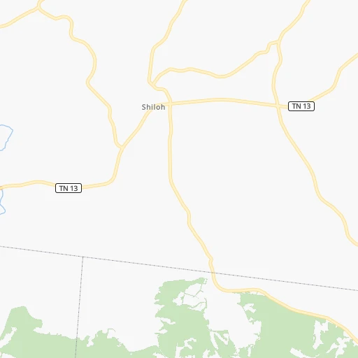
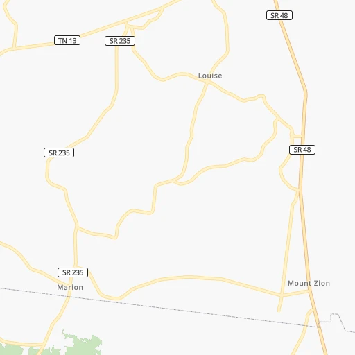
Roadmap (route) to go from Schmid Airport to Owensboro detailed above, you can also see the course layout on the map.
While doing trip Schmid (airport) - Owensboro by car, the calculated route ends at a distance , or more straight.
Distance and duration of the route between Schmid (airport) and Owensboro
Calculation of distance and route from Owensboro to Schmid (airport) :
163.9195.2 km3h4mn
Continue onto Buckeye Road 0h3mn 1.5 kmTurn left onto Ewing Richardson Road 0h28mn 30.8 kmTurn left onto State Highway 13 0h4mn 4.2 kmTurn left onto South Riverside Drive 0h2mn 1.6 kmTurn slight right onto South Riverside Drive 0h1mn 823 mTurn right onto College Street 0h12mn 11.3 kmKeep right onto Wilma Rudolph Boulevard 0h7mn 9.1 kmTurn left onto Guthrie Road 0h19mn 19.4 kmAt roundabout, take exit 4 onto North Main Street 1h48mn 48.2 kmContinue onto Main Street 0h6mn 6.8 kmTurn right onto US 62 0h0mn 112 mTurn left onto Everly Brothers Boulevard 0h3mn 2.9 kmTurn left onto Phillip Stone Way 0h6mn 6.1 kmContinue onto US 431 1h45mn 52.3 kmArrive at destination 0h0mn 0 m
Travel from Schmid (airport) (Kentucky) to a selection of major cities.
Distances from Schmid Airport to biggest cities in Tennessee
- Spring Hill,36,055 inhabitants.95 km
- La Vergne,34,794 inhabitants.105 km
- Gallatin,34,334 inhabitants.109 km
- Cookeville,32,113 inhabitants.196 km
- Mount Juliet,31,540 inhabitants.105 km
- Brentwood Estates,31,279 inhabitants.88 km
- Lebanon,30,262 inhabitants.125 km
- Morristown,29,478 inhabitants.393 km
- Oak Ridge,29,302 inhabitants.308 km
- Maryville,28,464 inhabitants.339 km
- Bristol,26,666 inhabitants.491 km
- Farragut,21,919 inhabitants.320 km
- Shelbyville,21,317 inhabitants.147 km
- East Ridge,20,979 inhabitants.265 km
Other major cities in country :
- Charlotte [NC], 827,097 inhabitants. 629 km
- Seattle [WA], 684,451 inhabitants. 3,097 km
- Denver [CO], 682,545 inhabitants. 1,561 km
- El Paso [TX], 681,124 inhabitants. 1,806 km
- Detroit [MI], 677,116 inhabitants. 774 km
- Boston [MA], 667,137 inhabitants. 1,574 km
- Portland [OR], 632,309 inhabitants. 3,087 km
- Oklahoma City [OK], 631,346 inhabitants. 893 km
- Las Vegas [NV], 623,747 inhabitants. 2,457 km
- Baltimore [MD], 621,849 inhabitants. 1,024 km
- Washington, D.C. [DC], 601,723 inhabitants. 978 km
- Milwaukee [WI], 600,155 inhabitants. 743 km
- South Boston [MA], 571,281 inhabitants. 1,574 km
- Albuquerque [NM], 559,121 inhabitants. 1,719 km
- Tucson [AZ], 531,641 inhabitants. 2,183 km
- Fresno [CA], 520,052 inhabitants. 2,858 km
- Sacramento [CA], 490,712 inhabitants. 2,982 km
- Kansas City [MO], 475,378 inhabitants. 680 km
- Long Beach [CA], 474,140 inhabitants. 2,784 km
- Mesa [AZ], 471,825 inhabitants. 2,224 km
Route from Owensboro to major cities (United States).
- Distance Owensboro New York City1,175 km
- Distance Owensboro Los Angeles2,824 km
- Distance Owensboro Chicago456 km
- Distance Owensboro Brooklyn1,178 km
- Distance Owensboro Houston1,173 km
- Distance Owensboro Queens1,188 km
- Distance Owensboro Philadelphia1,063 km
- Distance Owensboro Phoenix2,302 km
- Distance Owensboro Manhattan1,180 km
- Distance Owensboro San Antonio1,404 km
- Distance Owensboro San Diego2,777 km
- Distance Owensboro The Bronx1,190 km
- Distance Owensboro Dallas1,041 km
- Distance Owensboro San Jose3,052 km
- Distance Owensboro Austin1,287 km
- Distance Owensboro Jacksonville969 km
- Distance Owensboro San Francisco3,088 km
- Distance Owensboro Columbus432 km
- Distance Owensboro Fort Worth1,084 km
- Distance Owensboro Indianapolis237 km
Nearest cities to Schmid (airport) :
- Memphis, 655,770 inhabitants. 254 km
- New South Memphis, 641,608 inhabitants. 259 km
- Nashville, 530,852 inhabitants. 82 km
- St. Louis, 315,685 inhabitants. 337 km
- Louisville, 243,639 inhabitants. 270 km
- Birmingham, 212,461 inhabitants. 326 km
- Huntsville, 190,582 inhabitants. 207 km
- Chattanooga, 176,588 inhabitants. 259 km
- East Chattanooga, 154,024 inhabitants. 262 km
- Clarksville, 149,176 inhabitants. 33 km
- Murfreesboro, 126,118 inhabitants. 129 km
- Evansville, 119,943 inhabitants. 179 km
- Hoover, 84,848 inhabitants. 339 km
- Bloomington, 84,067 inhabitants. 327 km
- Franklin, 72,639 inhabitants. 87 km
- Jackson, 66,975 inhabitants. 133 km
- Saint Charles, 65,794 inhabitants. 366 km
- Bowling Green, 63,616 inhabitants. 129 km
- Owensboro, 59,042 inhabitants. 164 km
- Bartlett, 58,579 inhabitants. 238 km
- Hendersonville, 56,018 inhabitants. 94 km
- Decatur, 55,437 inhabitants. 206 km
- Southaven, 52,589 inhabitants. 262 km
- Saint Peters, 52,575 inhabitants. 376 km
- Florissant, 52,268 inhabitants. 357 km
- Collierville, 48,863 inhabitants. 233 km
- Chesterfield, 47,864 inhabitants. 362 km
- Madison, 46,962 inhabitants. 203 km
- Jeffersonville, 46,960 inhabitants. 273 km
- Columbus, 46,690 inhabitants. 351 km
- Smyrna, 46,607 inhabitants. 112 km
- Cleveland, 43,898 inhabitants. 286 km
- Belleville, 42,034 inhabitants. 315 km
- Brentwood, 41,763 inhabitants. 88 km
- Florence, 40,026 inhabitants. 174 km
- Cape Girardeau, 39,462 inhabitants. 195 km
- Germantown, 39,240 inhabitants. 240 km
- Newnan, 37,291 inhabitants. 423 km
- Columbia, 36,800 inhabitants. 101 km
- New Albany, 36,732 inhabitants. 269 km
- Rome, 36,323 inhabitants. 327 km
- Oakville, 36,143 inhabitants. 330 km
- Gadsden, 36,084 inhabitants. 302 km
- Spring Hill, 36,055 inhabitants. 95 km
- Olive Branch, 36,010 inhabitants. 250 km
- Wildwood, 35,899 inhabitants. 362 km
- East Florence, 35,733 inhabitants. 173 km
- Tupelo, 35,680 inhabitants. 253 km
- University City, 35,058 inhabitants. 345 km
- La Vergne, 34,794 inhabitants. 105 km
Location Schmid (airport) (Tennessee) :
| Country flag |  |
| Location | Schmid (airport) |
| State | Tennessee |
| County | Stewart County |
| Country | United States |
| Country code / ISO 2 | US |
| Latitude | 36.3667200 |
| Longitude | -87.6666800 |
| Altitude | 114 meters |
| Time zone | America/Chicago |
Location Owensboro (Kentucky) :
| Country flag | |
| Location | Owensboro |
| State | Kentucky |
| County | Daviess County |
| Country | United States |
| Country code / ISO 2 | US |
| Latitude | 37.7742200 |
| Longitude | -87.1133300 |
| Altitude | 120 meters |
| Time zone | America/Chicago |


