

How to get from McAfee Stol Patch (airport) (Tennessee) to Gallatin (Tennessee)
Calculate route from McAfee Stol Patch (airport) (Tennessee, United States) to Gallatin (Tennessee, United States).
The flight distance (as the crow flies) between McAfee Stol Patch (airport) and Gallatin is 362.8 km.
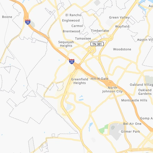
Roadmap (route) to go from McAfee Stol Patch Airport to Gallatin detailed above, you can also see the course layout on the map.
While doing trip McAfee Stol Patch (airport) - Gallatin by car, the calculated route ends at a distance , or more straight.
Distance and duration of the route between McAfee Stol Patch (airport) and Gallatin
Calculation of distance and route from Gallatin to McAfee Stol Patch (airport) :
362.8437.9 km5h33mn
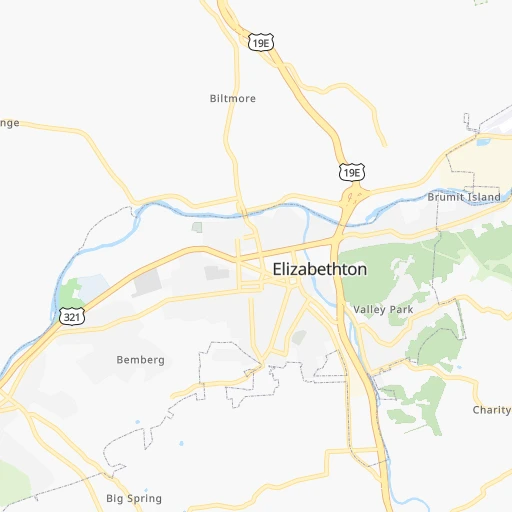
Continue onto Rovan Drive 0h1mn 361 mTurn left onto Cimarron Drive 0h0mn 173 mTurn right onto White Way Drive 0h1mn 420 mTurn right onto North Roan Street 0h2mn 2.4 kmTurn left onto Old Gray Station Road 0h1mn 737 mTurn left onto Boones Creek Road 0h1mn 1.3 kmKeep right and take I 26 West, US 23 South toward Kingsport 0h9mn 13.2 kmKeep right and take I 81 South toward Knoxville 2h47mn 176.9 kmKeep right onto I 40 and drive toward Nashville 2h9mn 218.6 kmKeep right and take TN 109 toward Gallatin 0h0mn 558 mTurn right onto SR 109 0h18mn 20.4 kmContinue onto South Water Avenue 0h3mn 2.8 kmTurn left onto West Main Street 0h0mn 20 mArrive at destination 0h0mn 0 m
Travel from McAfee Stol Patch (airport) (Tennessee) to a selection of major cities.
Distances from McAfee Stol Patch Airport to biggest cities in Tennessee
- Spring Hill,36,055 inhabitants.414 km
- La Vergne,34,794 inhabitants.379 km
- Gallatin,34,334 inhabitants.363 km
- Cookeville,32,113 inhabitants.280 km
- Mount Juliet,31,540 inhabitants.371 km
- Brentwood Estates,31,279 inhabitants.396 km
- Lebanon,30,262 inhabitants.350 km
- Morristown,29,478 inhabitants.83 km
- Oak Ridge,29,302 inhabitants.173 km
- Maryville,28,464 inhabitants.158 km
- Bristol,26,666 inhabitants.31 km
- Farragut,21,919 inhabitants.167 km
- Shelbyville,21,317 inhabitants.380 km
- East Ridge,20,979 inhabitants.300 km
Other major cities in country :
- Charlotte [NC], 827,097 inhabitants. 189 km
- Seattle [WA], 684,451 inhabitants. 3,488 km
- Denver [CO], 682,545 inhabitants. 2,010 km
- El Paso [TX], 681,124 inhabitants. 2,274 km
- Detroit [MI], 677,116 inhabitants. 666 km
- Boston [MA], 667,137 inhabitants. 1,180 km
- Portland [OR], 632,309 inhabitants. 3,496 km
- Oklahoma City [OK], 631,346 inhabitants. 1,366 km
- Las Vegas [NV], 623,747 inhabitants. 2,925 km
- Baltimore [MD], 621,849 inhabitants. 603 km
- Washington, D.C. [DC], 601,723 inhabitants. 549 km
- Milwaukee [WI], 600,155 inhabitants. 879 km
- South Boston [MA], 571,281 inhabitants. 1,179 km
- Albuquerque [NM], 559,121 inhabitants. 2,191 km
- Tucson [AZ], 531,641 inhabitants. 2,655 km
- Fresno [CA], 520,052 inhabitants. 3,321 km
- Sacramento [CA], 490,712 inhabitants. 3,437 km
- Kansas City [MO], 475,378 inhabitants. 1,114 km
- Long Beach [CA], 474,140 inhabitants. 3,256 km
- Mesa [AZ], 471,825 inhabitants. 2,697 km
Route from Gallatin to major cities (United States).
- Distance Gallatin New York City1,184 km
- Distance Gallatin Los Angeles2,890 km
- Distance Gallatin Chicago617 km
- Distance Gallatin Brooklyn1,186 km
- Distance Gallatin Houston1,111 km
- Distance Gallatin Queens1,196 km
- Distance Gallatin Philadelphia1,063 km
- Distance Gallatin Phoenix2,355 km
- Distance Gallatin Manhattan1,190 km
- Distance Gallatin San Antonio1,365 km
- Distance Gallatin San Diego2,834 km
- Distance Gallatin The Bronx1,200 km
- Distance Gallatin Dallas1,030 km
- Distance Gallatin San Jose3,140 km
- Distance Gallatin Austin1,251 km
- Distance Gallatin Jacksonville808 km
- Distance Gallatin San Francisco3,179 km
- Distance Gallatin Columbus499 km
- Distance Gallatin Fort Worth1,076 km
- Distance Gallatin Indianapolis377 km
Nearest cities to McAfee Stol Patch (airport) :
- Charlotte, 827,097 inhabitants. 189 km
- Atlanta, 463,878 inhabitants. 344 km
- Lexington-Fayette, 314,488 inhabitants. 262 km
- Cincinnati, 296,943 inhabitants. 359 km
- Meads, 288,649 inhabitants. 229 km
- Ironville, 288,649 inhabitants. 234 km
- Greensboro, 285,342 inhabitants. 236 km
- Winston-Salem, 241,218 inhabitants. 195 km
- Lexington, 225,366 inhabitants. 258 km
- Knoxville, 185,291 inhabitants. 145 km
- Chattanooga, 176,588 inhabitants. 302 km
- East Chattanooga, 154,024 inhabitants. 296 km
- Columbia, 133,803 inhabitants. 291 km
- Athens, 116,714 inhabitants. 283 km
- High Point, 110,268 inhabitants. 219 km
- Sandy Springs, 105,330 inhabitants. 327 km
- Roanoke, 99,897 inhabitants. 240 km
- Roswell, 94,501 inhabitants. 317 km
- Asheville, 88,512 inhabitants. 87 km
- Concord, 87,696 inhabitants. 195 km
- Johns Creek, 83,335 inhabitants. 308 km
- Gastonia, 74,543 inhabitants. 165 km
- Rock Hill, 71,548 inhabitants. 203 km
- Johnson City, 66,027 inhabitants. 7 km
- Greenville, 64,579 inhabitants. 169 km
- Alpharetta, 63,693 inhabitants. 309 km
- Marietta, 59,067 inhabitants. 333 km
- Smyrna, 56,146 inhabitants. 338 km
- Kingsport, 53,014 inhabitants. 25 km
- Huntersville, 52,704 inhabitants. 176 km
- Burlington, 52,472 inhabitants. 267 km
- Brookhaven, 51,910 inhabitants. 331 km
- Stonecrest, 50,000 inhabitants. 336 km
- Charleston, 49,736 inhabitants. 230 km
- Dunwoody, 48,733 inhabitants. 323 km
- Huntington, 48,638 inhabitants. 228 km
- Kannapolis, 46,144 inhabitants. 187 km
- Blacksburg, 44,215 inhabitants. 200 km
- Cleveland, 43,898 inhabitants. 262 km
- Augusta, 43,459 inhabitants. 325 km
- Fairfield, 42,767 inhabitants. 382 km
- Danville, 42,082 inhabitants. 269 km
- Covington, 40,997 inhabitants. 355 km
- Peachtree Corners, 40,978 inhabitants. 315 km
- Sumter, 40,816 inhabitants. 331 km
- North Atlanta, 40,456 inhabitants. 331 km
- Hickory, 40,374 inhabitants. 118 km
- Gainesville, 38,712 inhabitants. 265 km
- Florence, 38,228 inhabitants. 340 km
- Spartanburg, 37,867 inhabitants. 164 km
Location McAfee Stol Patch (airport) (Tennessee) :
| Country flag |  |
| Location | McAfee Stol Patch (airport) |
| State | Tennessee |
| County | Washington County |
| Country | United States |
| Country code / ISO 2 | US |
| Latitude | 36.3723300 |
| Longitude | -82.3915300 |
| Altitude | 571 meters |
| Time zone | America/New_York |
Location Gallatin (Tennessee) :
| Country flag | |
| Location | Gallatin |
| State | Tennessee |
| County | Sumner County |
| Country | United States |
| Country code / ISO 2 | US |
| Latitude | 36.3883800 |
| Longitude | -86.4466600 |
| Altitude | 164 meters |
| Time zone | America/Chicago |

