


How to get from Okmulgee Regional (airport) (Oklahoma) to Sapulpa (Oklahoma)
Calculate route from Okmulgee Regional (airport) (Oklahoma, United States) to Sapulpa (Oklahoma, United States).
The flight distance (as the crow flies) between Okmulgee Regional (airport) and Sapulpa is 39.6 km.
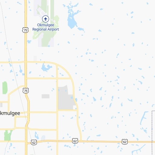
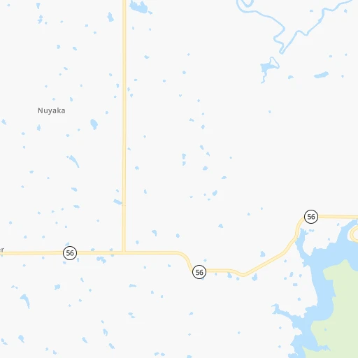
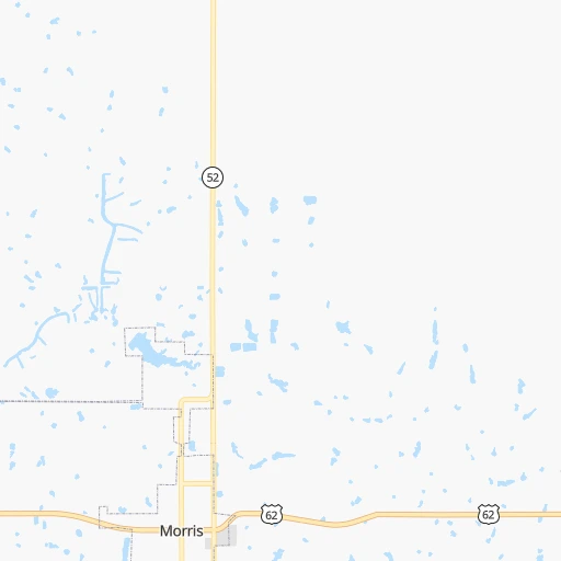
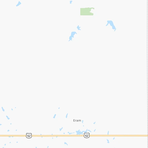
Roadmap (route) to go from Okmulgee Regional Airport to Sapulpa detailed above, you can also see the course layout on the map.
While doing trip Okmulgee Regional (airport) - Sapulpa by car, the calculated route ends at a distance , or more straight.
Distance and duration of the route between Okmulgee Regional (airport) and Sapulpa
An error occured: undefined - for url https://route.cartes.cc/route?point=35.66715%2C-95.95292&point=35.9987%2C-96.11417&vehicle=car&debug=false&data_type=application%2Fjson&locale=en&points_encoded=true&instructions=true&elevation=false&optimize=false&timeout=10000&skip.host=true&skip.basePath=true&graphhopper_maps_host=https%3A%2F%2Fgraphhopper.com%2Fmaps%2F%3F&turn_sign_map.0=continue&turn_sign_map.1=turn%20slight%20right&turn_sign_map.2=turn%20right&turn_sign_map.3=turn%20sharp%20right&turn_sign_map.4=finish&turn_sign_map.5=reached%20via%20point&turn_sign_map.6=enter%20roundabout&turn_sign_map.-6=leave%20roundabout&turn_sign_map.-3=turn%20sharp%20left&turn_sign_map.-2=turn%20left&turn_sign_map.-1=turn%20slight%20left&key=&position=topleft
Calculation of distance and route from Sapulpa to Okmulgee Regional (airport) :
39.645.6 km1h34mn
Continue onto East Airport Road 0h1mn 834 mTurn right onto North Wood Drive and take US 75 North toward Tulsa 0h15mn 24.0 kmTurn left onto West 201st Street South and drive toward Mounds 0h4mn 3.6 kmTurn right onto Russell Avenue 0h1mn 562 mTurn left onto 13th Street 0h0mn 190 mTurn right onto Maxwell Avenue 0h0mn 345 mTurn left onto 16th Street 0h0mn 264 mTurn right onto Commercial Avenue 0h13mn 15.8 kmArrive at destination 0h0mn 0 m
Travel from Okmulgee Regional (airport) (Oklahoma) to a selection of major cities.
Distances from Okmulgee Regional Airport to biggest cities in Oklahoma
Other major cities in country :
- Charlotte [NC], 827,097 inhabitants. 1,370 km
- Seattle [WA], 684,451 inhabitants. 2,547 km
- Denver [CO], 682,545 inhabitants. 915 km
- El Paso [TX], 681,124 inhabitants. 1,067 km
- Detroit [MI], 677,116 inhabitants. 1,338 km
- Boston [MA], 667,137 inhabitants. 2,268 km
- Memphis [TN], 655,770 inhabitants. 539 km
- New South Memphis [TN], 641,608 inhabitants. 539 km
- Portland [OR], 632,309 inhabitants. 2,495 km
- Las Vegas [NV], 623,747 inhabitants. 1,728 km
- Baltimore [MD], 621,849 inhabitants. 1,752 km
- Washington, D.C. [DC], 601,723 inhabitants. 1,710 km
- Milwaukee [WI], 600,155 inhabitants. 1,073 km
- South Boston [MA], 571,281 inhabitants. 2,269 km
- Albuquerque [NM], 559,121 inhabitants. 973 km
- Tucson [AZ], 531,641 inhabitants. 1,433 km
- Nashville [TN], 530,852 inhabitants. 828 km
- Fresno [CA], 520,052 inhabitants. 2,137 km
- Sacramento [CA], 490,712 inhabitants. 2,283 km
- Kansas City [MO], 475,378 inhabitants. 401 km
Route from Sapulpa to major cities (United States).
- Distance Sapulpa New York City1,994 km
- Distance Sapulpa Los Angeles2,025 km
- Distance Sapulpa Chicago980 km
- Distance Sapulpa Brooklyn1,998 km
- Distance Sapulpa Houston698 km
- Distance Sapulpa Queens2,008 km
- Distance Sapulpa Philadelphia1,886 km
- Distance Sapulpa Phoenix1,486 km
- Distance Sapulpa Manhattan1,998 km
- Distance Sapulpa San Antonio765 km
- Distance Sapulpa San Diego1,965 km
- Distance Sapulpa The Bronx2,008 km
- Distance Sapulpa Dallas364 km
- Distance Sapulpa San Jose2,300 km
- Distance Sapulpa Austin656 km
- Distance Sapulpa Jacksonville1,486 km
- Distance Sapulpa San Francisco2,343 km
- Distance Sapulpa Columbus1,231 km
- Distance Sapulpa Fort Worth381 km
- Distance Sapulpa Indianapolis969 km
Nearest cities to Okmulgee Regional (airport) :
- Dallas, 1,300,092 inhabitants. 331 km
- Fort Worth, 833,319 inhabitants. 351 km
- Oklahoma City, 631,346 inhabitants. 143 km
- Tulsa, 403,505 inhabitants. 54 km
- Wichita, 389,965 inhabitants. 257 km
- Arlington, 388,125 inhabitants. 343 km
- Plano, 283,558 inhabitants. 303 km
- Garland, 236,897 inhabitants. 313 km
- Irving, 236,607 inhabitants. 331 km
- Grand Prairie, 187,809 inhabitants. 339 km
- Springfield, 166,810 inhabitants. 294 km
- McKinney, 162,898 inhabitants. 282 km
- Frisco, 154,407 inhabitants. 291 km
- Mesquite, 144,788 inhabitants. 328 km
- Carrollton, 133,168 inhabitants. 314 km
- Denton, 131,044 inhabitants. 294 km
- Norman, 120,284 inhabitants. 144 km
- Richardson, 110,815 inhabitants. 311 km
- Broken Arrow, 106,563 inhabitants. 45 km
- Wichita Falls, 104,710 inhabitants. 303 km
- Lewisville, 104,039 inhabitants. 307 km
- Allen, 98,143 inhabitants. 293 km
- Lawton, 96,655 inhabitants. 251 km
- Edmond, 90,092 inhabitants. 138 km
- Fort Smith, 88,194 inhabitants. 144 km
- Fayetteville, 82,830 inhabitants. 168 km
- Springdale, 77,859 inhabitants. 174 km
- Flower Mound, 71,253 inhabitants. 313 km
- North Richland Hills, 69,204 inhabitants. 336 km
- Rogers, 63,159 inhabitants. 181 km
- Moore, 60,451 inhabitants. 144 km
- Rowlett, 60,236 inhabitants. 313 km
- Midwest City, 57,249 inhabitants. 133 km
- Euless, 54,219 inhabitants. 332 km
- Joplin, 51,818 inhabitants. 204 km
- Enid, 51,776 inhabitants. 191 km
- Grapevine, 51,404 inhabitants. 321 km
- Bedford, 49,337 inhabitants. 333 km
- Stillwater, 48,967 inhabitants. 111 km
- Wylie, 46,708 inhabitants. 300 km
- Keller, 45,758 inhabitants. 327 km
- Bentonville, 44,499 inhabitants. 176 km
- Haltom City, 44,206 inhabitants. 341 km
- Rockwall, 42,566 inhabitants. 308 km
- The Colony, 41,779 inhabitants. 300 km
- Hutchinson, 41,569 inhabitants. 319 km
- Coppell, 41,159 inhabitants. 317 km
- Sherman, 40,667 inhabitants. 234 km
- Hurst, 39,016 inhabitants. 336 km
- Muskogee, 38,456 inhabitants. 53 km
Location Okmulgee Regional (airport) (Oklahoma) :
| Country flag |  |
| Location | Okmulgee Regional (airport) |
| State | Oklahoma |
| County | Okmulgee County |
| Country | United States |
| Country code / ISO 2 | US |
| Latitude | 35.6671500 |
| Longitude | -95.9529200 |
| Altitude | 214 meters |
| Time zone | America/Chicago |
Location Sapulpa (Oklahoma) :
| Country flag | |
| Location | Sapulpa |
| State | Oklahoma |
| County | Creek County |
| Country | United States |
| Country code / ISO 2 | US |
| Latitude | 35.9987000 |
| Longitude | -96.1141700 |
| Altitude | 218 meters |
| Time zone | America/Chicago |
