


How to get from Mc Caslin (airport) (Oklahoma) to Sherman (Texas)
Calculate route from Mc Caslin (airport) (Oklahoma, United States) to Sherman (Texas, United States).
The flight distance (as the crow flies) between Mc Caslin (airport) and Sherman is 174.9 km.
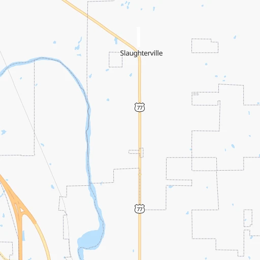
Roadmap (route) to go from Mc Caslin Airport to Sherman detailed above, you can also see the course layout on the map.
While doing trip Mc Caslin (airport) - Sherman by car, the calculated route ends at a distance , or more straight.
Distance and duration of the route between Mc Caslin (airport) and Sherman
Calculation of distance and route from Sherman to Mc Caslin (airport) :
174.9221.3 km2h27mn
Continue onto 72nd Avenue Southeast 0h1mn 389 mTurn right onto Slaughterville Road 0h0mn 75 mTurn left onto Blue Star Memorial Highway 0h9mn 10.4 kmTurn left onto North Green Avenue 0h3mn 3.8 kmTurn left 1h25mn 152.8 kmKeep right and take FM 372 toward Gainesville 0h0mn 457 mTurn left onto FM 372 0h4mn 3.7 kmTurn sharp left 0h15mn 17.8 kmKeep right and take TX 56 toward Main Street 0h1mn 499 mTurn right onto TX 56 0h29mn 31.4 kmArrive at destination 0h0mn 0 m
Travel from Mc Caslin (airport) (Texas) to a selection of major cities.
Distances from Mc Caslin Airport to biggest cities in Oklahoma
Other major cities in country :
- Charlotte [NC], 827,097 inhabitants. 1,499 km
- Seattle [WA], 684,451 inhabitants. 2,493 km
- Denver [CO], 682,545 inhabitants. 851 km
- El Paso [TX], 681,124 inhabitants. 927 km
- Detroit [MI], 677,116 inhabitants. 1,477 km
- Boston [MA], 667,137 inhabitants. 2,410 km
- Memphis [TN], 655,770 inhabitants. 663 km
- New South Memphis [TN], 641,608 inhabitants. 663 km
- Portland [OR], 632,309 inhabitants. 2,430 km
- Las Vegas [NV], 623,747 inhabitants. 1,613 km
- Baltimore [MD], 621,849 inhabitants. 1,892 km
- Washington, D.C. [DC], 601,723 inhabitants. 1,850 km
- Milwaukee [WI], 600,155 inhabitants. 1,201 km
- South Boston [MA], 571,281 inhabitants. 2,410 km
- Albuquerque [NM], 559,121 inhabitants. 848 km
- Tucson [AZ], 531,641 inhabitants. 1,298 km
- Nashville [TN], 530,852 inhabitants. 962 km
- Fresno [CA], 520,052 inhabitants. 2,026 km
- Sacramento [CA], 490,712 inhabitants. 2,181 km
- Kansas City [MO], 475,378 inhabitants. 509 km
Route from Sherman to major cities (United States).
- Distance Sherman New York City2,146 km
- Distance Sherman Los Angeles1,997 km
- Distance Sherman Chicago1,206 km
- Distance Sherman Brooklyn2,149 km
- Distance Sherman Queens2,159 km
- Distance Sherman Philadelphia2,031 km
- Distance Sherman Phoenix1,434 km
- Distance Sherman Manhattan2,152 km
- Distance Sherman San Diego1,915 km
- Distance Sherman The Bronx2,162 km
- Distance Sherman San Jose2,322 km
- Distance Sherman Jacksonville1,457 km
- Distance Sherman San Francisco2,370 km
- Distance Sherman Columbus1,400 km
- Distance Sherman Indianapolis1,155 km
- Distance Sherman Charlotte1,457 km
- Distance Sherman Seattle2,652 km
- Distance Sherman Denver1,009 km
- Distance Sherman Detroit1,531 km
- Distance Sherman Boston2,430 km
Nearest cities to Mc Caslin (airport) :
- Dallas, 1,300,092 inhabitants. 262 km
- Fort Worth, 833,319 inhabitants. 263 km
- Oklahoma City, 631,346 inhabitants. 45 km
- Tulsa, 403,505 inhabitants. 170 km
- Wichita, 389,965 inhabitants. 290 km
- Arlington, 388,125 inhabitants. 263 km
- Plano, 283,558 inhabitants. 238 km
- Garland, 236,897 inhabitants. 251 km
- Irving, 236,607 inhabitants. 256 km
- Grand Prairie, 187,809 inhabitants. 263 km
- McKinney, 162,898 inhabitants. 221 km
- Frisco, 154,407 inhabitants. 221 km
- Mesquite, 144,788 inhabitants. 268 km
- Carrollton, 133,168 inhabitants. 241 km
- Denton, 131,044 inhabitants. 210 km
- Abilene, 121,721 inhabitants. 368 km
- Norman, 120,284 inhabitants. 17 km
- Richardson, 110,815 inhabitants. 245 km
- Broken Arrow, 106,563 inhabitants. 176 km
- Wichita Falls, 104,710 inhabitants. 169 km
- Lewisville, 104,039 inhabitants. 230 km
- Tyler, 103,700 inhabitants. 358 km
- Allen, 98,143 inhabitants. 230 km
- Lawton, 96,655 inhabitants. 110 km
- Edmond, 90,092 inhabitants. 64 km
- Fort Smith, 88,194 inhabitants. 269 km
- Longview, 82,287 inhabitants. 375 km
- Flower Mound, 71,253 inhabitants. 232 km
- North Richland Hills, 69,204 inhabitants. 251 km
- Mansfield, 64,274 inhabitants. 282 km
- Moore, 60,451 inhabitants. 31 km
- Rowlett, 60,236 inhabitants. 254 km
- Midwest City, 57,249 inhabitants. 40 km
- Euless, 54,219 inhabitants. 252 km
- DeSoto, 52,486 inhabitants. 282 km
- Joplin, 51,818 inhabitants. 337 km
- Enid, 51,776 inhabitants. 153 km
- Grapevine, 51,404 inhabitants. 241 km
- Bedford, 49,337 inhabitants. 251 km
- Stillwater, 48,967 inhabitants. 117 km
- Cedar Hill, 48,507 inhabitants. 281 km
- Wylie, 46,708 inhabitants. 243 km
- Keller, 45,758 inhabitants. 240 km
- Haltom City, 44,206 inhabitants. 255 km
- Burleson, 43,625 inhabitants. 284 km
- Rockwall, 42,566 inhabitants. 254 km
- The Colony, 41,779 inhabitants. 227 km
- Hutchinson, 41,569 inhabitants. 335 km
- Coppell, 41,159 inhabitants. 240 km
- Sherman, 40,667 inhabitants. 175 km
Location Mc Caslin (airport) (Oklahoma) :
| Country flag |  |
| Location | Mc Caslin (airport) |
| State | Oklahoma |
| County | Cleveland County |
| Country | United States |
| Country code / ISO 2 | US |
| Latitude | 35.0908600 |
| Longitude | -97.3368500 |
| Altitude | 345 meters |
| Time zone | America/Chicago |
Location Sherman (Texas) :
| Country flag | |
| Location | Sherman |
| State | Texas |
| County | Grayson County |
| Country | United States |
| Country code / ISO 2 | US |
| Latitude | 33.6356600 |
| Longitude | -96.6088800 |
| Altitude | 224 meters |
| Time zone | America/Chicago |


