

How to get from Clinton-Sherman (airport) (Oklahoma) to Sand Springs (Oklahoma)
Calculate route from Clinton-Sherman (airport) (Oklahoma, United States) to Sand Springs (Oklahoma, United States).
The flight distance (as the crow flies) between Clinton-Sherman (airport) and Sand Springs is 292.5 km.
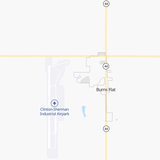
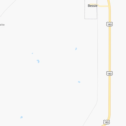
Roadmap (route) to go from Clinton-Sherman Airport to Sand Springs detailed above, you can also see the course layout on the map.
While doing trip Clinton-Sherman (airport) - Sand Springs by car, the calculated route ends at a distance , or more straight.
Distance and duration of the route between Clinton-Sherman (airport) and Sand Springs
Calculation of distance and route from Sand Springs to Clinton-Sherman (airport) :
292.5327.4 km3h24mn
Continue 0h1mn 301 mTurn right 0h0mn 215 mTurn left onto 2nd Street 0h1mn 527 mTurn right onto Apron Road 0h1mn 723 mTurn left onto 4th Street 0h2mn 1.0 kmContinue onto Pioneer Way 0h2mn 963 mTurn left onto Sioux Trail 0h0mn 236 mTurn right onto Cimarron Road 0h0mn 62 mTurn left onto OK 44 and take OK 44 North toward Foss 0h6mn 9.2 kmTurn right and take I 40 East toward Oklahoma City 1h12mn 127.2 kmKeep right and drive toward Cimarron Road, Clarence E. Page Municipal Airport 0h0mn 333 mKeep left 0h0mn 20 mTurn left onto North Cimarron Road 0h1mn 850 mTurn right onto OK 66, US Historic 66 1h32mn 40.5 kmKeep right onto I 44 and take I 44 Toll East toward Tulsa 1h12mn 129.5 kmKeep right and take OK 97 toward Sapulpa, Sand Springs 0h1mn 991 mTurn left onto North 9th Street and take OK 97 North toward Sand Springs 0h11mn 13.6 kmTurn right onto West Alexander Boulevard 0h1mn 512 mTurn left onto South Main Street 0h1mn 431 mTurn right onto East Broadway Street 0h0mn 122 mTurn left onto North McKinley Avenue 0h0mn 18 mArrive at destination 0h0mn 0 m
Travel from Clinton-Sherman (airport) (Oklahoma) to a selection of major cities.
Distances from Clinton-Sherman Airport to biggest cities in Oklahoma
Other major cities in country :
- Charlotte [NC], 827,097 inhabitants. 1,666 km
- Seattle [WA], 684,451 inhabitants. 2,349 km
- Denver [CO], 682,545 inhabitants. 707 km
- El Paso [TX], 681,124 inhabitants. 785 km
- Detroit [MI], 677,116 inhabitants. 1,599 km
- Boston [MA], 667,137 inhabitants. 2,548 km
- Memphis [TN], 655,770 inhabitants. 832 km
- New South Memphis [TN], 641,608 inhabitants. 832 km
- Portland [OR], 632,309 inhabitants. 2,277 km
- Las Vegas [NV], 623,747 inhabitants. 1,441 km
- Baltimore [MD], 621,849 inhabitants. 2,042 km
- Washington, D.C. [DC], 601,723 inhabitants. 2,001 km
- Milwaukee [WI], 600,155 inhabitants. 1,295 km
- South Boston [MA], 571,281 inhabitants. 2,548 km
- Albuquerque [NM], 559,121 inhabitants. 678 km
- Tucson [AZ], 531,641 inhabitants. 1,138 km
- Nashville [TN], 530,852 inhabitants. 1,125 km
- Fresno [CA], 520,052 inhabitants. 1,855 km
- Sacramento [CA], 490,712 inhabitants. 2,011 km
- Kansas City [MO], 475,378 inhabitants. 585 km
Route from Sand Springs to major cities (United States).
- Distance Sand Springs New York City1,988 km
- Distance Sand Springs Los Angeles2,025 km
- Distance Sand Springs Chicago968 km
- Distance Sand Springs Brooklyn1,992 km
- Distance Sand Springs Houston713 km
- Distance Sand Springs Queens2,001 km
- Distance Sand Springs Philadelphia1,880 km
- Distance Sand Springs Phoenix1,488 km
- Distance Sand Springs Manhattan1,992 km
- Distance Sand Springs San Antonio780 km
- Distance Sand Springs San Diego1,966 km
- Distance Sand Springs The Bronx2,001 km
- Distance Sand Springs Dallas379 km
- Distance Sand Springs San Jose2,297 km
- Distance Sand Springs Austin671 km
- Distance Sand Springs Jacksonville1,491 km
- Distance Sand Springs San Francisco2,340 km
- Distance Sand Springs Columbus1,224 km
- Distance Sand Springs Fort Worth396 km
- Distance Sand Springs Indianapolis962 km
Nearest cities to Clinton-Sherman (airport) :
- Dallas, 1,300,092 inhabitants. 360 km
- Fort Worth, 833,319 inhabitants. 339 km
- Oklahoma City, 631,346 inhabitants. 153 km
- Wichita, 389,965 inhabitants. 310 km
- Arlington, 388,125 inhabitants. 348 km
- Plano, 283,558 inhabitants. 346 km
- Lubbock, 249,042 inhabitants. 313 km
- Garland, 236,897 inhabitants. 359 km
- Irving, 236,607 inhabitants. 349 km
- Amarillo, 198,645 inhabitants. 240 km
- Grand Prairie, 187,809 inhabitants. 353 km
- McKinney, 162,898 inhabitants. 337 km
- Frisco, 154,407 inhabitants. 327 km
- Mesquite, 144,788 inhabitants. 374 km
- Carrollton, 133,168 inhabitants. 340 km
- Denton, 131,044 inhabitants. 303 km
- Abilene, 121,721 inhabitants. 326 km
- Norman, 120,284 inhabitants. 160 km
- Richardson, 110,815 inhabitants. 350 km
- Wichita Falls, 104,710 inhabitants. 171 km
- Lewisville, 104,039 inhabitants. 326 km
- Allen, 98,143 inhabitants. 341 km
- Lawton, 96,655 inhabitants. 110 km
- Edmond, 90,092 inhabitants. 160 km
- Flower Mound, 71,253 inhabitants. 323 km
- North Richland Hills, 69,204 inhabitants. 333 km
- Mansfield, 64,274 inhabitants. 363 km
- Moore, 60,451 inhabitants. 155 km
- Rowlett, 60,236 inhabitants. 364 km
- Midwest City, 57,249 inhabitants. 164 km
- Euless, 54,219 inhabitants. 340 km
- DeSoto, 52,486 inhabitants. 375 km
- Enid, 51,776 inhabitants. 167 km
- Grapevine, 51,404 inhabitants. 332 km
- Bedford, 49,337 inhabitants. 336 km
- Stillwater, 48,967 inhabitants. 212 km
- Cedar Hill, 48,507 inhabitants. 370 km
- Wylie, 46,708 inhabitants. 356 km
- Keller, 45,758 inhabitants. 322 km
- Haltom City, 44,206 inhabitants. 334 km
- Burleson, 43,625 inhabitants. 357 km
- Rockwall, 42,566 inhabitants. 368 km
- The Colony, 41,779 inhabitants. 329 km
- Hutchinson, 41,569 inhabitants. 323 km
- Coppell, 41,159 inhabitants. 333 km
- Sherman, 40,667 inhabitants. 304 km
- Duncanville, 39,826 inhabitants. 366 km
- Hurst, 39,016 inhabitants. 337 km
- Lancaster, 38,801 inhabitants. 380 km
- Little Elm, 38,341 inhabitants. 319 km
Location Clinton-Sherman (airport) (Oklahoma) :
| Country flag |  |
| Location | Clinton-Sherman (airport) |
| State | Oklahoma |
| County | Washita County |
| Country | United States |
| Country code / ISO 2 | US |
| Latitude | 35.3403300 |
| Longitude | -99.1989700 |
| Altitude | 581 meters |
| Time zone | America/Chicago |
Location Sand Springs (Oklahoma) :
| Country flag | |
| Location | Sand Springs |
| State | Oklahoma |
| County | Tulsa County |
| Country | United States |
| Country code / ISO 2 | US |
| Latitude | 36.1398100 |
| Longitude | -96.1088900 |
| Altitude | 206 meters |
| Time zone | America/Chicago |


