


How to get from Clarks Dream Strip (Ohio) to Muncie (Indiana)
Calculate route from Clarks Dream Strip (Ohio, United States) to Muncie (Indiana, United States).
The flight distance (as the crow flies) between Clarks Dream Strip and Muncie is 211.1 km.
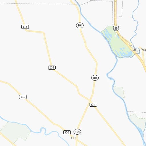
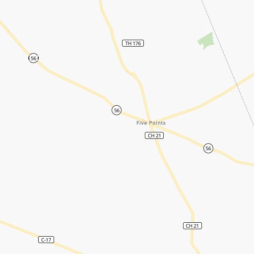
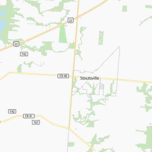
Roadmap (route) to go from Clarks Dream Strip to Muncie detailed above, you can also see the course layout on the map.
While doing trip Clarks Dream Strip - Muncie by car, the calculated route ends at a distance , or more straight.
Distance and duration of the route between Clarks Dream Strip and Muncie
Calculation of distance and route from Muncie to Clarks Dream Strip :
211.1246.5 km3h10mn
Continue 0h0mn 76 mTurn right onto McLean Mill Road 0h8mn 4.1 kmTurn right onto French Road 0h0mn 120 mTurn slight right onto SR 56 1h44mn 46.2 kmContinue onto North Main Street 0h8mn 7.8 kmTurn left 1h16mn 127.2 kmKeep right onto US 35 and take US 35 North toward Muncie 1h47mn 54.4 kmKeep left onto East 29th Street 0h3mn 2.8 kmKeep right 0h0mn 71 mTurn slight right onto South Madison Street 0h4mn 3.5 kmTurn left onto East Main Street 0h0mn 406 mTurn left onto South Walnut Street 0h0mn 32 mArrive at destination 0h0mn 0 m
Travel from Clarks Dream Strip (Indiana) to a selection of major cities.
Distances from Clarks Dream Strip to biggest cities in Ohio
- Mansfield,46,830 inhabitants.131 km
- Beavercreek,46,277 inhabitants.90 km
- Dublin,45,098 inhabitants.52 km
- Cleveland Heights,44,962 inhabitants.243 km
- Strongsville,44,668 inhabitants.211 km
- Fairfield,42,767 inhabitants.137 km
- Findlay,41,149 inhabitants.165 km
- Warren,40,245 inhabitants.257 km
- Lancaster,39,766 inhabitants.36 km
- Grove City,39,388 inhabitants.27 km
- Westerville,38,384 inhabitants.54 km
- Huber Heights,38,176 inhabitants.98 km
- Delaware,37,995 inhabitants.73 km
- Lima,37,873 inhabitants.154 km
- Reynoldsburg,37,158 inhabitants.39 km
- Marion,36,363 inhabitants.106 km
- Boardman,35,376 inhabitants.252 km
- Upper Arlington,34,907 inhabitants.39 km
- Stow,34,797 inhabitants.215 km
- Brunswick,34,689 inhabitants.204 km
Other major cities in country :
- Seattle [WA], 684,451 inhabitants. 3,252 km
- Denver [CO], 682,545 inhabitants. 1,877 km
- El Paso [TX], 681,124 inhabitants. 2,288 km
- Detroit [MI], 677,116 inhabitants. 299 km
- Boston [MA], 667,137 inhabitants. 1,048 km
- Memphis [TN], 655,770 inhabitants. 798 km
- New South Memphis [TN], 641,608 inhabitants. 803 km
- Portland [OR], 632,309 inhabitants. 3,281 km
- Oklahoma City [OK], 631,346 inhabitants. 1,360 km
- Las Vegas [NV], 623,747 inhabitants. 2,832 km
- Baltimore [MD], 621,849 inhabitants. 552 km
- Washington, D.C. [DC], 601,723 inhabitants. 522 km
- Milwaukee [WI], 600,155 inhabitants. 557 km
- South Boston [MA], 571,281 inhabitants. 1,048 km
- Albuquerque [NM], 559,121 inhabitants. 2,145 km
- Tucson [AZ], 531,641 inhabitants. 2,635 km
- Nashville [TN], 530,852 inhabitants. 509 km
- Fresno [CA], 520,052 inhabitants. 3,209 km
- Sacramento [CA], 490,712 inhabitants. 3,300 km
- Kansas City [MO], 475,378 inhabitants. 996 km
Route from Muncie to major cities (United States).
- Distance Muncie New York City965 km
- Distance Muncie Los Angeles2,977 km
- Distance Muncie Chicago265 km
- Distance Muncie Brooklyn970 km
- Distance Muncie Houston1,473 km
- Distance Muncie Queens979 km
- Distance Muncie Philadelphia871 km
- Distance Muncie Phoenix2,483 km
- Distance Muncie Manhattan968 km
- Distance Muncie San Antonio1,691 km
- Distance Muncie San Diego2,947 km
- Distance Muncie The Bronx977 km
- Distance Muncie Dallas1,312 km
- Distance Muncie San Jose3,162 km
- Distance Muncie Austin1,573 km
- Distance Muncie Jacksonville1,149 km
- Distance Muncie San Francisco3,193 km
- Distance Muncie Columbus205 km
- Distance Muncie Fort Worth1,352 km
- Distance Muncie Charlotte682 km
Nearest cities to Clarks Dream Strip :
- Columbus, 850,106 inhabitants. 35 km
- Detroit, 677,116 inhabitants. 299 km
- Cleveland, 388,072 inhabitants. 235 km
- Lexington-Fayette, 314,488 inhabitants. 217 km
- Cincinnati, 296,943 inhabitants. 141 km
- Meads, 288,649 inhabitants. 139 km
- Ironville, 288,649 inhabitants. 135 km
- Toledo, 279,789 inhabitants. 230 km
- Fort Wayne, 260,326 inhabitants. 244 km
- Louisville, 243,639 inhabitants. 283 km
- Lexington, 225,366 inhabitants. 224 km
- Akron, 197,542 inhabitants. 204 km
- Dayton, 140,599 inhabitants. 102 km
- Warren, 134,056 inhabitants. 317 km
- Sterling Heights, 132,052 inhabitants. 327 km
- Ann Arbor, 117,070 inhabitants. 300 km
- Clinton Township, 99,753 inhabitants. 328 km
- Erie, 99,475 inhabitants. 371 km
- Dearborn, 95,171 inhabitants. 299 km
- Livonia, 94,635 inhabitants. 305 km
- Canton, 86,825 inhabitants. 299 km
- Troy, 83,280 inhabitants. 330 km
- Westland, 82,000 inhabitants. 300 km
- Farmington Hills, 81,330 inhabitants. 318 km
- Parma, 79,937 inhabitants. 225 km
- Fishers, 76,794 inhabitants. 259 km
- Kalamazoo, 76,041 inhabitants. 366 km
- Southfield, 73,156 inhabitants. 316 km
- Canton, 71,885 inhabitants. 190 km
- Muncie, 70,087 inhabitants. 212 km
- West Bloomfield Township, 64,690 inhabitants. 327 km
- Youngstown, 64,628 inhabitants. 258 km
- Lorain, 63,647 inhabitants. 213 km
- Hamilton, 62,407 inhabitants. 136 km
- Taylor, 61,568 inhabitants. 290 km
- Pontiac, 59,917 inhabitants. 334 km
- Saint Clair Shores, 59,715 inhabitants. 318 km
- Springfield, 59,680 inhabitants. 75 km
- Noblesville, 59,093 inhabitants. 260 km
- Royal Oak, 59,008 inhabitants. 317 km
- Novi, 58,723 inhabitants. 318 km
- Dearborn Heights, 56,145 inhabitants. 301 km
- Kettering, 55,525 inhabitants. 99 km
- Anderson, 55,305 inhabitants. 233 km
- Elyria, 53,775 inhabitants. 207 km
- Elkhart, 52,348 inhabitants. 338 km
- Battle Creek, 51,589 inhabitants. 349 km
- Lakewood, 50,656 inhabitants. 229 km
- Redford, 49,936 inhabitants. 306 km
- Charleston, 49,736 inhabitants. 187 km
Location Clarks Dream Strip (Ohio) :
| Country flag |  |
| Location | Clarks Dream Strip |
| State | Ohio |
| County | Pickaway County |
| Country | United States |
| Country code / ISO 2 | US |
| Latitude | 39.6428300 |
| Longitude | -83.0151800 |
| Altitude | 207 meters |
| Time zone | America/New_York |
Location Muncie (Indiana) :
| Country flag | |
| Location | Muncie |
| State | Indiana |
| County | Delaware County |
| Country | United States |
| Country code / ISO 2 | US |
| Latitude | 40.1933800 |
| Longitude | -85.3863600 |
| Altitude | 284 meters |
| Time zone | America/Indiana/Indianapolis |


