

How to get from Camstra (airport) (Ohio) to Fort Wayne (Indiana)
Calculate route from Camstra (airport) (Ohio, United States) to Fort Wayne (Indiana, United States).
The flight distance (as the crow flies) between Camstra (airport) and Fort Wayne is 208.6 km.
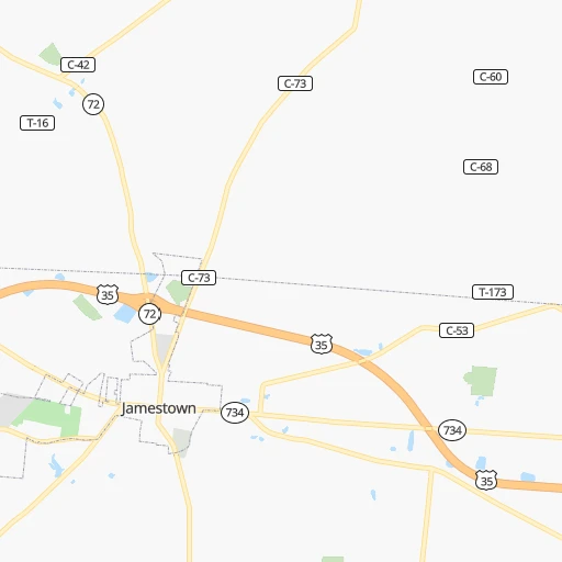
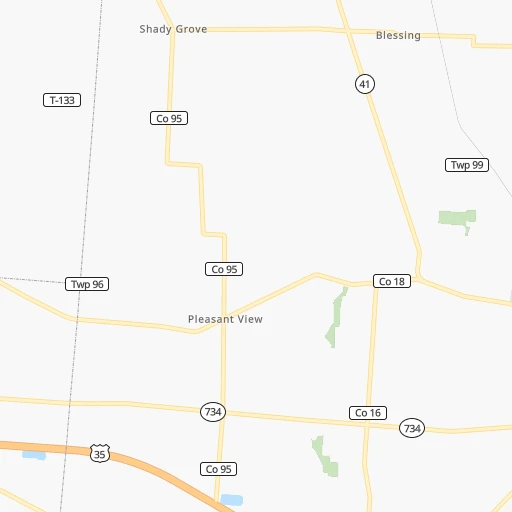
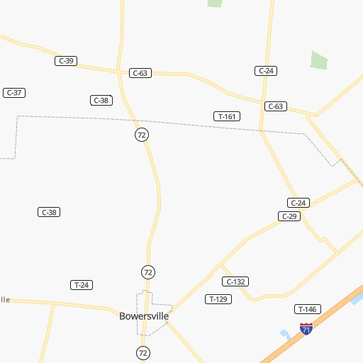
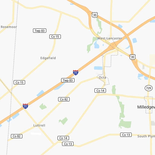
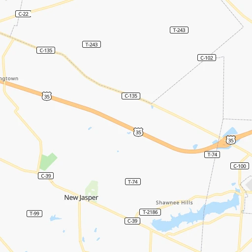
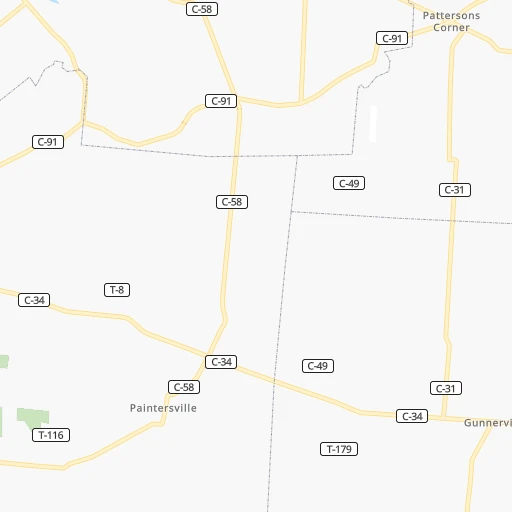
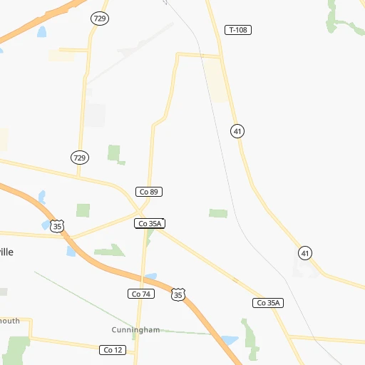
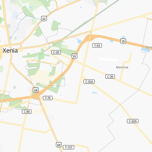
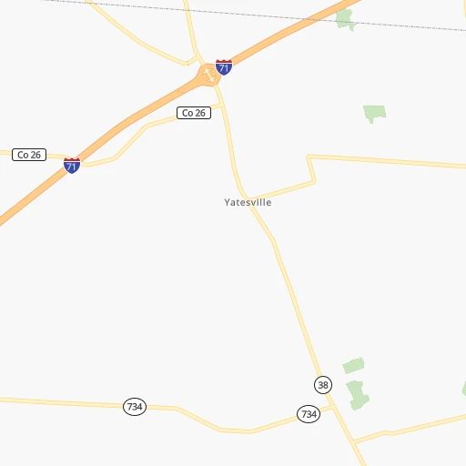
Roadmap (route) to go from Camstra Airport to Fort Wayne detailed above, you can also see the course layout on the map.
While doing trip Camstra (airport) - Fort Wayne by car, the calculated route ends at a distance , or more straight.
Distance and duration of the route between Camstra (airport) and Fort Wayne
Calculation of distance and route from Fort Wayne to Camstra (airport) :
208.6242.6 km4h33mn
Continue onto US 35 0h0mn 653 mKeep right onto SR 435 and take SR 435 toward Columbus, Cincinnati 0h1mn 1.2 kmTurn left onto Old United States Highway 35 0h0mn 22 mTurn left onto SR 435 0h15mn 24.7 kmKeep right onto US 35 Business 0h0mn 380 mTurn right onto North Bickett Road 0h3mn 2.3 kmTurn right onto US 42 0h0mn 200 mTurn sharp left onto Brush Row Road 0h7mn 5.8 kmTurn right onto US 68 0h1mn 923 mTurn left onto SR 235 0h10mn 10.7 kmTurn right and take I 675 North toward Columbus 0h4mn 6.6 kmContinue onto Spangler Road 0h6mn 7.4 kmTurn left onto Milton Carlisle Road 0h9mn 11.7 kmTurn sharp right onto State Route 202 0h6mn 8.6 kmTurn left onto SR 41 0h3mn 2.8 kmKeep left 0h0mn 7 mAt roundabout, take exit 2 onto Public Square 0h0mn 77 mTurn right onto West Main Street 0h1mn 733 mTurn right onto North Elm Street 0h10mn 12.7 kmTurn left onto Riverside Drive 1h46mn 48.5 kmTurn left onto Indiana Avenue 0h23mn 26.8 kmTurn right onto South Main Street 0h1mn 833 mTurn left onto West Bridge Street 0h12mn 13.7 kmTurn left onto Walcott Street 0h0mn 341 mTurn right onto Decatur Road 0h10mn 10.6 kmTurn right onto Mercer Avenue 0h7mn 6.1 kmTurn right onto US 27, US 33 0h22mn 24.3 kmTurn right onto South Anthony Boulevard 0h10mn 10.2 kmTurn slight right onto North Anthony Boulevard 0h1mn 1.0 kmTurn sharp left onto East Coliseum Boulevard 0h1mn 1.0 kmTurn right onto Parnell Avenue 0h0mn 275 mContinue onto Parnell Avenue and drive toward North Clinton Street 0h1mn 487 mTurn left onto Wakefield Avenue 0h0mn 72 mTurn right onto Riviera Drive 0h1mn 572 mTurn left onto Catalina Avenue 0h0mn 194 mTurn right onto Dartmouth Drive 0h0mn 133 mArrive at destination 0h0mn 0 m
Travel from Camstra (airport) (Indiana) to a selection of major cities.
Distances from Camstra Airport to biggest cities in Ohio
- Mansfield,46,830 inhabitants.157 km
- Beavercreek,46,277 inhabitants.38 km
- Dublin,45,098 inhabitants.68 km
- Cleveland Heights,44,962 inhabitants.273 km
- Strongsville,44,668 inhabitants.241 km
- Fairfield,42,767 inhabitants.86 km
- Findlay,41,149 inhabitants.156 km
- Warren,40,245 inhabitants.297 km
- Lancaster,39,766 inhabitants.89 km
- Grove City,39,388 inhabitants.53 km
- Westerville,38,384 inhabitants.81 km
- Huber Heights,38,176 inhabitants.48 km
- Delaware,37,995 inhabitants.88 km
- Lima,37,873 inhabitants.129 km
- Reynoldsburg,37,158 inhabitants.78 km
- Marion,36,363 inhabitants.114 km
- Boardman,35,376 inhabitants.295 km
- Upper Arlington,34,907 inhabitants.63 km
- Stow,34,797 inhabitants.251 km
- Brunswick,34,689 inhabitants.234 km
Other major cities in country :
- Seattle [WA], 684,451 inhabitants. 3,205 km
- Denver [CO], 682,545 inhabitants. 1,825 km
- El Paso [TX], 681,124 inhabitants. 2,236 km
- Detroit [MI], 677,116 inhabitants. 304 km
- Boston [MA], 667,137 inhabitants. 1,098 km
- Memphis [TN], 655,770 inhabitants. 756 km
- New South Memphis [TN], 641,608 inhabitants. 761 km
- Portland [OR], 632,309 inhabitants. 3,233 km
- Oklahoma City [OK], 631,346 inhabitants. 1,309 km
- Las Vegas [NV], 623,747 inhabitants. 2,779 km
- Baltimore [MD], 621,849 inhabitants. 604 km
- Washington, D.C. [DC], 601,723 inhabitants. 574 km
- Milwaukee [WI], 600,155 inhabitants. 520 km
- South Boston [MA], 571,281 inhabitants. 1,098 km
- Albuquerque [NM], 559,121 inhabitants. 2,092 km
- Tucson [AZ], 531,641 inhabitants. 2,583 km
- Nashville [TN], 530,852 inhabitants. 475 km
- Fresno [CA], 520,052 inhabitants. 3,157 km
- Sacramento [CA], 490,712 inhabitants. 3,248 km
- Kansas City [MO], 475,378 inhabitants. 943 km
Route from Fort Wayne to major cities (United States).
- Distance Fort Wayne New York City936 km
- Distance Fort Wayne Los Angeles3,005 km
- Distance Fort Wayne Chicago225 km
- Distance Fort Wayne Brooklyn942 km
- Distance Fort Wayne Houston1,567 km
- Distance Fort Wayne Queens951 km
- Distance Fort Wayne Philadelphia853 km
- Distance Fort Wayne Phoenix2,523 km
- Distance Fort Wayne Manhattan939 km
- Distance Fort Wayne San Antonio1,777 km
- Distance Fort Wayne San Diego2,981 km
- Distance Fort Wayne The Bronx946 km
- Distance Fort Wayne Dallas1,391 km
- Distance Fort Wayne San Jose3,174 km
- Distance Fort Wayne Austin1,659 km
- Distance Fort Wayne Jacksonville1,242 km
- Distance Fort Wayne San Francisco3,202 km
- Distance Fort Wayne Columbus222 km
- Distance Fort Wayne Fort Worth1,430 km
- Distance Fort Wayne Charlotte756 km
Nearest cities to Camstra (airport) :
- Columbus, 850,106 inhabitants. 65 km
- Indianapolis, 829,718 inhabitants. 217 km
- Detroit, 677,116 inhabitants. 304 km
- Cleveland, 388,072 inhabitants. 264 km
- Lexington-Fayette, 314,488 inhabitants. 191 km
- Cincinnati, 296,943 inhabitants. 95 km
- Meads, 288,649 inhabitants. 158 km
- Ironville, 288,649 inhabitants. 155 km
- Toledo, 279,789 inhabitants. 226 km
- Fort Wayne, 260,326 inhabitants. 209 km
- Louisville, 243,639 inhabitants. 240 km
- Lexington, 225,366 inhabitants. 198 km
- Akron, 197,542 inhabitants. 241 km
- Dayton, 140,599 inhabitants. 50 km
- Warren, 134,056 inhabitants. 322 km
- Sterling Heights, 132,052 inhabitants. 331 km
- Ann Arbor, 117,070 inhabitants. 294 km
- South Bend, 101,516 inhabitants. 317 km
- Clinton Township, 99,753 inhabitants. 334 km
- Dearborn, 95,171 inhabitants. 301 km
- Livonia, 94,635 inhabitants. 305 km
- Carmel, 88,713 inhabitants. 216 km
- Canton, 86,825 inhabitants. 297 km
- Bloomington, 84,067 inhabitants. 254 km
- Troy, 83,280 inhabitants. 333 km
- Westland, 82,000 inhabitants. 300 km
- Farmington Hills, 81,330 inhabitants. 318 km
- Parma, 79,937 inhabitants. 254 km
- Fishers, 76,794 inhabitants. 207 km
- Kalamazoo, 76,041 inhabitants. 338 km
- Southfield, 73,156 inhabitants. 317 km
- Canton, 71,885 inhabitants. 231 km
- Muncie, 70,087 inhabitants. 162 km
- West Bloomfield Township, 64,690 inhabitants. 327 km
- Youngstown, 64,628 inhabitants. 301 km
- Lorain, 63,647 inhabitants. 236 km
- Bowling Green, 63,616 inhabitants. 384 km
- Hamilton, 62,407 inhabitants. 84 km
- Taylor, 61,568 inhabitants. 291 km
- Pontiac, 59,917 inhabitants. 335 km
- Saint Clair Shores, 59,715 inhabitants. 324 km
- Springfield, 59,680 inhabitants. 35 km
- Noblesville, 59,093 inhabitants. 208 km
- Royal Oak, 59,008 inhabitants. 320 km
- Novi, 58,723 inhabitants. 317 km
- Kokomo, 57,995 inhabitants. 233 km
- Dearborn Heights, 56,145 inhabitants. 302 km
- Greenwood, 55,586 inhabitants. 212 km
- Kettering, 55,525 inhabitants. 46 km
- Anderson, 55,305 inhabitants. 182 km
Location Camstra (airport) (Ohio) :
| Country flag |  |
| Location | Camstra (airport) |
| State | Ohio |
| County | Fayette County |
| Country | United States |
| Country code / ISO 2 | US |
| Latitude | 39.6389500 |
| Longitude | -83.6324200 |
| Altitude | 324 meters |
| Time zone | America/New_York |
Location Fort Wayne (Indiana) :
| Country flag | |
| Location | Fort Wayne |
| State | Indiana |
| County | Allen County |
| Country | United States |
| Country code / ISO 2 | US |
| Latitude | 41.1306000 |
| Longitude | -85.1288600 |
| Altitude | 247 meters |
| Time zone | America/Indiana/Indianapolis |


