
How to get from McGinnis Landing Strip (New Jersey) to Jackson (New Jersey)
Calculate route from McGinnis Landing Strip (New Jersey, United States) to Jackson (New Jersey, United States).
The flight distance (as the crow flies) between McGinnis Landing Strip and Jackson is 49.8 km.
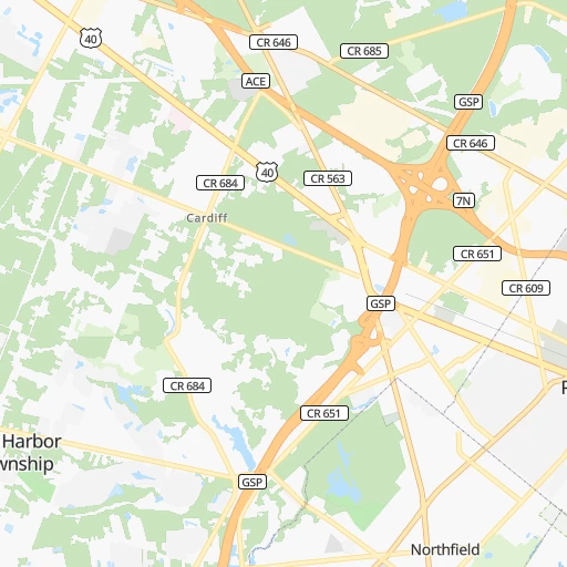
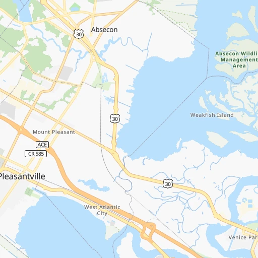
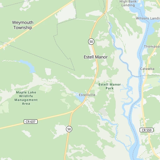
Roadmap (route) to go from McGinnis Landing Strip to Jackson detailed above, you can also see the course layout on the map.
While doing trip McGinnis Landing Strip - Jackson by car, the calculated route ends at a distance , or more straight.
Distance and duration of the route between McGinnis Landing Strip and Jackson
Calculation of distance and route from Jackson to McGinnis Landing Strip :
49.856.8 km1h52mn
Continue onto Oyster Bay Road 0h3mn 332 mTurn left onto West California Avenue 0h0mn 278 mTurn left onto South New Road 0h2mn 1.6 kmTurn left onto Absecon Boulevard 1h44mn 51.5 kmKeep right 0h0mn 57 mTurn slight right onto Auburn Avenue 0h0mn 86 mTurn left onto Carl Hasselhan Drive 0h0mn 150 mTurn right onto Atco Avenue 0h2mn 2.2 kmTurn slight right onto Jackson Road 0h1mn 636 mArrive at destination 0h0mn 0 m
Travel from McGinnis Landing Strip (New Jersey) to a selection of major cities.
Distances from McGinnis Landing Strip to biggest cities in New Jersey
- Union,56,771 inhabitants.144 km
- Piscataway,56,044 inhabitants.121 km
- Jackson,54,856 inhabitants.50 km
- Lakewood,53,805 inhabitants.80 km
- Hoboken,53,635 inhabitants.153 km
- West New York,53,366 inhabitants.158 km
- Perth Amboy,52,682 inhabitants.123 km
- Plainfield,51,217 inhabitants.136 km
- Parsippany,51,144 inhabitants.160 km
- Bloomfield,49,120 inhabitants.157 km
- East Brunswick,48,495 inhabitants.113 km
- West Orange,48,131 inhabitants.155 km
- Sayreville,44,920 inhabitants.117 km
- Hackensack,44,834 inhabitants.168 km
- Bridgewater,44,464 inhabitants.132 km
- Sicklerville,42,891 inhabitants.51 km
- Sayreville Junction,42,890 inhabitants.118 km
- Kearny,42,137 inhabitants.154 km
- Linden,42,021 inhabitants.136 km
- Mount Laurel,41,864 inhabitants.66 km
Other major cities in country :
- Charlotte [NC], 827,097 inhabitants. 729 km
- Seattle [WA], 684,451 inhabitants. 3,901 km
- Denver [CO], 682,545 inhabitants. 2,602 km
- El Paso [TX], 681,124 inhabitants. 3,000 km
- Detroit [MI], 677,116 inhabitants. 788 km
- Boston [MA], 667,137 inhabitants. 438 km
- Memphis [TN], 655,770 inhabitants. 1,453 km
- New South Memphis [TN], 641,608 inhabitants. 1,457 km
- Portland [OR], 632,309 inhabitants. 3,952 km
- Oklahoma City [OK], 631,346 inhabitants. 2,074 km
- Las Vegas [NV], 623,747 inhabitants. 3,561 km
- Baltimore [MD], 621,849 inhabitants. 181 km
- Washington, D.C. [DC], 601,723 inhabitants. 225 km
- Milwaukee [WI], 600,155 inhabitants. 1,190 km
- South Boston [MA], 571,281 inhabitants. 436 km
- Albuquerque [NM], 559,121 inhabitants. 2,873 km
- Tucson [AZ], 531,641 inhabitants. 3,359 km
- Nashville [TN], 530,852 inhabitants. 1,137 km
- Fresno [CA], 520,052 inhabitants. 3,935 km
- Sacramento [CA], 490,712 inhabitants. 4,019 km
Route from Jackson to major cities (United States).
- Distance Jackson New York City127 km
- Distance Jackson Los Angeles3,875 km
- Distance Jackson Chicago1,101 km
- Distance Jackson Brooklyn124 km
- Distance Jackson Houston2,173 km
- Distance Jackson Queens133 km
- Distance Jackson Philadelphia32 km
- Distance Jackson Phoenix3,374 km
- Distance Jackson Manhattan135 km
- Distance Jackson San Antonio2,442 km
- Distance Jackson San Diego3,842 km
- Distance Jackson The Bronx146 km
- Distance Jackson Dallas2,111 km
- Distance Jackson San Jose4,056 km
- Distance Jackson Austin2,330 km
- Distance Jackson Jacksonville1,219 km
- Distance Jackson San Francisco4,084 km
- Distance Jackson Columbus695 km
- Distance Jackson Fort Worth2,156 km
- Distance Jackson Indianapolis966 km
Nearest cities to McGinnis Landing Strip :
- New York City, 8,175,133 inhabitants. 151 km
- Brooklyn, 2,300,664 inhabitants. 145 km
- Queens, 2,272,771 inhabitants. 152 km
- Philadelphia, 1,567,442 inhabitants. 82 km
- Manhattan, 1,487,536 inhabitants. 159 km
- The Bronx, 1,385,108 inhabitants. 169 km
- Baltimore, 621,849 inhabitants. 181 km
- Washington, D.C., 601,723 inhabitants. 225 km
- Staten Island, 468,730 inhabitants. 131 km
- Virginia Beach, 452,745 inhabitants. 313 km
- Newark, 281,944 inhabitants. 150 km
- Jersey City, 264,290 inhabitants. 151 km
- Norfolk, 246,393 inhabitants. 326 km
- Chesapeake, 235,429 inhabitants. 328 km
- Richmond, 220,289 inhabitants. 330 km
- Jamaica, 216,866 inhabitants. 154 km
- Arlington, 207,627 inhabitants. 232 km
- Yonkers, 201,116 inhabitants. 176 km
- Worcester, 184,815 inhabitants. 390 km
- Newport News, 182,385 inhabitants. 311 km
- Harlem, 181,259 inhabitants. 162 km
- East Flatbush, 178,464 inhabitants. 146 km
- East New York, 173,198 inhabitants. 149 km
- Springfield, 154,341 inhabitants. 340 km
- Alexandria, 153,511 inhabitants. 229 km
- Washington Heights, 152,613 inhabitants. 167 km
- Astoria, 150,165 inhabitants. 159 km
- Borough Park, 149,248 inhabitants. 142 km
- East Hampton, 147,993 inhabitants. 309 km
- Paterson, 147,754 inhabitants. 169 km
- Bridgeport, 147,629 inhabitants. 224 km
- Hampton, 136,454 inhabitants. 310 km
- New Haven, 130,322 inhabitants. 250 km
- Elizabeth, 129,007 inhabitants. 141 km
- Stamford, 128,874 inhabitants. 200 km
- Sunset Park, 126,000 inhabitants. 143 km
- Hartford, 124,006 inhabitants. 303 km
- Sheepshead Bay, 122,534 inhabitants. 139 km
- North Stamford, 121,230 inhabitants. 208 km
- Allentown, 120,207 inhabitants. 157 km
- East Harlem, 115,921 inhabitants. 161 km
- Elmhurst, 113,364 inhabitants. 156 km
- Bushwick, 112,620 inhabitants. 151 km
- Gravesend, 112,229 inhabitants. 139 km
- Corona, 109,698 inhabitants. 158 km
- Waterbury, 108,802 inhabitants. 268 km
- Edison, 102,548 inhabitants. 123 km
- Columbia, 99,615 inhabitants. 201 km
- Portsmouth Heights, 99,049 inhabitants. 332 km
- Richmond Hill, 98,984 inhabitants. 154 km
Location McGinnis Landing Strip (New Jersey) :
| Country flag |  |
| Location | McGinnis Landing Strip |
| State | New Jersey |
| County | Atlantic County |
| Country | United States |
| Country code / ISO 2 | US |
| Latitude | 39.4178900 |
| Longitude | -74.5132100 |
| Altitude | 3 meters |
| Time zone | America/New_York |
Location Jackson (New Jersey) :
| Country flag | |
| Location | Jackson |
| State | New Jersey |
| County | Camden County |
| Country | United States |
| Country code / ISO 2 | US |
| Latitude | 39.7765000 |
| Longitude | -74.8623800 |
| Altitude | 37 meters |
| Time zone | America/New_York |
