

How to get from Ferebee Landing Strip (North Carolina) to Greenville (North Carolina)
Calculate route from Ferebee Landing Strip (North Carolina, United States) to Greenville (North Carolina, United States).
The flight distance (as the crow flies) between Ferebee Landing Strip and Greenville is 144.5 km.
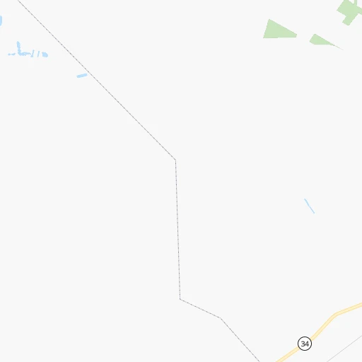
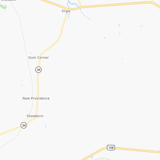
Roadmap (route) to go from Ferebee Landing Strip to Greenville detailed above, you can also see the course layout on the map.
While doing trip Ferebee Landing Strip - Greenville by car, the calculated route ends at a distance , or more straight.
Distance and duration of the route between Ferebee Landing Strip and Greenville
Calculation of distance and route from Greenville to Ferebee Landing Strip :
144.5164.4 km2h14mn
Continue 0h0mn 150 mTurn right onto North Indiantown Road 0h0mn 219 mTurn left onto State Road 1205 0h0mn 156 mTurn slight left onto Shawboro Road 0h9mn 8.9 kmTurn right onto US 158 0h7mn 8.7 kmTurn left onto North Water Street 0h0mn 375 mKeep right 0h0mn 130 mTurn slight right onto East Ehringhaus Street 0h3mn 3.0 kmTurn sharp left onto South Hughes Boulevard 1h47mn 65.5 kmTurn left onto US 17 0h9mn 11.0 kmTurn left onto East Water Street 0h2mn 1.7 kmTurn left onto US 13, US 17 0h15mn 19.5 kmTurn right onto East Boulevard 0h1mn 1.2 kmTurn left onto Washington Street 0h2mn 2.1 kmTurn right onto Bear Grass Road 0h14mn 12.4 kmTurn right onto Bear Grass Road 0h2mn 2.5 kmTurn right onto Beargrass Road 0h5mn 7.3 kmContinue onto NC 903 0h10mn 12.4 kmTurn left onto North Memorial Drive 0h2mn 2.4 kmTurn left onto North Greene Street 0h3mn 3.7 kmTurn left onto West 1st Street 0h1mn 872 mTurn right onto South Summit Street 0h0mn 137 mArrive at destination 0h0mn 0 m
Travel from Ferebee Landing Strip (North Carolina) to a selection of major cities.
Distances from Ferebee Landing Strip to biggest cities in North Carolina
- Kannapolis,46,144 inhabitants.421 km
- Apex,45,585 inhabitants.259 km
- Hickory,40,374 inhabitants.478 km
- Wake Forest,38,199 inhabitants.223 km
- Indian Trail,37,073 inhabitants.439 km
- Mooresville,36,009 inhabitants.435 km
- Goldsboro,35,826 inhabitants.206 km
- Monroe,34,623 inhabitants.433 km
- Salisbury,34,017 inhabitants.403 km
- Holly Springs,31,377 inhabitants.261 km
- Matthews,30,678 inhabitants.442 km
- New Bern,30,070 inhabitants.168 km
- Fort Bragg,29,183 inhabitants.299 km
- Sanford,29,144 inhabitants.297 km
- Cornelius,28,092 inhabitants.442 km
- Garner,28,053 inhabitants.240 km
- Thomasville,27,061 inhabitants.364 km
- Statesville,26,221 inhabitants.437 km
- Asheboro,26,103 inhabitants.344 km
- Mint Hill,25,627 inhabitants.434 km
Other major cities in country :
- Seattle [WA], 684,451 inhabitants. 3,958 km
- Denver [CO], 682,545 inhabitants. 2,548 km
- El Paso [TX], 681,124 inhabitants. 2,838 km
- Detroit [MI], 677,116 inhabitants. 891 km
- Boston [MA], 667,137 inhabitants. 791 km
- Memphis [TN], 655,770 inhabitants. 1,267 km
- New South Memphis [TN], 641,608 inhabitants. 1,269 km
- Portland [OR], 632,309 inhabitants. 3,986 km
- Oklahoma City [OK], 631,346 inhabitants. 1,930 km
- Las Vegas [NV], 623,747 inhabitants. 3,479 km
- Baltimore [MD], 621,849 inhabitants. 325 km
- Washington, D.C. [DC], 601,723 inhabitants. 290 km
- Milwaukee [WI], 600,155 inhabitants. 1,251 km
- South Boston [MA], 571,281 inhabitants. 790 km
- Albuquerque [NM], 559,121 inhabitants. 2,754 km
- Tucson [AZ], 531,641 inhabitants. 3,219 km
- Nashville [TN], 530,852 inhabitants. 960 km
- Fresno [CA], 520,052 inhabitants. 3,871 km
- Sacramento [CA], 490,712 inhabitants. 3,977 km
- Kansas City [MO], 475,378 inhabitants. 1,652 km
Route from Greenville to major cities (United States).
- Distance Greenville New York City639 km
- Distance Greenville Los Angeles3,712 km
- Distance Greenville Chicago1,130 km
- Distance Greenville Brooklyn635 km
- Distance Greenville Houston1,804 km
- Distance Greenville Queens643 km
- Distance Greenville Philadelphia520 km
- Distance Greenville Phoenix3,176 km
- Distance Greenville Manhattan648 km
- Distance Greenville San Antonio2,094 km
- Distance Greenville San Diego3,655 km
- Distance Greenville The Bronx658 km
- Distance Greenville Dallas1,814 km
- Distance Greenville San Jose3,953 km
- Distance Greenville Austin1,990 km
- Distance Greenville Jacksonville711 km
- Distance Greenville San Francisco3,990 km
- Distance Greenville Columbus692 km
- Distance Greenville Fort Worth1,862 km
- Distance Greenville Indianapolis901 km
Nearest cities to Ferebee Landing Strip :
- Baltimore, 621,849 inhabitants. 325 km
- Washington, D.C., 601,723 inhabitants. 290 km
- Virginia Beach, 452,745 inhabitants. 51 km
- Raleigh, 451,066 inhabitants. 240 km
- West Raleigh, 338,759 inhabitants. 242 km
- Durham, 257,636 inhabitants. 256 km
- Norfolk, 246,393 inhabitants. 53 km
- Chesapeake, 235,429 inhabitants. 49 km
- Richmond, 220,289 inhabitants. 177 km
- Arlington, 207,627 inhabitants. 290 km
- Fayetteville, 201,963 inhabitants. 293 km
- Newport News, 182,385 inhabitants. 83 km
- Cary, 159,769 inhabitants. 252 km
- Alexandria, 153,511 inhabitants. 281 km
- East Hampton, 147,993 inhabitants. 74 km
- Hampton, 136,454 inhabitants. 74 km
- Wilmington, 115,933 inhabitants. 295 km
- Columbia, 99,615 inhabitants. 323 km
- Portsmouth Heights, 99,049 inhabitants. 53 km
- Portsmouth, 96,201 inhabitants. 52 km
- Greenville, 90,597 inhabitants. 145 km
- Suffolk, 88,161 inhabitants. 57 km
- Germantown, 86,395 inhabitants. 326 km
- South Suffolk, 80,690 inhabitants. 57 km
- Silver Spring, 71,452 inhabitants. 300 km
- Centreville, 71,135 inhabitants. 296 km
- Waldorf, 67,752 inhabitants. 259 km
- Glen Burnie, 67,639 inhabitants. 311 km
- Gaithersburg, 67,456 inhabitants. 320 km
- Jacksonville, 67,357 inhabitants. 220 km
- Rockville, 66,980 inhabitants. 313 km
- Dale City, 65,969 inhabitants. 271 km
- Ellicott City, 65,834 inhabitants. 325 km
- Dundalk, 63,597 inhabitants. 319 km
- Bethesda, 60,858 inhabitants. 301 km
- Chapel Hill, 59,568 inhabitants. 272 km
- Reston, 58,404 inhabitants. 306 km
- Bowie, 58,025 inhabitants. 288 km
- Rocky Mount, 55,806 inhabitants. 161 km
- Towson, 55,197 inhabitants. 337 km
- Harrisonburg, 52,538 inhabitants. 335 km
- Leesburg, 51,209 inhabitants. 329 km
- Wilson, 49,643 inhabitants. 181 km
- Aspen Hill, 48,759 inhabitants. 310 km
- Wheaton, 48,284 inhabitants. 306 km
- McLean, 48,115 inhabitants. 298 km
- Charlottesville, 46,597 inhabitants. 279 km
- Apex, 45,585 inhabitants. 259 km
- Tuckahoe, 44,990 inhabitants. 186 km
- Potomac, 44,965 inhabitants. 307 km
Location Ferebee Landing Strip (North Carolina) :
| Country flag |  |
| Location | Ferebee Landing Strip |
| State | North Carolina |
| County | Currituck County |
| Country | United States |
| Country code / ISO 2 | US |
| Latitude | 36.4021000 |
| Longitude | -76.0885400 |
| Altitude | 3 meters |
| Time zone | America/New_York |
Location Greenville (North Carolina) :
| Country flag | |
| Location | Greenville |
| State | North Carolina |
| County | Pitt County |
| Country | United States |
| Country code / ISO 2 | US |
| Latitude | 35.6126600 |
| Longitude | -77.3663500 |
| Altitude | 18 meters |
| Time zone | America/New_York |


