
Home
››
Golden Triangle Regional Airport
››
Roadmap from Golden Triangle Regional Airport to Columbia
How to get from Golden Triangle Regional (airport) (Mississippi) to Columbia (Tennessee)
Calculate route from Golden Triangle Regional (airport) (Mississippi, United States) to Columbia (Tennessee, United States).
The flight distance (as the crow flies) between Golden Triangle Regional (airport) and Columbia is 279.6 km.
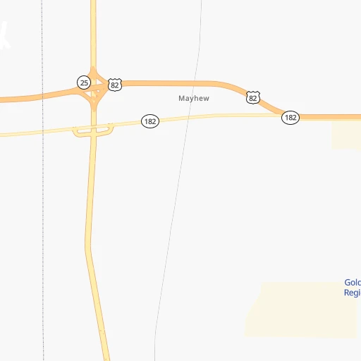
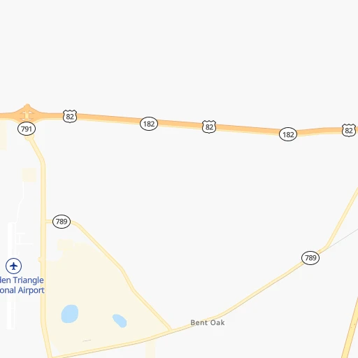
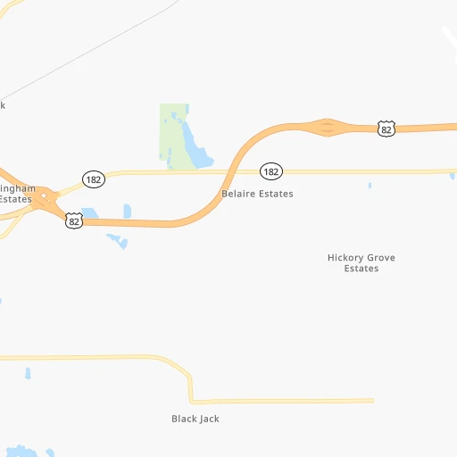
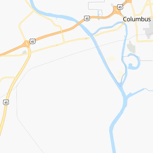
Roadmap (route) to go from Golden Triangle Regional Airport to Columbia detailed above, you can also see the course layout on the map.
While doing trip Golden Triangle Regional (airport) - Columbia by car, the calculated route ends at a distance , or more straight.
Distance and duration of the route between Golden Triangle Regional (airport) and Columbia
Calculation of distance and route from Columbia to Golden Triangle Regional (airport) :
279.6326.5 km5h37mn
Continue onto Billups Gate Road 0h3mn 1.6 kmContinue onto Raymond Road 0h1mn 694 mTurn right onto Ford Drive 0h3mn 1.3 kmTurn left onto Airport Road 0h1mn 1.0 kmKeep right 0h11mn 17.8 kmKeep right 0h0mn 232 mKeep left 0h0mn 37 mAt roundabout, take exit 3 onto Military Road 0h0mn 233 mAt roundabout, take exit 1 onto Military Road 0h7mn 7.5 kmTurn left onto Military Road 0h28mn 35.4 kmTurn left onto Pond Street 1h44mn 55.3 kmTurn left onto Military Street South 1h33mn 38.7 kmTurn left onto Andrew Jackson Highway 1h37mn 43.4 kmTurn slight right onto Woodward Avenue 0h1mn 1.5 kmKeep right onto US 43, US 72, AL 13, AL 17, AL 20 0h0mn 148 mTurn slight right onto Woodward Avenue 0h3mn 2.8 kmKeep right onto US 43, US 72, AL 13, AL 17 0h11mn 13.0 kmKeep left onto US 43, AL 13 and take US 43 North, AL 13 North toward Lawrenceburg 1h11mn 84.1 kmKeep right toward 243 0h0mn 105 mTurn slight right onto South Main Street 0h22mn 21.6 kmArrive at destination 0h0mn 0 m
Travel from Golden Triangle Regional (airport) (Tennessee) to a selection of major cities.
Distances from Golden Triangle Regional Airport to biggest cities in Mississippi
- Pascagoula,22,126 inhabitants.343 km
Other major cities in country :
- Charlotte [NC], 827,097 inhabitants. 739 km
- Seattle [WA], 684,451 inhabitants. 3,225 km
- Denver [CO], 682,545 inhabitants. 1,620 km
- El Paso [TX], 681,124 inhabitants. 1,687 km
- Detroit [MI], 677,116 inhabitants. 1,102 km
- Boston [MA], 667,137 inhabitants. 1,826 km
- Memphis [TN], 655,770 inhabitants. 232 km
- New South Memphis [TN], 641,608 inhabitants. 227 km
- Portland [OR], 632,309 inhabitants. 3,191 km
- Oklahoma City [OK], 631,346 inhabitants. 849 km
- Las Vegas [NV], 623,747 inhabitants. 2,437 km
- Baltimore [MD], 621,849 inhabitants. 1,254 km
- Washington, D.C. [DC], 601,723 inhabitants. 1,201 km
- Milwaukee [WI], 600,155 inhabitants. 1,069 km
- South Boston [MA], 571,281 inhabitants. 1,825 km
- Albuquerque [NM], 559,121 inhabitants. 1,669 km
- Tucson [AZ], 531,641 inhabitants. 2,090 km
- Nashville [TN], 530,852 inhabitants. 344 km
- Fresno [CA], 520,052 inhabitants. 2,851 km
- Sacramento [CA], 490,712 inhabitants. 3,001 km
Route from Columbia to major cities (United States).
- Distance Columbia New York City1,272 km
- Distance Columbia Los Angeles2,845 km
- Distance Columbia Chicago696 km
- Distance Columbia Brooklyn1,274 km
- Distance Columbia Houston1,016 km
- Distance Columbia Queens1,284 km
- Distance Columbia Philadelphia1,149 km
- Distance Columbia Phoenix2,303 km
- Distance Columbia Manhattan1,278 km
- Distance Columbia San Antonio1,276 km
- Distance Columbia San Diego2,783 km
- Distance Columbia The Bronx1,289 km
- Distance Columbia Dallas953 km
- Distance Columbia San Jose3,109 km
- Distance Columbia Austin1,163 km
- Distance Columbia Jacksonville773 km
- Distance Columbia San Francisco3,149 km
- Distance Columbia Columbus600 km
- Distance Columbia Fort Worth1,000 km
- Distance Columbia Indianapolis469 km
Nearest cities to Golden Triangle Regional (airport) :
- Memphis, 655,770 inhabitants. 232 km
- New South Memphis, 641,608 inhabitants. 227 km
- Nashville, 530,852 inhabitants. 344 km
- Baton Rouge, 228,590 inhabitants. 412 km
- Birmingham, 212,461 inhabitants. 166 km
- Montgomery, 200,602 inhabitants. 246 km
- Mobile, 194,288 inhabitants. 311 km
- Huntsville, 190,582 inhabitants. 233 km
- Jackson, 170,674 inhabitants. 197 km
- Murfreesboro, 126,118 inhabitants. 334 km
- Tuscaloosa, 98,332 inhabitants. 99 km
- Hoover, 84,848 inhabitants. 165 km
- Jonesboro, 73,907 inhabitants. 329 km
- Franklin, 72,639 inhabitants. 317 km
- Jackson, 66,975 inhabitants. 242 km
- Bartlett, 58,579 inhabitants. 228 km
- Hendersonville, 56,018 inhabitants. 365 km
- Decatur, 55,437 inhabitants. 196 km
- Southaven, 52,589 inhabitants. 216 km
- Collierville, 48,863 inhabitants. 203 km
- Madison, 46,962 inhabitants. 220 km
- Hattiesburg, 46,805 inhabitants. 245 km
- Smyrna, 46,607 inhabitants. 340 km
- Brentwood, 41,763 inhabitants. 332 km
- Florence, 40,026 inhabitants. 172 km
- Meridian, 39,661 inhabitants. 121 km
- Germantown, 39,240 inhabitants. 214 km
- Columbia, 36,800 inhabitants. 280 km
- Gadsden, 36,084 inhabitants. 247 km
- Spring Hill, 36,055 inhabitants. 298 km
- Olive Branch, 36,010 inhabitants. 203 km
- East Florence, 35,733 inhabitants. 174 km
- Tupelo, 35,680 inhabitants. 91 km
- Prattville, 35,420 inhabitants. 227 km
- La Vergne, 34,794 inhabitants. 340 km
- Gallatin, 34,334 inhabitants. 381 km
- Vestavia Hills, 34,174 inhabitants. 168 km
- Alabaster, 32,707 inhabitants. 167 km
- Greenville, 32,156 inhabitants. 230 km
- Mount Juliet, 31,540 inhabitants. 360 km
- Brentwood Estates, 31,279 inhabitants. 331 km
- Lebanon, 30,262 inhabitants. 372 km
- Ferry Pass, 28,921 inhabitants. 352 km
- Central, 28,295 inhabitants. 396 km
- Enterprise, 27,978 inhabitants. 350 km
- Paragould, 27,900 inhabitants. 339 km
- Horn Lake, 26,915 inhabitants. 214 km
- Bessemer, 26,730 inhabitants. 152 km
- Cantonment, 26,493 inhabitants. 338 km
- Pearl, 26,462 inhabitants. 195 km
Location Golden Triangle Regional (airport) (Mississippi) :
| Country flag |  |
| Location | Golden Triangle Regional (airport) |
| State | Mississippi |
| County | Lowndes County |
| Country | United States |
| Country code / ISO 2 | US |
| Latitude | 33.4501200 |
| Longitude | -88.5911600 |
| Altitude | 80 meters |
| Time zone | America/Chicago |
Location Columbia (Tennessee) :
| Country flag | |
| Location | Columbia |
| State | Tennessee |
| County | Maury County |
| Country | United States |
| Country code / ISO 2 | US |
| Latitude | 35.6150700 |
| Longitude | -87.0352800 |
| Altitude | 196 meters |
| Time zone | America/Chicago |