


How to get from Copiah County (airport) (Mississippi) to East Florence (Alabama)
Calculate route from Copiah County (airport) (Mississippi, United States) to East Florence (Alabama, United States).
The flight distance (as the crow flies) between Copiah County (airport) and East Florence is 409.5 km.
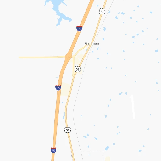
Roadmap (route) to go from Copiah County Airport to East Florence detailed above, you can also see the course layout on the map.
While doing trip Copiah County (airport) - East Florence by car, the calculated route ends at a distance , or more straight.
Distance and duration of the route between Copiah County (airport) and East Florence
An error occured: undefined - for url https://route.cartes.cc/route?point=31.9068%2C-90.36909&point=34.80953%2C-87.64947&vehicle=car&debug=false&data_type=application%2Fjson&locale=en&points_encoded=true&instructions=true&elevation=false&optimize=false&timeout=10000&skip.host=true&skip.basePath=true&graphhopper_maps_host=https%3A%2F%2Fgraphhopper.com%2Fmaps%2F%3F&turn_sign_map.0=continue&turn_sign_map.1=turn%20slight%20right&turn_sign_map.2=turn%20right&turn_sign_map.3=turn%20sharp%20right&turn_sign_map.4=finish&turn_sign_map.5=reached%20via%20point&turn_sign_map.6=enter%20roundabout&turn_sign_map.-6=leave%20roundabout&turn_sign_map.-3=turn%20sharp%20left&turn_sign_map.-2=turn%20left&turn_sign_map.-1=turn%20slight%20left&key=&position=topleft
Calculation of distance and route from East Florence to Copiah County (airport) :
409.5464.8 km7h33mn
Continue onto Airport Lane 0h1mn 656 mTurn sharp right onto Lilly Road 0h5mn 2.5 kmTurn sharp left onto East Gallman Road 0h4mn 1.9 kmTurn right onto Gallman Road 0h0mn 123 mTurn sharp right onto US 51 0h4mn 4.4 kmTurn sharp left onto Pat Harrison Drive 0h0mn 392 mKeep right toward I 55 North 0h22mn 37.5 kmKeep right onto I 55 0h2mn 3.4 kmKeep left onto I 55 and drive toward Grenada, Memphis 0h10mn 14.2 kmKeep right and take US 51 North toward Ridgeland 0h3mn 3.7 kmTurn right onto Rice Road 0h0mn 168 mTurn left 0h1mn 417 mTurn right onto Natchez Trace Parkway 5h4mn 352.0 kmTurn left onto Natchez Trace Access Road and take US 72 toward Cherokee, Iuka 0h1mn 1.3 kmTurn right onto East Lee Highway 0h16mn 25.5 kmTurn left onto Old Lee Highway 0h3mn 3.8 kmTurn left onto South Hook Street 0h4mn 3.8 kmTurn left onto South Montgomery Avenue 0h0mn 216 mKeep right 0h0mn 49 mTurn slight right onto East 1st Street 0h0mn 455 mContinue onto East 2nd Street 0h1mn 707 mTurn left onto North Jackson Highway 0h2mn 2.1 kmContinue onto Woodward Avenue 0h2mn 2.7 kmKeep right 0h0mn 54 mTurn slight right onto Veterans Drive 0h1mn 1.4 kmTurn left onto Sycamore Street 0h0mn 114 mTurn right onto East Limestone Street 0h0mn 215 mTurn sharp left onto South Royal Avenue 0h0mn 45 mAt roundabout, take exit 1 onto Huntsville Road 0h1mn 1.1 kmTurn left onto Midway Street 0h0mn 18 mArrive at destination 0h0mn 0 m
Travel from Copiah County (airport) (Alabama) to a selection of major cities.
Distances from Copiah County Airport to biggest cities in Mississippi
- Pascagoula,22,126 inhabitants.243 km
Other major cities in country :
- Charlotte [NC], 827,097 inhabitants. 957 km
- Seattle [WA], 684,451 inhabitants. 3,211 km
- Denver [CO], 682,545 inhabitants. 1,578 km
- El Paso [TX], 681,124 inhabitants. 1,523 km
- Detroit [MI], 677,116 inhabitants. 1,329 km
- Boston [MA], 667,137 inhabitants. 2,063 km
- Memphis [TN], 655,770 inhabitants. 362 km
- New South Memphis [TN], 641,608 inhabitants. 355 km
- Portland [OR], 632,309 inhabitants. 3,159 km
- Oklahoma City [OK], 631,346 inhabitants. 771 km
- Las Vegas [NV], 623,747 inhabitants. 2,327 km
- Baltimore [MD], 621,849 inhabitants. 1,489 km
- Washington, D.C. [DC], 601,723 inhabitants. 1,436 km
- Milwaukee [WI], 600,155 inhabitants. 1,258 km
- South Boston [MA], 571,281 inhabitants. 2,063 km
- Albuquerque [NM], 559,121 inhabitants. 1,550 km
- Tucson [AZ], 531,641 inhabitants. 1,937 km
- Nashville [TN], 530,852 inhabitants. 578 km
- Fresno [CA], 520,052 inhabitants. 2,745 km
- Sacramento [CA], 490,712 inhabitants. 2,910 km
Route from East Florence to major cities (United States).
- Distance East Florence New York City1,367 km
- Distance East Florence Los Angeles2,799 km
- Distance East Florence Chicago784 km
- Distance East Florence Brooklyn1,368 km
- Distance East Florence Houston917 km
- Distance East Florence Queens1,378 km
- Distance East Florence Philadelphia1,242 km
- Distance East Florence Phoenix2,250 km
- Distance East Florence Manhattan1,373 km
- Distance East Florence San Antonio1,184 km
- Distance East Florence San Diego2,732 km
- Distance East Florence The Bronx1,384 km
- Distance East Florence Dallas876 km
- Distance East Florence San Jose3,077 km
- Distance East Florence Austin1,073 km
- Distance East Florence Jacksonville751 km
- Distance East Florence San Francisco3,119 km
- Distance East Florence Columbus706 km
- Distance East Florence Fort Worth924 km
- Distance East Florence Indianapolis568 km
Nearest cities to Copiah County (airport) :
- New Orleans, 389,617 inhabitants. 219 km
- Baton Rouge, 228,590 inhabitants. 179 km
- Little Rock, 197,992 inhabitants. 363 km
- Mobile, 194,288 inhabitants. 259 km
- Jackson, 170,674 inhabitants. 47 km
- Metairie Terrace, 142,489 inhabitants. 216 km
- Metairie, 138,481 inhabitants. 215 km
- Lafayette, 127,657 inhabitants. 245 km
- Tuscaloosa, 98,332 inhabitants. 300 km
- Lake Charles, 76,070 inhabitants. 330 km
- Gulfport, 71,856 inhabitants. 210 km
- West Gulfport, 71,329 inhabitants. 207 km
- Kenner, 67,091 inhabitants. 213 km
- North Little Rock, 66,504 inhabitants. 364 km
- Monroe, 49,598 inhabitants. 178 km
- Alexandria, 47,889 inhabitants. 208 km
- Hattiesburg, 46,805 inhabitants. 121 km
- Biloxi, 45,637 inhabitants. 220 km
- Pine Bluff, 44,772 inhabitants. 300 km
- Florence, 40,026 inhabitants. 408 km
- Meridian, 39,661 inhabitants. 165 km
- East Florence, 35,733 inhabitants. 410 km
- Tupelo, 35,680 inhabitants. 304 km
- Hot Springs, 35,635 inhabitants. 382 km
- Hot Springs National Park, 35,193 inhabitants. 385 km
- Houma, 34,287 inhabitants. 259 km
- Benton, 34,177 inhabitants. 361 km
- Marrero, 33,141 inhabitants. 225 km
- Greenville, 32,156 inhabitants. 179 km
- New Iberia, 30,754 inhabitants. 253 km
- Sherwood, 30,517 inhabitants. 367 km
- Laplace, 29,872 inhabitants. 205 km
- Jacksonville, 28,643 inhabitants. 367 km
- Central, 28,295 inhabitants. 163 km
- Slidell, 27,942 inhabitants. 190 km
- Prairieville, 26,895 inhabitants. 188 km
- Pearl, 26,462 inhabitants. 47 km
- Madison, 25,799 inhabitants. 66 km
- Starkville, 25,366 inhabitants. 225 km
- Clinton, 25,254 inhabitants. 49 km
- Daphne, 24,896 inhabitants. 276 km
- Northport, 24,772 inhabitants. 300 km
- Ridgeland, 24,351 inhabitants. 62 km
- Brandon, 23,529 inhabitants. 54 km
- Terrytown, 23,319 inhabitants. 225 km
- Columbus, 23,168 inhabitants. 254 km
- Vicksburg, 23,131 inhabitants. 69 km
- Prichard, 22,351 inhabitants. 254 km
- Ruston, 22,340 inhabitants. 224 km
- Oxford, 22,314 inhabitants. 285 km
Location Copiah County (airport) (Mississippi) :
| Country flag |  |
| Location | Copiah County (airport) |
| State | Mississippi |
| County | Copiah County |
| Country | United States |
| Country code / ISO 2 | US |
| Latitude | 31.9068000 |
| Longitude | -90.3690900 |
| Altitude | 133 meters |
| Time zone | America/Chicago |
Location East Florence (Alabama) :
| Country flag | |
| Location | East Florence |
| State | Alabama |
| County | Lauderdale County |
| Country | United States |
| Country code / ISO 2 | US |
| Latitude | 34.8095300 |
| Longitude | -87.6494700 |
| Altitude | 167 meters |
| Time zone | America/Chicago |


