


Home
››
Excelsior Springs Memorial Airport
››
Roadmap from Excelsior Springs Memorial Airport to Quincy
How to get from Excelsior Springs Memorial (airport) (Missouri) to Quincy (Illinois)
Calculate route from Excelsior Springs Memorial (airport) (Missouri, United States) to Quincy (Illinois, United States).
The flight distance (as the crow flies) between Excelsior Springs Memorial (airport) and Quincy is 247.8 km.
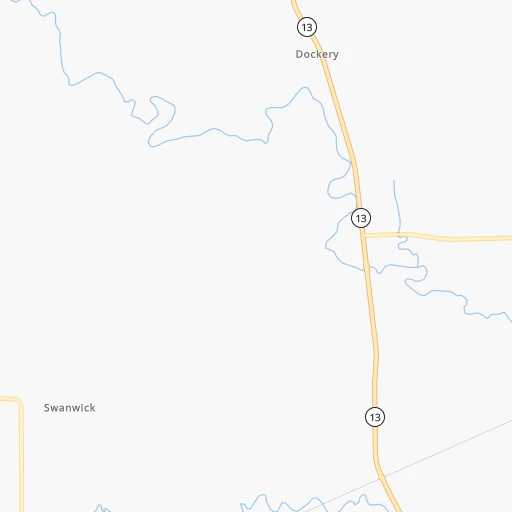
Roadmap (route) to go from Excelsior Springs Memorial Airport to Quincy detailed above, you can also see the course layout on the map.
While doing trip Excelsior Springs Memorial (airport) - Quincy by car, the calculated route ends at a distance , or more straight.
Distance and duration of the route between Excelsior Springs Memorial (airport) and Quincy
Calculation of distance and route from Quincy to Excelsior Springs Memorial (airport) :
247.8300.6 km4h18mn
Continue 0h0mn 88 mTurn sharp right onto East Golf Hill Drive 0h1mn 496 mTurn right onto Old 10 Highway 0h0mn 154 mTurn left 0h0mn 25 mTurn right onto MO 10 0h13mn 17.2 kmTurn left onto MO 10 Business 0h9mn 8.7 kmTurn left onto MO 10 1h31mn 42.7 kmTurn sharp left onto South Main Street 0h1mn 850 mKeep right onto Old US Highway 24 0h1mn 844 mContinue onto Old US Highway 24 0h2mn 1.9 kmTurn right onto US 24 1h54mn 59.0 kmKeep left onto US 24 2h40mn 109.8 kmTurn right onto 5th Street 0h2mn 1.8 kmTurn left onto US 24, US 36 Business 0h1mn 589 mTurn right onto US 24, US 36 Business and take US 24 East, US 36 East, MO 110 East toward Hannibal 0h12mn 18.6 kmKeep right onto US 24 and take US 24 East toward Palmyra 0h0mn 551 mTurn left onto US 24 0h22mn 27.0 kmKeep left onto US 24 0h9mn 10.0 kmTurn left onto North 4th Street 0h0mn 418 mTurn right onto Broadway Street 0h0mn 14 mArrive at destination 0h0mn 0 m
Travel from Excelsior Springs Memorial (airport) (Illinois) to a selection of major cities.
Distances from Excelsior Springs Memorial Airport to biggest cities in Missouri
- University City,35,058 inhabitants.345 km
- Ballwin,30,577 inhabitants.327 km
- Liberty,30,450 inhabitants.21 km
- Raytown,29,401 inhabitants.43 km
- Mehlville,28,380 inhabitants.348 km
- Kirkwood,27,750 inhabitants.339 km
- Maryland Heights,27,389 inhabitants.333 km
- Gladstone,26,861 inhabitants.34 km
- Hazelwood,25,661 inhabitants.337 km
- Grandview,25,256 inhabitants.58 km
- Webster Groves,23,177 inhabitants.343 km
- Belton,23,168 inhabitants.65 km
- Sedalia,21,516 inhabitants.110 km
- Arnold,21,357 inhabitants.346 km
- Ferguson,21,059 inhabitants.343 km
- Nixa,20,984 inhabitants.267 km
- Raymore,20,374 inhabitants.63 km
- Affton,20,307 inhabitants.346 km
- Rolla,20,019 inhabitants.261 km
Other major cities in country :
- Charlotte [NC], 827,097 inhabitants. 1,267 km
- Seattle [WA], 684,451 inhabitants. 2,435 km
- Denver [CO], 682,545 inhabitants. 927 km
- El Paso [TX], 681,124 inhabitants. 1,394 km
- Detroit [MI], 677,116 inhabitants. 996 km
- Boston [MA], 667,137 inhabitants. 1,971 km
- Memphis [TN], 655,770 inhabitants. 594 km
- New South Memphis [TN], 641,608 inhabitants. 599 km
- Portland [OR], 632,309 inhabitants. 2,425 km
- Oklahoma City [OK], 631,346 inhabitants. 521 km
- Las Vegas [NV], 623,747 inhabitants. 1,872 km
- Baltimore [MD], 621,849 inhabitants. 1,512 km
- Washington, D.C. [DC], 601,723 inhabitants. 1,481 km
- Milwaukee [WI], 600,155 inhabitants. 669 km
- South Boston [MA], 571,281 inhabitants. 1,972 km
- Albuquerque [NM], 559,121 inhabitants. 1,200 km
- Tucson [AZ], 531,641 inhabitants. 1,702 km
- Nashville [TN], 530,852 inhabitants. 742 km
- Fresno [CA], 520,052 inhabitants. 2,253 km
- Sacramento [CA], 490,712 inhabitants. 2,355 km
Route from Quincy to major cities (United States).
- Distance Quincy New York City1,477 km
- Distance Quincy Los Angeles2,464 km
- Distance Quincy Brooklyn1,482 km
- Distance Quincy Houston1,188 km
- Distance Quincy Queens1,492 km
- Distance Quincy Philadelphia1,385 km
- Distance Quincy Phoenix1,975 km
- Distance Quincy Manhattan1,480 km
- Distance Quincy San Antonio1,337 km
- Distance Quincy San Diego2,435 km
- Distance Quincy The Bronx1,488 km
- Distance Quincy Dallas931 km
- Distance Quincy San Jose2,654 km
- Distance Quincy Austin1,220 km
- Distance Quincy Jacksonville1,388 km
- Distance Quincy San Francisco2,685 km
- Distance Quincy Columbus718 km
- Distance Quincy Fort Worth961 km
- Distance Quincy Indianapolis449 km
- Distance Quincy Charlotte1,068 km
Nearest cities to Excelsior Springs Memorial (airport) :
- Kansas City, 475,378 inhabitants. 42 km
- Omaha, 443,885 inhabitants. 260 km
- Lincoln, 277,348 inhabitants. 266 km
- Des Moines, 210,330 inhabitants. 257 km
- Overland Park, 186,515 inhabitants. 57 km
- Springfield, 166,810 inhabitants. 249 km
- Kansas City, 151,306 inhabitants. 45 km
- Olathe, 134,305 inhabitants. 74 km
- Cedar Rapids, 130,405 inhabitants. 367 km
- Topeka, 127,265 inhabitants. 132 km
- Columbia, 119,108 inhabitants. 167 km
- Independence, 117,255 inhabitants. 33 km
- East Independence, 110,675 inhabitants. 30 km
- Lee's Summit, 95,094 inhabitants. 50 km
- Lawrence, 93,917 inhabitants. 98 km
- Saint Joseph, 76,780 inhabitants. 74 km
- Iowa City, 74,220 inhabitants. 343 km
- Ames, 65,060 inhabitants. 304 km
- Shawnee, 65,046 inhabitants. 56 km
- West Des Moines, 64,113 inhabitants. 253 km
- Council Bluffs, 62,597 inhabitants. 257 km
- Ankeny, 56,764 inhabitants. 271 km
- Manhattan, 56,308 inhabitants. 205 km
- Bellevue, 55,510 inhabitants. 247 km
- Blue Springs, 54,148 inhabitants. 36 km
- Lenexa, 52,490 inhabitants. 63 km
- Joplin, 51,818 inhabitants. 252 km
- Bentonville, 44,499 inhabitants. 330 km
- Urbandale, 44,062 inhabitants. 258 km
- Jefferson City, 43,169 inhabitants. 195 km
- Quincy, 40,780 inhabitants. 248 km
- Marion, 37,330 inhabitants. 372 km
- Bartlesville, 36,595 inhabitants. 328 km
- Leavenworth, 35,980 inhabitants. 62 km
- Leawood, 34,579 inhabitants. 55 km
- Liberty, 30,450 inhabitants. 21 km
- Raytown, 29,401 inhabitants. 43 km
- Bella Vista, 27,999 inhabitants. 318 km
- Marshalltown, 27,620 inhabitants. 321 km
- Gladstone, 26,861 inhabitants. 34 km
- Fremont, 26,474 inhabitants. 304 km
- Grandview, 25,256 inhabitants. 58 km
- Ponca City, 24,758 inhabitants. 387 km
- Emporia, 24,649 inhabitants. 201 km
- Ottumwa, 24,624 inhabitants. 241 km
- Junction City, 24,621 inhabitants. 230 km
- Belton, 23,168 inhabitants. 65 km
- Prairie Village, 21,877 inhabitants. 54 km
- Sedalia, 21,516 inhabitants. 110 km
- Nixa, 20,984 inhabitants. 267 km
Location Excelsior Springs Memorial (airport) (Missouri) :
| Country flag |  |
| Location | Excelsior Springs Memorial (airport) |
| State | Missouri |
| County | Ray County |
| Country | United States |
| Country code / ISO 2 | US |
| Latitude | 39.3365400 |
| Longitude | -94.1986300 |
| Altitude | 304 meters |
| Time zone | America/Chicago |
Location Quincy (Illinois) :
| Country flag | |
| Location | Quincy |
| State | Illinois |
| County | Adams County |
| Country | United States |
| Country code / ISO 2 | US |
| Latitude | 39.9356000 |
| Longitude | -91.4098700 |
| Altitude | 173 meters |
| Time zone | America/Chicago |


