

How to get from Butler (airport) (Missouri) to Nixa (Missouri)
Calculate route from Butler (airport) (Missouri, United States) to Nixa (Missouri, United States).
The flight distance (as the crow flies) between Butler (airport) and Nixa is 166.3 km.
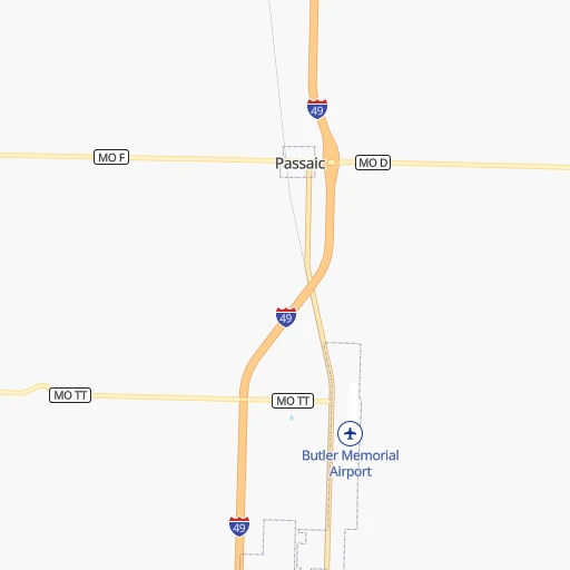
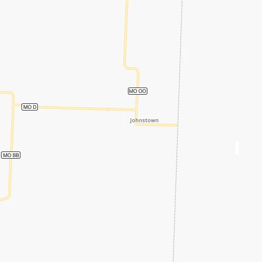
Roadmap (route) to go from Butler Airport to Nixa detailed above, you can also see the course layout on the map.
While doing trip Butler (airport) - Nixa by car, the calculated route ends at a distance , or more straight.
Distance and duration of the route between Butler (airport) and Nixa
Calculation of distance and route from Nixa to Butler (airport) :
166.3202.2 km3h32mn
Continue 0h0mn 139 mTurn left onto Orange Street 0h3mn 2.8 kmTurn left onto West Mill Street 1h47mn 51.5 kmTurn right and take MO 13 South toward Springfield 1h19mn 122.8 kmContinue onto North Kansas Expressway 0h12mn 12.2 kmKeep left onto MO 13 and take US 60 East, US 160 East, MO 13 South toward Rogersville 0h1mn 1.9 kmKeep right onto MO 13, US 160 and take MO 13 South, US 160 East toward Nixa 0h0mn 368 mKeep right onto MO 13, US 160 and take MO 13 South, US 160 East toward Nixa 0h4mn 5.8 kmTurn left onto MO CC 0h1mn 1.5 kmContinue onto North Main Street 0h4mn 3.3 kmTurn left onto East Mount Vernon Street 0h0mn 35 mArrive at destination 0h0mn 0 m
Travel from Butler (airport) (Missouri) to a selection of major cities.
Distances from Butler Airport to biggest cities in Missouri
- University City,35,058 inhabitants.354 km
- Ballwin,30,577 inhabitants.333 km
- Liberty,30,450 inhabitants.107 km
- Raytown,29,401 inhabitants.81 km
- Mehlville,28,380 inhabitants.351 km
- Kirkwood,27,750 inhabitants.345 km
- Maryland Heights,27,389 inhabitants.344 km
- Gladstone,26,861 inhabitants.103 km
- Hazelwood,25,661 inhabitants.350 km
- Grandview,25,256 inhabitants.68 km
- Webster Groves,23,177 inhabitants.349 km
- Belton,23,168 inhabitants.61 km
- Sedalia,21,516 inhabitants.107 km
- Arnold,21,357 inhabitants.346 km
- Ferguson,21,059 inhabitants.355 km
- Nixa,20,984 inhabitants.167 km
- Raymore,20,374 inhabitants.58 km
- Affton,20,307 inhabitants.351 km
- Rolla,20,019 inhabitants.228 km
Other major cities in country :
- Charlotte [NC], 827,097 inhabitants. 1,250 km
- Seattle [WA], 684,451 inhabitants. 2,488 km
- Denver [CO], 682,545 inhabitants. 934 km
- El Paso [TX], 681,124 inhabitants. 1,323 km
- Detroit [MI], 677,116 inhabitants. 1,058 km
- Boston [MA], 667,137 inhabitants. 2,020 km
- Memphis [TN], 655,770 inhabitants. 518 km
- New South Memphis [TN], 641,608 inhabitants. 523 km
- Portland [OR], 632,309 inhabitants. 2,466 km
- Oklahoma City [OK], 631,346 inhabitants. 423 km
- Las Vegas [NV], 623,747 inhabitants. 1,854 km
- Baltimore [MD], 621,849 inhabitants. 1,540 km
- Washington, D.C. [DC], 601,723 inhabitants. 1,505 km
- Milwaukee [WI], 600,155 inhabitants. 758 km
- South Boston [MA], 571,281 inhabitants. 2,021 km
- Albuquerque [NM], 559,121 inhabitants. 1,154 km
- Tucson [AZ], 531,641 inhabitants. 1,649 km
- Nashville [TN], 530,852 inhabitants. 710 km
- Fresno [CA], 520,052 inhabitants. 2,245 km
- Sacramento [CA], 490,712 inhabitants. 2,359 km
Route from Nixa to major cities (United States).
- Distance Nixa New York City1,717 km
- Distance Nixa Los Angeles2,277 km
- Distance Nixa Chicago722 km
- Distance Nixa Brooklyn1,721 km
- Distance Nixa Houston833 km
- Distance Nixa Queens1,731 km
- Distance Nixa Philadelphia1,609 km
- Distance Nixa Phoenix1,750 km
- Distance Nixa Manhattan1,721 km
- Distance Nixa San Antonio976 km
- Distance Nixa San Diego2,226 km
- Distance Nixa The Bronx1,731 km
- Distance Nixa Dallas572 km
- Distance Nixa San Jose2,527 km
- Distance Nixa Austin859 km
- Distance Nixa Jacksonville1,310 km
- Distance Nixa San Francisco2,566 km
- Distance Nixa Columbus953 km
- Distance Nixa Fort Worth605 km
- Distance Nixa Indianapolis692 km
Nearest cities to Butler (airport) :
- Kansas City, 475,378 inhabitants. 93 km
- Omaha, 443,885 inhabitants. 357 km
- Tulsa, 403,505 inhabitants. 279 km
- Wichita, 389,965 inhabitants. 271 km
- Lincoln, 277,348 inhabitants. 343 km
- Overland Park, 186,515 inhabitants. 82 km
- Springfield, 166,810 inhabitants. 151 km
- Kansas City, 151,306 inhabitants. 95 km
- Olathe, 134,305 inhabitants. 78 km
- Topeka, 127,265 inhabitants. 144 km
- Columbia, 119,108 inhabitants. 190 km
- Independence, 117,255 inhabitants. 90 km
- East Independence, 110,675 inhabitants. 90 km
- Broken Arrow, 106,563 inhabitants. 280 km
- Lee's Summit, 95,094 inhabitants. 69 km
- Lawrence, 93,917 inhabitants. 109 km
- Fort Smith, 88,194 inhabitants. 323 km
- Fayetteville, 82,830 inhabitants. 248 km
- Springdale, 77,859 inhabitants. 235 km
- Saint Joseph, 76,780 inhabitants. 170 km
- Shawnee, 65,046 inhabitants. 90 km
- Rogers, 63,159 inhabitants. 219 km
- Council Bluffs, 62,597 inhabitants. 356 km
- Manhattan, 56,308 inhabitants. 218 km
- Bellevue, 55,510 inhabitants. 344 km
- Blue Springs, 54,148 inhabitants. 81 km
- Lenexa, 52,490 inhabitants. 81 km
- Joplin, 51,818 inhabitants. 135 km
- Stillwater, 48,967 inhabitants. 341 km
- Bentonville, 44,499 inhabitants. 214 km
- Jefferson City, 43,169 inhabitants. 192 km
- Quincy, 40,780 inhabitants. 313 km
- Muskogee, 38,456 inhabitants. 297 km
- Bartlesville, 36,595 inhabitants. 225 km
- Leavenworth, 35,980 inhabitants. 124 km
- Leawood, 34,579 inhabitants. 79 km
- Owasso, 34,542 inhabitants. 262 km
- Shawnee, 31,286 inhabitants. 402 km
- Liberty, 30,450 inhabitants. 107 km
- Raytown, 29,401 inhabitants. 81 km
- Bella Vista, 27,999 inhabitants. 201 km
- Gladstone, 26,861 inhabitants. 103 km
- Grandview, 25,256 inhabitants. 68 km
- Ponca City, 24,758 inhabitants. 300 km
- Bixby, 24,657 inhabitants. 295 km
- Emporia, 24,649 inhabitants. 161 km
- Ottumwa, 24,624 inhabitants. 346 km
- Junction City, 24,621 inhabitants. 232 km
- Derby, 23,509 inhabitants. 270 km
- Belton, 23,168 inhabitants. 61 km
Location Butler (airport) (Missouri) :
| Country flag |  |
| Location | Butler (airport) |
| State | Missouri |
| County | Bates County |
| Country | United States |
| Country code / ISO 2 | US |
| Latitude | 38.2891800 |
| Longitude | -94.3413700 |
| Altitude | 265 meters |
| Time zone | America/Chicago |
Location Nixa (Missouri) :
| Country flag | |
| Location | Nixa |
| State | Missouri |
| County | Christian County |
| Country | United States |
| Country code / ISO 2 | US |
| Latitude | 37.0433900 |
| Longitude | -93.2943500 |
| Altitude | 395 meters |
| Time zone | America/Chicago |


