
Home
››
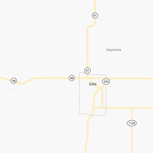
Mid South Flying Service Landing Strip
››
Roadmap from Mid South Flying Service Landing Strip to Indianapolis
How to get from Mid South Flying Service Landing Strip (Louisiana) to Indianapolis (Indiana)
Calculate route from Mid South Flying Service Landing Strip (Louisiana, United States) to Indianapolis (Indiana, United States).
The flight distance (as the crow flies) between Mid South Flying Service Landing Strip and Indianapolis is 1,183.3 km.
Roadmap (route) to go from Mid South Flying Service Landing Strip to Indianapolis detailed above, you can also see the course layout on the map.
While doing trip Mid South Flying Service Landing Strip - Indianapolis by car, the calculated route ends at a distance , or more straight.
Distance and duration of the route between Mid South Flying Service Landing Strip and Indianapolis
Calculation of distance and route from Indianapolis to Mid South Flying Service Landing Strip :
1,183.31,380.9 km17h31mn
Continue onto Church Point Highway 0h6mn 7.0 kmTurn right onto South Main Street 0h0mn 180 mTurn left onto East Ebey Street 0h6mn 6.5 kmContinue onto LA 357 0h15mn 15.2 kmTurn right onto West Vine Street 1h37mn 52.7 kmTurn left onto Maringouin Road East 0h5mn 4.9 kmTurn left onto Parlange Lane 0h7mn 7.3 kmTurn left onto False River Road 0h7mn 7.8 kmTurn left onto Major Parkway 0h2mn 2.1 kmTurn left onto Parent Street 0h0mn 160 mTurn right onto LA 10 0h15mn 18.6 kmTurn left onto US 61 0h1mn 993 mTurn sharp right onto State Route 966 0h1mn 981 mTurn left onto Audubon Lane 0h7mn 3.6 kmTurn right onto LA 965 0h7mn 6.7 kmTurn right onto LA 10 0h21mn 23.5 kmTurn left onto Liberty Street 1h34mn 34.1 kmKeep right 0h0mn 115 mTurn slight right onto MS 48, MS 569 0h6mn 6.4 kmTurn right onto West Main Street 0h30mn 32.6 kmTurn left 0h0mn 14 mContinue onto US 98 1h12mn 121.9 kmKeep right onto I 55 0h2mn 3.4 kmKeep left onto I 55 and drive toward Grenada, Memphis 3h10mn 319.7 kmKeep right and take SR 175 toward Whitehaven, Capleville, Shelby Drive 0h0mn 418 mKeep right and take SR 175 East toward Capleville 0h0mn 207 mTurn slight right onto East Shelby Drive 0h1mn 872 mTurn left onto Airways Boulevard 0h3mn 3.6 kmTurn slight right toward I 240 0h2mn 2.4 kmContinue onto Airways Boulevard 0h8mn 8.7 kmKeep right onto North Trezevant Street 0h1mn 762 mKeep right 0h6mn 6.4 kmContinue onto Jackson Avenue 0h29mn 38.4 kmTurn left onto Mount Carmel Road 0h11mn 13.0 kmTurn left onto West Church Avenue 0h0mn 181 mTurn sharp right onto US 51, TN 59 0h18mn 24.1 kmTurn slight right onto Jefferson Davis Highway 0h22mn 32.5 kmKeep right onto South Main Avenue 0h3mn 3.5 kmTurn left onto McGaughey Street 0h0mn 54 mTurn right onto Troy Avenue 0h1mn 644 mTurn right onto Gordon Street 0h4mn 4.9 kmKeep right onto US 51 and take US 412 West, US 51 North toward Union City, St. Louis 0h1mn 1.0 kmKeep right onto US 51 and take US 51 North toward Union City 0h29mn 45.6 kmTurn slight right onto West Reelfoot Avenue 0h2mn 2.6 kmTurn left onto US 51 0h9mn 11.9 kmKeep right onto US 45W, US 51 and take US 45W North, US 51 North toward South Fulton 0h6mn 9.3 kmTurn left onto Chickasaw Drive 0h1mn 1.3 kmTurn sharp left onto Nolan Avenue 0h0mn 473 mTurn right 1h47mn 79.3 kmKeep left onto I 69 and take I 24 East, I 69 North toward Nashville, Henderson 0h14mn 23.6 kmKeep right and take US 62, US 641 toward Eddyville 0h0mn 453 mKeep left 0h0mn 86 mTurn sharp left onto US 62, US 641, KY 93 0h6mn 6.1 kmTurn left onto US 641 0h13mn 13.8 kmTurn left onto Marion Road 1h34mn 38.9 kmKeep right onto KY 141 0h26mn 25.6 kmTurn right onto T L Bishop Road 0h3mn 1.4 kmTurn right onto Barker Road 0h3mn 1.4 kmTurn right onto Peter Cruz Road 0h2mn 1.2 kmTurn right onto Cr-1027 0h7mn 5.2 kmTurn right onto US 60 0h19mn 19.8 kmKeep right and take US 41 toward Evansville, Madisonville 0h0mn 228 mKeep left and take US 41 North toward Evansville 0h1mn 972 mTurn slight right onto US Highway 41 0h19mn 21.8 kmTurn right onto SR 57 1h26mn 140.9 kmKeep right toward SR 45 0h1mn 617 mTurn left onto SR 45 0h4mn 5.3 kmTurn left onto SR 45, SR 54 0h18mn 21.7 kmKeep left onto SR 45 1h49mn 76.7 kmContinue onto South Harding Street 0h3mn 3.0 kmTurn right onto West Morris Street 0h1mn 817 mTurn right onto Kentucky Avenue 0h3mn 2.0 kmTurn left onto South Illinois Street 0h0mn 11 mKeep left onto South Illinois Street 0h1mn 456 mTurn right onto West Maryland Street 0h0mn 154 mTurn left onto North Meridian Street 0h0mn 265 mEnter roundabout 0h0mn 4 mArrive at destination 0h0mn 0 m
Travel from Mid South Flying Service Landing Strip (Indiana) to a selection of major cities.
Distances from Mid South Flying Service Landing Strip to biggest cities in Louisiana
Other major cities in country :
- Charlotte [NC], 827,097 inhabitants. 1,197 km
- Seattle [WA], 684,451 inhabitants. 3,200 km
- Denver [CO], 682,545 inhabitants. 1,557 km
- El Paso [TX], 681,124 inhabitants. 1,364 km
- Detroit [MI], 677,116 inhabitants. 1,566 km
- Boston [MA], 667,137 inhabitants. 2,313 km
- Memphis [TN], 655,770 inhabitants. 572 km
- New South Memphis [TN], 641,608 inhabitants. 565 km
- Portland [OR], 632,309 inhabitants. 3,130 km
- Oklahoma City [OK], 631,346 inhabitants. 751 km
- Las Vegas [NV], 623,747 inhabitants. 2,219 km
- Baltimore [MD], 621,849 inhabitants. 1,738 km
- Washington, D.C. [DC], 601,723 inhabitants. 1,684 km
- Milwaukee [WI], 600,155 inhabitants. 1,464 km
- South Boston [MA], 571,281 inhabitants. 2,312 km
- Albuquerque [NM], 559,121 inhabitants. 1,445 km
- Tucson [AZ], 531,641 inhabitants. 1,785 km
- Nashville [TN], 530,852 inhabitants. 823 km
- Fresno [CA], 520,052 inhabitants. 2,639 km
- Sacramento [CA], 490,712 inhabitants. 2,820 km
Route from Indianapolis to major cities (United States).
- Distance Indianapolis New York City1,037 km
- Distance Indianapolis Los Angeles2,909 km
- Distance Indianapolis Chicago264 km
- Distance Indianapolis Brooklyn1,042 km
- Distance Indianapolis Houston1,394 km
- Distance Indianapolis Queens1,051 km
- Distance Indianapolis Philadelphia939 km
- Distance Indianapolis Phoenix2,411 km
- Distance Indianapolis Manhattan1,041 km
- Distance Indianapolis San Antonio1,610 km
- Distance Indianapolis San Diego2,876 km
- Distance Indianapolis The Bronx1,049 km
- Distance Indianapolis Dallas1,230 km
- Distance Indianapolis San Jose3,102 km
- Distance Indianapolis Austin1,492 km
- Distance Indianapolis Jacksonville1,127 km
- Distance Indianapolis San Francisco3,133 km
- Distance Indianapolis Columbus271 km
- Distance Indianapolis Fort Worth1,271 km
- Distance Indianapolis Charlotte690 km
Nearest cities to Mid South Flying Service Landing Strip :
- New Orleans, 389,617 inhabitants. 216 km
- Baton Rouge, 228,590 inhabitants. 107 km
- Shreveport, 197,204 inhabitants. 279 km
- Jackson, 170,674 inhabitants. 293 km
- Pasadena, 153,784 inhabitants. 293 km
- Metairie Terrace, 142,489 inhabitants. 207 km
- Metairie, 138,481 inhabitants. 207 km
- Lafayette, 127,657 inhabitants. 28 km
- Beaumont, 118,129 inhabitants. 179 km
- League City, 98,312 inhabitants. 289 km
- Longview, 82,287 inhabitants. 335 km
- Kingwood Area, 81,692 inhabitants. 291 km
- Baytown, 76,335 inhabitants. 270 km
- Lake Charles, 76,070 inhabitants. 92 km
- Bossier City, 68,094 inhabitants. 278 km
- Kenner, 67,091 inhabitants. 199 km
- Atascocita, 65,844 inhabitants. 283 km
- Port Arthur, 55,340 inhabitants. 170 km
- Galveston, 50,180 inhabitants. 271 km
- Monroe, 49,598 inhabitants. 240 km
- Alexandria, 47,889 inhabitants. 107 km
- Texas City, 47,618 inhabitants. 277 km
- Hattiesburg, 46,805 inhabitants. 304 km
- Friendswood, 38,800 inhabitants. 298 km
- Channelview, 38,289 inhabitants. 282 km
- Lufkin, 36,333 inhabitants. 260 km
- La Porte, 35,148 inhabitants. 276 km
- Houma, 34,287 inhabitants. 171 km
- Nacogdoches, 33,894 inhabitants. 267 km
- Deer Park, 33,806 inhabitants. 285 km
- Marrero, 33,141 inhabitants. 215 km
- New Iberia, 30,754 inhabitants. 58 km
- Laplace, 29,872 inhabitants. 175 km
- Central, 28,295 inhabitants. 120 km
- Slidell, 27,942 inhabitants. 239 km
- Prairieville, 26,895 inhabitants. 124 km
- Pearl, 26,462 inhabitants. 294 km
- Madison, 25,799 inhabitants. 311 km
- Alvin, 25,791 inhabitants. 306 km
- Clinton, 25,254 inhabitants. 288 km
- Ridgeland, 24,351 inhabitants. 307 km
- Marshall, 23,820 inhabitants. 315 km
- Brandon, 23,529 inhabitants. 304 km
- Terrytown, 23,319 inhabitants. 221 km
- Vicksburg, 23,131 inhabitants. 258 km
- Cloverleaf, 22,942 inhabitants. 287 km
- Ruston, 22,340 inhabitants. 244 km
- Hammond, 20,480 inhabitants. 174 km
- Harvey, 20,348 inhabitants. 217 km
- Sulphur, 20,189 inhabitants. 108 km
Location Mid South Flying Service Landing Strip (Louisiana) :
| Country flag |  |
| Location | Mid South Flying Service Landing Strip |
| State | Louisiana |
| County | Acadia Parish |
| Country | United States |
| Country code / ISO 2 | US |
| Latitude | 30.3582600 |
| Longitude | -92.2648500 |
| Altitude | 13 meters |
| Time zone | America/Chicago |
Location Indianapolis (Indiana) :
| Country flag | |
| Location | Indianapolis |
| State | Indiana |
| County | Marion County |
| Country | United States |
| Country code / ISO 2 | US |
| Latitude | 39.7683800 |
| Longitude | -86.1580400 |
| Altitude | 218 meters |
| Time zone | America/Indiana/Indianapolis |


