
How to get from Chataignier Landing Strip (Louisiana) to Texas City (Texas)
Calculate route from Chataignier Landing Strip (Louisiana, United States) to Texas City (Texas, United States).
The flight distance (as the crow flies) between Chataignier Landing Strip and Texas City is 287.8 km.
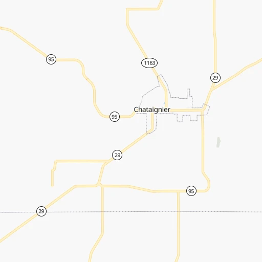
Roadmap (route) to go from Chataignier Landing Strip to Texas City detailed above, you can also see the course layout on the map.
While doing trip Chataignier Landing Strip - Texas City by car, the calculated route ends at a distance , or more straight.
Distance and duration of the route between Chataignier Landing Strip and Texas City
Calculation of distance and route from Texas City to Chataignier Landing Strip :
287.8356.6 km4h14mn
Continue onto L'Anse Aux Pailles Road 0h6mn 4.9 kmTurn left onto Chataiginer Road 0h2mn 2.1 kmContinue onto Vine Street 0h0mn 245 mTurn left onto South 1st Street 0h12mn 11.9 kmTurn sharp left onto North C C Duson Street 0h1mn 1.2 kmTurn right onto West Laurel Avenue 1h35mn 40.4 kmKeep left onto LA 383 0h2mn 1.7 kmTurn left onto US 165 0h23mn 28.4 kmKeep right 2h58mn 195.7 kmKeep right and take FM 565 toward Cove, Old River-Winfree 0h0mn 477 mTurn left onto Farm-to-Market Road 565 0h12mn 13.0 kmTurn left onto North Highway 146 0h3mn 3.1 kmKeep left onto North Robert C Lanier Freeway toward TX 146 South 1h32mn 44.9 kmKeep left onto TX 146 0h2mn 2.2 kmKeep right and take FM 1764 toward Texas City 0h0mn 517 mTurn left onto Palmer Highway 0h4mn 4.8 kmTurn right onto 6th Street 0h1mn 1.1 kmTurn right 0h0mn 14 mArrive at destination 0h0mn 0 m
Travel from Chataignier Landing Strip (Texas) to a selection of major cities.
Distances from Chataignier Landing Strip to biggest cities in Louisiana
Other major cities in country :
- Charlotte [NC], 827,097 inhabitants. 1,184 km
- Seattle [WA], 684,451 inhabitants. 3,182 km
- Denver [CO], 682,545 inhabitants. 1,539 km
- El Paso [TX], 681,124 inhabitants. 1,361 km
- Detroit [MI], 677,116 inhabitants. 1,543 km
- Boston [MA], 667,137 inhabitants. 2,295 km
- Memphis [TN], 655,770 inhabitants. 548 km
- New South Memphis [TN], 641,608 inhabitants. 541 km
- Portland [OR], 632,309 inhabitants. 3,113 km
- Oklahoma City [OK], 631,346 inhabitants. 732 km
- Las Vegas [NV], 623,747 inhabitants. 2,210 km
- Baltimore [MD], 621,849 inhabitants. 1,721 km
- Washington, D.C. [DC], 601,723 inhabitants. 1,668 km
- Milwaukee [WI], 600,155 inhabitants. 1,438 km
- South Boston [MA], 571,281 inhabitants. 2,295 km
- Albuquerque [NM], 559,121 inhabitants. 1,434 km
- Tucson [AZ], 531,641 inhabitants. 1,781 km
- Nashville [TN], 530,852 inhabitants. 802 km
- Fresno [CA], 520,052 inhabitants. 2,630 km
- Sacramento [CA], 490,712 inhabitants. 2,809 km
Route from Texas City to major cities (United States).
- Distance Texas City New York City2,275 km
- Distance Texas City Los Angeles2,265 km
- Distance Texas City Chicago1,534 km
- Distance Texas City Brooklyn2,276 km
- Distance Texas City Queens2,286 km
- Distance Texas City Philadelphia2,149 km
- Distance Texas City Phoenix1,691 km
- Distance Texas City Manhattan2,281 km
- Distance Texas City San Diego2,151 km
- Distance Texas City The Bronx2,292 km
- Distance Texas City San Jose2,650 km
- Distance Texas City Jacksonville1,283 km
- Distance Texas City San Francisco2,705 km
- Distance Texas City Columbus1,601 km
- Distance Texas City Indianapolis1,405 km
- Distance Texas City Charlotte1,472 km
- Distance Texas City Seattle3,105 km
- Distance Texas City Denver1,475 km
- Distance Texas City Detroit1,791 km
- Distance Texas City Boston2,576 km
Nearest cities to Chataignier Landing Strip :
- New Orleans, 389,617 inhabitants. 221 km
- Baton Rouge, 228,590 inhabitants. 107 km
- Shreveport, 197,204 inhabitants. 258 km
- Jackson, 170,674 inhabitants. 274 km
- Pasadena, 153,784 inhabitants. 301 km
- Metairie Terrace, 142,489 inhabitants. 212 km
- Metairie, 138,481 inhabitants. 213 km
- Lafayette, 127,657 inhabitants. 47 km
- Beaumont, 118,129 inhabitants. 186 km
- League City, 98,312 inhabitants. 299 km
- Longview, 82,287 inhabitants. 317 km
- Baytown, 76,335 inhabitants. 279 km
- Lake Charles, 76,070 inhabitants. 100 km
- Bossier City, 68,094 inhabitants. 256 km
- Kenner, 67,091 inhabitants. 205 km
- Atascocita, 65,844 inhabitants. 288 km
- Port Arthur, 55,340 inhabitants. 180 km
- Galveston, 50,180 inhabitants. 284 km
- Monroe, 49,598 inhabitants. 214 km
- Alexandria, 47,889 inhabitants. 82 km
- Texas City, 47,618 inhabitants. 288 km
- Hattiesburg, 46,805 inhabitants. 295 km
- Friendswood, 38,800 inhabitants. 307 km
- Channelview, 38,289 inhabitants. 290 km
- Texarkana, 37,280 inhabitants. 358 km
- Lufkin, 36,333 inhabitants. 250 km
- La Porte, 35,148 inhabitants. 285 km
- Houma, 34,287 inhabitants. 185 km
- Nacogdoches, 33,894 inhabitants. 255 km
- Deer Park, 33,806 inhabitants. 293 km
- Marrero, 33,141 inhabitants. 221 km
- Greenville, 32,156 inhabitants. 333 km
- New Iberia, 30,754 inhabitants. 78 km
- Texarkana, 30,353 inhabitants. 359 km
- Laplace, 29,872 inhabitants. 180 km
- Central, 28,295 inhabitants. 117 km
- Slidell, 27,942 inhabitants. 240 km
- Prairieville, 26,895 inhabitants. 127 km
- Pearl, 26,462 inhabitants. 275 km
- Madison, 25,799 inhabitants. 291 km
- Alvin, 25,791 inhabitants. 316 km
- Clinton, 25,254 inhabitants. 268 km
- Ridgeland, 24,351 inhabitants. 287 km
- Marshall, 23,820 inhabitants. 295 km
- Brandon, 23,529 inhabitants. 286 km
- Terrytown, 23,319 inhabitants. 227 km
- Vicksburg, 23,131 inhabitants. 236 km
- Cloverleaf, 22,942 inhabitants. 295 km
- Ruston, 22,340 inhabitants. 218 km
- Hammond, 20,480 inhabitants. 172 km
Location Chataignier Landing Strip (Louisiana) :
| Country flag |  |
| Location | Chataignier Landing Strip |
| State | Louisiana |
| County | Evangeline Parish |
| Country | United States |
| Country code / ISO 2 | US |
| Latitude | 30.5918600 |
| Longitude | -92.2570700 |
| Altitude | 18 meters |
| Time zone | America/Chicago |
Location Texas City (Texas) :
| Country flag | |
| Location | Texas City |
| State | Texas |
| County | Galveston County |
| Country | United States |
| Country code / ISO 2 | US |
| Latitude | 29.3838500 |
| Longitude | -94.9027000 |
| Altitude | 3 meters |
| Time zone | America/Chicago |


