
How to get from Silers Plane Valley (airport) (Kansas) to Columbus (Nebraska)
Calculate route from Silers Plane Valley (airport) (Kansas, United States) to Columbus (Nebraska, United States).
The flight distance (as the crow flies) between Silers Plane Valley (airport) and Columbus is 285.0 km.
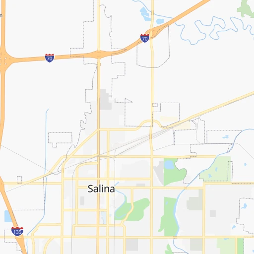
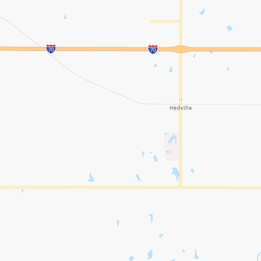
Roadmap (route) to go from Silers Plane Valley Airport to Columbus detailed above, you can also see the course layout on the map.
While doing trip Silers Plane Valley (airport) - Columbus by car, the calculated route ends at a distance , or more straight.
Distance and duration of the route between Silers Plane Valley (airport) and Columbus
Calculation of distance and route from Columbus to Silers Plane Valley (airport) :
285.0318.5 km3h27mn
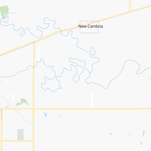
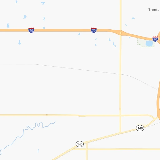
Continue 0h0mn 142 mTurn left onto East Stimmel Road 0h1mn 394 mTurn right onto North Simpson Road 0h0mn 207 mTurn sharp left onto East Old Highway 40 0h0mn 509 mKeep right onto East Stimmel Road 0h8mn 5.9 kmTurn right onto North 9th Street 0h5mn 5.0 kmTurn left onto K-143 Highway 0h3mn 3.0 kmTurn right 2h11mn 219.0 kmKeep right 0h3mn 3.4 kmKeep right 0h0mn 73 mTurn slight right onto North Lincoln Avenue 0h3mn 3.2 kmTurn left onto Highway 34 0h0mn 539 mTurn right onto US 81 0h20mn 30.5 kmKeep right onto US 81 0h0mn 345 mContinue onto County Road 130 0h13mn 19.7 kmTurn left onto A Road 0h18mn 26.5 kmMake a U-turn onto 33rd Avenue 0h0mn 96 mArrive at destination 0h0mn 0 m
Travel from Silers Plane Valley (airport) (Nebraska) to a selection of major cities.
Distances from Silers Plane Valley Airport to biggest cities in Kansas
- Gardner,20,868 inhabitants.226 km
- Liberal,20,746 inhabitants.360 km
- Pittsburg,20,409 inhabitants.296 km
Other major cities in country :
- Charlotte [NC], 827,097 inhabitants. 1,535 km
- Seattle [WA], 684,451 inhabitants. 2,221 km
- Denver [CO], 682,545 inhabitants. 649 km
- El Paso [TX], 681,124 inhabitants. 1,133 km
- Detroit [MI], 677,116 inhabitants. 1,282 km
- Boston [MA], 667,137 inhabitants. 2,261 km
- Memphis [TN], 655,770 inhabitants. 783 km
- New South Memphis [TN], 641,608 inhabitants. 787 km
- Portland [OR], 632,309 inhabitants. 2,191 km
- Oklahoma City [OK], 631,346 inhabitants. 379 km
- Las Vegas [NV], 623,747 inhabitants. 1,580 km
- Baltimore [MD], 621,849 inhabitants. 1,805 km
- Washington, D.C. [DC], 601,723 inhabitants. 1,773 km
- Milwaukee [WI], 600,155 inhabitants. 932 km
- South Boston [MA], 571,281 inhabitants. 2,262 km
- Albuquerque [NM], 559,121 inhabitants. 913 km
- Tucson [AZ], 531,641 inhabitants. 1,418 km
- Nashville [TN], 530,852 inhabitants. 995 km
- Fresno [CA], 520,052 inhabitants. 1,965 km
- Sacramento [CA], 490,712 inhabitants. 2,075 km
Route from Columbus to major cities (United States).
- Distance Columbus New York City1,956 km
- Distance Columbus Los Angeles2,006 km
- Distance Columbus Chicago809 km
- Distance Columbus Brooklyn1,962 km
- Distance Columbus Houston1,311 km
- Distance Columbus Queens1,971 km
- Distance Columbus Philadelphia1,876 km
- Distance Columbus Phoenix1,571 km
- Distance Columbus Manhattan1,958 km
- Distance Columbus San Antonio1,340 km
- Distance Columbus San Diego2,001 km
- Distance Columbus The Bronx1,965 km
- Distance Columbus Dallas964 km
- Distance Columbus San Jose2,151 km
- Distance Columbus Austin1,243 km
- Distance Columbus Jacksonville1,875 km
- Distance Columbus San Francisco2,179 km
- Distance Columbus Columbus1,222 km
- Distance Columbus Fort Worth969 km
- Distance Columbus Indianapolis965 km
Nearest cities to Silers Plane Valley (airport) :
- Kansas City, 475,378 inhabitants. 257 km
- Omaha, 443,885 inhabitants. 299 km
- Tulsa, 403,505 inhabitants. 331 km
- Wichita, 389,965 inhabitants. 132 km
- Lincoln, 277,348 inhabitants. 228 km
- Overland Park, 186,515 inhabitants. 248 km
- Kansas City, 151,306 inhabitants. 253 km
- Olathe, 134,305 inhabitants. 235 km
- Topeka, 127,265 inhabitants. 162 km
- Broken Arrow, 106,563 inhabitants. 349 km
- Lawrence, 93,917 inhabitants. 200 km
- Saint Joseph, 76,780 inhabitants. 252 km
- Shawnee, 65,046 inhabitants. 245 km
- Council Bluffs, 62,597 inhabitants. 302 km
- Manhattan, 56,308 inhabitants. 91 km
- Bellevue, 55,510 inhabitants. 289 km
- Lenexa, 52,490 inhabitants. 243 km
- Enid, 51,776 inhabitants. 277 km
- Grand Island, 51,440 inhabitants. 239 km
- Stillwater, 48,967 inhabitants. 309 km
- Salina, 47,813 inhabitants. 7 km
- Hutchinson, 41,569 inhabitants. 96 km
- Bartlesville, 36,595 inhabitants. 273 km
- Leavenworth, 35,980 inhabitants. 231 km
- Leawood, 34,579 inhabitants. 253 km
- Owasso, 34,542 inhabitants. 325 km
- Kearney, 33,021 inhabitants. 243 km
- Dodge City, 27,912 inhabitants. 250 km
- Gladstone, 26,861 inhabitants. 260 km
- Fremont, 26,474 inhabitants. 299 km
- Hastings, 24,924 inhabitants. 205 km
- Ponca City, 24,758 inhabitants. 244 km
- Bixby, 24,657 inhabitants. 357 km
- Emporia, 24,649 inhabitants. 129 km
- Junction City, 24,621 inhabitants. 64 km
- Derby, 23,509 inhabitants. 149 km
- Columbus, 22,797 inhabitants. 286 km
- Prairie Village, 21,877 inhabitants. 252 km
- Hays, 21,092 inhabitants. 155 km
- Gardner, 20,868 inhabitants. 226 km
- Jenks, 20,740 inhabitants. 346 km
- Sapulpa, 20,579 inhabitants. 343 km
- Pittsburg, 20,409 inhabitants. 296 km
- Sand Springs, 19,783 inhabitants. 329 km
- Papillion, 19,510 inhabitants. 285 km
- Newton, 19,216 inhabitants. 93 km
- Claremore, 18,997 inhabitants. 331 km
- La Vista, 16,921 inhabitants. 288 km
- Tahlequah, 16,598 inhabitants. 399 km
- Siloam Springs, 16,081 inhabitants. 399 km
Location Silers Plane Valley (airport) (Kansas) :
| Country flag |  |
| Location | Silers Plane Valley (airport) |
| State | Kansas |
| County | Saline County |
| Country | United States |
| Country code / ISO 2 | US |
| Latitude | 38.8678200 |
| Longitude | -97.5360800 |
| Altitude | 366 meters |
| Time zone | America/Chicago |
Location Columbus (Nebraska) :
| Country flag | |
| Location | Columbus |
| State | Nebraska |
| County | Platte County |
| Country | United States |
| Country code / ISO 2 | US |
| Latitude | 41.4297300 |
| Longitude | -97.3683800 |
| Altitude | 441 meters |
| Time zone | America/Chicago |


