

How to get from Saint Mary Hospital (airport) (Kansas) to Fremont (Nebraska)
Calculate route from Saint Mary Hospital (airport) (Kansas, United States) to Fremont (Nebraska, United States).
The flight distance (as the crow flies) between Saint Mary Hospital (airport) and Fremont is 249.5 km.
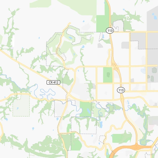
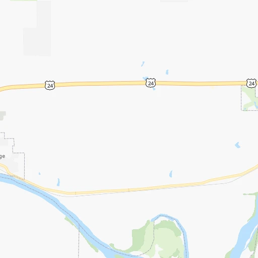
Roadmap (route) to go from Saint Mary Hospital Airport to Fremont detailed above, you can also see the course layout on the map.
While doing trip Saint Mary Hospital (airport) - Fremont by car, the calculated route ends at a distance , or more straight.
Distance and duration of the route between Saint Mary Hospital (airport) and Fremont
Calculation of distance and route from Fremont to Saint Mary Hospital (airport) :
249.5273.4 km3h27mn
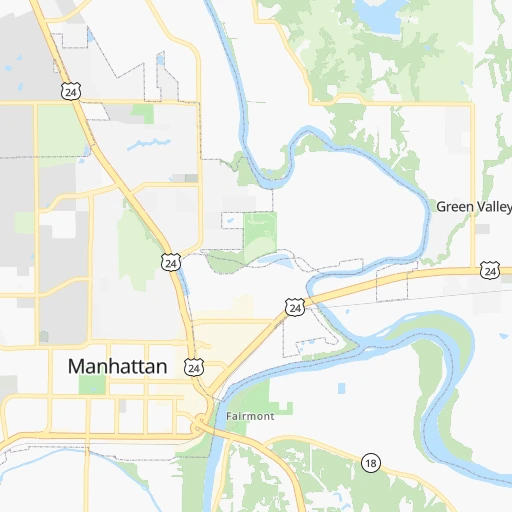
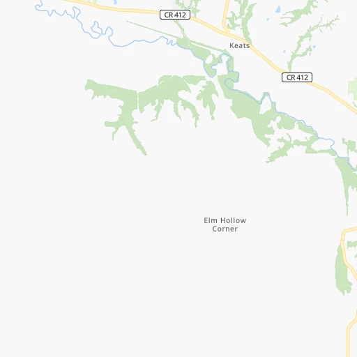
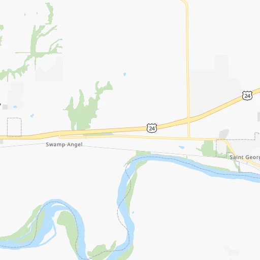
Continue 0h0mn 89 mTurn right onto College Heights Road 0h0mn 119 mTurn left onto Denison Avenue 0h0mn 290 mTurn slight right onto Denison Avenue 0h3mn 2.9 kmTurn right onto Marlatt Avenue 0h1mn 598 mTurn left onto Tuttle Creek Boulevard 0h1mn 1.3 kmTurn sharp right onto Barnes Road 0h5mn 5.1 kmTurn sharp right onto KS 13 0h21mn 33.0 kmTurn left onto KS 16, KS 99 0h16mn 23.7 kmTurn right onto East 3rd Street 0h0mn 157 mTurn left onto North Locust Street 0h11mn 15.4 kmTurn left onto Pony Express Highway 0h6mn 8.8 kmTurn right onto North Oak Street 0h15mn 17.7 kmTurn right onto East State Line Road 0h1mn 1.6 kmTurn left onto South 162nd Road 0h7mn 8.4 kmContinue onto South 162nd Road 0h2mn 2.8 kmContinue onto South 162nd Road 1h32mn 38.8 kmContinue onto South 162 Road 0h2mn 1.5 kmTurn right onto 7th Street 0h1mn 614 mTurn right onto East Highway 41 0h0mn 705 mTurn left onto Highway 43 0h20mn 29.4 kmContinue onto South 148th Street 0h17mn 22.2 kmTurn right onto US Highway 6 0h1mn 2.0 kmTurn left onto North 162nd Street 0h11mn 12.9 kmTurn left onto Ashland Road 0h1mn 1.3 kmContinue onto County Road 11 0h16mn 19.6 kmTurn slight right onto County Road 11 0h13mn 19.6 kmAt roundabout, take exit 3 onto South Broad Street 0h3mn 2.7 kmTurn right onto West 4th Street 0h0mn 57 mTurn left 0h0mn 44 mArrive at destination 0h0mn 0 m
Travel from Saint Mary Hospital (airport) (Nebraska) to a selection of major cities.
Distances from Saint Mary Hospital Airport to biggest cities in Kansas
- Gardner,20,868 inhabitants.150 km
- Liberal,20,746 inhabitants.448 km
- Pittsburg,20,409 inhabitants.257 km
Other major cities in country :
- Charlotte [NC], 827,097 inhabitants. 1,462 km
- Seattle [WA], 684,451 inhabitants. 2,270 km
- Denver [CO], 682,545 inhabitants. 724 km
- El Paso [TX], 681,124 inhabitants. 1,219 km
- Detroit [MI], 677,116 inhabitants. 1,193 km
- Boston [MA], 667,137 inhabitants. 2,172 km
- Memphis [TN], 655,770 inhabitants. 733 km
- New South Memphis [TN], 641,608 inhabitants. 737 km
- Portland [OR], 632,309 inhabitants. 2,247 km
- Oklahoma City [OK], 631,346 inhabitants. 422 km
- Las Vegas [NV], 623,747 inhabitants. 1,665 km
- Baltimore [MD], 621,849 inhabitants. 1,719 km
- Washington, D.C. [DC], 601,723 inhabitants. 1,687 km
- Milwaukee [WI], 600,155 inhabitants. 844 km
- South Boston [MA], 571,281 inhabitants. 2,173 km
- Albuquerque [NM], 559,121 inhabitants. 1,002 km
- Tucson [AZ], 531,641 inhabitants. 1,508 km
- Nashville [TN], 530,852 inhabitants. 926 km
- Fresno [CA], 520,052 inhabitants. 2,047 km
- Sacramento [CA], 490,712 inhabitants. 2,153 km
Route from Fremont to major cities (United States).
- Distance Fremont New York City1,884 km
- Distance Fremont Los Angeles2,076 km
- Distance Fremont Chicago737 km
- Distance Fremont Brooklyn1,890 km
- Distance Fremont Houston1,303 km
- Distance Fremont Queens1,899 km
- Distance Fremont Philadelphia1,804 km
- Distance Fremont Phoenix1,635 km
- Distance Fremont Manhattan1,886 km
- Distance Fremont San Antonio1,349 km
- Distance Fremont San Diego2,069 km
- Distance Fremont The Bronx1,893 km
- Distance Fremont Dallas963 km
- Distance Fremont San Jose2,224 km
- Distance Fremont Austin1,248 km
- Distance Fremont Jacksonville1,817 km
- Distance Fremont San Francisco2,251 km
- Distance Fremont Columbus1,150 km
- Distance Fremont Fort Worth972 km
- Distance Fremont Indianapolis893 km
Nearest cities to Saint Mary Hospital (airport) :
- Kansas City, 475,378 inhabitants. 174 km
- Omaha, 443,885 inhabitants. 237 km
- Wichita, 389,965 inhabitants. 179 km
- Lincoln, 277,348 inhabitants. 179 km
- Des Moines, 210,330 inhabitants. 368 km
- Overland Park, 186,515 inhabitants. 167 km
- Kansas City, 151,306 inhabitants. 169 km
- Olathe, 134,305 inhabitants. 157 km
- Topeka, 127,265 inhabitants. 80 km
- Independence, 117,255 inhabitants. 188 km
- East Independence, 110,675 inhabitants. 193 km
- Lee's Summit, 95,094 inhabitants. 193 km
- Lawrence, 93,917 inhabitants. 119 km
- Saint Joseph, 76,780 inhabitants. 163 km
- Ames, 65,060 inhabitants. 404 km
- Shawnee, 65,046 inhabitants. 162 km
- West Des Moines, 64,113 inhabitants. 361 km
- Rogers, 63,159 inhabitants. 385 km
- Council Bluffs, 62,597 inhabitants. 239 km
- Ankeny, 56,764 inhabitants. 379 km
- Manhattan, 56,308 inhabitants. 1 km
- Bellevue, 55,510 inhabitants. 225 km
- Blue Springs, 54,148 inhabitants. 200 km
- Lenexa, 52,490 inhabitants. 162 km
- Joplin, 51,818 inhabitants. 296 km
- Enid, 51,776 inhabitants. 331 km
- Grand Island, 51,440 inhabitants. 244 km
- Salina, 47,813 inhabitants. 97 km
- Bentonville, 44,499 inhabitants. 377 km
- Urbandale, 44,062 inhabitants. 365 km
- Hutchinson, 41,569 inhabitants. 172 km
- Bartlesville, 36,595 inhabitants. 277 km
- Leavenworth, 35,980 inhabitants. 144 km
- Leawood, 34,579 inhabitants. 172 km
- Owasso, 34,542 inhabitants. 331 km
- Kearney, 33,021 inhabitants. 271 km
- Liberty, 30,450 inhabitants. 187 km
- Raytown, 29,401 inhabitants. 184 km
- Bella Vista, 27,999 inhabitants. 364 km
- Gladstone, 26,861 inhabitants. 175 km
- Fremont, 26,474 inhabitants. 250 km
- Grandview, 25,256 inhabitants. 181 km
- Hastings, 24,924 inhabitants. 219 km
- Ponca City, 24,758 inhabitants. 280 km
- Emporia, 24,649 inhabitants. 94 km
- Junction City, 24,621 inhabitants. 28 km
- Norfolk, 24,366 inhabitants. 324 km
- Derby, 23,509 inhabitants. 192 km
- Belton, 23,168 inhabitants. 183 km
- Columbus, 22,797 inhabitants. 258 km
Location Saint Mary Hospital (airport) (Kansas) :
| Country flag |  |
| Location | Saint Mary Hospital (airport) |
| State | Kansas |
| County | Riley County |
| Country | United States |
| Country code / ISO 2 | US |
| Latitude | 39.1888900 |
| Longitude | -96.5863900 |
| Altitude | 322 meters |
| Time zone | America/Chicago |
Location Fremont (Nebraska) :
| Country flag | |
| Location | Fremont |
| State | Nebraska |
| County | Dodge County |
| Country | United States |
| Country code / ISO 2 | US |
| Latitude | 41.4333300 |
| Longitude | -96.4980800 |
| Altitude | 365 meters |
| Time zone | America/Chicago |
