


How to get from Marysville (Kansas) to Brooklyn (New York)
Calculate route from Marysville (Kansas, United States) to Brooklyn (New York, United States).
The flight distance (as the crow flies) between Marysville and Brooklyn is 1,921.9 km.
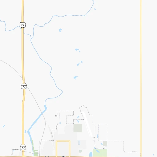
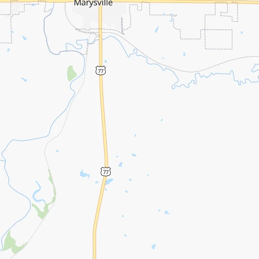
Roadmap (route) to go from Marysville to Brooklyn detailed above, you can also see the course layout on the map.
While doing trip Marysville - Brooklyn by car, the calculated route ends at a distance , or more straight.
Distance and duration of the route between Marysville and Brooklyn
Calculation of distance and route from Brooklyn to Marysville :
1,921.92,086.5 km23h48mn
Continue 0h0mn 32 mTurn left onto South 9th Street 0h0mn 101 mTurn right onto Center Street 5h18mn 472.7 kmKeep right onto I 72, US 36 and take I-172 north, IL 110 (CKC) east toward Quincy 2h34mn 158.4 kmKeep right onto I 72, US 36 and take I 72 East, US 36 East toward Decatur 0h29mn 48.2 kmKeep left onto I 72 toward I 72 East, US 51 North 3h42mn 262.8 kmKeep right toward I 465 North, US 136 West 0h0mn 266 mKeep left and take US 136 West toward Crawfordsville Road 0h1mn 658 mTurn left onto Crawfordsville Road 0h3mn 2.8 kmTurn slight right onto Crawfordsville Road 0h1mn 622 mAt roundabout, take exit 2 onto West 16th Street 0h0mn 267 mTurn slight right onto West 16th Street 0h6mn 4.6 kmTurn right onto Indiana Avenue 0h1mn 1.1 kmKeep left onto West 10th Street 0h1mn 674 mTurn left onto North West Street 0h0mn 139 mKeep left toward I 65 South 0h1mn 1.7 kmKeep right and take I 70 East toward Dayton 1h14mn 120.7 kmKeep left onto I 70 1h44mn 72.5 kmKeep left onto I 70 1h47mn 79.0 kmKeep right onto West Freeway 2h60mn 198.6 kmKeep right onto I 470 1h36mn 55.9 kmKeep right and take US 40 toward Chestnut Street 0h0mn 261 mKeep right toward US 40 0h3mn 2.4 kmKeep right 0h0mn 215 mTurn left onto West Beau Street 0h3mn 2.5 kmKeep right 0h0mn 51 mTurn slight right onto Clare Drive 0h0mn 66 mTurn left 0h2mn 3.1 kmContinue onto Dwight D Eisenhower Highway 0h23mn 30.2 kmKeep right and drive toward Speers 0h14mn 18.1 kmKeep right and take PA 31 toward Mount Pleasant, West Newton 0h0mn 424 mKeep right 0h0mn 78 mTurn slight right onto Mount Pleasant Road 0h27mn 29.7 kmKeep left 0h0mn 248 mTurn left 0h0mn 159 mKeep right 2h13mn 219.4 kmKeep right and take I 81, US 11 toward Carlisle, Harrisburg 0h1mn 1.4 kmKeep left and take US 11 North toward Harrisburg 0h2mn 2.2 kmContinue onto Harrisburg Pike 0h0mn 242 mTurn sharp left onto Cook Drive 0h19mn 28.5 kmContinue onto American Legion Memorial Highway 0h20mn 30.7 kmKeep right onto I 78 and take I 78 East toward Allentown 1h55mn 82.0 kmKeep right onto Lehigh Valley Thruway and take US 22 East toward Pennsylvania Turnpike, LVI Airport 0h24mn 31.6 kmKeep right and take PA 248 toward Wilson, 25th Street 0h0mn 295 mKeep left and take PA 248 toward Wilson, Easton, Lehighton 0h0mn 39 mTurn slight left onto Wood Avenue 0h0mn 193 mKeep right and take PA 248 East toward Wilson 0h0mn 74 mTurn slight right onto Northampton Street 0h3mn 3.4 kmAt roundabout, take exit 2 onto Northampton Street 0h1mn 649 mTurn right onto South Main Street 0h4mn 4.2 kmKeep right onto New Brunswick Avenue 0h3mn 2.0 kmTurn right onto US 22 0h0mn 111 mKeep right onto US 22 toward I 78, US 22 East 0h0mn 216 mKeep left onto US 22 and take I 78 East, US 22 East toward New York 0h29mn 45.1 kmKeep right onto Phillipsburg-Newark Expressway 0h10mn 16.4 kmKeep right and drive toward Berkeley Heights, Scotch Plains 0h0mn 358 mKeep left and take CR 641 South toward Berkeley Heights, Scotch Plains 0h0mn 31 mTurn left onto Dale Road 0h1mn 730 mTurn right onto Plainfield Avenue 0h3mn 2.8 kmKeep right 0h1mn 453 mKeep right 0h0mn 115 mTurn slight right onto Park Avenue 0h2mn 1.3 kmTurn left onto Midway Avenue 0h8mn 6.5 kmKeep right 0h0mn 251 mKeep left onto South Avenue West 0h3mn 2.6 kmTurn right onto Aldene Road 0h1mn 335 mKeep left onto West 3rd Avenue 0h5mn 3.9 kmTurn right onto Elmora Avenue 0h2mn 1.6 kmAt roundabout, take exit 6 onto Bayway 0h1mn 1.2 kmTurn left onto Brunswick Avenue 0h0mn 171 mKeep right and take I 278 Toll East toward Goethals Bridge 0h2mn 2.7 kmKeep right and drive toward Inspection Station 0h9mn 10.7 kmKeep left onto Staten Island Expressway and drive toward Upper Level 0h4mn 4.8 kmKeep right toward I 278 East 0h0mn 324 mKeep right and drive toward Fort Hamilton Parkway 0h0mn 253 mKeep right and drive toward Fort Hamilton Parkway 0h0mn 44 mTurn slight right onto Fort Hamilton Parkway 0h3mn 3.2 kmTurn right onto 39th Street 0h1mn 691 mTurn left onto 14th Avenue 0h4mn 3.3 kmTurn right onto Nostrand Avenue 0h0mn 78 mArrive at destination 0h0mn 0 m
Travel from Marysville (New York) to a selection of major cities.
Distances from Marysville to biggest cities in Kansas
- Gardner,20,868 inhabitants.187 km
- Liberal,20,746 inhabitants.486 km
- Pittsburg,20,409 inhabitants.319 km
Other major cities in country :
- Charlotte [NC], 827,097 inhabitants. 1,484 km
- Seattle [WA], 684,451 inhabitants. 2,227 km
- Denver [CO], 682,545 inhabitants. 713 km
- El Paso [TX], 681,124 inhabitants. 1,263 km
- Detroit [MI], 677,116 inhabitants. 1,173 km
- Boston [MA], 667,137 inhabitants. 2,156 km
- Memphis [TN], 655,770 inhabitants. 782 km
- New South Memphis [TN], 641,608 inhabitants. 786 km
- Portland [OR], 632,309 inhabitants. 2,211 km
- Oklahoma City [OK], 631,346 inhabitants. 493 km
- Las Vegas [NV], 623,747 inhabitants. 1,669 km
- Baltimore [MD], 621,849 inhabitants. 1,717 km
- Washington, D.C. [DC], 601,723 inhabitants. 1,688 km
- Milwaukee [WI], 600,155 inhabitants. 811 km
- South Boston [MA], 571,281 inhabitants. 2,157 km
- Albuquerque [NM], 559,121 inhabitants. 1,029 km
- Tucson [AZ], 531,641 inhabitants. 1,537 km
- Nashville [TN], 530,852 inhabitants. 956 km
- Fresno [CA], 520,052 inhabitants. 2,044 km
- Sacramento [CA], 490,712 inhabitants. 2,141 km
Route from Brooklyn to major cities (United States).
- Distance Brooklyn Los Angeles3,945 km
- Distance Brooklyn Chicago1,153 km
- Distance Brooklyn Houston2,285 km
- Distance Brooklyn Philadelphia129 km
- Distance Brooklyn Phoenix3,452 km
- Distance Brooklyn San Antonio2,550 km
- Distance Brooklyn San Diego3,917 km
- Distance Brooklyn Dallas2,211 km
- Distance Brooklyn San Jose4,113 km
- Distance Brooklyn Austin2,436 km
- Distance Brooklyn Jacksonville1,343 km
- Distance Brooklyn San Francisco4,140 km
- Distance Brooklyn Columbus772 km
- Distance Brooklyn Fort Worth2,256 km
- Distance Brooklyn Indianapolis1,042 km
- Distance Brooklyn Charlotte854 km
- Distance Brooklyn Seattle3,877 km
- Distance Brooklyn Denver2,627 km
- Distance Brooklyn El Paso3,065 km
- Distance Brooklyn Detroit781 km
Nearest cities to Marysville :
- Kansas City, 475,378 inhabitants. 196 km
- Omaha, 443,885 inhabitants. 168 km
- Wichita, 389,965 inhabitants. 247 km
- Lincoln, 277,348 inhabitants. 107 km
- Overland Park, 186,515 inhabitants. 195 km
- Kansas City, 151,306 inhabitants. 191 km
- Olathe, 134,305 inhabitants. 190 km
- Topeka, 127,265 inhabitants. 121 km
- Independence, 117,255 inhabitants. 209 km
- East Independence, 110,675 inhabitants. 214 km
- Lee's Summit, 95,094 inhabitants. 221 km
- Lawrence, 93,917 inhabitants. 155 km
- Sioux City, 82,821 inhabitants. 297 km
- Saint Joseph, 76,780 inhabitants. 154 km
- Shawnee, 65,046 inhabitants. 188 km
- West Des Moines, 64,113 inhabitants. 314 km
- Council Bluffs, 62,597 inhabitants. 172 km
- Manhattan, 56,308 inhabitants. 73 km
- Bellevue, 55,510 inhabitants. 158 km
- Blue Springs, 54,148 inhabitants. 223 km
- Lenexa, 52,490 inhabitants. 192 km
- Joplin, 51,818 inhabitants. 359 km
- Grand Island, 51,440 inhabitants. 188 km
- Salina, 47,813 inhabitants. 139 km
- Urbandale, 44,062 inhabitants. 317 km
- Hutchinson, 41,569 inhabitants. 227 km
- Leavenworth, 35,980 inhabitants. 159 km
- Leawood, 34,579 inhabitants. 200 km
- Kearney, 33,021 inhabitants. 228 km
- Liberty, 30,450 inhabitants. 202 km
- Raytown, 29,401 inhabitants. 209 km
- Gladstone, 26,861 inhabitants. 193 km
- Fremont, 26,474 inhabitants. 178 km
- Grandview, 25,256 inhabitants. 211 km
- Hastings, 24,924 inhabitants. 170 km
- Fort Dodge, 24,649 inhabitants. 361 km
- Emporia, 24,649 inhabitants. 165 km
- Junction City, 24,621 inhabitants. 92 km
- Norfolk, 24,366 inhabitants. 252 km
- Derby, 23,509 inhabitants. 261 km
- Belton, 23,168 inhabitants. 215 km
- Columbus, 22,797 inhabitants. 187 km
- Prairie Village, 21,877 inhabitants. 197 km
- Hays, 21,092 inhabitants. 254 km
- Johnston, 20,871 inhabitants. 322 km
- Gardner, 20,868 inhabitants. 187 km
- Pittsburg, 20,409 inhabitants. 319 km
- Raymore, 20,374 inhabitants. 222 km
- Warrensburg, 19,927 inhabitants. 278 km
- Papillion, 19,510 inhabitants. 155 km
Location Marysville (Kansas) :
| Country flag |  |
| Location | Marysville |
| State | Kansas |
| County | Marshall County |
| Country | United States |
| Country code / ISO 2 | US |
| Latitude | 39.8411100 |
| Longitude | -96.6472400 |
| Altitude | 354 meters |
| Time zone | America/Chicago |
Location Brooklyn (New York) :
| Country flag | |
| Location | Brooklyn |
| State | New York |
| County | Kings County |
| Country | United States |
| Country code / ISO 2 | US |
| Latitude | 40.6501000 |
| Longitude | -73.9495800 |
| Altitude | 15 meters |
| Time zone | America/New_York |


