
How to get from Methodist Hospital Helistop (Indiana) to Portage (Indiana)
Calculate route from Methodist Hospital Helistop (Indiana, United States) to Portage (Indiana, United States).
The flight distance (as the crow flies) between Methodist Hospital Helistop and Portage is 216.0 km.
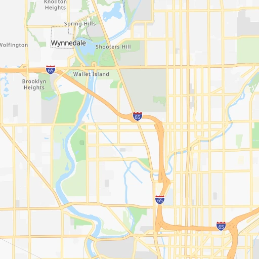
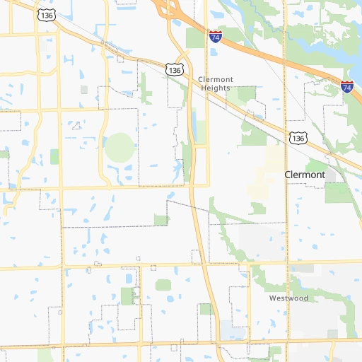
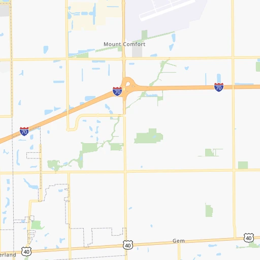
Roadmap (route) to go from Methodist Hospital Helistop to Portage detailed above, you can also see the course layout on the map.
While doing trip Methodist Hospital Helistop - Portage by car, the calculated route ends at a distance , or more straight.
Distance and duration of the route between Methodist Hospital Helistop and Portage
Calculation of distance and route from Portage to Methodist Hospital Helistop :
216.0245.6 km3h37mn
Continue onto North Capitol Avenue 0h0mn 226 mTurn sharp right onto West 16th Street 0h1mn 604 mTurn right onto Dr Martin Luther King Jr Street 0h3mn 2.8 kmKeep left 2h20mn 230.9 kmKeep right and take I 80 East, I 94 East, US 6 East toward Toledo, Detroit 0h1mn 1.4 kmKeep right and drive toward Central Avenue 0h0mn 535 mKeep right and drive toward Lake Station 0h0mn 59 mTurn slight right onto Central Avenue 0h8mn 6.8 kmTurn left onto Central Avenue 0h3mn 2.3 kmArrive at destination 0h0mn 0 m
Travel from Methodist Hospital Helistop (Indiana) to a selection of major cities.
Distances from Methodist Hospital Helistop to biggest cities in Indiana
- Columbus,46,690 inhabitants.69 km
- West Lafayette,45,550 inhabitants.95 km
- Portage,36,738 inhabitants.216 km
- Westfield,36,738 inhabitants.28 km
- New Albany,36,732 inhabitants.170 km
- Richmond,35,854 inhabitants.109 km
- Merrillville,35,224 inhabitants.213 km
- Goshen,32,983 inhabitants.201 km
- Valparaiso,32,626 inhabitants.202 km
- Michigan City,31,459 inhabitants.222 km
- Plainfield,30,590 inhabitants.22 km
- Granger,30,465 inhabitants.219 km
- Marion,29,081 inhabitants.96 km
- Crown Point,28,879 inhabitants.208 km
- Schererville,28,791 inhabitants.217 km
- East Chicago,28,699 inhabitants.233 km
- Hobart,28,404 inhabitants.215 km
- Zionsville,26,296 inhabitants.20 km
- Brownsburg,24,996 inhabitants.21 km
- Franklin,24,598 inhabitants.36 km
Other major cities in country :
- Seattle [WA], 684,451 inhabitants. 3,008 km
- Denver [CO], 682,545 inhabitants. 1,608 km
- El Paso [TX], 681,124 inhabitants. 2,035 km
- Detroit [MI], 677,116 inhabitants. 385 km
- Boston [MA], 667,137 inhabitants. 1,297 km
- Memphis [TN], 655,770 inhabitants. 620 km
- New South Memphis [TN], 641,608 inhabitants. 626 km
- Portland [OR], 632,309 inhabitants. 3,029 km
- Oklahoma City [OK], 631,346 inhabitants. 1,110 km
- Las Vegas [NV], 623,747 inhabitants. 2,563 km
- Baltimore [MD], 621,849 inhabitants. 821 km
- Washington, D.C. [DC], 601,723 inhabitants. 792 km
- Milwaukee [WI], 600,155 inhabitants. 390 km
- South Boston [MA], 571,281 inhabitants. 1,298 km
- Albuquerque [NM], 559,121 inhabitants. 1,880 km
- Tucson [AZ], 531,641 inhabitants. 2,374 km
- Nashville [TN], 530,852 inhabitants. 407 km
- Fresno [CA], 520,052 inhabitants. 2,940 km
- Sacramento [CA], 490,712 inhabitants. 3,032 km
- Kansas City [MO], 475,378 inhabitants. 727 km
Route from Portage to major cities (United States).
- Distance Portage New York City1,107 km
- Distance Portage Los Angeles2,840 km
- Distance Portage Chicago50 km
- Distance Portage Brooklyn1,113 km
- Distance Portage Houston1,507 km
- Distance Portage Queens1,122 km
- Distance Portage Philadelphia1,028 km
- Distance Portage Phoenix2,367 km
- Distance Portage Manhattan1,109 km
- Distance Portage San Antonio1,694 km
- Distance Portage San Diego2,821 km
- Distance Portage The Bronx1,116 km
- Distance Portage Dallas1,297 km
- Distance Portage San Jose3,000 km
- Distance Portage Austin1,576 km
- Distance Portage Jacksonville1,346 km
- Distance Portage San Francisco3,028 km
- Distance Portage Columbus395 km
- Distance Portage Fort Worth1,333 km
- Distance Portage Charlotte896 km
Nearest cities to Methodist Hospital Helistop :
- Chicago, 2,720,546 inhabitants. 261 km
- Indianapolis, 829,718 inhabitants. 2 km
- Lexington-Fayette, 314,488 inhabitants. 244 km
- Cincinnati, 296,943 inhabitants. 160 km
- Toledo, 279,789 inhabitants. 303 km
- Fort Wayne, 260,326 inhabitants. 173 km
- Louisville, 243,639 inhabitants. 175 km
- Lexington, 225,366 inhabitants. 248 km
- Aurora, 200,661 inhabitants. 285 km
- Rockford, 148,278 inhabitants. 370 km
- Joliet, 147,861 inhabitants. 252 km
- Naperville, 147,100 inhabitants. 278 km
- Dayton, 140,599 inhabitants. 169 km
- Evansville, 119,943 inhabitants. 235 km
- Ann Arbor, 117,070 inhabitants. 343 km
- Lansing, 115,056 inhabitants. 354 km
- Elgin, 112,111 inhabitants. 307 km
- South Bend, 101,516 inhabitants. 211 km
- Kenosha, 99,858 inhabitants. 341 km
- Dearborn, 95,171 inhabitants. 377 km
- Livonia, 94,635 inhabitants. 371 km
- Carmel, 88,713 inhabitants. 21 km
- Waukegan, 88,475 inhabitants. 319 km
- Canton, 86,825 inhabitants. 359 km
- West Town, 86,429 inhabitants. 267 km
- Champaign, 86,096 inhabitants. 181 km
- Near North Side, 85,711 inhabitants. 266 km
- Bloomington, 84,067 inhabitants. 76 km
- Cicero, 83,886 inhabitants. 265 km
- Westland, 82,000 inhabitants. 365 km
- Farmington Hills, 81,330 inhabitants. 380 km
- Belmont Cragin, 79,159 inhabitants. 274 km
- Bloomington, 78,292 inhabitants. 253 km
- Racine, 77,742 inhabitants. 354 km
- Hammond, 77,614 inhabitants. 229 km
- Gary, 77,156 inhabitants. 224 km
- Fishers, 76,794 inhabitants. 22 km
- Kalamazoo, 76,041 inhabitants. 283 km
- Arlington Heights, 75,926 inhabitants. 298 km
- Waterford, 75,737 inhabitants. 397 km
- Evanston, 75,527 inhabitants. 282 km
- Schaumburg, 74,693 inhabitants. 297 km
- Bolingbrook, 74,306 inhabitants. 266 km
- South Lawndale, 73,826 inhabitants. 263 km
- Logan Square, 73,702 inhabitants. 270 km
- Decatur, 73,254 inhabitants. 239 km
- Southfield, 73,156 inhabitants. 387 km
- West Ridge, 72,211 inhabitants. 278 km
- Lafayette, 71,111 inhabitants. 92 km
- Muncie, 70,087 inhabitants. 80 km
Location Methodist Hospital Helistop (Indiana) :
| Country flag |  |
| Location | Methodist Hospital Helistop |
| State | Indiana |
| County | Marion County |
| Country | United States |
| Country code / ISO 2 | US |
| Latitude | 39.7903200 |
| Longitude | -86.1619300 |
| Altitude | 220 meters |
| Time zone | America/Indiana/Indianapolis |
Location Portage (Indiana) :
| Country flag | |
| Location | Portage |
| State | Indiana |
| County | Porter County |
| Country | United States |
| Country code / ISO 2 | US |
| Latitude | 41.5758700 |
| Longitude | -87.1761500 |
| Altitude | 194 meters |
| Time zone | America/Chicago |


