
How to get from Huntingburg (airport) (Indiana) to Smyrna (Tennessee)
Calculate route from Huntingburg (airport) (Indiana, United States) to Smyrna (Tennessee, United States).
The flight distance (as the crow flies) between Huntingburg (airport) and Smyrna is 254.6 km.
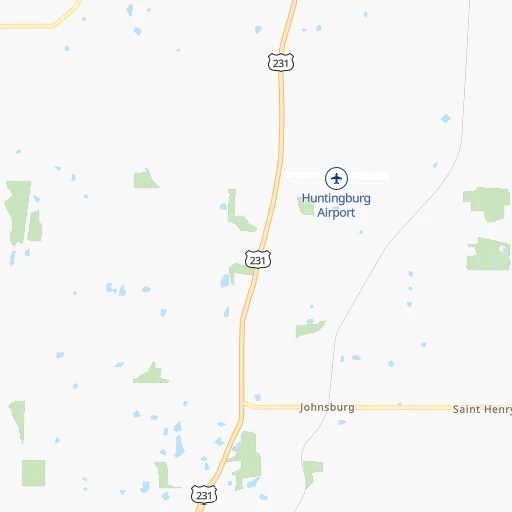
Roadmap (route) to go from Huntingburg Airport to Smyrna detailed above, you can also see the course layout on the map.
While doing trip Huntingburg (airport) - Smyrna by car, the calculated route ends at a distance , or more straight.
Distance and duration of the route between Huntingburg (airport) and Smyrna
Calculation of distance and route from Smyrna to Huntingburg (airport) :
254.6300.2 km3h26mn
Continue onto 900 South 0h1mn 411 mTurn right onto 900 South 0h1mn 270 mTurn left onto US 231 1h50mn 63.0 kmKeep right and take I 165 South toward Bowling Green 1h7mn 113.3 kmKeep right and take I 65 South toward Nashville 1h44mn 74.2 kmKeep right and drive toward Rivergate Parkway, Goodlettsville, Hendersonville 0h0mn 346 mKeep left and drive toward Rivergate Parkway, Hendersonville 0h1mn 686 mKeep right onto Rivergate Parkway 0h1mn 867 mKeep right 0h0mn 139 mTurn slight right onto Gallatin Pike 0h7mn 7.4 kmTurn left onto Joyce Lane 0h12mn 15.9 kmKeep right and take US 41, US 70S toward Murfreesboro Road 0h0mn 421 mKeep left toward US 41 South, US 70S East 0h21mn 23.0 kmTurn left onto Sam Hager Street 0h0mn 76 mTurn right onto 2nd Street 0h0mn 97 mArrive at destination 0h0mn 0 m
Travel from Huntingburg (airport) (Tennessee) to a selection of major cities.
Distances from Huntingburg Airport to biggest cities in Indiana
- Columbus,46,690 inhabitants.139 km
- West Lafayette,45,550 inhabitants.243 km
- Portage,36,738 inhabitants.371 km
- Westfield,36,738 inhabitants.212 km
- New Albany,36,732 inhabitants.99 km
- Richmond,35,854 inhabitants.251 km
- Merrillville,35,224 inhabitants.362 km
- Goshen,32,983 inhabitants.383 km
- Valparaiso,32,626 inhabitants.359 km
- Michigan City,31,459 inhabitants.385 km
- Plainfield,30,590 inhabitants.169 km
- Granger,30,465 inhabitants.397 km
- Marion,29,081 inhabitants.280 km
- Crown Point,28,879 inhabitants.355 km
- Schererville,28,791 inhabitants.362 km
- East Chicago,28,699 inhabitants.380 km
- Hobart,28,404 inhabitants.367 km
- Zionsville,26,296 inhabitants.199 km
- Brownsburg,24,996 inhabitants.184 km
- Franklin,24,598 inhabitants.158 km
Other major cities in country :
- Seattle [WA], 684,451 inhabitants. 3,035 km
- Denver [CO], 682,545 inhabitants. 1,566 km
- El Paso [TX], 681,124 inhabitants. 1,917 km
- Detroit [MI], 677,116 inhabitants. 563 km
- Boston [MA], 667,137 inhabitants. 1,422 km
- Memphis [TN], 655,770 inhabitants. 442 km
- New South Memphis [TN], 641,608 inhabitants. 448 km
- Portland [OR], 632,309 inhabitants. 3,041 km
- Oklahoma City [OK], 631,346 inhabitants. 989 km
- Las Vegas [NV], 623,747 inhabitants. 2,499 km
- Baltimore [MD], 621,849 inhabitants. 905 km
- Washington, D.C. [DC], 601,723 inhabitants. 866 km
- Milwaukee [WI], 600,155 inhabitants. 539 km
- South Boston [MA], 571,281 inhabitants. 1,423 km
- Albuquerque [NM], 559,121 inhabitants. 1,790 km
- Tucson [AZ], 531,641 inhabitants. 2,273 km
- Nashville [TN], 530,852 inhabitants. 232 km
- Fresno [CA], 520,052 inhabitants. 2,888 km
- Sacramento [CA], 490,712 inhabitants. 2,995 km
- Kansas City [MO], 475,378 inhabitants. 669 km
Route from Smyrna to major cities (United States).
- Distance Smyrna New York City1,211 km
- Distance Smyrna Los Angeles2,888 km
- Distance Smyrna Chicago660 km
- Distance Smyrna Brooklyn1,213 km
- Distance Smyrna Houston1,078 km
- Distance Smyrna Queens1,223 km
- Distance Smyrna Philadelphia1,089 km
- Distance Smyrna Phoenix2,349 km
- Distance Smyrna Manhattan1,217 km
- Distance Smyrna San Antonio1,337 km
- Distance Smyrna San Diego2,828 km
- Distance Smyrna The Bronx1,228 km
- Distance Smyrna Dallas1,009 km
- Distance Smyrna San Jose3,144 km
- Distance Smyrna Austin1,223 km
- Distance Smyrna Jacksonville775 km
- Distance Smyrna San Francisco3,183 km
- Distance Smyrna Columbus540 km
- Distance Smyrna Fort Worth1,056 km
- Distance Smyrna Indianapolis423 km
Nearest cities to Huntingburg (airport) :
- Indianapolis, 829,718 inhabitants. 183 km
- Nashville, 530,852 inhabitants. 232 km
- Lexington-Fayette, 314,488 inhabitants. 220 km
- Cincinnati, 296,943 inhabitants. 234 km
- Fort Wayne, 260,326 inhabitants. 357 km
- Louisville, 243,639 inhabitants. 105 km
- Lexington, 225,366 inhabitants. 219 km
- Clarksville, 149,176 inhabitants. 195 km
- Dayton, 140,599 inhabitants. 292 km
- Murfreesboro, 126,118 inhabitants. 272 km
- Evansville, 119,943 inhabitants. 61 km
- Springfield, 116,565 inhabitants. 290 km
- Peoria, 115,070 inhabitants. 354 km
- North Peoria, 113,004 inhabitants. 356 km
- Carmel, 88,713 inhabitants. 206 km
- Champaign, 86,096 inhabitants. 236 km
- Bloomington, 84,067 inhabitants. 109 km
- Bloomington, 78,292 inhabitants. 304 km
- Fishers, 76,794 inhabitants. 207 km
- Decatur, 73,254 inhabitants. 248 km
- Franklin, 72,639 inhabitants. 259 km
- Lafayette, 71,111 inhabitants. 242 km
- Muncie, 70,087 inhabitants. 255 km
- Jackson, 66,975 inhabitants. 336 km
- Bowling Green, 63,616 inhabitants. 147 km
- Hamilton, 62,407 inhabitants. 244 km
- Terre Haute, 60,825 inhabitants. 141 km
- Noblesville, 59,093 inhabitants. 216 km
- Owensboro, 59,042 inhabitants. 54 km
- Kokomo, 57,995 inhabitants. 259 km
- Hendersonville, 56,018 inhabitants. 218 km
- Greenwood, 55,586 inhabitants. 169 km
- Kettering, 55,525 inhabitants. 290 km
- Anderson, 55,305 inhabitants. 234 km
- Normal, 54,373 inhabitants. 307 km
- Middletown, 48,760 inhabitants. 263 km
- Lawrence, 47,809 inhabitants. 195 km
- Jeffersonville, 46,960 inhabitants. 107 km
- Columbus, 46,690 inhabitants. 139 km
- Smyrna, 46,607 inhabitants. 255 km
- Beavercreek, 46,277 inhabitants. 299 km
- West Lafayette, 45,550 inhabitants. 243 km
- Fairfield, 42,767 inhabitants. 241 km
- Urbana, 42,311 inhabitants. 234 km
- Brentwood, 41,763 inhabitants. 247 km
- Covington, 40,997 inhabitants. 232 km
- Cape Girardeau, 39,462 inhabitants. 249 km
- Huber Heights, 38,176 inhabitants. 303 km
- Lima, 37,873 inhabitants. 370 km
- Columbia, 36,800 inhabitants. 293 km
Location Huntingburg (airport) (Indiana) :
| Country flag |  |
| Location | Huntingburg (airport) |
| State | Indiana |
| County | Dubois County |
| Country | United States |
| Country code / ISO 2 | US |
| Latitude | 38.2475400 |
| Longitude | -86.9568000 |
| Altitude | 155 meters |
| Time zone | America/Indiana/Vincennes |
Location Smyrna (Tennessee) :
| Country flag | |
| Location | Smyrna |
| State | Tennessee |
| County | Rutherford County |
| Country | United States |
| Country code / ISO 2 | US |
| Latitude | 35.9828400 |
| Longitude | -86.5186000 |
| Altitude | 166 meters |
| Time zone | America/Chicago |


