
How to get from Evansville Regional (airport) (Indiana) to Valparaiso (Indiana)
Calculate route from Evansville Regional (airport) (Indiana, United States) to Valparaiso (Indiana, United States).
The flight distance (as the crow flies) between Evansville Regional (airport) and Valparaiso is 384.0 km.
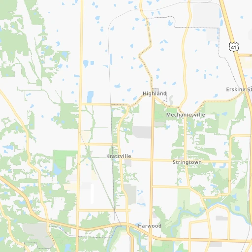
Roadmap (route) to go from Evansville Regional Airport to Valparaiso detailed above, you can also see the course layout on the map.
While doing trip Evansville Regional (airport) - Valparaiso by car, the calculated route ends at a distance , or more straight.
Distance and duration of the route between Evansville Regional (airport) and Valparaiso
Calculation of distance and route from Valparaiso to Evansville Regional (airport) :
384.0427.8 km5h26mn
Continue onto Flightline Drive 0h0mn 189 mTurn right onto Flightline Drive 0h0mn 35 mTurn right onto US 41 1h0mn 78.0 kmKeep right onto US 41, US 150 and take US 41 North, US 150 toward Terre Haute 3h24mn 271.2 kmTurn right onto State Road 14 0h12mn 15.3 kmTurn left 0h9mn 14.4 kmKeep right and take SR 10 toward Roselawn, Demotte 0h0mn 415 mKeep right 0h0mn 54 mTurn slight right onto West State Road 10 0h4mn 5.5 kmTurn left onto North State Road 10 0h4mn 5.0 kmTurn slight left onto North Halleck Street 0h13mn 14.6 kmContinue onto South State Road 2 0h12mn 14.7 kmAt roundabout, take exit 2 onto South State Road 2 0h4mn 5.4 kmAt roundabout, take exit 2 onto South State Road 2 0h4mn 3.1 kmTurn left onto Walnut Street 0h0mn 11 mArrive at destination 0h0mn 0 m
Travel from Evansville Regional (airport) (Indiana) to a selection of major cities.
Distances from Evansville Regional Airport to biggest cities in Indiana
- Columbus,46,690 inhabitants.191 km
- West Lafayette,45,550 inhabitants.271 km
- Portage,36,738 inhabitants.395 km
- Westfield,36,738 inhabitants.254 km
- New Albany,36,732 inhabitants.152 km
- Richmond,35,854 inhabitants.304 km
- Merrillville,35,224 inhabitants.384 km
- Goshen,32,983 inhabitants.421 km
- Valparaiso,32,626 inhabitants.385 km
- Michigan City,31,459 inhabitants.412 km
- Plainfield,30,590 inhabitants.210 km
- Granger,30,465 inhabitants.431 km
- Marion,29,081 inhabitants.324 km
- Crown Point,28,879 inhabitants.377 km
- Schererville,28,791 inhabitants.383 km
- East Chicago,28,699 inhabitants.401 km
- Hobart,28,404 inhabitants.390 km
- Zionsville,26,296 inhabitants.240 km
- Brownsburg,24,996 inhabitants.224 km
- Franklin,24,598 inhabitants.206 km
Other major cities in country :
- Seattle [WA], 684,451 inhabitants. 3,004 km
- Denver [CO], 682,545 inhabitants. 1,521 km
- El Paso [TX], 681,124 inhabitants. 1,862 km
- Detroit [MI], 677,116 inhabitants. 612 km
- Boston [MA], 667,137 inhabitants. 1,478 km
- Memphis [TN], 655,770 inhabitants. 392 km
- New South Memphis [TN], 641,608 inhabitants. 398 km
- Portland [OR], 632,309 inhabitants. 3,007 km
- Oklahoma City [OK], 631,346 inhabitants. 934 km
- Las Vegas [NV], 623,747 inhabitants. 2,450 km
- Baltimore [MD], 621,849 inhabitants. 959 km
- Washington, D.C. [DC], 601,723 inhabitants. 920 km
- Milwaukee [WI], 600,155 inhabitants. 558 km
- South Boston [MA], 571,281 inhabitants. 1,479 km
- Albuquerque [NM], 559,121 inhabitants. 1,737 km
- Tucson [AZ], 531,641 inhabitants. 2,219 km
- Nashville [TN], 530,852 inhabitants. 219 km
- Fresno [CA], 520,052 inhabitants. 2,840 km
- Sacramento [CA], 490,712 inhabitants. 2,950 km
- Kansas City [MO], 475,378 inhabitants. 624 km
Route from Valparaiso to major cities (United States).
- Distance Valparaiso New York City1,097 km
- Distance Valparaiso Los Angeles2,848 km
- Distance Valparaiso Chicago64 km
- Distance Valparaiso Brooklyn1,103 km
- Distance Valparaiso Houston1,503 km
- Distance Valparaiso Queens1,112 km
- Distance Valparaiso Philadelphia1,017 km
- Distance Valparaiso Phoenix2,373 km
- Distance Valparaiso Manhattan1,100 km
- Distance Valparaiso San Antonio1,692 km
- Distance Valparaiso San Diego2,828 km
- Distance Valparaiso The Bronx1,107 km
- Distance Valparaiso Dallas1,296 km
- Distance Valparaiso San Jose3,011 km
- Distance Valparaiso Austin1,574 km
- Distance Valparaiso Jacksonville1,332 km
- Distance Valparaiso San Francisco3,038 km
- Distance Valparaiso Columbus382 km
- Distance Valparaiso Fort Worth1,331 km
- Distance Valparaiso Charlotte882 km
Nearest cities to Evansville Regional (airport) :
- Indianapolis, 829,718 inhabitants. 227 km
- Memphis, 655,770 inhabitants. 392 km
- New South Memphis, 641,608 inhabitants. 398 km
- Nashville, 530,852 inhabitants. 219 km
- St. Louis, 315,685 inhabitants. 241 km
- Louisville, 243,639 inhabitants. 157 km
- Chattanooga, 176,588 inhabitants. 388 km
- East Chattanooga, 154,024 inhabitants. 389 km
- Clarksville, 149,176 inhabitants. 168 km
- Murfreesboro, 126,118 inhabitants. 264 km
- Evansville, 119,943 inhabitants. 7 km
- Springfield, 116,565 inhabitants. 268 km
- Peoria, 115,070 inhabitants. 344 km
- North Peoria, 113,004 inhabitants. 347 km
- Carmel, 88,713 inhabitants. 249 km
- Champaign, 86,096 inhabitants. 239 km
- Bloomington, 84,067 inhabitants. 153 km
- Bloomington, 78,292 inhabitants. 300 km
- Fishers, 76,794 inhabitants. 251 km
- Decatur, 73,254 inhabitants. 235 km
- Franklin, 72,639 inhabitants. 242 km
- Lafayette, 71,111 inhabitants. 271 km
- Muncie, 70,087 inhabitants. 304 km
- Jackson, 66,975 inhabitants. 293 km
- Saint Charles, 65,794 inhabitants. 270 km
- Bowling Green, 63,616 inhabitants. 151 km
- Hamilton, 62,407 inhabitants. 300 km
- Terre Haute, 60,825 inhabitants. 160 km
- Noblesville, 59,093 inhabitants. 260 km
- Owensboro, 59,042 inhabitants. 47 km
- Bartlett, 58,579 inhabitants. 378 km
- Kokomo, 57,995 inhabitants. 298 km
- Hendersonville, 56,018 inhabitants. 209 km
- Greenwood, 55,586 inhabitants. 215 km
- Anderson, 55,305 inhabitants. 281 km
- Normal, 54,373 inhabitants. 303 km
- Florissant, 52,268 inhabitants. 257 km
- Collierville, 48,863 inhabitants. 384 km
- Lawrence, 47,809 inhabitants. 240 km
- Jeffersonville, 46,960 inhabitants. 160 km
- Columbus, 46,690 inhabitants. 191 km
- Smyrna, 46,607 inhabitants. 246 km
- West Lafayette, 45,550 inhabitants. 271 km
- Cleveland, 43,898 inhabitants. 399 km
- Fairfield, 42,767 inhabitants. 297 km
- Urbana, 42,311 inhabitants. 238 km
- Belleville, 42,034 inhabitants. 220 km
- Brentwood, 41,763 inhabitants. 233 km
- Cape Girardeau, 39,462 inhabitants. 193 km
- Germantown, 39,240 inhabitants. 386 km
Location Evansville Regional (airport) (Indiana) :
| Country flag |  |
| Location | Evansville Regional (airport) |
| State | Indiana |
| County | Vanderburgh County |
| Country | United States |
| Country code / ISO 2 | US |
| Latitude | 38.0365600 |
| Longitude | -87.5370100 |
| Altitude | 116 meters |
| Time zone | America/Chicago |
Location Valparaiso (Indiana) :
| Country flag | |
| Location | Valparaiso |
| State | Indiana |
| County | Porter County |
| Country | United States |
| Country code / ISO 2 | US |
| Latitude | 41.4730900 |
| Longitude | -87.0611400 |
| Altitude | 242 meters |
| Time zone | America/Chicago |


