


How to get from Evansville (Indiana) to Goshen (Indiana)
Calculate route from Evansville (Indiana, United States) to Goshen (Indiana, United States).
The flight distance (as the crow flies) between Evansville and Goshen is 427.0 km.
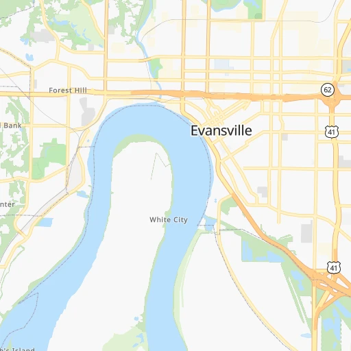
Roadmap (route) to go from Evansville to Goshen detailed above, you can also see the course layout on the map.
While doing trip Evansville - Goshen by car, the calculated route ends at a distance , or more straight.
Distance and duration of the route between Evansville and Goshen
Calculation of distance and route from Goshen to Evansville :
427.0481.7 km6h1mn
Continue 0h0mn 160 mTurn right onto South Morton Avenue 0h0mn 37 mTurn left onto East Walnut Street 0h1mn 959 mTurn left onto US 41 0h8mn 8.7 kmTurn right onto SR 57 1h26mn 140.9 kmKeep right toward SR 45 0h1mn 617 mTurn left onto SR 45 0h4mn 5.3 kmTurn left onto SR 45, SR 54 0h18mn 21.7 kmKeep left onto SR 45 1h49mn 76.7 kmContinue onto South Harding Street 0h3mn 3.0 kmTurn right onto West Morris Street 0h1mn 718 mContinue onto West Morris Street 0h1mn 1.0 kmTurn left onto South Missouri Street 0h0mn 116 mKeep right and take I 70 East toward Dayton 0h4mn 4.2 kmKeep left onto I 70 0h3mn 3.2 kmKeep right and drive toward South Rural Street 0h0mn 444 mTurn left onto North Rural Street 0h4mn 4.5 kmTurn right onto East Fall Creek Parkway North Drive 0h0mn 296 mTurn slight right onto Binford Boulevard 0h11mn 14.8 kmKeep right onto IN-37 and take SR 37 North toward 116th Street 0h1mn 1.1 kmKeep left onto IN-37 toward SR 37 North 0h1mn 1.1 kmKeep left onto IN-37 toward SR 37 North 0h10mn 13.6 kmContinue onto SR 37 0h5mn 6.3 kmAt roundabout, take exit 2 onto SR 37 0h17mn 18.8 kmTurn left onto SR 13 1h33mn 36.5 kmTurn right onto East Marion Street 0h1mn 668 mTurn left onto SR 13 0h18mn 23.2 kmTurn left onto South Wabash Street 0h2mn 1.8 kmTurn left onto West Market Street 0h0mn 291 mTurn right onto South Cass Street 1h44mn 51.1 kmTurn right onto East Winona Avenue 0h0mn 320 mTurn left onto South Detroit Street 1h35mn 39.4 kmArrive at destination 0h0mn 0 m
Travel from Evansville (Indiana) to a selection of major cities.
Distances from Evansville to biggest cities in Indiana
- West Lafayette,45,550 inhabitants.279 km
- Portage,36,738 inhabitants.402 km
- Westfield,36,738 inhabitants.261 km
- New Albany,36,732 inhabitants.156 km
- Richmond,35,854 inhabitants.310 km
- Merrillville,35,224 inhabitants.391 km
- Goshen,32,983 inhabitants.428 km
- Valparaiso,32,626 inhabitants.392 km
- Michigan City,31,459 inhabitants.419 km
- Plainfield,30,590 inhabitants.217 km
- Granger,30,465 inhabitants.438 km
- Marion,29,081 inhabitants.331 km
- Crown Point,28,879 inhabitants.384 km
- Schererville,28,791 inhabitants.390 km
- East Chicago,28,699 inhabitants.408 km
- Hobart,28,404 inhabitants.397 km
- Zionsville,26,296 inhabitants.247 km
- Brownsburg,24,996 inhabitants.231 km
- Franklin,24,598 inhabitants.212 km
- Munster,22,984 inhabitants.400 km
Other major cities in country :
- Seattle [WA], 684,451 inhabitants. 3,006 km
- Denver [CO], 682,545 inhabitants. 1,521 km
- El Paso [TX], 681,124 inhabitants. 1,858 km
- Detroit [MI], 677,116 inhabitants. 618 km
- Boston [MA], 667,137 inhabitants. 1,483 km
- Memphis [TN], 655,770 inhabitants. 385 km
- New South Memphis [TN], 641,608 inhabitants. 392 km
- Portland [OR], 632,309 inhabitants. 3,009 km
- Oklahoma City [OK], 631,346 inhabitants. 931 km
- Las Vegas [NV], 623,747 inhabitants. 2,449 km
- Baltimore [MD], 621,849 inhabitants. 962 km
- Washington, D.C. [DC], 601,723 inhabitants. 922 km
- Milwaukee [WI], 600,155 inhabitants. 565 km
- South Boston [MA], 571,281 inhabitants. 1,483 km
- Albuquerque [NM], 559,121 inhabitants. 1,735 km
- Tucson [AZ], 531,641 inhabitants. 2,216 km
- Nashville [TN], 530,852 inhabitants. 213 km
- Fresno [CA], 520,052 inhabitants. 2,840 km
- Sacramento [CA], 490,712 inhabitants. 2,950 km
- Kansas City [MO], 475,378 inhabitants. 624 km
Route from Goshen to major cities (United States).
- Distance Goshen New York City995 km
- Distance Goshen Los Angeles2,951 km
- Distance Goshen Chicago154 km
- Distance Goshen Brooklyn1,001 km
- Distance Goshen Houston1,570 km
- Distance Goshen Queens1,010 km
- Distance Goshen Philadelphia917 km
- Distance Goshen Phoenix2,475 km
- Distance Goshen Manhattan997 km
- Distance Goshen San Antonio1,770 km
- Distance Goshen San Diego2,931 km
- Distance Goshen The Bronx1,005 km
- Distance Goshen Dallas1,379 km
- Distance Goshen San Jose3,112 km
- Distance Goshen Austin1,652 km
- Distance Goshen Jacksonville1,307 km
- Distance Goshen San Francisco3,139 km
- Distance Goshen Columbus299 km
- Distance Goshen Fort Worth1,416 km
- Distance Goshen Charlotte830 km
Nearest cities to Evansville :
- Indianapolis, 829,718 inhabitants. 234 km
- Memphis, 655,770 inhabitants. 385 km
- New South Memphis, 641,608 inhabitants. 392 km
- Nashville, 530,852 inhabitants. 213 km
- St. Louis, 315,685 inhabitants. 242 km
- Louisville, 243,639 inhabitants. 160 km
- Chattanooga, 176,588 inhabitants. 383 km
- East Chattanooga, 154,024 inhabitants. 384 km
- Clarksville, 149,176 inhabitants. 162 km
- Murfreesboro, 126,118 inhabitants. 259 km
- Evansville, 119,943 inhabitants. 0 km
- Springfield, 116,565 inhabitants. 272 km
- Peoria, 115,070 inhabitants. 350 km
- North Peoria, 113,004 inhabitants. 352 km
- Carmel, 88,713 inhabitants. 255 km
- Champaign, 86,096 inhabitants. 246 km
- Bloomington, 84,067 inhabitants. 160 km
- Bloomington, 78,292 inhabitants. 306 km
- Fishers, 76,794 inhabitants. 258 km
- Decatur, 73,254 inhabitants. 240 km
- Franklin, 72,639 inhabitants. 236 km
- Lafayette, 71,111 inhabitants. 278 km
- Muncie, 70,087 inhabitants. 310 km
- Jackson, 66,975 inhabitants. 286 km
- Saint Charles, 65,794 inhabitants. 271 km
- Bowling Green, 63,616 inhabitants. 147 km
- Hamilton, 62,407 inhabitants. 305 km
- Terre Haute, 60,825 inhabitants. 167 km
- Noblesville, 59,093 inhabitants. 267 km
- Owensboro, 59,042 inhabitants. 45 km
- Bartlett, 58,579 inhabitants. 371 km
- Kokomo, 57,995 inhabitants. 305 km
- Hendersonville, 56,018 inhabitants. 204 km
- Greenwood, 55,586 inhabitants. 222 km
- Anderson, 55,305 inhabitants. 287 km
- Normal, 54,373 inhabitants. 309 km
- Southaven, 52,589 inhabitants. 398 km
- Florissant, 52,268 inhabitants. 258 km
- Collierville, 48,863 inhabitants. 377 km
- Lawrence, 47,809 inhabitants. 246 km
- Jeffersonville, 46,960 inhabitants. 163 km
- Columbus, 46,690 inhabitants. 197 km
- Smyrna, 46,607 inhabitants. 240 km
- West Lafayette, 45,550 inhabitants. 279 km
- Cleveland, 43,898 inhabitants. 394 km
- Fairfield, 42,767 inhabitants. 302 km
- Urbana, 42,311 inhabitants. 244 km
- Belleville, 42,034 inhabitants. 221 km
- Brentwood, 41,763 inhabitants. 227 km
- Cape Girardeau, 39,462 inhabitants. 188 km
Location Evansville (Indiana) :
| Country flag |  |
| Location | Evansville |
| State | Indiana |
| County | Vanderburgh County |
| Country | United States |
| Country code / ISO 2 | US |
| Latitude | 37.9747600 |
| Longitude | -87.5558500 |
| Altitude | 118 meters |
| Time zone | America/Chicago |
Location Goshen (Indiana) :
| Country flag | |
| Location | Goshen |
| State | Indiana |
| County | Elkhart County |
| Country | United States |
| Country code / ISO 2 | US |
| Latitude | 41.5822700 |
| Longitude | -85.8344400 |
| Altitude | 244 meters |
| Time zone | America/Indiana/Indianapolis |


